Capitol Reef: 2 Days of Fruita, Slickrock and Canyon Walks
A natural bridge, a pioneer gorge and a cliff-top arch
- Length
- 2 days
- Difficulty
- Moderate
- Best months
- Apr–May, Sep–Oct
- Budget
- $$
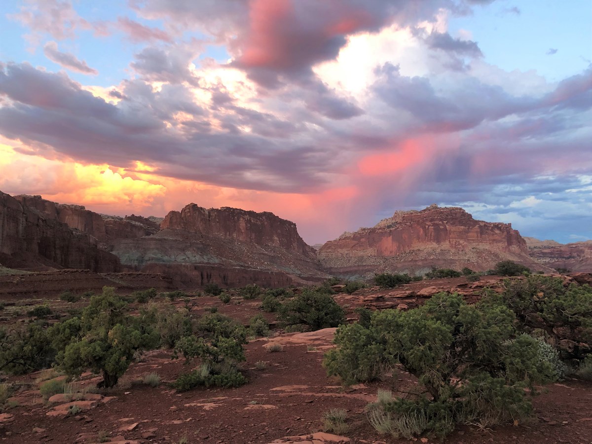
Two relaxed days in Capitol Reef's Fruita corridor: Hickman Bridge, the Scenic Drive and Capitol Gorge, then Cassidy Arch, petroglyphs and the historic orchards. One Torrey hotel base and easy meals.
- Hike to Hickman Bridge, a 133-foot natural bridge
- Drive the Scenic Drive and walk Capitol Gorge to the Pioneer Register
- Climb to the top of Cassidy Arch
- Fremont petroglyphs and the Fruita orchards
- Sunset at Panorama Point
The story
Capitol Reef is a long wrinkle in the Utah desert, a 100-mile fold of tilted rock that NPS calls the Waterpocket Fold, with a pioneer orchard village tucked into its middle. Two days is enough for the Fruita corridor, where the best sights sit within a few miles of the visitor center.
Day one pairs the short climb to Hickman Bridge with the Scenic Drive and a stroll down Capitol Gorge, where pioneers carved their names into the canyon wall. After a late lunch in Torrey, catch the sunset glow at Panorama Point. Day two starts early for Cassidy Arch, the park's classic strenuous hike, then eases into Fremont petroglyphs and the Fruita orchards before a final lunch in Torrey.
Both nights are at the Broken Spur Inn in Torrey, about a 15 to 20 minute drive from the visitor center, so there is no packing up in between. Spring and fall are the comfortable seasons; summer afternoons are hot and monsoon season brings flash-flood risk.
Day by day
Hickman Bridge, Scenic Drive and Capitol Gorge
Hike to the natural bridge, drive the Scenic Drive to Capitol Gorge, then lunch in Torrey and catch the sunset.
Hickman Bridge Trail
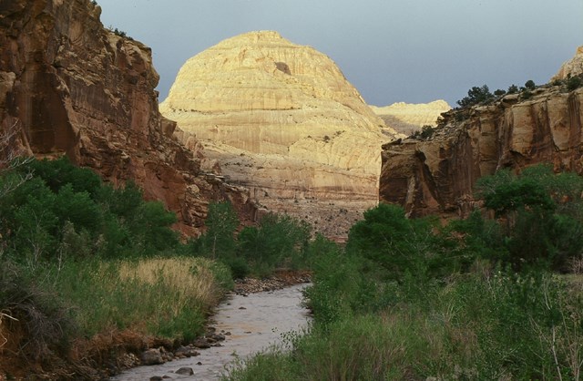
Start with the park's best short hike. The trail climbs from the Fremont River past juniper and slickrock, with Capitol Dome in view, to a 133-foot natural bridge that NPS describes as formed by flowing water. It is steep in places but short; going early keeps the sun off the climb. The trailhead is on UT-24, about 2 miles east of the visitor center.
- Distance
- 1.8 mi
- Elevation gain
- 400 ft
- Route
- Out and back
- Difficulty
- Moderate
- Dogs allowed
- No
- Trailhead
- Hickman Bridge Trailhead on UT-24, about 2 miles east of the visitor center
- Distance note
- NPS lists 0.9 mi one way with a 400 ft elevation change (one-way basis); round trip is about 1.8 mi. Trailhead coordinates are from OpenStreetMap.
Sources (4)
- NPS - Capitol Reef trail guide · retrieved 2026-10-03
- NPS - Capitol Dome (trailhead location) · retrieved 2026-10-03
- NPS - Hike an Easy or Moderate Trail · retrieved 2026-10-03
- OpenStreetMap - Hickman Bridge Trailhead · retrieved 2026-10-03
Scenic Drive
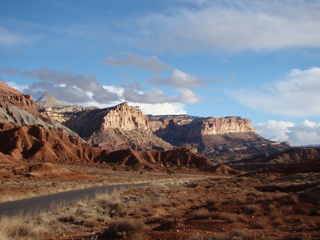
A 7.9-mile paved road runs south from the visitor center along the face of the Waterpocket Fold, past the Fruita orchards and cliff walls streaked with desert varnish, with numbered NPS roadside stops. It is a dead-end, so you return the same way. NPS allots about an hour and a half round trip for the drive plus the two dirt spurs; this plan takes the Capitol Gorge spur and walks the trail.
- Time
- About 1.5 hours round trip including the Grand Wash and Capitol Gorge spurs (NPS), before hiking
- Best time
- Morning or late afternoon
- Reservation needed
- No
- Length note
- 7.9 miles paved; dirt spurs usually suitable for passenger cars and RVs up to 27 feet (NPS)
Sources (3)
- NPS Data API - places (care) · retrieved 2026-10-03
- NPS - Capitol Reef Scenic Drive · retrieved 2026-10-03
- NPS - Scenic Drive Tour · retrieved 2026-10-03
Capitol Gorge Trail to the Pioneer Register and the Tanks
At the end of the dirt Capitol Gorge Road, a flat, easy trail follows a narrow wash between tall walls. About half a mile in, names and dates left by pioneers, prospectors and surveyors are carved into the north wall, and the trail continues to the Tanks, small natural pools in the sandstone. Do not add your own name; defacing the Register is illegal.
- Distance
- 2 mi
- Elevation gain
- 80 ft
- Route
- Out and back
- Difficulty
- Easy
- Dogs allowed
- No
- Trailhead
- End of Capitol Gorge Road (dirt spur off the Scenic Drive)
- Distance note
- NPS lists 1.0 mi one way with an 80 ft elevation change (one-way basis) to the Tanks; round trip is about 2.0 mi. The Pioneer Register is about 0.5 mi in.
Sources (3)
- NPS - Capitol Reef trail guide · retrieved 2026-10-03
- NPS - Pioneer Register · retrieved 2026-10-03
- NPS - Scenic Drive Stop 11 (Capitol Gorge) · retrieved 2026-10-03
Lunch at Slackers Burger Joint
A casual Main Street stop in Torrey for burgers, fries and shakes after a morning in the park. The town's official business listing describes a family-friendly spot with desserts such as a Giant Banana Split. It is about 12 miles from the visitor center.
- Meal
- Lunch
- Cuisine
- American, burgers
- Reservation needed
- No
Sources (1)
- Town of Torrey - Slackers Burger Joint listing · retrieved 2026-10-03
Broken Spur Inn & Steakhouse
A hilltop hotel in Torrey with red-rock views, about 5 minutes from the park entrance by its own account. It has hotel rooms and Conestoga wagon units, an indoor pool and hot tub, EV charging and guest laundry. Hot breakfast (7-10 AM) is complimentary for guests, which helps with the early starts here. Check current rates.
- Type
- Hotel
- Location
- Outside the park
- Booking
- Book / details
- Reservation notes
- Check current rates on the official site; the site promises its lowest available rate when booking direct.
Sources (3)
- Broken Spur Inn & Steakhouse official site · retrieved 2026-10-03
- Broken Spur - Steakhouse and breakfast · retrieved 2026-10-03
- Town of Torrey - Broken Spur listing · retrieved 2026-10-03
Sunset at Panorama Point
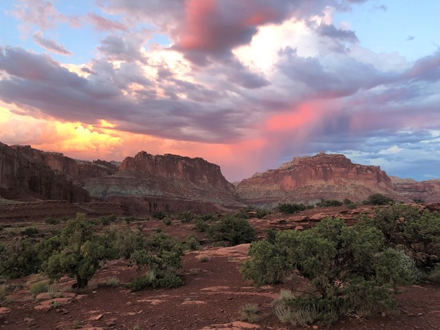
A very short walk from the parking area on UT-24 leads to a 360-degree view of huge sandstone cliffs, and NPS says the colors get most vibrant toward sunset. Arrive about 45 minutes early. For a longer walk, the 0.4-mile one-way Sunset Point Trail at the end of the 1-mile dirt Panorama Point Road is NPS's other easy sunset option. It is on the way back to Torrey.
- Time
- Short walk from the parking area; allow about an hour including the light
- Best time
- Sunset
- Reservation needed
- No
Sources (2)
- NPS - Panorama Point · retrieved 2026-10-03
- NPS - Watch the Sunset · retrieved 2026-10-03
Dinner at The Pioneer Kitchen
The restaurant at Capitol Reef Resort, on the east side of Torrey nearest the park. The town's listing describes American comfort food and regional dishes such as orange-peel grilled trout and enchiladas, with vegetarian and gluten-free options, served for breakfast and dinner. Check closing time before a late sunset.
- Meal
- Dinner
- Cuisine
- American comfort food, regional
Sources (1)
- Town of Torrey - The Pioneer Kitchen listing · retrieved 2026-10-03
Cassidy Arch, Petroglyphs and Fruita
Start early on the park's classic arch hike, then take two easy stops on UT-24 and have a late lunch in Torrey.
Cassidy Arch Trail
The park's signature strenuous hike. From the Grand Wash Road parking area, the trail climbs steeply up the north canyon wall over slickrock with some exposure along high cliffs and ends on top of the arch, with canyon views. NPS says the arch is named for Butch Cassidy. Start early for cooler air, carry plenty of water, and skip it if rain threatens.
- Distance
- 3.4 mi
- Elevation gain
- 670 ft
- Route
- Out and back
- Difficulty
- Strenuous
- Dogs allowed
- No
- Trailhead
- Cassidy Arch Trailhead on the dirt Grand Wash Road, off the Scenic Drive
- Distance note
- NPS lists 1.7 mi one way with a 670 ft elevation change (one-way basis); round trip is about 3.4 mi. Trailhead coordinates are from OpenStreetMap. The 3-hour allowance is a planning estimate.
Sources (4)
- NPS - Capitol Reef trail guide · retrieved 2026-10-03
- NPS - Scenic Drive Stop 4 (Cassidy Arch name) · retrieved 2026-10-03
- NPS - Hike a Strenuous Trail · retrieved 2026-10-03
- OpenStreetMap - Cassidy Arch Trailhead · retrieved 2026-10-03
Fremont Petroglyph Panel
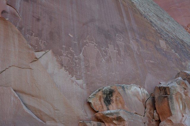
Two wooden boardwalks along UT-24 lead to rock art pecked into the cliff by the Fremont Culture, who lived in this region from about 300 to 1300 CE according to NPS. Look for the human-like figures with trapezoid bodies and bighorn-sheep shapes. It is a short stop on the way to Fruita.
- Time
- 5 to 30 minutes (NPS)
- Reservation needed
- No
Sources (2)
- NPS - Petroglyph Panel · retrieved 2026-10-03
- NPS - Visit the Petroglyph Panel · retrieved 2026-10-03
Fruita Historic Orchards
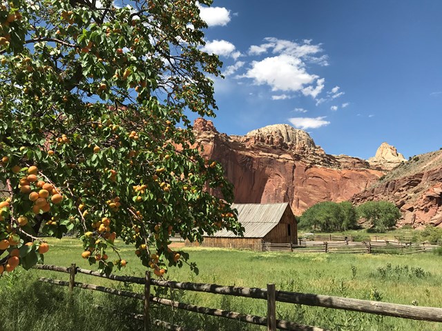
The orchards along the Fremont River and Sulphur Creek are what is left of the pioneer community of Fruita, settled in 1880. Walk among the heirloom trees and old farm buildings near the visitor center; NPS says fruit is available for harvest in season. The seasonal Gifford House, run by the Capitol Reef Natural History Association, sells snacks and gifts. The Doc Inglesby picnic area is about 0.75 mile from the visitor center.
- Time
- About an hour for an easy walk
- Reservation needed
- No
Sources (3)
- NPS - Capitol Reef Orchards · retrieved 2026-10-03
- NPS - Gifford House · retrieved 2026-10-03
- NPS - Picnic · retrieved 2026-10-03
Lunch at Rock Reef Cafe
A family-style Main Street restaurant in Torrey. The town's listing highlights homemade pizza from a family recipe, brisket, burgers and draft beer, and says it suits groups and families. A solid way to end the trip before the drive out.
- Meal
- Lunch
- Cuisine
- Pizza, brisket, American
- Reservation needed
- No
Sources (1)
- Town of Torrey - Rock Reef Cafe listing · retrieved 2026-10-03
Where to stay
Map of places
- Hickman Bridge Trailhead (opens Google Maps in a new tab) Day 1
- Capitol Reef National Park's Scenic Drive (opens Google Maps in a new tab) Day 1
- Capitol Gorge Trailhead (Scenic Drive Stop 11) (opens Google Maps in a new tab) Day 1
- Slackers Burger Joint (opens Google Maps in a new tab) Day 1
- Broken Spur Inn & Steakhouse (opens Google Maps in a new tab) Day 1
- Panorama Point (opens Google Maps in a new tab) Day 1
- The Pioneer Kitchen at Capitol Reef Resort (opens Google Maps in a new tab) Day 1
- Cassidy Arch Trailhead (opens Google Maps in a new tab) Day 2
- Petroglyph Panel (opens Google Maps in a new tab) Day 2
- Capitol Reef Orchards (opens Google Maps in a new tab) Day 2
- Rock Reef Cafe (opens Google Maps in a new tab) Day 2
- Red Sands Hotel & Spa (opens Google Maps in a new tab) Option
- The Rim Rock Inn (opens Google Maps in a new tab) Option
- Fruita Campground (opens Google Maps in a new tab) Option
Good to know
Current conditions (as of 2026-10-03)
- NPS alerts: elevated E. coli in the Fremont River and Sulphur Creek (Utah DEQ advisory; do not swim or wade), and a monsoon/flash-flood notice; closures are posted at the visitor center.
- Private-vehicle entrance fee is $20 per vehicle (NPS, as of 2026-10-03).
- Visitor center hours are 8:00 AM-4:30 PM daily; winter hours (9:00 AM-4:30 PM) run 2026-11-29 to 2027-03-06, with closures on Thanksgiving, Christmas Day and New Year's Day (NPS).
- NPS lists the Gifford House as open mid-March through the Saturday after Thanksgiving.
Evergreen tips
- Best seasons are spring and fall; NPS notes July-September monsoon storms can cause flash floods, and summer highs average in the high 80s F.
- Capitol Reef is open 24 hours (NPS); the visitor center is the place to pay the fee and pick up the Scenic Drive guide.
- Flash floods can close Grand Wash and Capitol Gorge roads; never enter canyons when storms threaten.
- Carry water on all hikes; Cassidy Arch has steep slickrock and exposure.
- Most Torrey businesses are small; confirm hours before you go. NPS lists no pets on the trails in this plan.
- Distances and gains: NPS gives one-way distance and elevation change; this plan states round-trip distance.
Want live alerts and up-to-date info?
Conditions change fast. Create an account on the DriftKin app to get live park alerts, closures and information for your trip.
Sources
Good to know: distances and drive times are typical figures without live traffic, and where routes are shown the route data comes from OpenStreetMap contributors. Toll amounts are estimates and change often, so check them in the DriftKin planner or with the toll authority before you plan around them. Opening hours, fees, prices, permits and closures also change, so confirm with the park or business before you go.
- NPS - Capitol Reef trail guide retrieved 2026-10-03
- NPS - Capitol Dome (trailhead location) retrieved 2026-10-03
- NPS - Hike an Easy or Moderate Trail retrieved 2026-10-03
- OpenStreetMap - Hickman Bridge Trailhead retrieved 2026-10-03
- NPS Data API - places (care) retrieved 2026-10-03
- NPS - Capitol Reef Scenic Drive retrieved 2026-10-03
- NPS - Scenic Drive Tour retrieved 2026-10-03
- NPS - Pioneer Register retrieved 2026-10-03
- NPS - Scenic Drive Stop 11 (Capitol Gorge) retrieved 2026-10-03
- Town of Torrey - Slackers Burger Joint listing retrieved 2026-10-03
- Broken Spur Inn & Steakhouse official site retrieved 2026-10-03
- Broken Spur - Steakhouse and breakfast retrieved 2026-10-03
- Town of Torrey - Broken Spur listing retrieved 2026-10-03
- NPS - Panorama Point retrieved 2026-10-03
- NPS - Watch the Sunset retrieved 2026-10-03
- Town of Torrey - The Pioneer Kitchen listing retrieved 2026-10-03
- NPS - Scenic Drive Stop 4 (Cassidy Arch name) retrieved 2026-10-03
- NPS - Hike a Strenuous Trail retrieved 2026-10-03
- OpenStreetMap - Cassidy Arch Trailhead retrieved 2026-10-03
- NPS - Petroglyph Panel retrieved 2026-10-03
- NPS - Visit the Petroglyph Panel retrieved 2026-10-03
- NPS - Capitol Reef Orchards retrieved 2026-10-03
- NPS - Gifford House retrieved 2026-10-03
- NPS - Picnic retrieved 2026-10-03
- Town of Torrey - Rock Reef Cafe listing retrieved 2026-10-03
- Red Sands Hotel & Spa official site retrieved 2026-10-03
- Town of Torrey - Rim Rock Inn listing retrieved 2026-10-03
- NPS Data API - campgrounds (care) retrieved 2026-10-03
- NPS - Fruita Campground retrieved 2026-10-03
More trips like this
 National parkGrand Canyon
Grand Canyon South Rim: 3 Days of Rim Sunsets and First Steps Below
3 days Moderate$$ National parkArches
Arches: 2 Days of Icons and Sandstone Fins
2 days Moderate$$ National parkGreat Smoky Mountains
Great Smoky Mountains: 4 Days of Waterfalls, Ridgelines and Cades Cove
4 days Moderate$$