Death Valley: 2 Days of Badlands, Salt Flats and Dunes
Fact-checked against official sources · Updated
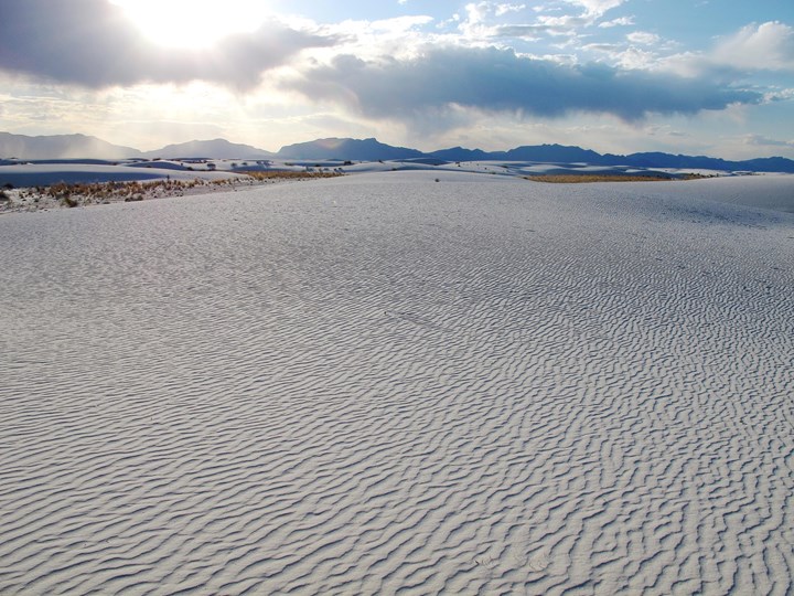
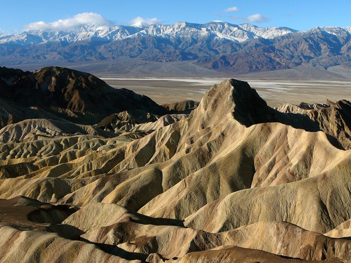
Sunrise at Zabriskie, the lowest point in North America, and sand at sunset
- Length
- 2 days
- Difficulty
- Moderate
- Best months
- Jan–Apr, Oct–Dec
- Budget
- $$
A two-day, Furnace Creek-based loop that pairs early-morning canyon hikes and viewpoints with a midday rest and a golden-hour dune walk. Everything is short, close to the road and suited to first-time visitors.
- Sunrise at Zabriskie Point
- Golden Canyon to Red Cathedral (3 mi round trip)
- Mesquite Flat Sand Dunes at sunset
- Dantes View above Badwater Basin
- Badwater Basin, 282 feet below sea level
- Artists Palette on Artists Drive
Why visit Death Valley
Death Valley 2-day itinerary, day by day
Day 1 · 5 stopsBadlands, Canyon and Dunes
Sunrise at Zabriskie Point, a morning walk in Golden Canyon, a midday break at Furnace Creek, then the Mesquite Flat dunes at golden hour.
Badlands, Canyon and Dunes
Sunrise at Zabriskie Point, a morning walk in Golden Canyon, a midday break at Furnace Creek, then the Mesquite Flat dunes at golden hour.
Zabriskie Point at sunrise
- Time
- About 15 minutes from Furnace Creek; 1/4 mile paved walk each way. Start time assumes winter (about Nov-Jan); set arrival 20-30 minutes before sunrise for your date.
- Best time
- Sunrise (also popular at sunset)
- Fee
- Free
Sources (3)
- National Park Service: nps.gov/deva · retrieved 2026-09-30
- NPS - Zabriskie Point · retrieved 2026-09-30
- Coffee & Cream hours (6 a.m.-noon daily) · retrieved 2026-09-30
Golden Canyon to Red Cathedral
- Distance
- 3 mi
- Elevation gain
- 577 ft
- Route
- Out and back
- Difficulty
- Moderate
- Trailhead
- Golden Canyon parking area, Badwater Road, 2 miles south of CA-190
Sources (3)
- National Park Service: nps.gov/deva · retrieved 2026-09-30
- NPS - Golden Canyon area trails · retrieved 2026-09-30
- NPS - Golden Canyon · retrieved 2026-09-30
The Ranch 1849 Restaurant (lunch buffet)
- Meal
- Lunch
- Cuisine
- American buffet
Sources (2)
- NPS - The Ranch at Death Valley · retrieved 2026-09-30
- The Ranch 1849 Restaurant - official · retrieved 2026-09-30
The Ranch at Death Valley
- Type
- Hotel
- Location
- Inside the park
- Booking
- Book / details
Sources (2)
- NPS - The Ranch at Death Valley · retrieved 2026-09-30
- The Ranch at Death Valley - official · retrieved 2026-09-30
Mesquite Flat Sand Dunes at sunset
- Distance
- 2 mi
- Elevation gain
- 185 ft
- Route
- Out and back
- Difficulty
- Moderate
- Trailhead
- Mesquite Flat dunes parking lot, just east of Stovepipe Wells Village off CA-190
Sources (2)
- National Park Service: nps.gov/deva · retrieved 2026-09-30
- NPS - Mesquite Flat Sand Dunes · retrieved 2026-09-30
Day 2 · 4 stopsHigh Views and Low Points
Dantes View above the valley, Badwater Basin at the bottom, and the color of Artists Palette on the way back for lunch.
High Views and Low Points
Dantes View above the valley, Badwater Basin at the bottom, and the color of Artists Palette on the way back for lunch.
Dantes View
- Time
- About 45 minutes drive from Furnace Creek; sunrise, sunset and clear dark nights are suggested
- Best time
- Morning or sunset
- Fee
- Free
Sources (2)
- National Park Service: nps.gov/deva · retrieved 2026-09-30
- NPS - Dantes View · retrieved 2026-09-30
Badwater Basin salt flats walk
- Time
- Boardwalk about 1 mile round trip (40 minutes); salt formations 1.5-2 miles round trip. Badwater is about 17 miles (27 km) south of Furnace Creek, about 30 minutes' drive.
- Best time
- Morning in the cool season
- Fee
- Free
Sources (3)
- National Park Service: nps.gov/deva · retrieved 2026-09-30
- NPS - Badwater Basin · retrieved 2026-09-30
- NPS - Badwater Basin (17 mi / 30 min from Furnace Creek) · retrieved 2026-09-30
Artists Drive and Artists Palette
- Time
- About 30 minutes; entrance is 8.5 miles south of the CA-190/Badwater Road junction; one-way loop, 25 ft vehicle limit
- Best time
- Sunrise or sunset light
- Fee
- Free
Sources (3)
- National Park Service: nps.gov/deva · retrieved 2026-09-30
- NPS - Artists Palette · retrieved 2026-09-30
- NPS - Tour Artists Drive · retrieved 2026-09-30
The Last Kind Words Saloon
- Meal
- Lunch
- Cuisine
- American, steaks and barbecue
- Reservation needed
- Yes
Sources (2)
- NPS - The Ranch at Death Valley · retrieved 2026-09-30
- The Last Kind Words Saloon - official · retrieved 2026-09-30
Where to stay in Death Valley
Map of the places on this Death Valley itinerary
- Zabriskie Point (opens Google Maps in a new tab) Day 1
- Golden Canyon (opens Google Maps in a new tab) Day 1
- The Ranch 1849 Restaurant (opens Google Maps in a new tab) Day 1
- The Ranch at Death Valley (opens Google Maps in a new tab) Day 1
- Mesquite Flat Sand Dunes (opens Google Maps in a new tab) Day 1
- Dantes View (opens Google Maps in a new tab) Day 2
- Badwater Basin (parking lot and boardwalk) (opens Google Maps in a new tab) Day 2
- Artists Palette (opens Google Maps in a new tab) Day 2
- The Last Kind Words Saloon (opens Google Maps in a new tab) Day 2
- The Inn at Death Valley (opens Google Maps in a new tab) Option
- Stovepipe Wells Village (opens Google Maps in a new tab) Option
- Furnace Creek Campground (opens Google Maps in a new tab) Option
Death Valley travel tips
Death Valley trip FAQ
How many days does this Death Valley itinerary take?
2 days to cover Death Valley National Park. Day 1: Badlands, Canyon and Dunes; Day 2: High Views and Low Points.
When is the best time for Death Valley?
The best months are January to April and October to December. Season: Winter and spring; summer highs average 110-116 F, and hiking after 10 a.m. is not advised in summer. Spring can be windy.
What are the highlights of this Death Valley itinerary?
Sunrise at Zabriskie Point; Golden Canyon to Red Cathedral (3 mi round trip); Mesquite Flat Sand Dunes at sunset; Dantes View above Badwater Basin; Badwater Basin, 282 feet below sea level.
Where should you stay for Death Valley?
This itinerary suggests The Inn at Death Valley, Stovepipe Wells Village and Furnace Creek Campground. Check current rates and availability before you book.
Where should you eat on this Death Valley trip?
Places this itinerary uses or suggests include The Ranch 1849 Restaurant and The Last Kind Words Saloon. Opening hours change, so confirm before you go.
Sources
Good to know: distances and drive times are typical figures without live traffic, and where routes are shown the route data comes from OpenStreetMap contributors. Toll amounts are estimates and change often, so check them in the DriftKin planner or with the toll authority before you plan around them. Opening hours, fees, prices, permits and closures also change, so confirm with the park or business before you go.
- National Park Service: nps.gov/deva retrieved 2026-09-30
- NPS - Zabriskie Point retrieved 2026-09-30
- Coffee & Cream hours (6 a.m.-noon daily) retrieved 2026-09-30
- NPS - Golden Canyon area trails retrieved 2026-09-30
- NPS - Golden Canyon retrieved 2026-09-30
- NPS - The Ranch at Death Valley retrieved 2026-09-30
- The Ranch 1849 Restaurant - official retrieved 2026-09-30
- The Ranch at Death Valley - official retrieved 2026-09-30
- NPS - Mesquite Flat Sand Dunes retrieved 2026-09-30
- NPS - Dantes View retrieved 2026-09-30
- NPS - Badwater Basin retrieved 2026-09-30
- NPS - Badwater Basin (17 mi / 30 min from Furnace Creek) retrieved 2026-09-30
- NPS - Artists Palette retrieved 2026-09-30
- NPS - Tour Artists Drive retrieved 2026-09-30
- The Last Kind Words Saloon - official retrieved 2026-09-30
- NPS - The Inn at Death Valley retrieved 2026-09-30
- The Oasis at Death Valley - official retrieved 2026-09-30
- The Inn Dining Room - official retrieved 2026-09-30
- NPS - Stovepipe Wells Village retrieved 2026-09-30
- Stovepipe Wells Village - official retrieved 2026-09-30
- NPS - Furnace Creek Campground retrieved 2026-09-30