Joshua Tree: 4 Days of Boulders, Palm Oases and Desert Skies
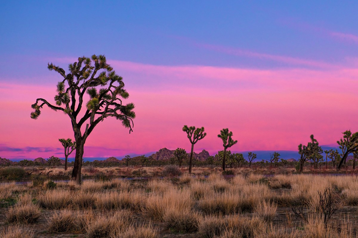
From the Mojave's Joshua tree groves to the cholla gardens of the Colorado Desert
- Length
- 4 days
- Difficulty
- Moderate
- Best months
- Feb–Apr, Oct–Nov
- Budget
- $$
Four days moving west to south through Joshua Tree, mixing short boulder loops, the Ryan Mountain summit, a mining-history hike and two palm oases. Meals and beds are in Joshua Tree village and Twentynine Palms. Lodging rates are not published outside booking pages, so the $$ budget tier is an estimate.
- Hidden Valley, Barker Dam and Cap Rock on day one
- Ryan Mountain summit and Keys View on day two
- Split Rock, Skull Rock and Arch Rock on day three
- Fortynine Palms Oasis and Mastodon Peak on day four
- Dinner in Pioneertown at Pappy & Harriet's
The story
Joshua Tree is where two deserts meet: the Mojave, home to the park's namesake spiky trees, and the Colorado Desert, where cholla cactus gardens take over. This four-day route sweeps across both, starting in the west, crossing the boulder country to the east, and then dropping south toward the I-10 corridor, so you never retrace Park Boulevard more than you have to.
Day one is a warm-up on the western side. Circle the boulders of Hidden Valley, walk out to Barker Dam and its rock art, and finish with the easy Cap Rock loop. You sleep in Joshua Tree village, a short drive from the West Entrance, and eat at a classic desert diner and a village saloon.
Day two is the big one. Ryan Mountain climbs 1,050 feet in three miles and rewards you with a sweeping view of the park. Keys View then looks out over the Coachella Valley, and the trek to the Lost Horse Mine stamp mill adds a slice of mining history. Dinner is in Pioneertown, a Western-themed village where Pappy & Harriet's serves dinner.
Day three shifts east. After the morning drive across the park you can wander Split Rock's washes, circle Skull Rock, and walk out to Arch Rock, then exit by the North Entrance to Twentynine Palms and the adobe bungalows of 29 Palms Inn.
Day four is about water in the desert. Start in the palm oasis canyon of Fortynine Palms (with a ready-made fallback if it is closed), then follow Pinto Basin Road south past the Cholla Cactus Garden to Cottonwood Spring, where the Mastodon Peak loop finishes the trip among granite and fan palms before you exit toward I-10.
There are no restaurants inside the park, so the plan leans on Joshua Tree and Twentynine Palms for meals, with picnic lunches on the trail. Keys Ranch tours, stargazing and the long Lost Palms hike are held in reserve as options if your dates and energy allow. Plan the trip for October and November or February through April, when the days are warm rather than hot, and pack layers because desert nights can turn cold.
Day by day
West-side boulders and Joshua tree groves
Arrive in Joshua Tree village, then drive Park Boulevard's most accessible short walks: Hidden Valley, Barker Dam and Cap Rock. Finish with dinner and a night in town.
Breakfast at Crossroads Cafe
Start in Joshua Tree village with a big diner breakfast. The cafe's own site lists bacon pancakes and homemade chorizo and eggs among its dishes, and it sits about five miles from the park's West Entrance, so you can fuel up and be inside the park within half an hour.
- Meal
- Breakfast
- Cuisine
- American diner
Sources (1)
- Crossroads Cafe official website · retrieved 2026-09-29
Joshua Tree Visitor Center
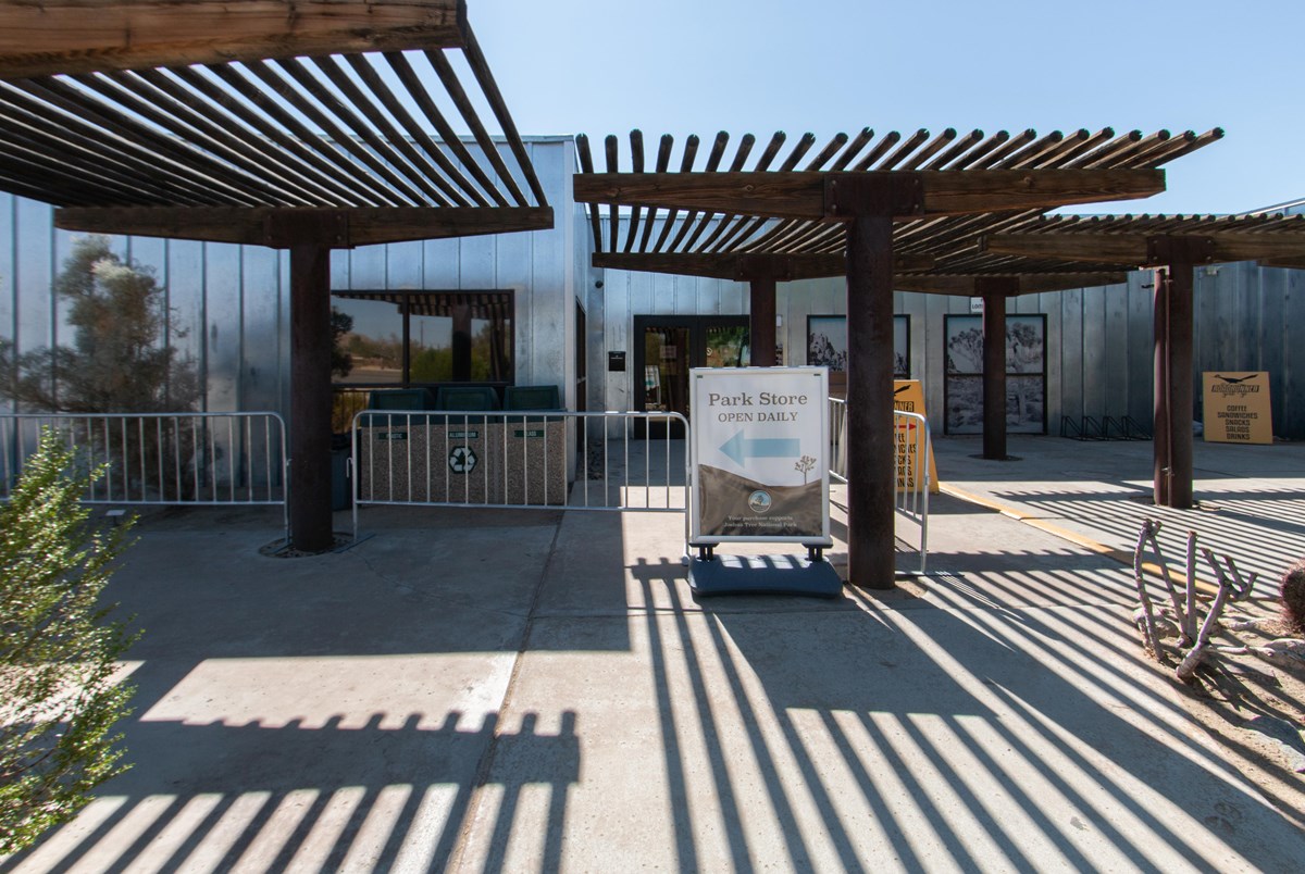
Pick up a park map, ask a ranger about current trail and road conditions, and buy your entrance pass if you have not already done so online. NPS describes the center as five miles from the West Entrance, with exhibits and a bookstore.
- Time
- 20-30 minutes
Sources (1)
- NPS place page: Joshua Tree Visitor Center · retrieved 2026-09-29
Hidden Valley Nature Trail
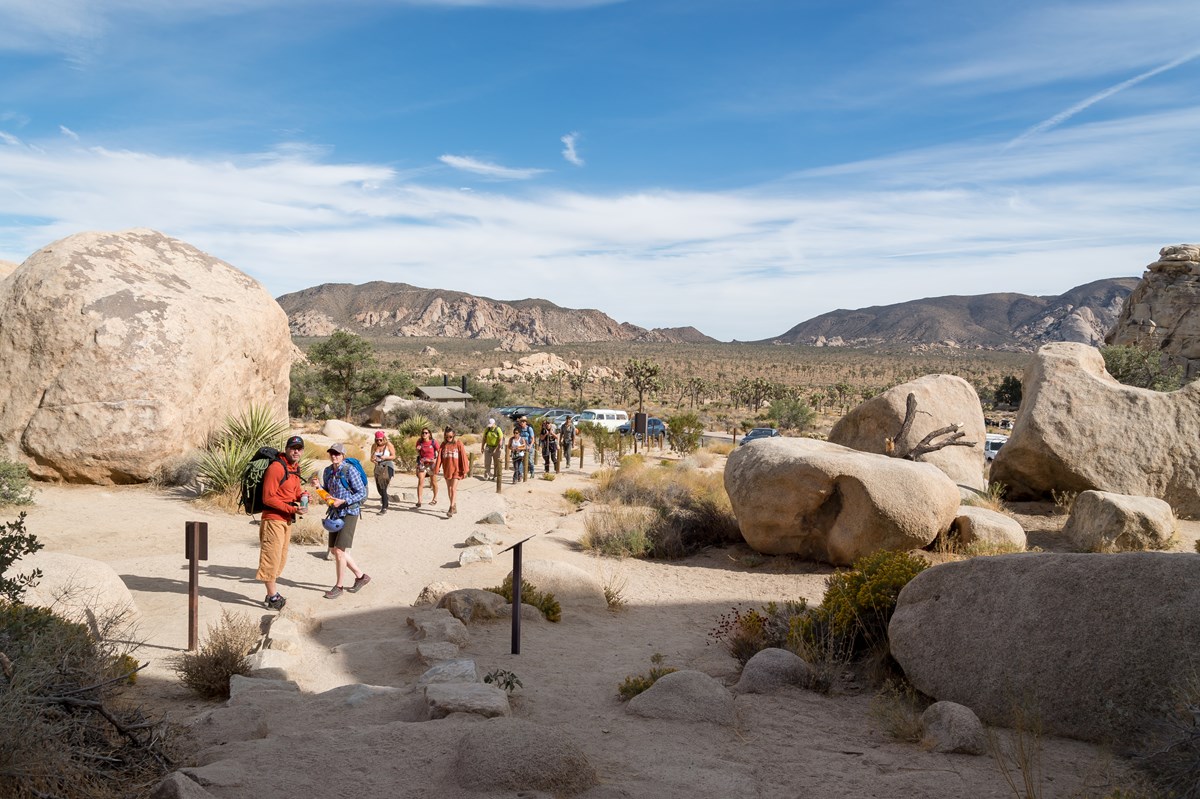
Off Park Boulevard, this one-mile loop circles a boulder-ringed basin that NPS says was rumored to have hidden cattle rustlers. It is the gentlest possible introduction to the granite monoliths and Joshua tree groves that define the park's western half. Interpretive signs cover the plants and wildlife, shade is limited, and there is no cell service.
- Distance
- 1 mi
- Elevation gain
- 100 ft
- Route
- Loop
- Difficulty
- Easy
- Permit required
- No
- Dogs allowed
- No
- Trailhead
- Hidden Valley Trailhead, Hidden Valley Picnic Area lot
- Stats basis
- loop total
Sources (3)
- NPS: Joshua Tree hiking trails (distance and elevation table) · retrieved 2026-09-29
- NPS place page: Hidden Valley Trailhead · retrieved 2026-09-29
- NPS thingstodo page: Hike Hidden Valley Trail · retrieved 2026-09-29
Barker Dam Nature Trail
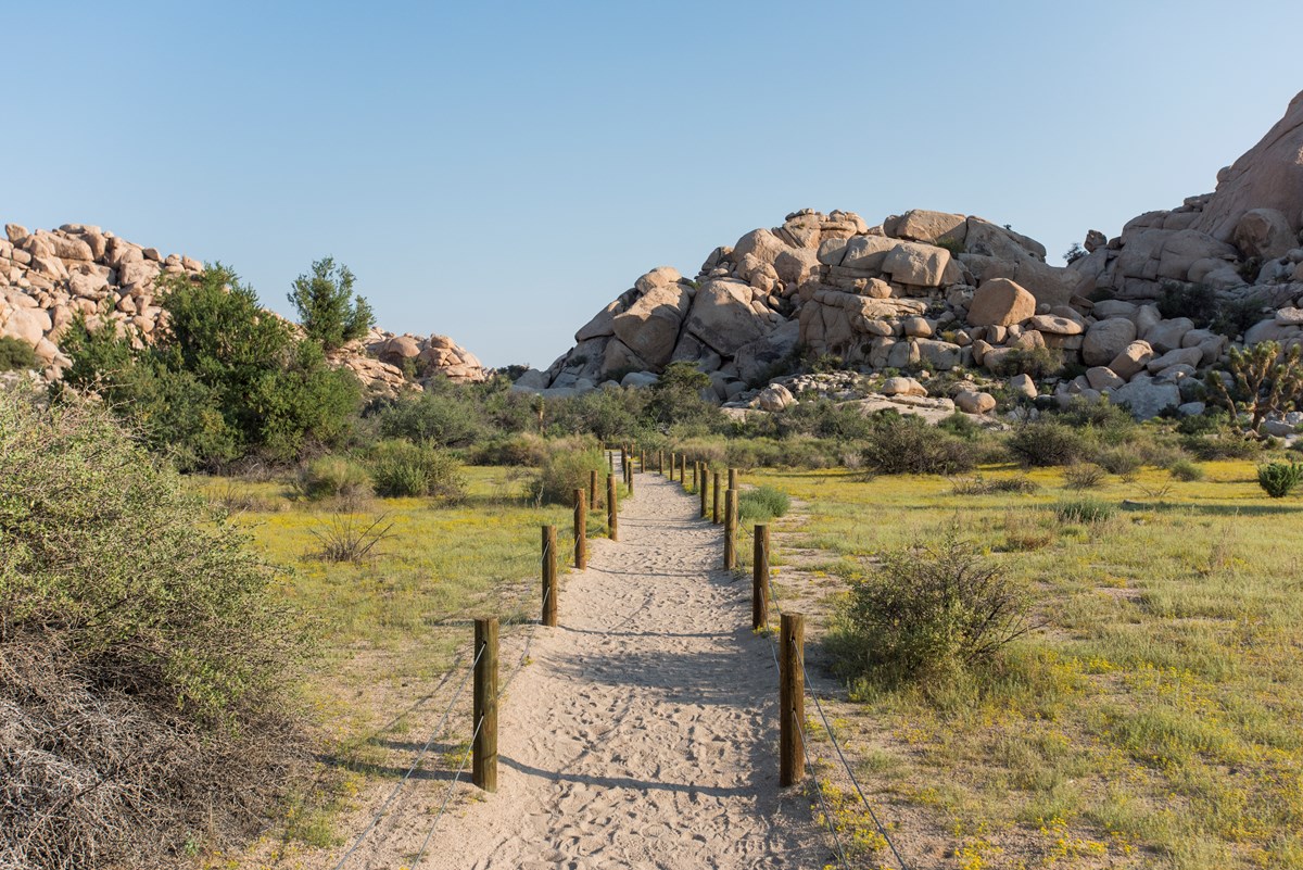
A flat 1.1-mile loop past boulders and Joshua trees to Barker Dam. NPS notes the reservoir is dry most of the year and only fills after heavy rain. The trail's highlight is a rock art site; view it from the signed distance and do not touch or climb on the boulder.
- Distance
- 1.1 mi
- Elevation gain
- 50 ft
- Route
- Loop
- Difficulty
- Easy
- Permit required
- No
- Dogs allowed
- No
- Trailhead
- Barker Dam parking area, off Park Boulevard via Barker Dam Road
- Stats basis
- loop total
Sources (3)
- NPS: Joshua Tree hiking trails (distance and elevation table) · retrieved 2026-09-29
- NPS place page: Barker Dam Trailhead · retrieved 2026-09-29
- NPS thingstodo page: Hike Barker Dam Trail · retrieved 2026-09-29
Cap Rock Nature Trail
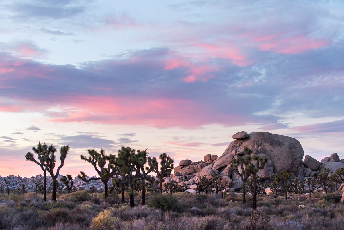
Cap Rock sits at the junction of Park Boulevard and Keys View Road, and its 0.4-mile loop threads Joshua trees, Mojave yuccas and granite domes with benches and interpretive signs. There are picnic tables and a restroom at the trailhead, which makes it a natural spot for the picnic lunch you packed in Joshua Tree village. NPS also lists the parking lot as one of four designated stargazing areas.
- Distance
- 0.4 mi
- Elevation gain
- 20 ft
- Route
- Loop
- Difficulty
- Easy
- Permit required
- No
- Dogs allowed
- No
- Trailhead
- Cap Rock parking area
- Stats basis
- loop total
Sources (3)
- NPS: Joshua Tree hiking trails (distance and elevation table) · retrieved 2026-09-29
- NPS place page: Cap Rock · retrieved 2026-09-29
- NPS thingstodo page: Hike Cap Rock · retrieved 2026-09-29
Check in at The Joshua Tree Inn
Drive back toward Joshua Tree village (roughly 30 minutes) and settle in. The inn's website describes 12 distinct accommodations, from standard rooms with private patios to themed suites and a three-bedroom house. Book directly and confirm rates on the booking page, as no rates are published on the inn's room page.
- Type
- Hotel
- Location
- Outside the park
- Booking
- Book / details
- Reservation notes
- Nightly rates are shown only in the online booking system.
Sources (1)
- The Joshua Tree Inn: Rooms and Rates · retrieved 2026-09-29
Dinner at Joshua Tree Saloon
A village fixture since 1984 according to its website, with a half-pound burger and a black bean quesadilla among its signature dishes. The kitchen closes at 10 PM, and there is live music on the patio most weekends, so it suits a relaxed first night.
- Meal
- Dinner
- Cuisine
- American pub fare
Sources (1)
- Joshua Tree Saloon official website · retrieved 2026-09-29
Ryan Mountain, Keys View and a Pioneertown dinner
A bigger day: the park's best-known summit, the overlook above the Coachella Valley, and a mining-history hike, capped by dinner in Pioneertown.
Ryan Mountain
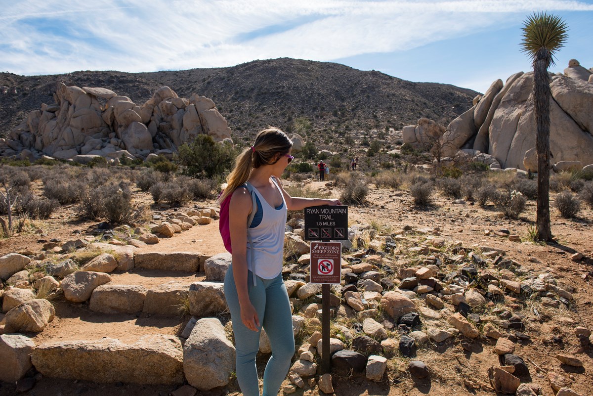
The park's best-known summit hike is short but steep: 3 miles round trip with 1,050 feet of gain, with a relatively flat first section before the climb. NPS says it offers sweeping panoramic views of the park. Go early, carry plenty of water, and note the trail has no shade. NPS lists the Ryan Mountain lot as a designated stargazing area too.
- Distance
- 3 mi
- Elevation gain
- 1,050 ft
- Route
- Out and back
- Difficulty
- Strenuous
- Permit required
- No
- Dogs allowed
- No
- Trailhead
- Ryan Mountain Trailhead on Park Boulevard between Ryan and Sheep Pass campgrounds
- Stats basis
- round trip
Sources (3)
- NPS: Joshua Tree hiking trails (distance and elevation table) · retrieved 2026-09-29
- NPS place page: Ryan Mountain Trailhead · retrieved 2026-09-29
- NPS thingstodo page: Hike Ryan Mountain · retrieved 2026-09-29
Keys View
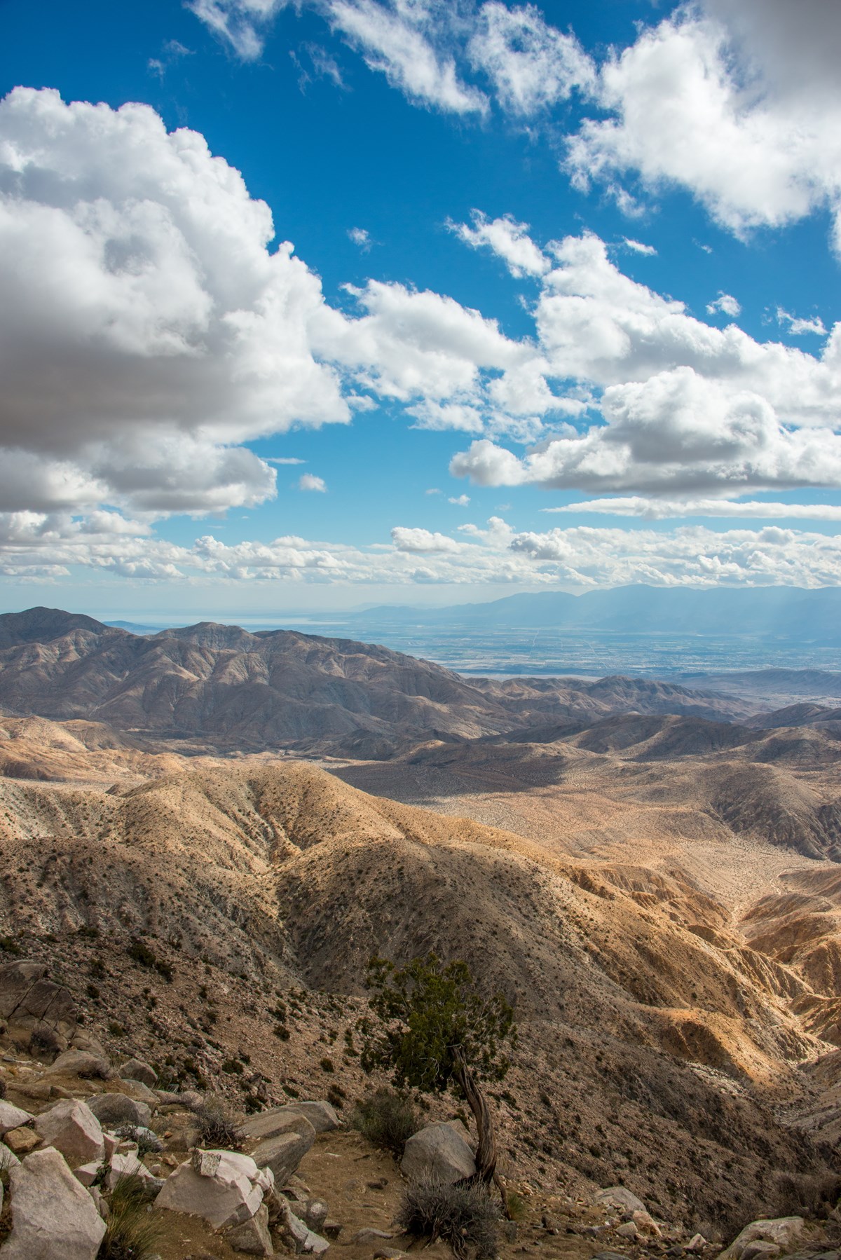
A paved road climbs to the Little San Bernardino Mountains crest for a wide view over the Coachella Valley. NPS lists a 0.25-mile loop with 25 feet of gain at the overlook. Views depend on air quality, so check conditions with a ranger.
- Time
- 20-30 minutes
- Best time
- Clear days; check conditions
Sources (2)
- NPS: Joshua Tree hiking trails (distance and elevation table) · retrieved 2026-09-29
- NPS place page: Keys View · retrieved 2026-09-29
Lost Horse Mine (out-and-back to the stamp mill)
A trail through mining history: you reach the remains of a stamp mill and mining equipment, with a fenced-off milling site to admire from a distance. NPS pages give varying figures for the full loop (roughly 6.2 to 6.8 miles), so treat that as uncertain. The shorter, consistently listed option is a 4-mile round trip to the stamp mill and back, with 550 feet of gain. This plan uses the shorter version. The trailhead lot is small and fills on busy weekends.

- Distance
- 4 mi
- Elevation gain
- 550 ft
- Route
- Out and back
- Difficulty
- Moderate
- Permit required
- No
- Dogs allowed
- No
- Trailhead
- Lost Horse Mine Trailhead, off Keys View Road
- Stats basis
- round trip (shortened out-and-back to the stamp mill); NPS pages give varying figures for the full loop, roughly 6.2-6.8 mi
Sources (3)
- NPS: Joshua Tree hiking trails (distance and elevation table) · retrieved 2026-09-29
- NPS place page: Lost Horse Mine Trailhead · retrieved 2026-09-29
- NPS thingstodo page: Hike Lost Horse Mine · retrieved 2026-09-29
Dinner at Pappy & Harriet's Pioneertown Palace
Finish in Pioneertown. The restaurant's site describes classic American fare, BBQ and live music. It is open daily 11 AM to 11 PM with a last dinner seating at 9:30 PM. It takes no reservations for parties of eight or fewer, so arrive early on weekends. Allow around an hour to drive from the Lost Horse trailhead. Pappy & Harriet's own info page warns that Pioneertown Road is dark, steep and winding at night, so allow extra time for the drive back.
- Meal
- Dinner
- Cuisine
- American / BBQ
- Reservation needed
- No
Sources (1)
- Pappy & Harriet's Info page · retrieved 2026-09-29
Return to The Joshua Tree Inn (second night)
Stay a second night at the same inn to avoid repacking; the drive back from Pioneertown takes around an hour after dark, so give yourself a relaxed evening.
- Type
- Hotel
- Location
- Outside the park
- Booking
- Book / details
- Reservation notes
- Nightly rates are shown only in the online booking system.
Sources (1)
- The Joshua Tree Inn: Rooms and Rates · retrieved 2026-09-29
Jumbo Rocks and the eastern boulder fields
Cross to the park's eastern boulder country: Split Rock, Skull Rock and Arch Rock, then exit through the North Entrance to Twentynine Palms.
Drive from Joshua Tree village to Split Rock
Check out and drive east through the park (roughly an hour). Carry a picnic lunch and water for the day; there is no food service inside the park.
Sources (1)
- NPS thingstodo page: Drive Park Boulevard · retrieved 2026-09-29
Split Rock Loop
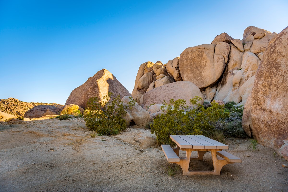
A 2.5-mile loop with 150 feet of gain through washes and boulder gardens on the northern side of the park's boulder country. NPS says it is fun for all ages. Bring a map if you link it with the Discovery and Skull Rock trails, which NPS says makes an approximately 5-6 mile route.
- Distance
- 2.5 mi
- Elevation gain
- 150 ft
- Route
- Loop
- Difficulty
- Moderate
- Permit required
- No
- Dogs allowed
- No
- Trailhead
- Split Rock Trailhead, off Park Boulevard
- Stats basis
- loop total
Sources (3)
- NPS: Joshua Tree hiking trails (distance and elevation table) · retrieved 2026-09-29
- NPS place page: Split Rock Trailhead · retrieved 2026-09-29
- NPS thingstodo page: Hike Split Rock · retrieved 2026-09-29
Skull Rock Nature Trail
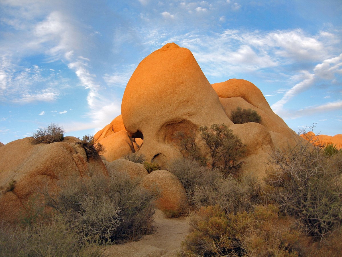
The namesake boulder sits about 70 feet from the road, its hollows resembling eye sockets. The 1.7-mile loop then winds through the Jumbo Rocks boulder field and across Jumbo Rocks Campground. The trail is sandy with almost no shade.
- Distance
- 1.7 mi
- Elevation gain
- 160 ft
- Route
- Loop
- Difficulty
- Easy
- Permit required
- No
- Dogs allowed
- No
- Trailhead
- Skull Rock parking area on Park Boulevard
- Stats basis
- loop total; the NPS hiking table lists 160 ft of gain, and other NPS pages give slightly different figures
Sources (3)
- NPS: Joshua Tree hiking trails (distance and elevation table) · retrieved 2026-09-29
- NPS place page: Skull Rock · retrieved 2026-09-29
- NPS thingstodo page: Hike Skull Rock · retrieved 2026-09-29
Arch Rock Nature Trail
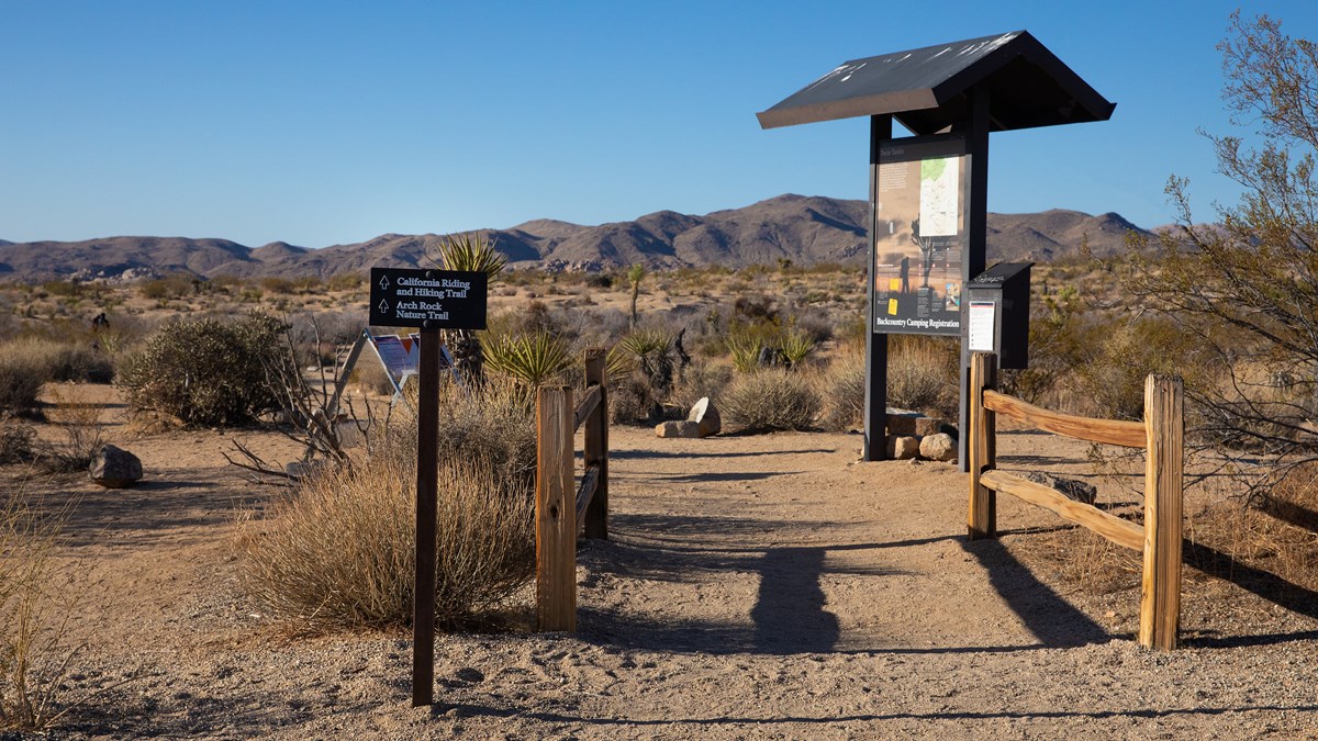
A lollipop trail from the Twin Tanks lot on Pinto Basin Road: 0.6 miles straight east across sand, then a short 0.2-mile loop with the arch about 0.1 mile in. NPS recommends going counterclockwise because the arch is easier to spot from that direction. The trail has no shade and no cell service. Pack a picnic lunch for the trail; there is no food service in the park.
- Distance
- 1.4 mi
- Elevation gain
- 100 ft
- Route
- Out and back
- Difficulty
- Easy
- Permit required
- No
- Dogs allowed
- No
- Trailhead
- Arch Rock/Twin Tanks parking lot on Pinto Basin Road
- Stats basis
- NPS lists 1.4 mi total and 100 ft of elevation change for this lollipop (0.6 mi out, a 0.2 mi loop, 0.6 mi back)
Sources (3)
- NPS: Joshua Tree hiking trails (distance and elevation table) · retrieved 2026-09-29
- NPS place page: Arch Rock and Twin Tanks Trailhead · retrieved 2026-09-29
- NPS thingstodo page: Hike Arch Rock · retrieved 2026-09-29
Joshua Tree National Park Visitor Center (Twentynine Palms)
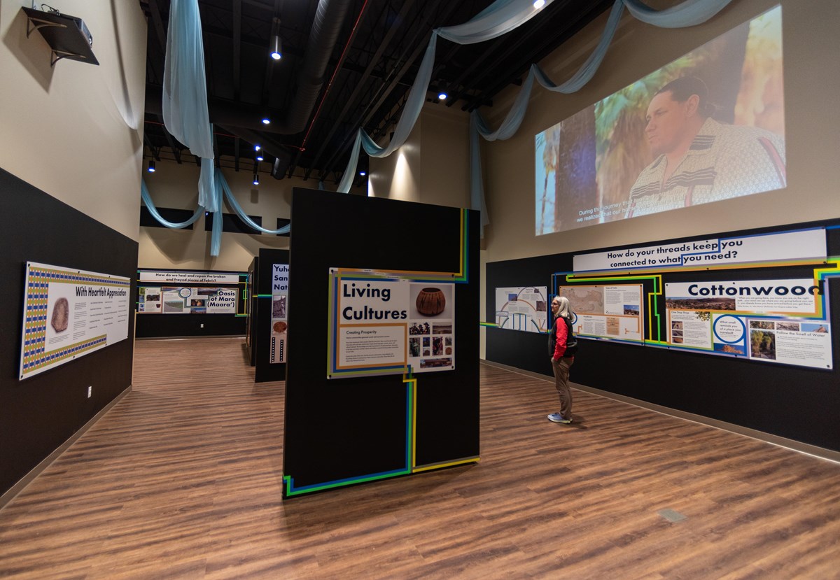
After exiting via the North Entrance, stop at the park's Twentynine Palms visitor center for exhibits, a bookstore and trip advice for tomorrow. NPS lists it as open 8 AM to 5 PM daily.
- Time
- 20-30 minutes
Sources (1)
- NPS place page: Joshua Tree National Park Visitor Center · retrieved 2026-09-29
Check in at 29 Palms Inn
Spend the last night in Twentynine Palms, close to the North Entrance and tomorrow's early-morning hike. The inn describes adobe bungalows and wood-framed cabins, with no two rooms alike. Rates appear only in its booking system.
- Type
- Cabin
- Location
- Outside the park
- Reservation notes
- Booking via the inn's website (Vertical Booking); rates not published on its homepage.
Sources (1)
- 29 Palms Inn official website · retrieved 2026-09-29
Dinner at the 29 Palms Inn Restaurant
The inn's own restaurant serves Wednesday through Sunday, with lunch from noon to 4 PM and dinner from 5 to 8:30 PM, and is closed Mondays and Tuesdays. The inn's Dine page says to call (760) 367-3505 for dinner reservations. On Mondays and Tuesdays the inn lists bar hours of 2 to 7 PM, but the restaurant is closed, so plan dinner elsewhere on those nights and ask the visitor center for current options.
- Meal
- Dinner
- Reservation notes
- Call (760) 367-3505 for dinner reservations.
Sources (1)
- 29 Palms Inn: Dine · retrieved 2026-09-29
Palm oases and the road to Cottonwood
Start with a canyon of fan palms, then cut south through the cactus gardens of Pinto Basin to Cottonwood Spring and Mastodon Peak, before exiting toward I-10.
Fortynine Palms Oasis
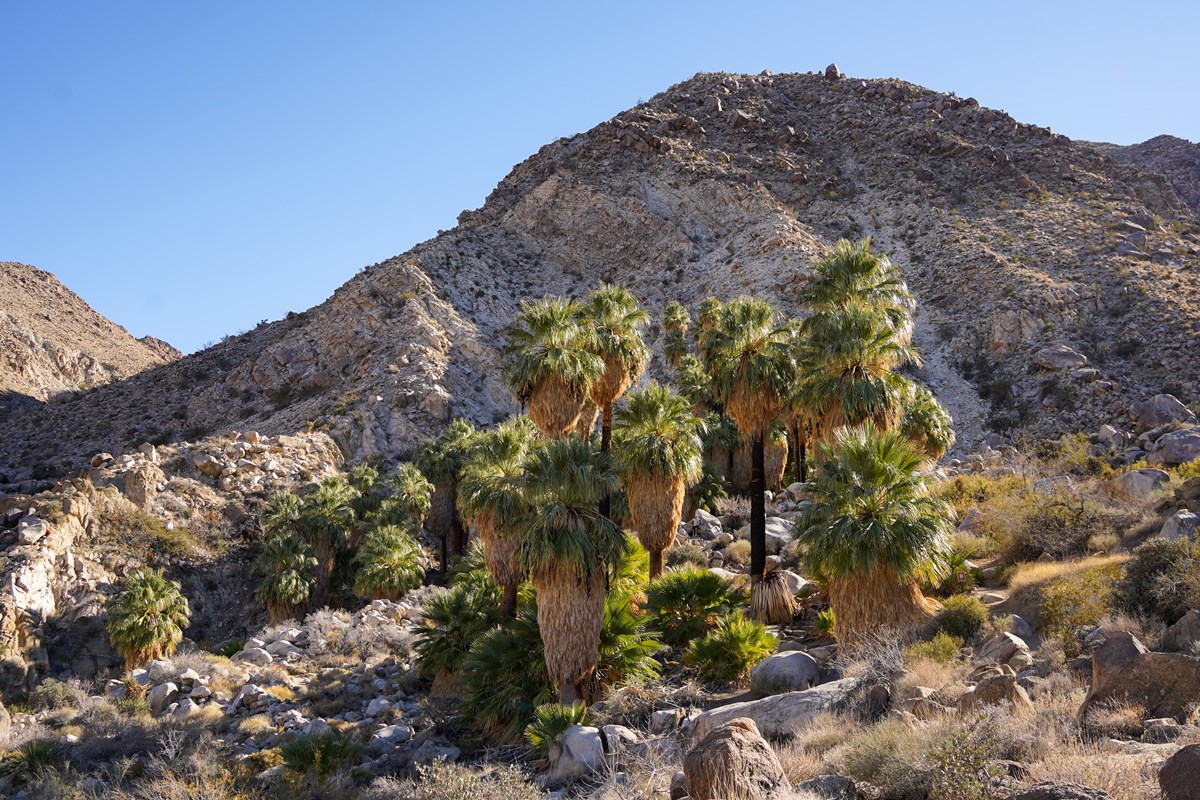
A 3-mile round trip with 300 feet of gain in each direction, climbing over a ridge and down into a canyon oasis of fan palms. NPS says it is difficult, mostly shadeless, and that the oasis itself is a sensitive water source for wildlife, so do not enter it. Go in the early morning: NPS advises finishing exposed desert hikes before the heat builds. The trail is closed every summer, so if it is closed on your dates, use this fallback: leave Twentynine Palms around 08:00, head south on Pinto Basin Road to the Cholla Cactus Garden (about 09:15), then continue to Cottonwood Spring for Mastodon Peak, or for a full day, the longer Lost Palms Oasis hike listed under options. All three are open year-round and listed on NPS pages.
- Distance
- 3 mi
- Elevation gain
- 300 ft
- Route
- Out and back
- Difficulty
- Moderate
- Permit required
- No
- Dogs allowed
- No
- Trailhead
- Fortynine Palms Oasis Trailhead, Canyon Road
- Stats basis
- round trip; NPS says 300 ft of gain in each direction
Sources (4)
- NPS: Joshua Tree hiking trails (distance and elevation table) · retrieved 2026-09-29
- NPS: Summer closures and restrictions · retrieved 2026-09-29
- NPS place page: Fortynine Palms Oasis Trailhead · retrieved 2026-09-29
- NPS thingstodo page: Hike Fortynine Palms Oasis · retrieved 2026-09-29
Cholla Cactus Garden
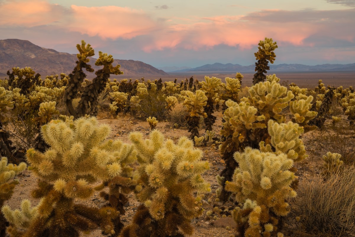
From the North Entrance area, follow Pinto Basin Road south (allow roughly 45-60 minutes from Twentynine Palms) to a quarter-mile loop through a dense patch of teddy bear cholla at the edge of Pinto Basin. NPS says to wear closed shoes and to start before 10 AM in summer, since there is no shade or cell service. Stay on the path.
- Time
- 15-30 minutes; 0.25 mi loop, 10 ft elevation change
- Best time
- Morning or late afternoon
Sources (3)
- NPS: Joshua Tree hiking trails (distance and elevation table) · retrieved 2026-09-29
- NPS place page: Cholla Cactus Garden · retrieved 2026-09-29
- NPS thingstodo page: Hike Cholla Cactus Garden · retrieved 2026-09-29
Mastodon Peak Loop from Cottonwood Spring
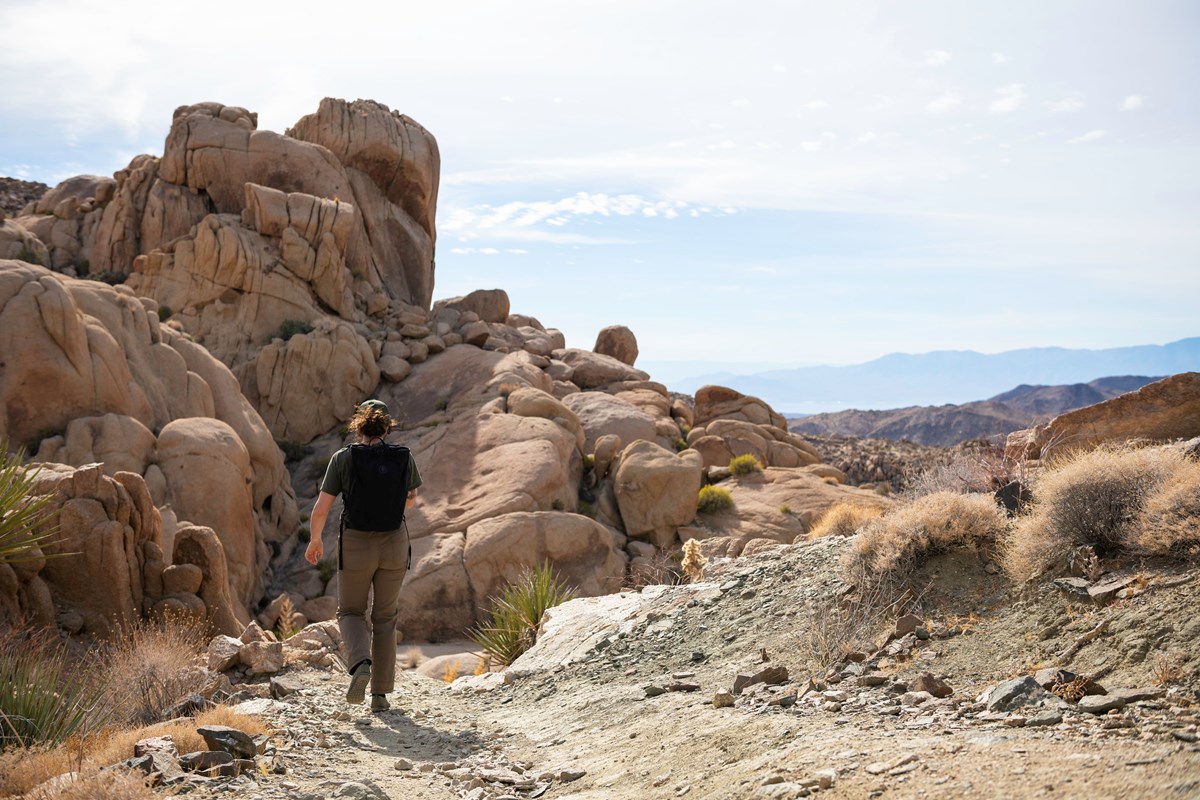
Begin at Cottonwood Spring's oasis and take the Mastodon Peak loop of 3 miles with 375 feet of gain, with a scramble option to the peak. NPS says the trail has no shade and no cell service. After the hike, the short 0.1-mile stroll to Cottonwood Spring's fan palms is a good cooldown. Cottonwood Visitor Center is a few minutes toward I-10.
- Distance
- 3 mi
- Elevation gain
- 375 ft
- Route
- Loop
- Difficulty
- Moderate
- Permit required
- No
- Dogs allowed
- No
- Trailhead
- Cottonwood Spring Oasis parking lot
- Stats basis
- loop total
Sources (4)
- NPS: Joshua Tree hiking trails (distance and elevation table) · retrieved 2026-09-29
- NPS place page: Mastodon Peak Trailhead (Cottonwood Spring) · retrieved 2026-09-29
- NPS thingstodo page: Hike Cottonwood Spring · retrieved 2026-09-29
- NPS thingstodo page: Hike Mastodon Peak · retrieved 2026-09-29
Cottonwood Visitor Center
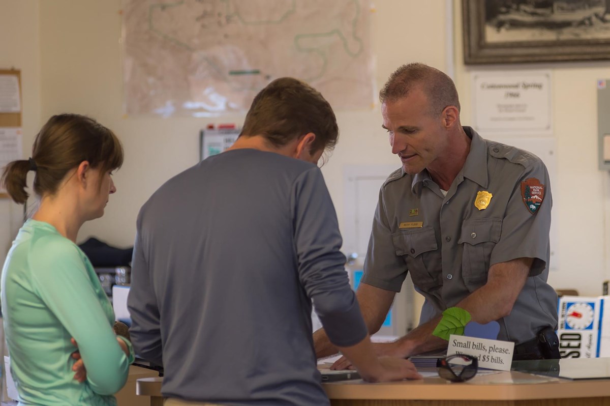
The southern gateway stop: exhibits, a bookstore and restrooms about 7 miles north of Interstate 10 exit 168, per NPS. It closes at 4 PM, so time your Mastodon Peak hike accordingly. Continue south to I-10 from here.
- Time
- 15-20 minutes
Sources (1)
- NPS place page: Cottonwood Visitor Center · retrieved 2026-09-29
Where to stay
Jumbo Rocks Campground
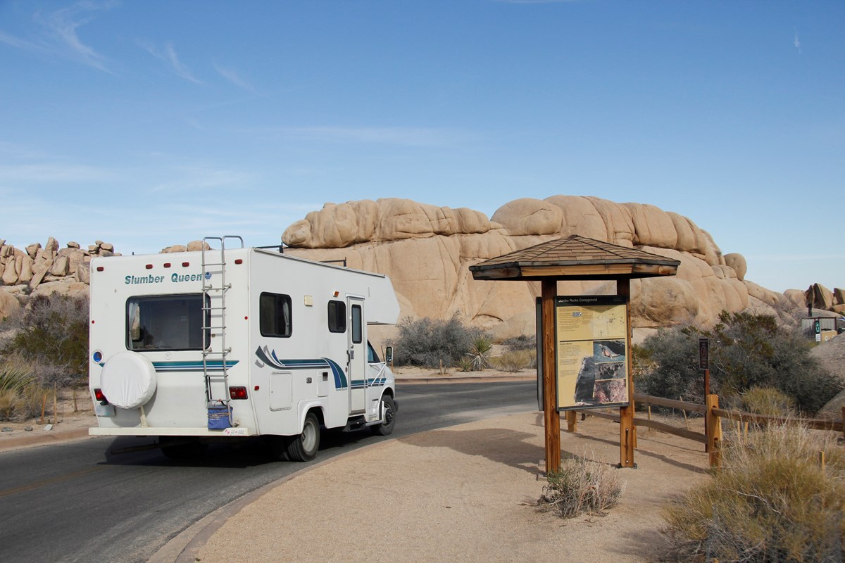
In-park camping in the middle of the boulder country. NPS says it has 124 individual sites and reservations are required year-round, bookable up to six months ahead on Recreation.gov.
- Type
- Campground
- Location
- Inside the park
- Price per night
- From $30 (as of 2026-09-29)
- Booking
- Book / details
- Reservation notes
- Reservations required year-round; up to 6 months in advance.
Sources (1)
- NPS place page: Jumbo Rocks Campground · retrieved 2026-09-29
Safari Motor Inn
A single-story motel in Joshua Tree village, close to the Joshua Tree Visitor Center and about five miles from the West Entrance (per NPS's distance for the visitor center). It offers king, queen or two-queen rooms. Rates are shown only on its online booking system.
- Type
- Hotel
- Location
- Outside the park
- Reservation notes
- Rates shown only on the online booking system.
Sources (2)
- Safari Motor Inn official website · retrieved 2026-09-29
- NPS: Visitor centers · retrieved 2026-09-29
More options
Keys Ranch guided tour (limited days, Oct-May)
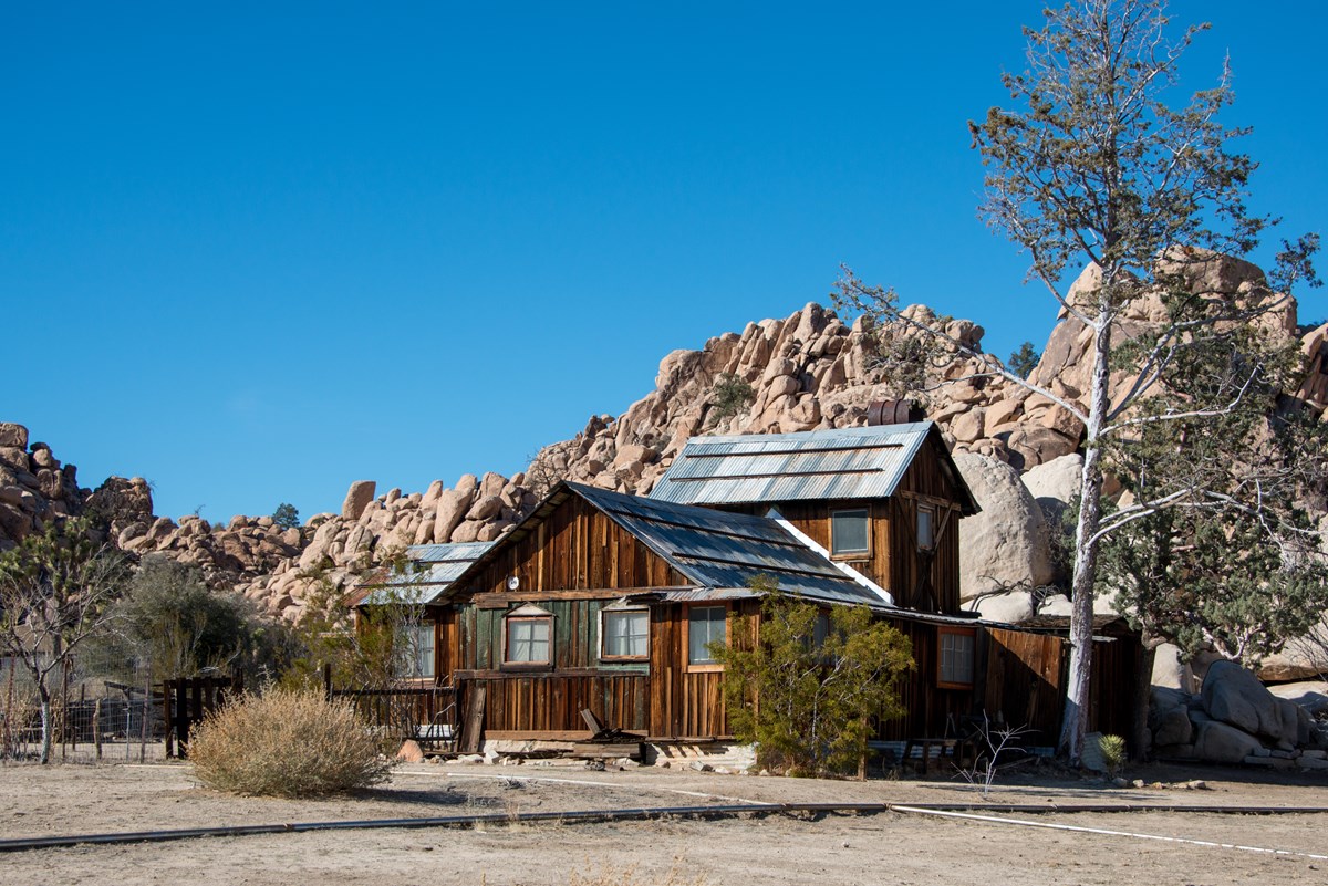
The only way to see this historic homestead is on a ranger-led tour of about half a mile, lasting around 120 minutes. NPS says tours typically run October through May, reservations are required on Recreation.gov up to 60 days ahead, and tours can be canceled for weather. Check the current schedule and fee before booking, as NPS pages list different prices. NPS directions: pass the Hidden Valley Campground entrance, turn left at the Y-intersection and follow the road about two miles to the locked gate, arriving 15 minutes early.
- Time
- About 120 minutes
- Reservation needed
- Yes
Sources (3)
- NPS: Keys Ranch Guided Walking Tour · retrieved 2026-09-29
- NPS place page: Keys Ranch · retrieved 2026-09-29
- NPS thingstodo page: Attend a Keys Ranch Tour · retrieved 2026-09-29
Stargazing at a designated dark-sky lot
NPS names four designated stargazing lots: Quail Springs, Hidden Valley, Cap Rock and Ryan Mountain, and says Pinto Basin has the darkest skies. Bring a red-light flashlight, allow 20 to 30 minutes for your eyes to adjust, stay within 20 feet of your vehicle in Pinto Basin, and check the moon phase.
- Time
- 1-2 hours after dark
- Best time
- New moon nights
Sources (2)
- NPS place page: Cap Rock · retrieved 2026-09-29
- NPS thingstodo page: Stargazing at Joshua Tree · retrieved 2026-09-29
Lost Palms Oasis (bigger day from Cottonwood)
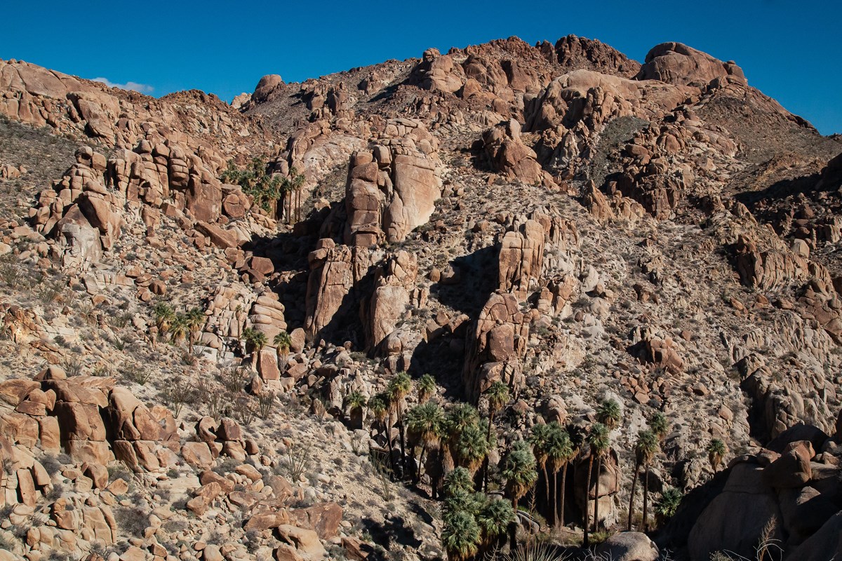
NPS lists this as a difficult 7.5-mile round trip with 500 feet of gain from Cottonwood Spring, ending at a canyon of fan palms. It is also a full-day fallback for the start of day 4 if Fortynine Palms is closed. Plan four to six hours, per NPS.
- Distance
- 7.5 mi
- Elevation gain
- 500 ft
- Route
- Out and back
- Difficulty
- Strenuous
- Permit required
- No
- Dogs allowed
- No
- Trailhead
- Cottonwood Spring
- Stats basis
- round trip; NPS 500 ft gain
Sources (2)
- NPS place page: Lost Palms Oasis Trailhead · retrieved 2026-09-29
- NPS thingstodo page: Hike Lost Palms Oasis · retrieved 2026-09-29
Map of places
- Crossroads Cafe (opens Google Maps in a new tab) Day 1
- Joshua Tree Visitor Center (opens Google Maps in a new tab) Day 1
- Hidden Valley Trailhead (opens Google Maps in a new tab) Day 1
- Barker Dam Trailhead (opens Google Maps in a new tab) Day 1
- Cap Rock (opens Google Maps in a new tab) Day 1
- The Joshua Tree Inn (opens Google Maps in a new tab) Day 1
- Joshua Tree Saloon (opens Google Maps in a new tab) Day 1
- Ryan Mountain Trailhead (opens Google Maps in a new tab) Day 2
- Keys View (opens Google Maps in a new tab) Day 2
- Lost Horse Mine Trailhead (opens Google Maps in a new tab) Day 2
- Pappy & Harriet's (opens Google Maps in a new tab) Day 2
- The Joshua Tree Inn (opens Google Maps in a new tab) Day 2
- Split Rock Trailhead (opens Google Maps in a new tab) Day 3
- Skull Rock (opens Google Maps in a new tab) Day 3
- Arch Rock and Twin Tanks Trailhead (opens Google Maps in a new tab) Day 3
- Joshua Tree National Park Visitor Center (opens Google Maps in a new tab) Day 3
- 29 Palms Inn (opens Google Maps in a new tab) Day 3
- 29 Palms Inn Restaurant (opens Google Maps in a new tab) Day 3
- Fortynine Palms Oasis Trailhead (opens Google Maps in a new tab) Day 4
- Cholla Cactus Garden (opens Google Maps in a new tab) Day 4
- Mastodon Peak Trailhead (Cottonwood Spring) (opens Google Maps in a new tab) Day 4
- Cottonwood Visitor Center (opens Google Maps in a new tab) Day 4
- Jumbo Rocks Campground (opens Google Maps in a new tab) Option
- Safari Motor Inn (opens Google Maps in a new tab) Option
- Keys Ranch (opens Google Maps in a new tab) Option
- Cap Rock (opens Google Maps in a new tab) Option
- Lost Palms Oasis Trailhead (opens Google Maps in a new tab) Option
Good to know
Current conditions (as of 2026-09-29). NPS alerts posted: annual summer closures and restrictions (including the Fortynine Palms trail and some campgrounds) are listed on the NPS summer closures page; the Fortynine Palms trail is closed for the summer season (NPS closes it June 1 through September 30) and the reopening date can slip later, so this plan's day-4 fallback applies until it reopens; the Oasis of Mara trail is closed past the oasis after flooding (posted 2026-03-19), which is why this plan does not include a walk there; the Black Rock Nature Center is open weekends only. Entrance is $30 per private vehicle for 7 days, $25 per motorcycle, $15 per person on foot or bike, and an annual pass is $55 (NPS API, as of 2026-09-29); entrance stations accept cards only. Keys Ranch fees are listed inconsistently on NPS sources, so confirm on Recreation.gov.
When to go. Fall through spring is the comfortable window; NPS says visitation peaks in wildflower season and drops in summer heat. Nights can be much colder than days, so pack layers.
Reservations and permits. No timed entry is listed by NPS. Ryan, Jumbo Rocks, Indian Cove, Black Rock and Cottonwood campgrounds require reservations on Recreation.gov (up to six months ahead); Hidden Valley, Belle and White Tank are first-come, first-served per NPS. There is no restaurant inside the park, so carry lunches and plenty of water.
Safety. There is little shade and no cell service on most trails. Use the official NPS app rather than third-party trail apps, which NPS says may show inaccurate information. Summer hikers are advised to start before 10 AM. Do not enter oases or touch rock art.
Getting around. Joshua Tree village is just outside the West Entrance, Twentynine Palms is by the North Entrance, and Cottonwood is the south gateway off I-10. Drive times in this plan are estimates; allow extra time on busy weekends when trailhead lots fill.
Sources note. Hike distances and elevation gains follow the NPS hiking table and NPS trail pages. Where NPS pages differ (for example the full Lost Horse Mine loop), the item says so.
Want live alerts and up-to-date info?
Conditions change fast. Create an account on the DriftKin app to get live park alerts, closures and information for your trip.
Sources
- Crossroads Cafe official website retrieved 2026-09-29
- NPS: Visitor centers retrieved 2026-09-29
- NPS: Joshua Tree hiking trails (distance and elevation table) retrieved 2026-09-29
- NPS place page: Hidden Valley Trailhead retrieved 2026-09-29
- NPS thingstodo page: Hike Hidden Valley Trail retrieved 2026-09-29
- NPS place page: Barker Dam Trailhead retrieved 2026-09-29
- NPS thingstodo page: Hike Barker Dam Trail retrieved 2026-09-29
- NPS place page: Cap Rock retrieved 2026-09-29
- NPS thingstodo page: Hike Cap Rock retrieved 2026-09-29
- The Joshua Tree Inn: Rooms and Rates retrieved 2026-09-29
- Joshua Tree Saloon official website retrieved 2026-09-29
- NPS place page: Ryan Mountain Trailhead retrieved 2026-09-29
- NPS thingstodo page: Hike Ryan Mountain retrieved 2026-09-29
- NPS place page: Keys View retrieved 2026-09-29
- NPS place page: Lost Horse Mine Trailhead retrieved 2026-09-29
- NPS thingstodo page: Hike Lost Horse Mine retrieved 2026-09-29
- Pappy & Harriet's Info page retrieved 2026-09-29
- NPS thingstodo page: Drive Park Boulevard retrieved 2026-09-29
- NPS place page: Split Rock Trailhead retrieved 2026-09-29
- NPS thingstodo page: Hike Split Rock retrieved 2026-09-29
- NPS place page: Skull Rock retrieved 2026-09-29
- NPS thingstodo page: Hike Skull Rock retrieved 2026-09-29
- NPS place page: Arch Rock and Twin Tanks Trailhead retrieved 2026-09-29
- NPS thingstodo page: Hike Arch Rock retrieved 2026-09-29
- 29 Palms Inn official website retrieved 2026-09-29
- 29 Palms Inn: Dine retrieved 2026-09-29
- NPS: Summer closures and restrictions retrieved 2026-09-29
- NPS place page: Fortynine Palms Oasis Trailhead retrieved 2026-09-29
- NPS thingstodo page: Hike Fortynine Palms Oasis retrieved 2026-09-29
- NPS place page: Cholla Cactus Garden retrieved 2026-09-29
- NPS thingstodo page: Hike Cholla Cactus Garden retrieved 2026-09-29
- NPS place page: Mastodon Peak Trailhead (Cottonwood Spring) retrieved 2026-09-29
- NPS thingstodo page: Hike Cottonwood Spring retrieved 2026-09-29
- NPS thingstodo page: Hike Mastodon Peak retrieved 2026-09-29
- NPS place page: Jumbo Rocks Campground retrieved 2026-09-29
- Safari Motor Inn official website retrieved 2026-09-29
- NPS: Keys Ranch Guided Walking Tour retrieved 2026-09-29
- NPS place page: Keys Ranch retrieved 2026-09-29
- NPS thingstodo page: Attend a Keys Ranch Tour retrieved 2026-09-29
- NPS thingstodo page: Stargazing at Joshua Tree retrieved 2026-09-29
- NPS place page: Lost Palms Oasis Trailhead retrieved 2026-09-29
- NPS thingstodo page: Hike Lost Palms Oasis retrieved 2026-09-29
Hours, fees, prices and closures change. Confirm details with the park or business before you go.