Nashville to Memphis the Quiet Way: The Natchez Trace and Shiloh
Leiper's Fork, a Meriwether Lewis stop, river catfish and a Civil War battlefield instead of I-40

- Length
- 1 day
- Total distance
- 248.4 mi
- Driving time
- 5 h 12 min
- Est. tolls
- $0
- Stops
- 5
- Driving
- Moderate
- Best months
- Apr–May, Sep–Oct
- Budget
- $
A one-day, one-way drive from Nashville to Memphis that skips most of I-40: 248.4 miles and about 5 h 12 min of driving with no tolls, the Natchez Trace Parkway, catfish on the Tennessee River, Shiloh and a Mississippi riverfront finish.
- Drive time5 h 12 min
- Distance248.4 mi
- Est. tolls$0
- Meriwether Lewis Monument: the explorer's grave on the Natchez Trace Parkway
- Shiloh National Military Park: film, then the Hornets' Nest and Pittsburg Landing
- Hagy's Catfish Hotel: river catfish a few minutes from the battlefield
The story
Day by day
Day 1 · 11 stopsNashville to Memphis by the Natchez Trace and Shiloh
Leave Nashville at 7:30, stretch in Leiper's Fork, drive the Natchez Trace to the Meriwether Lewis Monument, lunch on the Tennessee River at Hagy's, tour Shiloh, then take US-64 to Tom Lee Park in Memphis for about 4:50 pm.
Nashville to Memphis by the Natchez Trace and Shiloh
Leave Nashville at 7:30, stretch in Leiper's Fork, drive the Natchez Trace to the Meriwether Lewis Monument, lunch on the Tennessee River at Hagy's, tour Shiloh, then take US-64 to Tom Lee Park in Memphis for about 4:50 pm.
Start in Nashville: Bicentennial Capitol Mall State Park
- Time
- 15 minutes to fuel, load up and go
Sources (4)
- Wikimedia Commons: photo (CC BY-SA 3.0) · retrieved 2026-10-14
- Tennessee State Parks: Bicentennial Capitol Mall State Park (address) · retrieved 2026-10-14
- Sunrise-Sunset.org: Memphis October 2026 sunset times · retrieved 2026-10-14
- Sunrise-Sunset.org: Memphis November 2026 sunset times (CST) · retrieved 2026-10-14
Nashville to Leiper's Fork
- Distance
- 23.7 mi
- Drive time
- 36 min
- Toll
- $0
- Via
- US-431 (Hillsboro Pike), TN-46
Sources (2)
- Natchez Trace Parkway: no entrance fees · retrieved 2026-10-14
- OpenStreetMap contributors (routing: distance, time and route line) · retrieved 2026-10-14
Leiper's Fork: stroll Old Hillsboro Road
Sources (3)
- Wikimedia Commons: photo (CC BY 2.0) · retrieved 2026-10-14
- Wikipedia: Leiper's Fork (historic district, Natchez Trace history) · retrieved 2026-10-14
- National Park Service NRHP record: Leipers Fork Historic District (listed 1998) · retrieved 2026-10-14
Leiper's Fork to the Meriwether Lewis site
- Distance
- 45.7 mi
- Drive time
- 59 min
- Toll
- $0
- Via
- TN-46, Natchez Trace Parkway
Sources (2)
- Natchez Trace Parkway: no entrance fees · retrieved 2026-10-14
- OpenStreetMap contributors (routing: distance, time and route line) · retrieved 2026-10-14
Meriwether Lewis Monument and Grinder's Stand site
- Fee
- Free
- Parking
- Free lot at the site
Sources (4)
- Wikimedia Commons: photo (public domain, NARA) · retrieved 2026-10-14
- Natchez Trace Parkway: no entrance fees · retrieved 2026-10-14
- Natchez Trace Parkway: hours and seasons · retrieved 2026-10-14
- Natchez Trace Parkway: Meriwether Lewis Burial Monument · retrieved 2026-10-14
Meriwether Lewis site to Hagy's Catfish Hotel
- Distance
- 68.2 mi
- Drive time
- 1 h 20 min
- Toll
- $0
- Via
- Natchez Trace Parkway, US-64, TN-22
Sources (2)
- Natchez Trace Parkway: no entrance fees · retrieved 2026-10-14
- OpenStreetMap contributors (routing: distance, time and route line) · retrieved 2026-10-14
Lunch at Hagy's Catfish Hotel
- Meal
- Lunch
- Cuisine
- Southern catfish and river food
- Price
- $$
Sources (2)
- Tennessee Vacation: Hagy's Catfish Hotel history · retrieved 2026-10-14
- Hagy's Catfish Hotel (official: address, phone, hours, menu prices) · retrieved 2026-10-14
Hagy's Catfish Hotel to Shiloh
- Distance
- 2.3 mi
- Drive time
- 7 min
- Toll
- $0
- Via
- Hagy Lane, Pittsburg Landing Road
Sources (2)
- Natchez Trace Parkway: no entrance fees · retrieved 2026-10-14
- OpenStreetMap contributors (routing: distance, time and route line) · retrieved 2026-10-14
Shiloh Battlefield Visitor Center and driving tour
- Time
- About 1 h 45 min covers the film and the main tour stops; the full tour takes longer
- Fee
- Free
- Parking
- Free lot at the visitor center
Sources (3)
- Shiloh: Hornets' Nest, tour stop 10 · retrieved 2026-10-14
- Shiloh National Military Park (official) · retrieved 2026-10-14
- Shiloh National Military Park: hours and film times · retrieved 2026-10-14
Shiloh to Memphis
- Distance
- 108.5 mi
- Drive time
- 2 h 10 min
- Toll
- $0
- Via
- TN-142, US-45, US-64 / US-64 Business, I-40, Sam Cooper Blvd, US-72
Sources (2)
- Natchez Trace Parkway: no entrance fees · retrieved 2026-10-14
- OpenStreetMap contributors (routing: distance, time and route line) · retrieved 2026-10-14
Finish at Tom Lee Park, Memphis
Sources (1)
- Memphis River Parks Partnership: Tom Lee Park (hours, features) · retrieved 2026-10-14
More options
Route map
- Bicentennial Capitol Mall State Park (opens Google Maps in a new tab) Day 1
- Leiper's Fork (Old Hillsboro Road) (opens Google Maps in a new tab) Day 1
- Meriwether Lewis Burial Monument (opens Google Maps in a new tab) Day 1
- Hagy's Catfish Hotel (opens Google Maps in a new tab) Day 1
- Shiloh Battlefield Visitor Center (opens Google Maps in a new tab) Day 1
- Tom Lee Park (opens Google Maps in a new tab) Day 1
Good to know
Sources
Good to know: distances and drive times are typical figures without live traffic, and where routes are shown the route data comes from OpenStreetMap contributors. Toll amounts are estimates and change often, so check them in the DriftKin planner or with the toll authority before you plan around them. Opening hours, fees, prices, permits and closures also change, so confirm with the park or business before you go.
- Wikimedia Commons: photo (CC BY-SA 3.0) retrieved 2026-10-14
- Tennessee State Parks: Bicentennial Capitol Mall State Park (address) retrieved 2026-10-14
- Sunrise-Sunset.org: Memphis October 2026 sunset times retrieved 2026-10-14
- Sunrise-Sunset.org: Memphis November 2026 sunset times (CST) retrieved 2026-10-14
- Natchez Trace Parkway: no entrance fees retrieved 2026-10-14
- OpenStreetMap contributors (routing: distance, time and route line) retrieved 2026-10-14
- Wikimedia Commons: photo (CC BY 2.0) retrieved 2026-10-14
- Wikipedia: Leiper's Fork (historic district, Natchez Trace history) retrieved 2026-10-14
- National Park Service NRHP record: Leipers Fork Historic District (listed 1998) retrieved 2026-10-14
- Wikimedia Commons: photo (public domain, NARA) retrieved 2026-10-14
- Natchez Trace Parkway: hours and seasons retrieved 2026-10-14
- Natchez Trace Parkway: Meriwether Lewis Burial Monument retrieved 2026-10-14
- Tennessee Vacation: Hagy's Catfish Hotel history retrieved 2026-10-14
- Hagy's Catfish Hotel (official: address, phone, hours, menu prices) retrieved 2026-10-14
- Shiloh: Hornets' Nest, tour stop 10 retrieved 2026-10-14
- Shiloh National Military Park (official) retrieved 2026-10-14
- Shiloh National Military Park: hours (Corinth Interpretive Center open 9-5) retrieved 2026-10-14
- Memphis River Parks Partnership: Tom Lee Park (hours, features) retrieved 2026-10-14
- Wikipedia: Tupelo, Mississippi (birthplace of Elvis Presley) retrieved 2026-10-14
More trips like this
 Road tripPittsburgh to Washington, DC
Pittsburgh to Washington, DC the Slow Way: Fallingwater, the National Road and the Canal
1 day Moderate$$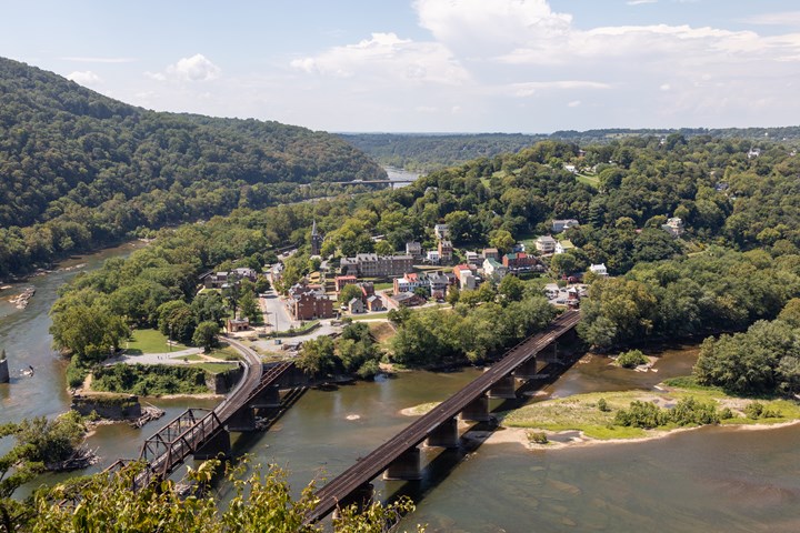 Road tripPhiladelphia to Harpers Ferry
Philadelphia to Harpers Ferry in a Day: Loudoun Heights and the Meeting of the Rivers
1 day Easy$ Road tripAtlanta to Asheville through the Blue Ridge Mountains
Atlanta to Asheville the Mountain Way: Dahlonega, Highlands and the Parkway
1 day Moderate$$