Page to Moab in One Day: Monument Valley, Valley of the Gods and Natural Bridges
Buttes, gravel, switchbacks and stone arches on the long way to Moab

- Length
- 1 day
- Total distance
- 321.8 mi
- Driving time
- 7 h 27 min
- Est. tolls
- No tolls
- Stops
- 4
- Driving
- Moderate
- Best months
- Apr–May, Sep–Oct
- Budget
- $$
A one-day, one-way drive from Page, Arizona to Moab, Utah: 321.8 miles and about 7 hours 27 minutes of driving, with a Monument Valley Valley Drive, the gravel of Valley of the Gods and the Moki Dugway, and Natural Bridges. Five stops, no tolls, dinner in Moab to finish.
- Drive time7 h 27 min
- Distance321.8 mi
- Est. tollsNo tolls
- Monument Valley: the 17-mile Valley Drive past the Mittens and Merrick Butte
- Valley of the Gods and the Moki Dugway: gravel road, then switchbacks up Cedar Mesa
- Natural Bridges National Monument: a paved loop with short walks to bridge overlooks
The story
Page to Moab is a 276-mile drive on the map, and that is exactly why this version skips the shortest line. A navigation app sends you straight up US-160, US-163 and US-191 in under five hours. This plan stitches together the roads that make the Four Corners country worth driving: the sandstone silhouettes of Monument Valley, a slow cruise through the gravel of Valley of the Gods, the switchbacks of the Moki Dugway, and the natural bridges tucked into Cedar Mesa.
The day is long on purpose. About 321.8 miles and 7 hours 27 minutes of driving, spread over roughly twelve hours with stops, means a 7:15 AM start from Page (6:15 on Page clocks; the Navajo Nation observes daylight saving time and Page does not) and a dinner reservation in Moab around sunset. The rhythm follows real road-trip habits: one fuel and driver-change break in Kayenta after the first 107 minutes, a long and rewarding stop at Monument Valley, a scenic gravel stretch that ends at the top of the Moki Dugway, one national monument, and a final two-hour run on US-191 into Moab. There is no sit-down lunch on the plan; pack one in Page and eat it at the top of the Dugway, or detour to Goulding's (see the options).
Come in the cooler months. Valley of the Gods Road and the Moki Dugway are unpaved and BLM warns the Valley of the Gods road can be difficult or impassable when wet, so check the weather and current road status on the day of travel. Two alternative routes in the options show where to add more scenery if you have extra time or want to spread the drive over two days: the La Sal Mountain Loop with the UT-128 river road, and the Needles Overlook spur.
Day by day
Page to Moab through Monument Valley and Cedar Mesa
Leave Page at first light on the Utah clock, cross the Navajo Nation to Monument Valley for the Valley Drive, then take the gravel through Valley of the Gods and up the Moki Dugway before a stop at Natural Bridges and the run north to Moab.
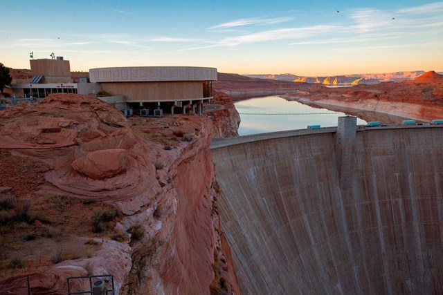
Start in Page: Carl Hayden Visitor Center
The drive starts at Glen Canyon Dam above Page, a convenient pin at the edge of town (any Page address works; the first leg changes only slightly). Fill the tank and pick up coffee and a packed lunch before leaving; this plan has no sit-down lunch stop, and the next planned stop is Kayenta, about 100 miles away. Sunrise at Page on Oct 10 is about 07:27 on the Utah clock (computed from standard solar formulas), so this plan leaves just after first light rather than in the dark. All times use Mountain Daylight Time, the clock in Kayenta and Utah; in daylight-saving months Page's clocks are one hour behind, so 07:15 here reads 06:15 in Page.
- Time
- 15 minutes to fuel up and leave around sunrise; the visitor center itself opens later in the morning and is not part of the plan
Sources (3)
- NPS Data API: Glen Canyon visitor centers · retrieved 2026-10-04
- Time in Arizona (Navajo Nation observes daylight saving time; most of Arizona does not) · retrieved 2026-10-04
- Carl Hayden Visitor Center (NPS) · retrieved 2026-10-04
Page to Kayenta
- Distance
- 101.3 mi
- Drive time
- 1 h 47 min
- Est. tolls
- No tolls
- Via
- N Lake Powell Blvd, AZ-98, US-160
About 100 miles of open Navajo Nation country: AZ-98 joins US-160 into Kayenta. Watch for livestock near the road, especially in the first low-light stretch after sunrise.
Tolls: No toll roads or toll bridges on this leg (as of 2026-10-03); no toll authority applies.
Sources (1)
- OpenStreetMap contributors (road network, routing via local OSRM) · retrieved 2026-10-04
Fuel and stretch in Kayenta
The one planned break on the long run to Monument Valley: a driver change, restroom and fuel stop where US-160 meets US-163, about 107 minutes into the day and right before the turn north. OpenStreetMap lists several gas stations at the junction. Top up here; the next fuel on the route is at Goulding's or in Mexican Hat, both off the plan's timeline, and Cedar Mesa has no services.
- Time
- 10-minute break
Sources (2)
- Kayenta, Arizona (Wikipedia) · retrieved 2026-10-04
- OpenStreetMap contributors (road network, routing via local OSRM) · retrieved 2026-10-04
Kayenta to Monument Valley Visitor Center
- Distance
- 27.4 mi
- Drive time
- 36 min
- Est. tolls
- No tolls
- Via
- US-160, US-163 N, Indian Route 42 (Monument Valley Tribal Park Rd)
US-163 runs north across the Arizona-Utah line and the buttes start appearing on the horizon long before you turn east onto Indian Route 42 for the last stretch to the visitor center.
Tolls: No toll roads or toll bridges on this leg (as of 2026-10-03); no toll authority applies.
Sources (1)
- OpenStreetMap contributors (road network, routing via local OSRM) · retrieved 2026-10-04
Monument Valley Navajo Tribal Park: the 17-mile Valley Drive
The marquee stop of the day. From the visitor center overlook the Mitten Buttes and Merrick Butte fill the view; the park's 17-mile loop road then drops among the formations on rough, sandy terrain, with Navajo vendors selling crafts along the way. Plan about 80 minutes for the loop at a steady pace with photo stops (more if you linger); sites such as Ear of the Wind are reached by Navajo-guided tour only. Motorcycles are not allowed on the loop. Enter well before the posted last-entry time. The loop is a long, dusty block of the day, and the plan has you leave the park by about 11:20 for the drive north.
- Time
- About 80 minutes for the loop at a steady pace, longer with extra stops
- Reservation needed
- No
- Parking
- Visitor center lot
- Fee note
- Park site lists $10 per person per day plus a $15 vehicle fee (as of 2026-10-03); confirm what applies to your party at the gate
- Price as of
- 2026-10-03
Sources (2)
- Monument Valley Navajo Tribal Park (Navajo Nation Parks & Recreation) · retrieved 2026-10-04
- Monument Valley Visitor Center (OpenStreetMap node) · retrieved 2026-10-04
Monument Valley to the Moki Dugway through Valley of the Gods
- Distance
- 51 mi
- Drive time
- 1 h 51 min
- Est. tolls
- No tolls
- Via
- Indian Route 42, US-163 through Mexican Hat, Valley of the Gods Rd (CR 242), UT-261
- Vs default
- {"default_distance_mi":37,"default_drive_minutes":52}
The scenic heart of the drive, and the longest block between stops. Indian Route 42 and US-163 lead north past Goulding's and through Mexican Hat, then you turn onto Valley of the Gods Road (San Juan County Road 242), 17 miles of graded gravel and clay among sandstone monoliths with names like Rooster Butte and the Seven Sailors, per BLM. It exits onto UT-261 at the foot of the Moki Dugway, and the leg ends at the top of the climb. Passenger cars usually manage the road when dry, but BLM says it can be difficult or impassable when wet. BLM suggests about two hours for the loop with stops; the router time of 111 minutes covers the whole leg at OSM's default gravel speeds, so allow extra time for photos. There is no meal stop here: Goulding's Stagecoach Restaurant (see the options) is the sit-down alternative on the way.
Tolls: No toll roads or toll bridges on this leg (as of 2026-10-04); no toll authority applies.
Sources (3)
- Valley of the Gods & Moki Dugway brochure (BLM) · retrieved 2026-10-04
- Valley of the Gods (BLM) · retrieved 2026-10-04
- OpenStreetMap contributors (road network, routing via local OSRM) · retrieved 2026-10-04
Moki Dugway pullout over Valley of the Gods
UT-261 climbs Cedar Mesa on three miles of graded gravel at an 11% grade, rising about 1,200 feet by BLM's count. The dugway was cut in the 1950s for uranium and vanadium ore trucks. The plan stops at the top, where BLM notes a parking area with views back over Valley of the Gods; pull completely off the road for photos. This is also the natural spot for the packed lunch. BLM cautions motor homes and trailers on this road.
- Time
- About 25 minutes for the views and a quick packed lunch
- Reservation needed
- No
- Parking
- BLM notes a parking area near the top of the Dugway
Sources (3)
- Valley of the Gods & Moki Dugway brochure (BLM): grade, length, pullouts · retrieved 2026-10-04
- Moki Dugway viewpoint (OpenStreetMap node) · retrieved 2026-10-04
- OpenStreetMap: Valley of the Gods Road and Moki Dugway · retrieved 2026-10-04
Moki Dugway to Natural Bridges
- Distance
- 29.5 mi
- Drive time
- 1 h 10 min
- Est. tolls
- No tolls
- Via
- UT-261, UT-95, UT-275
Over the top of Cedar Mesa on UT-261, then UT-95 and the short spur of UT-275 to the monument. Mostly high, quiet piñon-juniper country with long gaps between services.
Tolls: No toll roads or toll bridges on this leg (as of 2026-10-04); no toll authority applies.
Sources (1)
- OpenStreetMap contributors (road network, routing via local OSRM) · retrieved 2026-10-04
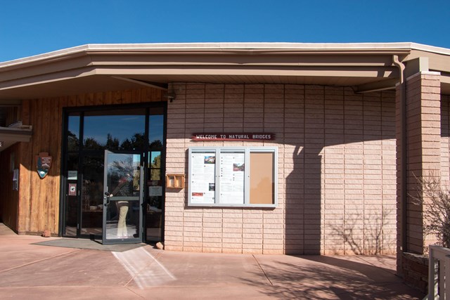
Natural Bridges National Monument: Bridge View Drive
A paved nine-mile loop with short walks to overlooks of the monument's three natural bridges (none are visible from the road). NPS lists about 10 minutes each for the Sipapu, Kachina and Owachomo viewpoint walks; with an hour, do the visitor center and all three viewpoints at an unhurried pace. The visitor center closes at 4 PM (NPS), so the plan arrives at about 14:49 and leaves by 15:49. The monument is cashless: pay by card or buy a pass online.
- Time
- About 60 minutes for the visitor center and three viewpoint walks
- Fee
- $20
- Reservation needed
- No
- Parking
- Visitor center lot and viewpoint lots
- Fee note
- $20 per private vehicle, valid 7 days, as of 2026-10-03; America the Beautiful passes accepted; card or mobile payment only
- Price as of
- 2026-10-03
Sources (5)
- NPS Data API: Natural Bridges visitor center · retrieved 2026-10-04
- Natural Bridges fees and payment (NPS) · retrieved 2026-10-04
- Operating hours: road and trails open 24/7 (NPS) · retrieved 2026-10-04
- Things to do: nine-mile loop (NPS) · retrieved 2026-10-04
- Walk to the Sipapu Bridge Viewpoint, 10 minutes (NPS) · retrieved 2026-10-04
Natural Bridges to Moab
- Distance
- 112.6 mi
- Drive time
- 2 h 3 min
- Est. tolls
- No tolls
- Via
- UT-275, UT-95, US-191 via Blanding and Monticello
UT-275 back to UT-95, then east through Blanding and north on US-191 over the high plateau (La Sal Mountains to the east) and down into Moab. This is the day's last long block, about two hours with no planned stop. Blanding and Monticello are the fuel and restroom towns on the way if you need a break; Monticello is also where the scenic alternatives in the options branch off. Watch for wildlife at dusk.
Tolls: No toll roads or toll bridges on this leg (as of 2026-10-04); no toll authority applies.
Sources (1)
- OpenStreetMap contributors (road network, routing via local OSRM) · retrieved 2026-10-04
Dinner in Moab at Desert Bistro
The finish line is a sit-down dinner in downtown Moab, reached at about 17:52 with sunset around 18:49. The restaurant describes its cooking as internationally inspired fine cuisine with a southwestern flair, takes reservations, and opens at 5 PM; book for about 6:00 PM so there is time to park. If a quicker meal suits the hour, see the Moab Grill option.
- Meal
- Dinner
- Cuisine
- Internationally inspired, southwestern flair
- Reservation needed
- Yes
- Reservation notes
- Official site offers reservations for 1-6 guests
Sources (2)
- Desert Bistro (official site: address, hours, reservations) · retrieved 2026-10-04
- OpenStreetMap contributors (road network, routing via local OSRM) · retrieved 2026-10-04
Where to stay
Where to eat
Sit-down lunch alternative: Stagecoach Restaurant at Goulding's
If a packed lunch will not do, Goulding's sits right on the route 5.6 miles from the Monument Valley visitor center: a sit-down lunch with cliff and butte views through large windows, Southwestern and American dishes from an all-day menu. Goulding's is owned by the Navajo Nation, and the property also has a trading post museum and gas station if you need to top off. Budget about 40 minutes plus a few minutes' detour; that pushes Natural Bridges to about 15:30, so trim the viewpoint walks to fit before the 4 PM visitor-center close.

- Meal
- Lunch
- Cuisine
- Southwestern / American
- Reservation needed
- No
- Alt note
- Replaces the packed lunch at the Moki Dugway
- Detour minutes
- 5
Sources (2)
- Goulding's Resort (official site: address, gas and grocery on site) · retrieved 2026-10-04
- Stagecoach Restaurant (Goulding's Resort official site) · retrieved 2026-10-04
Quicker dinner: Moab Grill
Home-style Main Street diner-grill with burgers, steaks and a long breakfast menu, open every day from early morning until late evening per its website. Handy if the day runs late.
- Meal
- Dinner
- Cuisine
- American grill, burgers, breakfast
- Reservation needed
- No
Sources (2)
- Moab Grill (official site: address, hours) · retrieved 2026-10-04
- OpenStreetMap contributors (road network, routing via local OSRM) · retrieved 2026-10-04
More options
Scenic alternative: La Sal Mountain Loop and the Colorado River road into Moab
Instead of continuing on US-191 from Monticello straight into Moab, climb the 60-mile paved La Sal Mountain Loop (USFS: about 2.5 to 3 hours to drive end to end, not suitable for large RVs or trailers, no services along it), drop into Castle Valley and follow UT-128 along the Colorado River into town. A navigation app prefers the direct highway. Too long to add after Natural Bridges the same day; it works if you skip Natural Bridges or split the trip. The USFS page mentions a federal highway widening project on the loop, so check for road work before committing.
- Distance
- 96.2 mi
- Drive time
- 2 h 6 min
- Est. tolls
- No tolls
- Via
- US-191, La Sal Mountain Loop Rd (CR-127 / CR-73), Castle Valley Rd, UT-128
- To
- Desert Bistro, Moab
- From
- Monticello (US-191 at Center St)
- Vs default
- {"extra_miles":41.9,"extra_minutes":70,"default_distance_mi":54.3,"default_drive_minutes":56}
Tolls: No toll roads (as of 2026-10-04).
Sources (3)
- Utah State Route 128 (Wikipedia) · retrieved 2026-10-04
- La Sal Mountain Loop State Scenic Backway (USFS Manti-La Sal National Forest) · retrieved 2026-10-04
- OpenStreetMap contributors (road network, routing via local OSRM) · retrieved 2026-10-04
Scenic alternative: Needles Overlook via Canyon Rims Road
A side trip west on Canyon Rims Road (CR-133) to Needles Overlook, a BLM viewpoint above the Needles district of Canyonlands (BLM describes the road as paved). Out-and-back from US-191, then on to Moab. A navigation app would never route this. Adds roughly an hour and three-quarters; a daylight-only option best taken with an early start or an overnight in Moab.
- Distance
- 98 mi
- Drive time
- 2 h 42 min
- Est. tolls
- No tolls
- Via
- US-191, Canyon Rims Rd (CR-133 / BLM B133) out and back, US-191
- To
- Desert Bistro, Moab
- From
- Monticello (US-191 at Center St)
- Vs default
- {"extra_miles":43.7,"extra_minutes":106,"default_distance_mi":54.3,"default_drive_minutes":56}
Tolls: No toll roads (as of 2026-10-04).
Sources (2)
- Needles Overlook Interpretive Site (BLM) · retrieved 2026-10-04
- OpenStreetMap contributors (road network, routing via local OSRM) · retrieved 2026-10-04
Optional detour: Goosenecks State Park
A deep, entrenched meander of the San Juan River, viewed from the rim of the canyon. The access road is UT-316 off UT-261 near Mexican Hat. Utah State Parks lists the park as open 24 hours with a day-use fee. OSM puts a round trip from Mexican Hat at about 14 miles and 45 minutes, which does not fit the one-day schedule; consider it only with an overnight stop.

- Time
- About 30 minutes at the rim
- Reservation needed
- No
- Detour minutes
- 45
Sources (2)
- Goosenecks State Park (Utah State Parks) · retrieved 2026-10-04
- OpenStreetMap contributors (road network, routing via local OSRM) · retrieved 2026-10-04
Route map
- Carl Hayden Visitor Center (opens Google Maps in a new tab) Day 1
- Kayenta (US-160 at US-163) (opens Google Maps in a new tab) Day 1
- Monument Valley Navajo Tribal Park Visitor Center (opens Google Maps in a new tab) Day 1
- Moki Dugway (top of the climb, UT-261) (opens Google Maps in a new tab) Day 1
- Natural Bridges Visitor Center (opens Google Maps in a new tab) Day 1
- Desert Bistro (opens Google Maps in a new tab) Day 1
- Stagecoach Restaurant at Goulding's Resort (opens Google Maps in a new tab) Option
- Goosenecks State Park (opens Google Maps in a new tab) Option
- Apache Motel (opens Google Maps in a new tab) Option
- Moab Springs Ranch (opens Google Maps in a new tab) Option
- Red Cliffs Lodge Moab (opens Google Maps in a new tab) Option
- Moab Grill (opens Google Maps in a new tab) Option
Good to know
Route, timing and weekday assumptions
- Assumed weekday: a Saturday departure (Saturday Oct 10, 2026). Natural Bridges' visitor center is open Friday through Monday in the off-season, so a Saturday works; on a Tuesday-Thursday in fall the visitor center would be closed (the road and trails stay open). Confirm hours before you go; see also the dated block below.
- Clock: all times use Mountain Daylight Time, which Kayenta, Monument Valley and Utah observe in daylight-saving months. Page, Arizona stays on Mountain Standard Time all year, so in those months Page clocks run one hour behind the times in this plan.
- Daylight: sunrise at Page on Oct 10 is about 07:27 on the Utah clock, so the 07:15 start is at first light. The plan reaches Moab about 17:52, before sunset (about 18:49 in Moab on that date; both computed from standard solar formulas). The Valley of the Gods and Moki Dugway sections are best done in daylight.
- Total driving: 321.8 miles and 7 hours 27 minutes (447 minutes) of driving time (sum of the five legs, no tolls). The direct OSM route Page to Moab is about 276 miles and 4 hours 45 minutes.
- Stop rhythm: driving blocks between stops are 107 minutes (Page to Kayenta), 36 minutes (Kayenta to Monument Valley), 111 minutes (Monument Valley to the top of the Moki Dugway through Valley of the Gods, including gravel), 70 minutes (Dugway to Natural Bridges) and 123 minutes (Natural Bridges to Moab).
Driving notes
- Valley of the Gods Road is graded gravel and clay; BLM says passenger cars generally manage it when dry but it can be difficult or impassable when wet. An OSM contributor note on the road says the second half toward UT-261 may need high clearance, so check with a rental company before taking a low car. Check UDOT (UT-261) and the BLM Monticello Field Office (435-587-1500) for current road status on the day of travel.
- The Moki Dugway is three miles of graded gravel at about 11% grade; BLM cautions motor homes and trailers. Pull completely off the road to photograph.
- Cell service is unreliable on Cedar Mesa; carry water and a full tank. No tolls anywhere on the route.
- Fuel and food: fill up in Page, then Kayenta (planned break). Goulding's (gas, grocery and the Stagecoach Restaurant) and Mexican Hat or Bluff are the next options after Monument Valley, and Blanding or Monticello come later on US-191. There is nothing planned for lunch, so pack one.
Current conditions (as of 2026-10-04)
- Monument Valley Navajo Tribal Park lists Valley Drive hours of 8 AM-6 PM with last entry 3:30 PM through Oct 16, 2026, then winter hours from Oct 17 (8 AM-5 PM, last entry 2:30 PM). The page lists fees of $10 per person per day plus a $15 per-vehicle fee and says entry is first come, first served; confirm at the gate.
- Natural Bridges National Monument is cashless (card or mobile payment); the entrance fee is $20 per private vehicle for 7 days. The NPS visitor-center page says it is open 9 AM to 4 PM, seven days a week through September and Friday through Monday in the off-season; the NPS API record also lists daily hours through Oct 31, 2026 and reduced days from Nov 1.
- No closure or alert for Valley of the Gods or UT-261 was found on the BLM page, but UDOT road status could not be read for this draft; check it before you go.
- Goosenecks State Park lists open 24 hours; check day-use fee on the Utah State Parks site.
Want live alerts and up-to-date info?
Roads, tolls and closures change fast. Create an account on the DriftKin app to get live alerts and up-to-date information for your drive.
Before you go
Hours, fees and road conditions change; confirm with the official sites in each item's sources before you leave.
Sources
Good to know: distances and drive times are typical figures without live traffic, and where routes are shown the route data comes from OpenStreetMap contributors. Toll amounts are estimates and change often, so check them in the DriftKin planner or with the toll authority before you plan around them. Opening hours, fees, prices, permits and closures also change, so confirm with the park or business before you go.
- NPS Data API: Glen Canyon visitor centers retrieved 2026-10-04
- Time in Arizona (Navajo Nation observes daylight saving time; most of Arizona does not) retrieved 2026-10-04
- Carl Hayden Visitor Center (NPS) retrieved 2026-10-04
- OpenStreetMap contributors (road network, routing via local OSRM) retrieved 2026-10-04
- Kayenta, Arizona (Wikipedia) retrieved 2026-10-04
- Monument Valley Navajo Tribal Park (Navajo Nation Parks & Recreation) retrieved 2026-10-04
- Monument Valley Visitor Center (OpenStreetMap node) retrieved 2026-10-04
- Valley of the Gods & Moki Dugway brochure (BLM): grade, length, pullouts retrieved 2026-10-04
- Valley of the Gods (BLM) retrieved 2026-10-04
- Moki Dugway viewpoint (OpenStreetMap node) retrieved 2026-10-04
- OpenStreetMap: Valley of the Gods Road and Moki Dugway retrieved 2026-10-04
- NPS Data API: Natural Bridges visitor center retrieved 2026-10-04
- Natural Bridges fees and payment (NPS) retrieved 2026-10-04
- Operating hours: road and trails open 24/7 (NPS) retrieved 2026-10-04
- Things to do: nine-mile loop (NPS) retrieved 2026-10-04
- Walk to the Sipapu Bridge Viewpoint, 10 minutes (NPS) retrieved 2026-10-04
- Desert Bistro (official site: address, hours, reservations) retrieved 2026-10-04
- Goulding's Resort (official site: address, gas and grocery on site) retrieved 2026-10-04
- Stagecoach Restaurant (Goulding's Resort official site) retrieved 2026-10-04
- Utah State Route 128 (Wikipedia) retrieved 2026-10-04
- La Sal Mountain Loop State Scenic Backway (USFS Manti-La Sal National Forest) retrieved 2026-10-04
- Needles Overlook Interpretive Site (BLM) retrieved 2026-10-04
- Goosenecks State Park (Utah State Parks) retrieved 2026-10-04
- Apache Motel (official site) retrieved 2026-10-04
- Moab Springs Ranch (official site) retrieved 2026-10-04
- Red Cliffs Lodge Moab (official site) retrieved 2026-10-04
- Moab Grill (official site: address, hours) retrieved 2026-10-04
More trips like this
 Road tripLas Vegas to Lone Pine
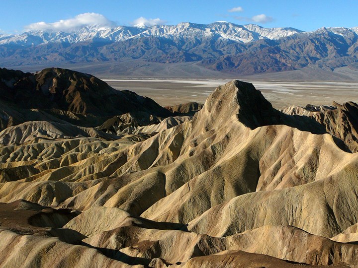
Las Vegas to Lone Pine in One Day: Through Death Valley to the Eastern Sierra
1 day Moderate$$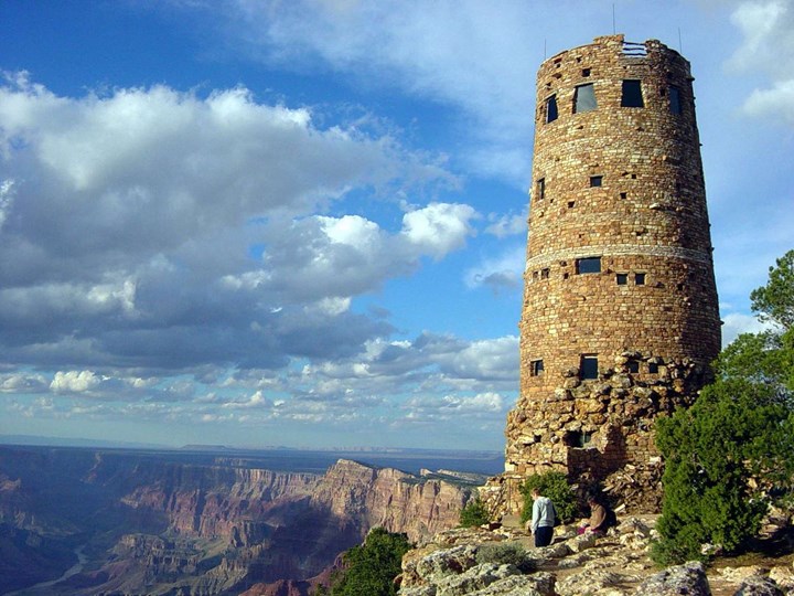 Road tripPhoenix to Grand Canyon (South Rim) via Sedona
Phoenix to the Grand Canyon in One Day: Red Rocks, Oak Creek and the East Rim
1 day Moderate$$ Road tripBoston to Portland via the White Mountains
Boston to Portland the Long Way: The Kancamagus and the White Mountains
1 day Easy$$