Rapid City to Medora: A 4-Day Black Hills, Badlands and Devils Tower Road Trip
Three nights, one new base a night, from the Badlands through the Black Hills and Devils Tower to a finale in Theodore Roosevelt's Medora
- Length
- 4 days
- Total distance
- 603.1 mi
- Driving time
- 11 h 28 min
- Est. tolls
- No tolls
- Stops
- 14
- Driving
- Moderate
- Best months
- May–Jun, Sep
- Budget
- $$
Four days and three nights from Rapid City to Medora: the Badlands Loop Road and Door Trail, Mount Rushmore and Custer State Park's Needles Highway, Devils Tower, and the South Unit of Theodore Roosevelt National Park. Days 1 to 3 each end at a new base after about 2 to 3.5 hours of driving; Day 4 finishes in Medora, with no overnight there.
- Drive time11 h 28 min
- Distance603.1 mi
- Est. tollsNo tolls
- Needles Highway and the Needles Eye Tunnel in Custer State Park
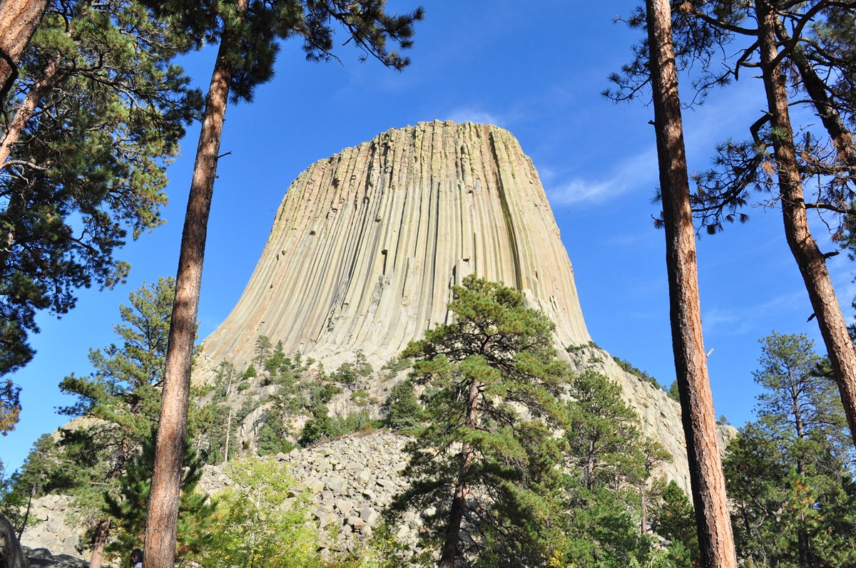
- Devils Tower from the paved Tower Trail
- Badlands Loop Road with the Door and Window boardwalks
The story
The rhythm is simple: drive to something worth seeing, explore it, sleep nearby and move on, for three nights. This trip starts at Main Street Square in Rapid City and ends in Medora, North Dakota, by way of the Badlands, the Black Hills and Devils Tower.
Day one is Badlands country: lunch at Wall Drug, the Pinnacles Overlook, the Loop Road and the short Door and Window boardwalks, with a night at Cedar Pass Lodge. Day two climbs into the Black Hills for Mount Rushmore, Iron Mountain Road's tunnels, the Wildlife Loop in Custer State Park and the one-lane Needles Eye Tunnel, ending beside Sylvan Lake. Day three crosses into Wyoming for the Tower Trail at Devils Tower, then loops back through the historic general store at Aladdin to Belle Fourche, where a monument marks what the museum calls the geographic center of the nation.
Day four is the long, quiet run up US-85 to Painted Canyon, a Western-style lunch in Medora and the South Unit Scenic Drive of Theodore Roosevelt National Park. None of it is technical driving, but the byways are narrow and winding, distances are real, and wildlife shares the road.
Day by day
Rapid City to the Badlands: Wall Drug, the Loop Road and the Door
Drive east to Wall for lunch, enter the Badlands at the Pinnacles and follow the Loop Road to the Door and Window boardwalks, ending at Cedar Pass Lodge inside the park.
Start in Rapid City
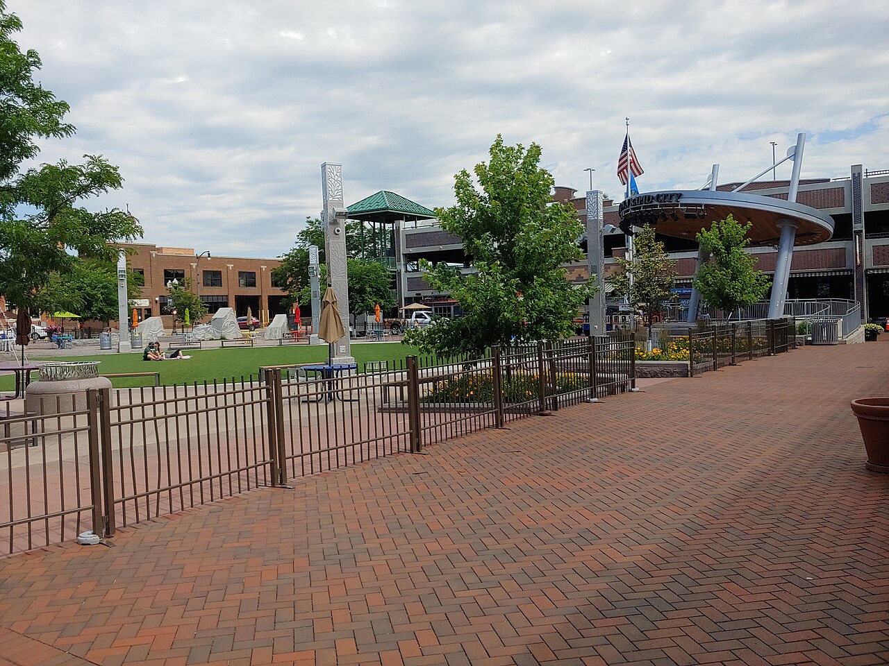
Begin at Main Street Square, the downtown plaza that Visit Rapid City says is run by a nonprofit. Park nearby, fill the tank and pick up water and snacks; the first real stop, Wall Drug, is about an hour east on I-90, and the days ahead include long stretches between towns.
- Time
- Fuel, coffee and supplies before the drive
Sources (2)
- OpenStreetMap Nominatim - coordinates · retrieved 2026-10-07
- Visit Rapid City - Main Street Square (address, operator) · retrieved 2026-10-07
Rapid City to Wall Drug
- Distance
- 55.4 mi
- Drive time
- 50 min
- Est. tolls
- No tolls
- Via
- I-90 E
I-90 east across open grassland to the town of Wall. Wall Drug is on Main Street, a short drive from the interstate exit.
Tolls: No tolls on this leg (as of 2026-10-07): SDDOT says all South Dakota state roads and bridges are toll-free, and FHWA Highway Statistics Table HM-25 lists no tolled road miles in South Dakota, Wyoming or North Dakota.
Sources (3)
- South Dakota DOT: all South Dakota state-owned roads and bridges are toll-free · retrieved 2026-10-07
- FHWA Highway Statistics Table HM-25: tolled roadway length by state (South Dakota, Wyoming and North Dakota list 0 miles) · retrieved 2026-10-07
- OpenStreetMap contributors (route computed with a local OSRM router) · retrieved 2026-10-07
Lunch at Wall Drug
Wall Drug's site says the business was established in 1931 and now offers dining, shopping, visitor information and, famously, free ice water. Its cafe is listed 8 am to 5 pm daily and the main store 8 am to 6 pm. Eat here before the park, then take your free ice water with you.
- Meal
- Lunch
- Cuisine
- American cafe
- Reservation needed
- No
Sources (1)
- Wall Drug official site (address, hours, history) · retrieved 2026-10-07
Wall Drug to Pinnacles Overlook
- Distance
- 8.8 mi
- Drive time
- 12 min
- Est. tolls
- No tolls
- Via
- SD-240 (Badlands Loop Road)
South from Wall on SD-240 to the Pinnacles Entrance, the northwest corner of the Badlands Loop Road.
Tolls: No tolls on this leg (as of 2026-10-07): SDDOT says all South Dakota state roads and bridges are toll-free, and FHWA Highway Statistics Table HM-25 lists no tolled road miles in South Dakota, Wyoming or North Dakota.
Sources (3)
- South Dakota DOT: all South Dakota state-owned roads and bridges are toll-free · retrieved 2026-10-07
- FHWA Highway Statistics Table HM-25: tolled roadway length by state (South Dakota, Wyoming and North Dakota list 0 miles) · retrieved 2026-10-07
- OpenStreetMap contributors (route computed with a local OSRM router) · retrieved 2026-10-07
Pinnacles Overlook
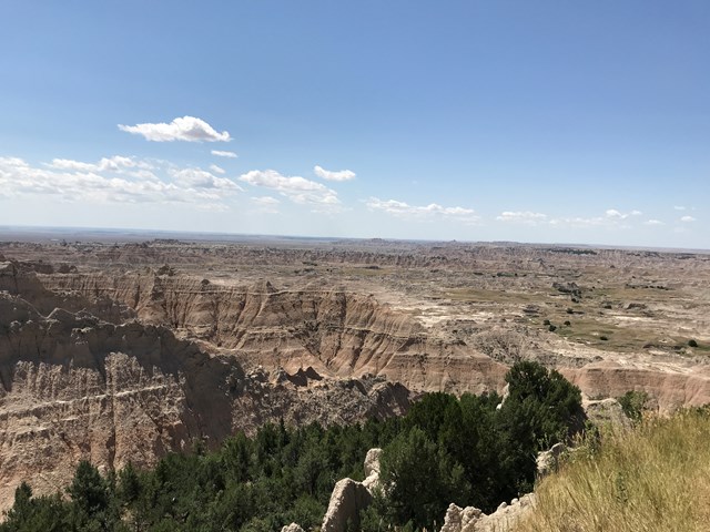
Pinnacles Overlook faces south over the Sage Creek Wilderness, and its caption calls it a great sunset destination. At midday the view still runs far across the grassland, and on a clear day the Black Hills can show on the horizon. It is also a popular spot for bighorn sheep, with lambing in late April to early May.
- Time
- About 40 minutes
- Best time
- Sunset; this plan visits at midday
- Reservation needed
- No
Sources (3)
- NPS Data API - places (badl) · retrieved 2026-10-07
- NPS - Pinnacles Overlook · retrieved 2026-10-07
- NPS - Badlands Sunrises & Sunsets · retrieved 2026-10-07
Pinnacles Overlook to Door Trailhead
- Distance
- 23.9 mi
- Drive time
- 40 min
- Est. tolls
- No tolls
- Via
- SD-240 (Badlands Loop Road)
The Badlands Loop Road (SD-240) runs east along the edge of the Wall past overlooks such as Yellow Mounds, Bigfoot Pass and Panorama Point. Driving takes about 40 minutes; this schedule adds roughly 30 minutes of pull-offs, so the hike starts at 2:25 pm.
Tolls: No tolls on this leg (as of 2026-10-07): SDDOT says all South Dakota state roads and bridges are toll-free, and FHWA Highway Statistics Table HM-25 lists no tolled road miles in South Dakota, Wyoming or North Dakota.
Sources (4)
- South Dakota DOT: all South Dakota state-owned roads and bridges are toll-free · retrieved 2026-10-07
- FHWA Highway Statistics Table HM-25: tolled roadway length by state (South Dakota, Wyoming and North Dakota list 0 miles) · retrieved 2026-10-07
- NPS - Yellow Mounds Overlook (Loop Road overlook) · retrieved 2026-10-07
- OpenStreetMap contributors (route computed with a local OSRM router) · retrieved 2026-10-07
Door Trail and Window Trail
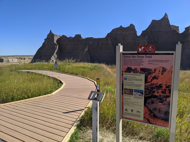
From the Door and Window parking area, the Door Trail is 0.75 mile round trip, mostly boardwalk, ending at a panoramic badlands view; beyond the end of the maintained trail you are on your own. The separate Window Trail is a 0.25-mile round-trip boardwalk to a natural window above an eroded canyon. Do both for the classic first look.
- Distance
- 0.75 mi
- Elevation gain
- 32 ft
- Route
- Out and back
- Difficulty
- Easy
- Dogs allowed
- No
- Trailhead
- Door and Window parking area off SD-240
- Distance note
- Door Trail only: 0.75 mi round trip; the Window Trail adds 0.25 mi round trip. No elevation gain is given; the 32 ft figure (Door Trail) comes from the Cedar Pass Lodge concessioner's trail list, which rounds the trail to 0.8 mi.
Sources (5)
- NPS Data API - places (badl) · retrieved 2026-10-07
- Cedar Pass Lodge - Explore (Door Trail 32 ft gain) · retrieved 2026-10-07
- NPS - Door Trail · retrieved 2026-10-07
- NPS - Window Trail · retrieved 2026-10-07
- NPS - Hiking the Badlands (Door 0.75 mi RT, Window 0.25 mi RT) · retrieved 2026-10-07
Door Trailhead to Cedar Pass Lodge
- Distance
- 2.3 mi
- Drive time
- 6 min
- Est. tolls
- No tolls
- Via
- SD-240
A few minutes back along SD-240 to the lodge near the Ben Reifel Visitor Center.
Tolls: No tolls on this leg (as of 2026-10-07): SDDOT says all South Dakota state roads and bridges are toll-free, and FHWA Highway Statistics Table HM-25 lists no tolled road miles in South Dakota, Wyoming or North Dakota.
Sources (3)
- South Dakota DOT: all South Dakota state-owned roads and bridges are toll-free · retrieved 2026-10-07
- FHWA Highway Statistics Table HM-25: tolled roadway length by state (South Dakota, Wyoming and North Dakota list 0 miles) · retrieved 2026-10-07
- OpenStreetMap contributors (route computed with a local OSRM router) · retrieved 2026-10-07
Overnight at Cedar Pass Lodge
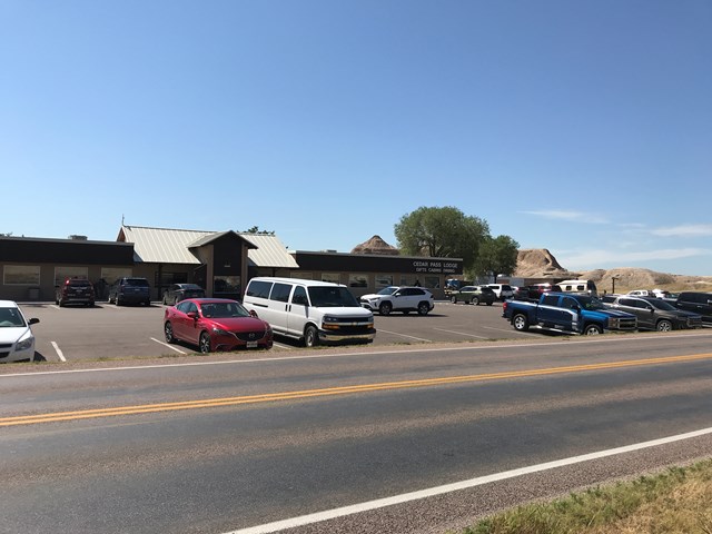
The in-park base, with cabins a short drive from the Door and Window trails. The lodge site lists check-in at 4 PM and check-out at 11 AM, and the Waysides restaurant serves breakfast from 7 and dinner until 8 PM, handy for the early start to Rushmore. Norbeck Pass, a few miles west, is listed among the sunset spots. Check current rates.
- Type
- Cabin
- Location
- Inside the park
- Booking
- Book / details
- Reservation notes
- Reserve online or by phone, 855-765-0737. Check current rates.
Sources (4)
- NPS Data API - places (badl) · retrieved 2026-10-07
- Cedar Pass Lodge - Stay (season, check-in, Waysides hours) · retrieved 2026-10-07
- NPS - Cedar Pass Lodge · retrieved 2026-10-07
- NPS - Badlands sunrise and sunset spots (Norbeck Pass) · retrieved 2026-10-07
Into the Black Hills: Mount Rushmore, Custer State Park and the Needles Highway
Drive to Mount Rushmore, wind down Iron Mountain Road to Custer State Park for lunch and the Wildlife Loop, then climb the Needles Highway to a night beside Sylvan Lake.
Cedar Pass Lodge to Mount Rushmore
- Distance
- 106 mi
- Drive time
- 1 h 48 min
- Est. tolls
- No tolls
- Via
- SD-240, I-90 W, US-16, US-16A, SD-244
I-90 west to Rapid City, then US-16 up into the Black Hills. This is the longest leg of the day, so leave right after breakfast at Waysides, which opens at 7 am.
Tolls: No tolls on this leg (as of 2026-10-07): SDDOT says all South Dakota state roads and bridges are toll-free, and FHWA Highway Statistics Table HM-25 lists no tolled road miles in South Dakota, Wyoming or North Dakota.
Sources (3)
- South Dakota DOT: all South Dakota state-owned roads and bridges are toll-free · retrieved 2026-10-07
- FHWA Highway Statistics Table HM-25: tolled roadway length by state (South Dakota, Wyoming and North Dakota list 0 miles) · retrieved 2026-10-07
- OpenStreetMap contributors (route computed with a local OSRM router) · retrieved 2026-10-07
Mount Rushmore from the Grand View Terrace
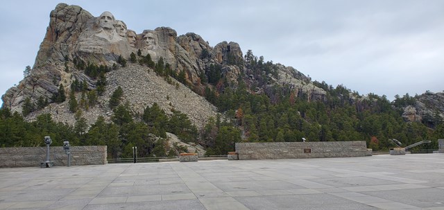
The Grand View Terrace is the main viewing area and the first place for a close, unobstructed look, reached along the Avenue of Flags. From the terrace the 0.6-mile Presidential Trail loops past new angles, with 422 stairs on its last 0.4 mile, and the Lincoln Borglum Visitor Center sits below. Carver's Cafe is on site.
- Time
- Allow about 90 minutes; the Presidential Trail takes 20-45 minutes
- Best time
- Morning
- Reservation needed
- No
- Fee note
- No entrance fee; parking is charged (see current conditions)
Sources (5)
- NPS Data API - places (moru) · retrieved 2026-10-07
- NPS - Mount Rushmore hours · retrieved 2026-10-07
- NPS - Grand View Terrace · retrieved 2026-10-07
- NPS - Presidential Trail (0.6 mi, 422 stairs) · retrieved 2026-10-07
- NPS - Walk the Presidential Trail (20-45 minutes) · retrieved 2026-10-07
Mount Rushmore to Custer State Park Visitor Center
- Distance
- 20.5 mi
- Drive time
- 35 min
- Est. tolls
- No tolls
- Via
- SD-244 and US-16A (Iron Mountain Road)
Iron Mountain Road (US-16A) begins at the memorial's edge and winds south through pigtail bridges and single-lane tunnels that frame Mount Rushmore. Go slowly and honk before each tunnel; the road can close in hazardous weather. The 65 minutes before the Wildlife Loop leave time for lunch at the State Game Lodge next door (restaurant lunch 11 am-4:30 pm in summer, reservations recommended, 605-255-4541).
Tolls: No tolls on this leg (as of 2026-10-07): SDDOT says all South Dakota state roads and bridges are toll-free, and FHWA Highway Statistics Table HM-25 lists no tolled road miles in South Dakota, Wyoming or North Dakota.
Sources (6)
- South Dakota DOT: all South Dakota state-owned roads and bridges are toll-free · retrieved 2026-10-07
- Custer State Park Resort - Iron Mountain Road · retrieved 2026-10-07
- Custer State Park Resort - Dining (State Game Lodge lunch hours) · retrieved 2026-10-07
- FHWA Highway Statistics Table HM-25: tolled roadway length by state (South Dakota, Wyoming and North Dakota list 0 miles) · retrieved 2026-10-07
- NPS - Iron Mountain Road (North Entrance) · retrieved 2026-10-07
- OpenStreetMap contributors (route computed with a local OSRM router) · retrieved 2026-10-07
Wildlife Loop Road in Custer State Park
SD Game, Fish & Parks lists the Wildlife Loop Road at 18 miles and about 1.5 hours depending on wildlife jams. It cites roughly 1,350 free-roaming buffalo, plus deer, elk, bighorn sheep and coyotes, with early morning and late evening the best viewing. Stay in the car around bison and pull fully off the road to watch.

- Time
- About 1.5 hours per GFP; allow more for wildlife jams
- Best time
- Early morning or late evening; this plan drives it in the afternoon
- Fee
- $25
- Reservation needed
- No
- Fee note
- Custer State Park entrance license, per vehicle for 1-7 days (see current conditions)
- Distance note
- 18-mile loop per GFP; the drive is not counted in the leg totals.
Sources (2)
- SD Game, Fish & Parks - Scenic Drives (Wildlife Loop) · retrieved 2026-10-07
- SD Game, Fish & Parks - Custer State Park (visitor center, fees) · retrieved 2026-10-07
Custer State Park Visitor Center to Needles Eye Tunnel
- Distance
- 18.5 mi
- Drive time
- 41 min
- Est. tolls
- No tolls
- Via
- US-16A and SD-87 (Needles Highway)
Rejoin US-16A and turn north onto SD-87, the Needles Highway, which GFP lists as 14 miles and an hour or more. Expect granite spires close to the road, tight curves and one-lane tunnels; take turns and slow down.
Tolls: No tolls on this leg (as of 2026-10-07): SDDOT says all South Dakota state roads and bridges are toll-free, and FHWA Highway Statistics Table HM-25 lists no tolled road miles in South Dakota, Wyoming or North Dakota.
Sources (4)
- South Dakota DOT: all South Dakota state-owned roads and bridges are toll-free · retrieved 2026-10-07
- SD Game, Fish & Parks - Scenic Drives (Needles Highway) · retrieved 2026-10-07
- FHWA Highway Statistics Table HM-25: tolled roadway length by state (South Dakota, Wyoming and North Dakota list 0 miles) · retrieved 2026-10-07
- OpenStreetMap contributors (route computed with a local OSRM router) · retrieved 2026-10-07
Needles Eye Tunnel on the Needles Highway
The Needles Eye Tunnel is a one-lane bore through a granite wall between rock spires. GFP lists it at 8 feet wide and 9 feet 9 inches high; other sources give slightly different figures, so check posted limits and skip it in a large RV or with wide mirrors. Take turns through the tunnel and enjoy the pinnacles.

- Time
- About 30 minutes
- Best time
- Mid-afternoon, when the road is less crowded than midday
- Fee
- $25
- Reservation needed
- No
- Fee note
- Custer State Park entrance license (see current conditions)
Sources (2)
- SD Game, Fish & Parks - Scenic Drives (Needles Eye Tunnel dimensions, seasonal closure) · retrieved 2026-10-07
- OpenStreetMap Nominatim - coordinates · retrieved 2026-10-07
Needles Eye Tunnel to Sylvan Lake Lodge
- Distance
- 2 mi
- Drive time
- 5 min
- Est. tolls
- No tolls
- Via
- SD-87
A few minutes on along SD-87 to Sylvan Lake, which sits at the northern end of the Needles Highway.
Tolls: No tolls on this leg (as of 2026-10-07): SDDOT says all South Dakota state roads and bridges are toll-free, and FHWA Highway Statistics Table HM-25 lists no tolled road miles in South Dakota, Wyoming or North Dakota.
Sources (3)
- South Dakota DOT: all South Dakota state-owned roads and bridges are toll-free · retrieved 2026-10-07
- FHWA Highway Statistics Table HM-25: tolled roadway length by state (South Dakota, Wyoming and North Dakota list 0 miles) · retrieved 2026-10-07
- OpenStreetMap contributors (route computed with a local OSRM router) · retrieved 2026-10-07
Overnight at Sylvan Lake Lodge
A 1937 lodge at 6,145 feet beside Sylvan Lake, with 31 cabins on a pine-and-spruce hillside plus lodge rooms. The restaurant lists breakfast 7-10 am, lunch 11 am-3 pm and dinner 4-8 pm. Check-in time is not listed on the pages checked; check current rates and book direct.
- Type
- Lodge
- Location
- Inside the park
- Booking
- Book / details
- Address note
- The resort's contact page lists the address as 24572 US Hwy 87; the road is SD-87.
- Reservation notes
- Reserve through Custer State Park Resort (888-875-0001). Rates not shown on the pages checked; check current rates.
Sources (3)
- Custer State Park Resort - Contact (address, phone) · retrieved 2026-10-07
- Custer State Park Resort - Dining (Sylvan Lake restaurant hours) · retrieved 2026-10-07
- Custer State Park Resort - Sylvan Lake Lodge (season, elevation, cabins) · retrieved 2026-10-07
Devils Tower and the Wyoming prairie to Belle Fourche
Cross into Wyoming for the Tower Trail at Devils Tower, stop at Aladdin's historic store, and finish in Belle Fourche beside the Center of the Nation monument.
Sylvan Lake Lodge to the Wyoming state line
- Distance
- 33.5 mi
- Drive time
- 43 min
- Est. tolls
- No tolls
- Via
- SD-87, SD-89, US-16
Down through Custer and west on US-16 to the South Dakota-Wyoming line, where this leg ends and the next begins (the local OSM regions meet here; it is a routing point, not a stop). Fuel up in Custer first, and take a break wherever it is safe.
Tolls: No tolls on this leg (as of 2026-10-07): SDDOT says all South Dakota state roads and bridges are toll-free, and FHWA Highway Statistics Table HM-25 lists no tolled road miles in South Dakota, Wyoming or North Dakota.
Sources (3)
- South Dakota DOT: all South Dakota state-owned roads and bridges are toll-free · retrieved 2026-10-07
- FHWA Highway Statistics Table HM-25: tolled roadway length by state (South Dakota, Wyoming and North Dakota list 0 miles) · retrieved 2026-10-07
- OpenStreetMap contributors (route computed with a local OSRM router) · retrieved 2026-10-07
Wyoming state line to Devils Tower
- Distance
- 84.7 mi
- Drive time
- 1 h 29 min
- Est. tolls
- No tolls
- Via
- US-16, US-85, WY-585, I-90, US-14, WY-24
Quiet roads north and west: US-16 and US-85, WY-585, a short hop on I-90, then US-14 and WY-24 to the Devils Tower road. Plan on about 90 minutes without stops and watch for farm traffic.
Tolls: No tolls on this leg (as of 2026-10-07): SDDOT says all South Dakota state roads and bridges are toll-free, and FHWA Highway Statistics Table HM-25 lists no tolled road miles in South Dakota, Wyoming or North Dakota.
Sources (3)
- South Dakota DOT: all South Dakota state-owned roads and bridges are toll-free · retrieved 2026-10-07
- FHWA Highway Statistics Table HM-25: tolled roadway length by state (South Dakota, Wyoming and North Dakota list 0 miles) · retrieved 2026-10-07
- OpenStreetMap contributors (route computed with a local OSRM router) · retrieved 2026-10-07
Tower Trail Loop at Devils Tower
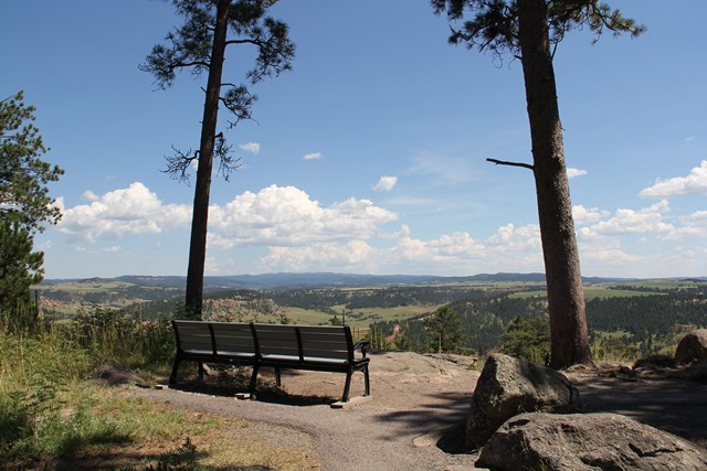
The paved Tower Trail circles the base of the tower: 1.3 miles, with a very steep start, benches and wayside signs. Allow 45 to 60 minutes and watch for climbers on the rock. Spring and fall are the best seasons; summer can be very hot. A picnic area by the river suits a packed lunch.
- Fee
- $25
- Reservation needed
- No
- Fee note
- Park entrance fee, per private vehicle (see current conditions)
- Trailhead
- Devils Tower Visitor Center
- Difficulty
- easy
- Route type
- loop
- Distance mi
- 1.3
- Dogs allowed
- No
- Distance note
- 1.3-mile paved loop; no elevation gain published, so this is typed as an activity rather than a hike.
Sources (5)
- NPS Data API - thingstodo (deto) · retrieved 2026-10-07
- NPS Data API - visitorcenters (deto) · retrieved 2026-10-07
- NPS - Devils Tower hiking (1.3-mile loop) · retrieved 2026-10-07
- NPS - Walk the Tower Trail Loop · retrieved 2026-10-07
- NPS - Eat Lunch at the Devils Tower Picnic Area · retrieved 2026-10-07
Devils Tower to Aladdin
- Distance
- 37 mi
- Drive time
- 43 min
- Est. tolls
- No tolls
- Via
- WY-110, WY-24
Leave the monument on WY-24 and wind east through rolling ranch country toward the Wyoming-South Dakota line.
Tolls: No tolls on this leg (as of 2026-10-07): SDDOT says all South Dakota state roads and bridges are toll-free, and FHWA Highway Statistics Table HM-25 lists no tolled road miles in South Dakota, Wyoming or North Dakota.
Sources (3)
- South Dakota DOT: all South Dakota state-owned roads and bridges are toll-free · retrieved 2026-10-07
- FHWA Highway Statistics Table HM-25: tolled roadway length by state (South Dakota, Wyoming and North Dakota list 0 miles) · retrieved 2026-10-07
- OpenStreetMap contributors (route computed with a local OSRM router) · retrieved 2026-10-07
Aladdin General Store
A general store that opened in 1896 and has been on the National Register of Historic Places since 1991, in a hamlet WyoHistory counts at about 15 people. It is a stretch-your-legs stop for a cold drink and a browse. The pages checked do not publish hours, so confirm before counting on it.

- Time
- About 30 minutes
- Reservation needed
- No
Sources (2)
- OpenStreetMap Nominatim - address and coordinates · retrieved 2026-10-07
- WyoHistory - Aladdin General Store (1896, National Register 1991) · retrieved 2026-10-07
Aladdin to Super 8 Belle Fourche
- Distance
- 17.5 mi
- Drive time
- 19 min
- Est. tolls
- No tolls
- Via
- WY-24, SD-34, US-85
WY-24 becomes SD-34 and US-85 as the road drops into Belle Fourche, ending at the motel.
Tolls: No tolls on this leg (as of 2026-10-07): SDDOT says all South Dakota state roads and bridges are toll-free, and FHWA Highway Statistics Table HM-25 lists no tolled road miles in South Dakota, Wyoming or North Dakota.
Sources (3)
- South Dakota DOT: all South Dakota state-owned roads and bridges are toll-free · retrieved 2026-10-07
- FHWA Highway Statistics Table HM-25: tolled roadway length by state (South Dakota, Wyoming and North Dakota list 0 miles) · retrieved 2026-10-07
- OpenStreetMap contributors (route computed with a local OSRM router) · retrieved 2026-10-07
Overnight at Super 8 by Wyndham Belle Fourche
A chain motel on US-85 that Wyndham's site says offers a free light breakfast, free Wi-Fi, free large-vehicle parking, pet-friendly rooms and 24-hour reception. Check-in times are not listed on the page checked. For the afternoon, the Tri-State Museum & Center of the Nation monument (415 5th Ave, free, open Tue-Sat 9-5 after Labor Day) is minutes away. Check current rates.
- Type
- Hotel
- Location
- Outside the park
- Booking
- Book / details
- Reservation notes
- Rates shown dynamically on the Wyndham site; check current rates.
Sources (2)
- Tri-State Museum & Visitor Center (address, hours, admission) · retrieved 2026-10-07
- Wyndham - Super 8 Belle Fourche (address, amenities) · retrieved 2026-10-07
North to Medora: the long prairie drive and the South Unit finale
A long, quiet drive up US-85 and I-94 brings you to Painted Canyon, a Western-style lunch in Medora and the South Unit Scenic Drive in Theodore Roosevelt National Park.
Super 8 Belle Fourche to Bowman
- Distance
- 117.1 mi
- Drive time
- 1 h 57 min
- Est. tolls
- No tolls
- Via
- US-85 (US-12 through Bowman)
US-85 north across the grasslands of northwestern South Dakota and into North Dakota, 117 miles with little between towns. Fuel up in Belle Fourche before leaving.
Tolls: No tolls on this leg (as of 2026-10-07): SDDOT says all South Dakota state roads and bridges are toll-free, and FHWA Highway Statistics Table HM-25 lists no tolled road miles in South Dakota, Wyoming or North Dakota.
Sources (3)
- South Dakota DOT: all South Dakota state-owned roads and bridges are toll-free · retrieved 2026-10-07
- FHWA Highway Statistics Table HM-25: tolled roadway length by state (South Dakota, Wyoming and North Dakota list 0 miles) · retrieved 2026-10-07
- OpenStreetMap contributors (route computed with a local OSRM router) · retrieved 2026-10-07
Bowman: fuel and stretch break
Bowman is the halfway pause of the drive, about 117 miles from Belle Fourche. Top up the tank, use the restrooms and swap drivers before the last 68 miles to I-94. Stops here are for services, not sightseeing, so keep it to 15 minutes.
- Time
- Fuel and rest break
Sources (2)
- OpenStreetMap Nominatim - coordinates · retrieved 2026-10-07
- OpenStreetMap contributors (route computed with a local OSRM router) · retrieved 2026-10-07
Bowman to Painted Canyon Overlook
- Distance
- 68 mi
- Drive time
- 1 h 9 min
- Est. tolls
- No tolls
- Via
- US-85, I-94 W
US-85 north to Belfield, then I-94 west to exit 32 and the Painted Canyon Overlook.
Tolls: No tolls on this leg (as of 2026-10-07): SDDOT says all South Dakota state roads and bridges are toll-free, and FHWA Highway Statistics Table HM-25 lists no tolled road miles in South Dakota, Wyoming or North Dakota.
Sources (3)
- South Dakota DOT: all South Dakota state-owned roads and bridges are toll-free · retrieved 2026-10-07
- FHWA Highway Statistics Table HM-25: tolled roadway length by state (South Dakota, Wyoming and North Dakota list 0 miles) · retrieved 2026-10-07
- OpenStreetMap contributors (route computed with a local OSRM router) · retrieved 2026-10-07
Painted Canyon Overlook
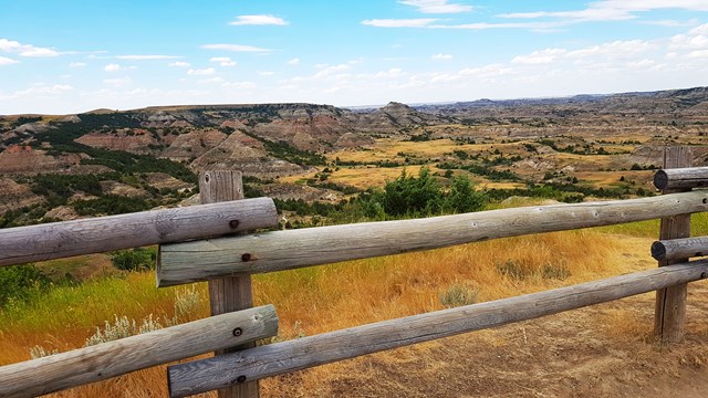
Approach from I-94 exit 32, about 15 minutes from Medora, and the badlands open up all at once. The buttes show distinct layers of colored rock that give the canyon its painted look, and you can pick out Buck Hill across the canyon. It is the easiest introduction to the geology the afternoon drive builds on.
- Time
- 20-30 minutes
- Best time
- Late morning
- Reservation needed
- No
- Fee note
- Theodore Roosevelt NP lists one $30 private-vehicle pass (see current conditions); the pages checked do not say whether a stop at the overlook alone requires it.
Sources (4)
- NPS Data API - places (thro) · retrieved 2026-10-07
- NPS - Painted Canyon Overlook · retrieved 2026-10-07
- NPS - Theodore Roosevelt fees and passes · retrieved 2026-10-07
- NPS - South Unit (Painted Canyon location) · retrieved 2026-10-07
Painted Canyon Overlook to Medora
- Distance
- 7.7 mi
- Drive time
- 10 min
- Est. tolls
- No tolls
- Via
- I-94 W
Eight miles on I-94 west to the Medora exit and the town's main street.
Tolls: No tolls on this leg (as of 2026-10-07): SDDOT says all South Dakota state roads and bridges are toll-free, and FHWA Highway Statistics Table HM-25 lists no tolled road miles in South Dakota, Wyoming or North Dakota.
Sources (3)
- South Dakota DOT: all South Dakota state-owned roads and bridges are toll-free · retrieved 2026-10-07
- FHWA Highway Statistics Table HM-25: tolled roadway length by state (South Dakota, Wyoming and North Dakota list 0 miles) · retrieved 2026-10-07
- OpenStreetMap contributors (route computed with a local OSRM router) · retrieved 2026-10-07
Lunch at Little Missouri Saloon & Dining
A Medora institution a few blocks from the park entrance. The saloon's own site describes hearty Western cooking built around steaks, burgers, brisket and bison burgers. It is first come, first served with no reservations, and open daily 11 am to 1 am, so go early for a table before the afternoon in the park.
- Meal
- Lunch
- Cuisine
- Western, steaks and burgers
- Reservation needed
- No
Sources (1)
- Little Missouri Saloon & Dining official site (address, hours, menu, reservations) · retrieved 2026-10-07
Little Missouri Saloon to South Unit Scenic Drive
- Distance
- 0.2 mi
- Drive time
- 1 min
- Est. tolls
- No tolls
- Via
- I-94 Business, East River Road
A one-minute drive to the South Unit entrance and visitor center.
Tolls: No tolls on this leg (as of 2026-10-07): SDDOT says all South Dakota state roads and bridges are toll-free, and FHWA Highway Statistics Table HM-25 lists no tolled road miles in South Dakota, Wyoming or North Dakota.
Sources (3)
- South Dakota DOT: all South Dakota state-owned roads and bridges are toll-free · retrieved 2026-10-07
- FHWA Highway Statistics Table HM-25: tolled roadway length by state (South Dakota, Wyoming and North Dakota list 0 miles) · retrieved 2026-10-07
- OpenStreetMap contributors (route computed with a local OSRM router) · retrieved 2026-10-07
South Unit Scenic Drive
The paved road starts at the visitor center and threads prairie dog towns and broken badlands. Stops include Skyline Vista (a 0.1-mile accessible walk, just over 4 miles in), Wind Canyon about 10.5 miles in, Boicourt Trail and Buck Hill, and the road's end at Badlands Overlook is a good spot for elk or bison. Allow at least 2 hours.
- Time
- At least 2 hours; this plan allows 3 with short walks
- Best time
- Afternoon light; wildlife often at dawn and dusk
- Fee
- $30
- Reservation needed
- No
- Fee note
- One 7-day private-vehicle pass covers the park (see current conditions)
- Distance note
- The things-to-do record gives 24 miles out-and-back and 36 miles on the South Unit page; sources disagree, so no mileage is relied on here.
Sources (4)
- NPS Data API - thingstodo (thro) · retrieved 2026-10-07
- NPS - Drive the South Unit Scenic Drive · retrieved 2026-10-07
- NPS - Hike Wind Canyon Trail · retrieved 2026-10-07
- NPS - South Unit · retrieved 2026-10-07
Where to stay
More options
Route map
- Main Street Square (opens Google Maps in a new tab) Day 1
- Wall Drug Store (opens Google Maps in a new tab) Day 1
- Pinnacles Overlook (opens Google Maps in a new tab) Day 1
- Door Trailhead (opens Google Maps in a new tab) Day 1
- Cedar Pass Lodge (opens Google Maps in a new tab) Day 1
- Grand View Terrace, Mount Rushmore National Memorial (opens Google Maps in a new tab) Day 2
- Custer State Park Visitor Center (Wildlife Loop start) (opens Google Maps in a new tab) Day 2
- Needles Eye Tunnel (opens Google Maps in a new tab) Day 2
- Sylvan Lake Lodge (opens Google Maps in a new tab) Day 2
- Tower Trail (Devils Tower Visitor Center trailhead) (opens Google Maps in a new tab) Day 3
- Aladdin General Store (Wyoming Mercantile) (opens Google Maps in a new tab) Day 3
- Super 8 by Wyndham Belle Fourche SD (opens Google Maps in a new tab) Day 3
- Bowman, North Dakota (opens Google Maps in a new tab) Day 4
- Painted Canyon Overlook (opens Google Maps in a new tab) Day 4
- Little Missouri Saloon & Dining (opens Google Maps in a new tab) Day 4
- South Unit Scenic Drive (starts at South Unit Visitor Center) (opens Google Maps in a new tab) Day 4
- State Game Lodge (opens Google Maps in a new tab) Option
Good to know
Pacing and logistics
- Time zone. Every stop on this route is on Mountain Time, so the schedule needs no clock changes.
- Weekday assumption. Day 1 is a Tuesday, so Day 3 falls on a Thursday: the optional Tri-State Museum is closed Sunday-Monday between Labor Day and Memorial Day, and every other timed stop (Wall Drug, Rushmore, Devils Tower, the saloon) lists daily hours.
- Drive time. The legs add up to 603.1 miles and 11 h 28 min of driving over four days: Day 1 90.4 mi / 1 h 48 min, Day 2 147.0 mi / 3 h 09 min, Day 3 172.7 mi / 3 h 14 min, Day 4 193.0 mi / 3 h 17 min. The 18-mile Wildlife Loop is extra. No tolls on any leg.
- Difficulty: moderate. Paved roads throughout, but Iron Mountain Road and the Needles Highway are narrow, winding and tunnelled; GFP lists the Needles Eye Tunnel at about 8 ft wide and 9 ft 9 in high, so skip the Needles Highway in a large RV. Iron Mountain Road also has narrow one-lane tunnels (check posted clearances).
- Fuel. Fill up in Rapid City, Custer and Belle Fourche; the Belle Fourche to Bowman stretch of US-85 is 117 miles.
- Alternate routes (see Options): Spearfish Canyon Scenic Byway on Day 3 and SD-44 through Scenic on Day 2.
- Wildlife. Stay in your vehicle around bison on the Wildlife Loop and keep well back from all animals.
Current conditions (as of 2026-10-07)
- Season. Several lodgings are near their season end: Cedar Pass Lodge lists April 15 to October 15 (lodge site), Sylvan Lake Lodge and the State Game Lodge restaurant list roughly May or the end of April to mid-October (Creekside Lodge at the State Game Lodge is year-round), so treat this as a May-September 2027 plan or book the days just before closing.
- Closures. SD Game, Fish & Parks says the Needles Highway closes to vehicles with the first snow and does not reopen until April 1 or later; Iron Mountain Road can close periodically in winter and in hazardous weather; the Wildlife Loop is open year-round with careful winter driving.
- Fees. Custer State Park entrance license $25 per vehicle for 1-7 days (GFP, 2026); Badlands $30 per private vehicle; Devils Tower $25 per private vehicle; Theodore Roosevelt NP $30 per private vehicle, cashless since May 2026 and collected at visitor centers outside May-September; Mount Rushmore has no entrance fee but charges for parking, and the ticket is valid for a year (price not published on the page checked).
- Mount Rushmore, October. Grounds are open 6 am-9 pm and the Lincoln Borglum Visitor Center 8 am-6 pm for October; the evening ranger program runs late May through September.
- Badlands. The Notch Trail is closed for ladder repairs; the Door and Window trails are unaffected.
- Devils Tower. Park alerts list a section of the Tower Trail closed from 12 pm on Oct 8 to 9 am on Oct 9, Stage 2 burn restrictions (all campfires prohibited), the campground closing for the season on Oct 15, and a stoplight in use at the entrance due to limited parking.
- Medora. The South Unit Visitor Center is listed 9 am-4:30 pm daily from Oct 1, 2026 to May 24, 2027, and the Painted Canyon Visitor Center is listed closed from about Oct 24, 2026 to mid-June 2027 (the overlook itself is separate); the Little Missouri Saloon lists daily 11 am-1 am, but some seasonal Medora businesses close for the year.
Want live alerts and up-to-date info?
Roads, tolls and closures change fast. Create an account on the DriftKin app to get live alerts and up-to-date information for your drive.
Evergreen tips
- Pack water and snacks; services are thin between stops, and Day 1 and Day 4 have long open stretches.
- Do not scramble off the maintained trails at the Badlands; the rock is crumbly and slick when wet.
- The Aladdin General Store does not publish hours on the pages checked; confirm before relying on it.
Sources
Good to know: distances and drive times are typical figures without live traffic, and where routes are shown the route data comes from OpenStreetMap contributors. Toll amounts are estimates and change often, so check them in the DriftKin planner or with the toll authority before you plan around them. Opening hours, fees, prices, permits and closures also change, so confirm with the park or business before you go.
- OpenStreetMap Nominatim - coordinates retrieved 2026-10-07
- Visit Rapid City - Main Street Square (address, operator) retrieved 2026-10-07
- South Dakota DOT: all South Dakota state-owned roads and bridges are toll-free retrieved 2026-10-07
- FHWA Highway Statistics Table HM-25: tolled roadway length by state (South Dakota, Wyoming and North Dakota list 0 miles) retrieved 2026-10-07
- OpenStreetMap contributors (route computed with a local OSRM router) retrieved 2026-10-07
- Wall Drug official site (address, hours, history) retrieved 2026-10-07
- NPS Data API - places (badl) retrieved 2026-10-07
- NPS - Pinnacles Overlook retrieved 2026-10-07
- NPS - Badlands sunrise and sunset spots (Norbeck Pass) retrieved 2026-10-07
- NPS - Yellow Mounds Overlook (Loop Road overlook) retrieved 2026-10-07
- Cedar Pass Lodge - Explore (Door Trail 32 ft gain) retrieved 2026-10-07
- NPS - Door Trail retrieved 2026-10-07
- NPS - Window Trail retrieved 2026-10-07
- NPS - Hiking the Badlands (Door 0.75 mi RT, Window 0.25 mi RT) retrieved 2026-10-07
- Cedar Pass Lodge - Stay (season, check-in, Waysides hours) retrieved 2026-10-07
- NPS - Cedar Pass Lodge retrieved 2026-10-07
- NPS Data API - places (moru) retrieved 2026-10-07
- NPS - Mount Rushmore hours retrieved 2026-10-07
- NPS - Grand View Terrace retrieved 2026-10-07
- NPS - Presidential Trail (0.6 mi, 422 stairs) retrieved 2026-10-07
- NPS - Walk the Presidential Trail (20-45 minutes) retrieved 2026-10-07
- Custer State Park Resort - scenic drives (context) retrieved 2026-10-07
- Custer State Park Resort - Dining (Sylvan Lake restaurant hours) retrieved 2026-10-07
- NPS - Iron Mountain Road (North Entrance) retrieved 2026-10-07
- SD Game, Fish & Parks - Scenic Drives (Needles Eye Tunnel dimensions, seasonal closure) retrieved 2026-10-07
- SD Game, Fish & Parks - Custer State Park (visitor center, fees) retrieved 2026-10-07
- OpenStreetMap Nominatim - coordinates retrieved 2026-10-07
- Custer State Park Resort - Contact (address, phone) retrieved 2026-10-07
- Custer State Park Resort - Sylvan Lake Lodge (season, elevation, cabins) retrieved 2026-10-07
- NPS Data API - thingstodo (deto) retrieved 2026-10-07
- NPS Data API - visitorcenters (deto) retrieved 2026-10-07
- NPS - Devils Tower (destination of the alternate route) retrieved 2026-10-07
- NPS - Walk the Tower Trail Loop retrieved 2026-10-07
- NPS - Eat Lunch at the Devils Tower Picnic Area retrieved 2026-10-07
- OpenStreetMap Nominatim - address and coordinates retrieved 2026-10-07
- WyoHistory - Aladdin General Store (1896, National Register 1991) retrieved 2026-10-07
- Tri-State Museum & Visitor Center (address, hours, admission) retrieved 2026-10-07
- Wyndham - Super 8 Belle Fourche (address, amenities) retrieved 2026-10-07
- OpenStreetMap Nominatim - coordinates retrieved 2026-10-07
- NPS Data API - places (thro) retrieved 2026-10-07
- NPS - Painted Canyon Overlook retrieved 2026-10-07
- NPS - Theodore Roosevelt fees and passes retrieved 2026-10-07
- NPS - South Unit retrieved 2026-10-07
- Little Missouri Saloon & Dining official site (address, hours, menu, reservations) retrieved 2026-10-07
- NPS Data API - thingstodo (thro) retrieved 2026-10-07
- NPS - Drive the South Unit Scenic Drive retrieved 2026-10-07
- NPS - Hike Wind Canyon Trail retrieved 2026-10-07
- Custer State Park Resort - State Game Lodge (season, rooms) retrieved 2026-10-07
More trips like this
 Road tripLas Vegas to Moab
Las Vegas to Moab: A 5-Day Utah National Parks Road Trip
5 days Moderate$$$ Road tripAnchorage Alaska National Parks Loop
Anchorage to Kenai Fjords, Talkeetna and Denali: A 5-Day Alaska National Parks Road Trip
5 days Moderate$$$ Road tripLos Angeles to San Francisco
Los Angeles to San Francisco in 2 Days: The Pacific Coast Highway
2 days Moderate$$$