Las Vegas to Moab: A 5-Day Utah National Parks Road Trip
Zion, Bryce Canyon, Scenic Byway 12, Capitol Reef and Moab, one park and one night at a time
- Length
- 5 days
- Total distance
- 785.2 mi
- Driving time
- 15 h 57 min
- Est. tolls
- No tolls
- Stops
- 18
- Driving
- Moderate
- Best months
- Apr–May, Sep–Oct
- Budget
- $$$
A one-way five-day drive from Las Vegas to Moab, with a night near each of Zion, Bryce Canyon, Capitol Reef and Moab. Short hikes at every park, a waterfall hike on Scenic Byway 12 and a sunset walk to Delicate Arch, with about three hours of driving on most days.
- Drive time15 h 57 min
- Distance785.2 mi
- Est. tollsNo tolls
- Lower Calf Creek Falls on Scenic Byway 12
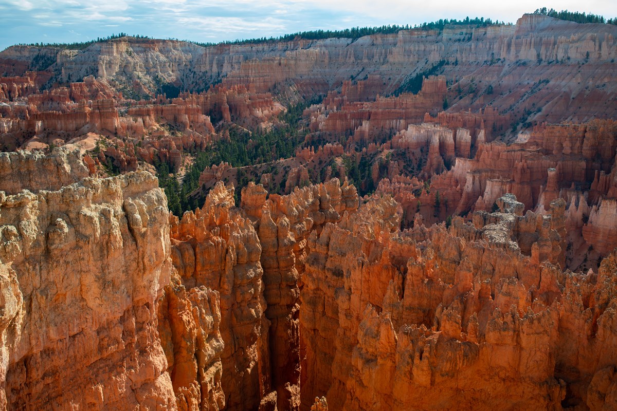
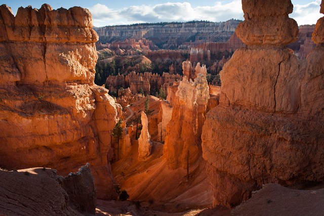
- Queen's Garden among the Bryce Canyon hoodoos
- Sunset hike to Delicate Arch in Arches
The story
Five national parks and one scenic byway, strung together one night at a time. The rhythm is simple: drive to a park, walk its best short trail, sleep nearby, and move on in the morning.
It starts in Kolob Canyons, Zion's quiet corner, then Springdale for a riverside walk at dusk. The next day UT-14 climbs through high forest to the Red Canyon tunnels and Bryce Canyon, where Queen's Garden drops into the hoodoos and the rim glows at sunset.
Day 3 is the star: Scenic Byway 12 to the waterfall at Lower Calf Creek, across the Hogback and Boulder Mountain, and into Capitol Reef for a short natural-bridge hike and the Scenic Drive in late light. Then the long, empty drive east to Goblin Valley's mushroom-shaped rocks and on to Moab. The last day pairs Canyonlands' Island in the Sky with a sunset hike to Delicate Arch.
Most days involve about three hours of driving, so the afternoons stay free for trails. Expect remote stretches, big elevation changes and desert heat in summer; this plan is timed for early autumn.
Day by day
Las Vegas to Zion: Kolob Canyons and Springdale
Drive north on I-15 to Kolob Canyons for a ridge walk and a picnic, then cross to Springdale for a dusk stroll along the Virgin River.
Start in Las Vegas
Fuel up, buy water and snacks, and leave early: this is the longest driving day of the trip. Las Vegas runs on Pacific Time and Utah on Mountain Time, one hour ahead; times before the Mesquite stop are Pacific and every later time is Utah time.
- Time
- Departure 7:00 AM Pacific = 8:00 AM Mountain; on the road by 7:30 Pacific
Sources (1)
- OpenStreetMap geocode (coordinates) · retrieved 2026-10-06
Las Vegas to Mesquite
- Distance
- 81.1 mi
- Drive time
- 1 h 14 min
- Est. tolls
- No tolls
- Via
- I-15 N
I-15 northeast out of the Las Vegas valley and across open Mojave desert to the Nevada-Arizona-Utah corner country at Mesquite.
Tolls: No tolls on this leg (as of 2026-10-06). Nevada has no toll roads and I-15 through Nevada and Utah south of Spanish Fork is toll-free.
Sources (3)
- UDOT: Utah's only tolled roads are the I-15 Express Lanes (Spanish Fork to Layton), not on this route · retrieved 2026-10-06
- KTNV: NDOT states Nevada does not have tolls on public roads · retrieved 2026-10-06
- OpenStreetMap contributors (route computed with a local OSRM router) · retrieved 2026-10-06
Fuel and rest break in Mesquite
The last Nevada town before I-15 crosses the Virgin River Gorge in Arizona and enters Utah. Top up the tank and take a short break; the next stretch is a canyon highway with few services.
- Time
- 15-minute break (Pacific time); arrive about 8:44 after the 74-minute leg, leave 9:00 Pacific = 10:00 Mountain. The stop is the I-15 point where the two OSM graphs join; coordinates from OSM.
- Timezone note
- Pacific time until this stop
Sources (2)
- OpenStreetMap reverse geocode (I-15, Mesquite NV) · retrieved 2026-10-06
- City of Mesquite official site · retrieved 2026-10-06
Mesquite to Timber Creek Overlook
- Distance
- 75.7 mi
- Drive time
- 1 h 23 min
- Est. tolls
- No tolls
- Via
- I-15 N, Kolob Canyons Road
I-15 climbs through the Virgin River Gorge in Arizona, then crosses St. George and runs north to Exit 40, where Kolob Canyons Road leads to the end of the line. Start time is Mountain time (9:00 AM Pacific).
Tolls: No tolls on this leg (as of 2026-10-06). Nevada has no toll roads; I-15 through Nevada and Utah south of Spanish Fork is toll-free.
Sources (3)
- UDOT: Utah's only tolled roads are the I-15 Express Lanes (Spanish Fork to Layton), not on this route · retrieved 2026-10-06
- KTNV: NDOT states Nevada does not have tolls on public roads · retrieved 2026-10-06
- OpenStreetMap contributors (route computed with a local OSRM router) · retrieved 2026-10-06
Timber Creek Overlook, Kolob Canyons
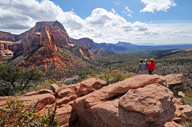
Kolob Canyons is Zion's quiet corner, reached from I-15 Exit 40. Stop at the visitor center, drive the five-mile scenic road to its end, then walk a short ridge trail to a rim view of Timber Creek, Kolob Terrace and the Pine Valley Mountains. It makes a good picnic stop before the drive to Springdale.
- Distance
- 1.2 mi
- Elevation gain
- 117 ft
- Route
- Out and back
- Difficulty
- Easy
- Permit required
- No
- Dogs allowed
- No
- Trailhead
- End of Kolob Canyons Road
- Fee note
- Zion entrance fee applies; pay at the Kolob Canyons Visitor Center.
- Distance note
- Round trip (0.6 mi each way). Elevation gain is the one-way figure (117 ft; 103 ft loss), so the round-trip climb is somewhat higher.
Sources (2)
- NPS Data API thingstodo: Timber Creek Overlook · retrieved 2026-10-06
- NPS: Kolob Canyons (Exit 40, five-mile scenic route) · retrieved 2026-10-06
Timber Creek Overlook to Cable Mountain Lodge
- Distance
- 44.5 mi
- Drive time
- 58 min
- Est. tolls
- No tolls
- Via
- I-15 S, UT-17, UT-9
From Exit 40 you run south on I-15, then east on UT-17 and UT-9 through La Verkin and Virgin, with the Zion cliffs rising ahead as you reach Springdale.
Tolls: No tolls on this leg (as of 2026-10-06). Utah's only toll roads are the I-15 Express Lanes between Spanish Fork and Layton, far north of this route.
Sources (2)
- UDOT: Utah's only tolled roads are the I-15 Express Lanes (Spanish Fork to Layton), not on this route · retrieved 2026-10-06
- OpenStreetMap contributors (route computed with a local OSRM router) · retrieved 2026-10-06
Cable Mountain Lodge, Springdale (night 1)
Recommended base for the Zion night, at the edge of Springdale next to the park entrance, so the car can stay parked while you walk to the visitor center. The lodge's site lists studios, suites and multi-room residences, a pool and a heated spa. Drop bags here and keep the afternoon easy.
- Type
- Hotel
- Location
- Outside the park
- Booking
- Book / details
- Duration note
- Early arrival for bag drop; check-in time is set by the lodge. Free time (rest, pool) until the 5:45 PM walk.
- Reservation notes
- Rates are not published on the lodge's site; check the booking engine for your dates. Book well ahead for spring and fall.
Sources (2)
- OpenStreetMap geocode of address (coordinates) · retrieved 2026-10-06
- Cable Mountain Lodge official site · retrieved 2026-10-06
Pa'rus Trail walk at dusk
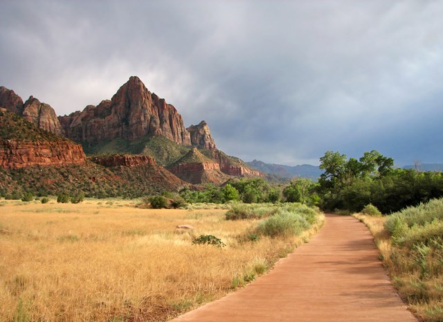
A paved riverside path that links the visitor center with Canyon Junction and frames The Watchman as the light drops (sunset is around 7:10 PM in early October). It is flat and easy, so walk out as far as you like and return the same way. Zion is an International Dark Sky Park, so linger after sunset if you like. It starts about 0.2 miles from the lodge.
- Time
- Your choice of length; 3.5 miles end to end
- Best time
- Late afternoon to dusk
- Route note
- 3.5 miles for the full trail; the accessibility listing shows 1.6 miles one way with 152 ft of gain, so the two figures describe different stretches. Walk from the visitor-center end and turn back whenever you like.
- Dogs allowed
- Yes
Sources (3)
- NPS Data API thingstodo: Stargazing in Zion (International Dark Sky Park) · retrieved 2026-10-06
- NPS Data API thingstodo: Pa'rus Trail · retrieved 2026-10-06
- NPS: Pa'rus Trail · retrieved 2026-10-06
Zion to Bryce Canyon over the Markagunt Plateau
Climb UT-14 through the high forest to Scenic Byway 12 and the Red Canyon tunnels, then spend the afternoon among Bryce's hoodoos.
Cable Mountain Lodge to Cedar City
- Distance
- 57.9 mi
- Drive time
- 1 h 1 min
- Est. tolls
- No tolls
- Via
- UT-9, UT-17, I-15 N
Back down UT-9 and UT-17, then north on I-15 through Parowan Valley farmland. This stretch is mostly interstate; the scenery begins when you turn east.
Tolls: No tolls on this leg (as of 2026-10-06). Utah's only toll roads are the I-15 Express Lanes between Spanish Fork and Layton, far north of this route.
Sources (2)
- UDOT: Utah's only tolled roads are the I-15 Express Lanes (Spanish Fork to Layton), not on this route · retrieved 2026-10-06
- OpenStreetMap contributors (route computed with a local OSRM router) · retrieved 2026-10-06
Fuel and coffee break in Cedar City
The last full-service town before the mountain road to Bryce, with the next fuel stops many miles away. Top up the tank, buy picnic food for the Red Canyon and Bryce stops and stretch your legs before climbing onto the Markagunt Plateau.
- Time
- Break stop, 20 minutes
Sources (2)
- OpenStreetMap geocode (coordinates) · retrieved 2026-10-06
- Cedar City official site · retrieved 2026-10-06
Cedar City to Red Canyon
- Distance
- 65 mi
- Drive time
- 1 h 24 min
- Est. tolls
- No tolls
- Via
- UT-14, US-89, UT-12
Utah's Highway 14 climbs through aspen and conifer forest past Duck Creek Village and Navajo Lake country, then drops to US-89 and Scenic Byway 12. This is high plateau country, noticeably cooler than Springdale.
Tolls: No tolls on this leg (as of 2026-10-06). Utah's only toll roads are the I-15 Express Lanes between Spanish Fork and Layton, far north of this route.
Sources (2)
- UDOT: Utah's only tolled roads are the I-15 Express Lanes (Spanish Fork to Layton), not on this route · retrieved 2026-10-06
- OpenStreetMap contributors (route computed with a local OSRM router) · retrieved 2026-10-06
Red Canyon and the Scenic Byway 12 tunnels
Scenic Byway 12 slips through two arched rock tunnels in Red Canyon's orange spires, the first real taste of Bryce country. Pull off for photos and a short walk among the formations before the last 15 miles to the park. The recreation area has campgrounds and forest trails if you want a longer leg-stretch.

- Time
- Short roadside stop; coordinates are those USFS lists for the Red Canyon Visitor Center area
- Fee
- Free
Sources (3)
- Wikimedia Commons: Red Canyon East Tunnel photo (CC BY-SA 4.0) · retrieved 2026-10-06
- Dixie National Forest: Red Canyon Recreation Area · retrieved 2026-10-06
- Dixie National Forest: Red Canyon Visitor Center (coordinates, location on Highway 12) · retrieved 2026-10-06
Red Canyon to The Lodge at Bryce Canyon
- Distance
- 15.4 mi
- Drive time
- 24 min
- Est. tolls
- No tolls
- Via
- UT-12, UT-63
A short run east on UT-12 and south on UT-63 into the park, passing Ruby's Inn and the entrance station.
Tolls: No tolls on this leg (as of 2026-10-06). Utah's only toll roads are the I-15 Express Lanes between Spanish Fork and Layton, far north of this route.
Sources (2)
- UDOT: Utah's only tolled roads are the I-15 Express Lanes (Spanish Fork to Layton), not on this route · retrieved 2026-10-06
- OpenStreetMap contributors (route computed with a local OSRM router) · retrieved 2026-10-06
The Lodge at Bryce Canyon (night 2)
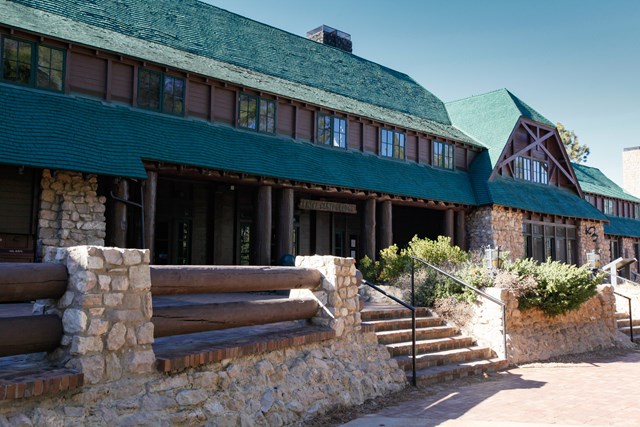
The historic in-park lodge stands a short walk from both Sunrise and Sunset Points, so rim walks at golden hour need no driving. It has 114 rooms including suites, motel rooms and cabins, with dining and shopping on site. Reservations are highly recommended. Ruby's Inn in the options is the year-round alternative outside the gate.
- Type
- Lodge
- Location
- Inside the park
- Duration note
- Bag drop, lunch on your own and free time before the 3:00 PM hike
- Reservation notes
- Reservations highly recommended. Rates not checked; check current rates with the lodge.
Sources (2)
- NPS: Bryce Canyon lodging (114 rooms; reservations recommended) · retrieved 2026-10-06
- NPS: Bryce Canyon Lodge place record · retrieved 2026-10-06
Queen's Garden Trail
Queen's Garden is the least difficult trail descending into the Bryce Amphitheater. It drops from Sunrise Point through fins and hoodoos to a short spur ending at the Queen Victoria hoodoo; the climb back out is the work. Take water and an unhurried pace: the rim is high, so the climb back out feels longer than it looks.
- Distance
- 1.8 mi
- Elevation gain
- 450 ft
- Route
- Out and back
- Difficulty
- Moderate
- Permit required
- No
- Dogs allowed
- No
- Trailhead
- Sunrise Point, about 0.3 miles from the lodge
- Distance note
- 1.8 mi round trip, 450 ft elevation gain, 1-2 hours. The trail is commonly combined with the Navajo Loop for 2.9 miles; this plan uses the out-and-back.
Sources (2)
- NPS Data API places: Queens Garden Trailhead · retrieved 2026-10-06
- NPS Data API thingstodo: Queen's Garden Trail · retrieved 2026-10-06
Sunset Point at dusk
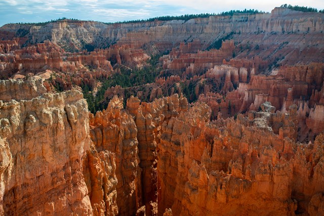
Walk the paved Rim Trail from the lodge for the evening light over the amphitheater; the Sunset to Sunrise Point stretch is the park's only paved rim section and its easiest walk. The hoodoos glow orange before sunset. Walk back to the lodge afterward; the rim stays dark, so carry a light.
- Time
- About 90 minutes with light; sunset is around 7:05 PM in early October (astronomical calculation for Bryce, MDT)
- Best time
- Sunset
Sources (2)
- NPS Data API places: Sunset Point · retrieved 2026-10-06
- NPS: Sunset Point to Sunrise Point Hike (paved, 1.0 mi round trip) · retrieved 2026-10-06
Bryce to Capitol Reef on Scenic Byway 12
Hike to a waterfall at Calf Creek, cross the Hogback and Boulder Mountain, then catch Capitol Reef's cliffs in the evening light.
The Lodge at Bryce Canyon to Lower Calf Creek Falls
- Distance
- 67 mi
- Drive time
- 1 h 25 min
- Est. tolls
- No tolls
- Via
- UT-63, UT-12 (Scenic Byway 12)
The heart of Scenic Byway 12: down from the Paunsaugunt Plateau through Tropic, Cannonville and Escalante, then east past slickrock domes and white sandstone ridges to the Calf Creek canyon.
Tolls: No tolls on this leg (as of 2026-10-06). Utah's only toll roads are the I-15 Express Lanes between Spanish Fork and Layton, far north of this route.
Sources (2)
- UDOT: Utah's only tolled roads are the I-15 Express Lanes (Spanish Fork to Layton), not on this route · retrieved 2026-10-06
- OpenStreetMap contributors (route computed with a local OSRM router) · retrieved 2026-10-06
Lower Calf Creek Falls
A sandy canyon walk beside a spring-fed creek, past pictographs and granaries, to a 126-foot waterfall and a cool, shaded pool. BLM rates it moderate because of soft sand, and warns that heat and exposure can be an issue, so carry plenty of water. Calf Creek is the one long walk of the trip and the best reason to take this road.

- Distance
- 6 mi
- Elevation gain
- 200 ft
- Route
- Out and back
- Difficulty
- Moderate
- Permit required
- No
- Dogs allowed
- Yes
- Trailhead
- Calf Creek Recreation Area on Highway 12
- Fee note
- BLM lists a day-use fee per vehicle (see Current conditions); Interagency passes cover it.
- Distance note
- BLM: 6.0 mi round trip, 3-4 hours, 'minimal' elevation change. The 200 ft gain figure comes from americansouthwest.net (2.75 mi one way, 200 ft elevation change) because BLM gives no number; treat as approximate.
Sources (3)
- American Southwest: trail stats (200 ft elevation change) · retrieved 2026-10-06
- BLM trail brochure (3-4 hours, sandy, minimal elevation change) · retrieved 2026-10-06
- BLM: Lower Calf Creek Falls Trail (6.0 mi round trip, 126 ft falls, coordinates) · retrieved 2026-10-06
Lower Calf Creek Falls to Hickman Bridge Trailhead
- Distance
- 59.2 mi
- Drive time
- 1 h 12 min
- Est. tolls
- No tolls
- Via
- UT-12 (Scenic Byway 12), UT-24
This is the famous part of Byway 12: through Boulder, then over the Hogback, a narrow ridge with steep drop-offs on both sides, and across Boulder Mountain's forests before descending to Torrey and the red cliffs of Capitol Reef on UT-24.
Tolls: No tolls on this leg (as of 2026-10-06). Utah's only toll roads are the I-15 Express Lanes between Spanish Fork and Layton, far north of this route.
Sources (2)
- UDOT: Utah's only tolled roads are the I-15 Express Lanes (Spanish Fork to Layton), not on this route · retrieved 2026-10-06
- OpenStreetMap contributors (route computed with a local OSRM router) · retrieved 2026-10-06
Hickman Bridge Trail
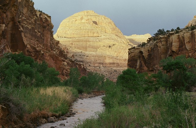
The park's best short hike climbs from the Fremont River past juniper and slickrock, with Capitol Dome in view, to a 133-foot natural bridge. It is steep in places but short, and the trailhead is on UT-24 about two miles east of the visitor center. Leave the car at the roadside lot and carry water.
- Distance
- 1.8 mi
- Elevation gain
- 400 ft
- Route
- Out and back
- Difficulty
- Moderate
- Permit required
- No
- Dogs allowed
- No
- Trailhead
- Hickman Bridge Trailhead on UT-24
- Distance note
- 0.9 mi one way with a 400 ft elevation change (one-way basis); round trip is about 1.8 mi. Trailhead coordinates are from OpenStreetMap.
Sources (3)
- NPS: Capitol Reef trail guide · retrieved 2026-10-06
- NPS: Hike an Easy or Moderate Trail · retrieved 2026-10-06
- OpenStreetMap: Hickman Bridge Trailhead · retrieved 2026-10-06
Hickman Bridge Trailhead to the Scenic Drive
- Distance
- 2.1 mi
- Drive time
- 3 min
- Est. tolls
- No tolls
- Via
- UT-24
A few minutes west along the Fremont River to the visitor center and the start of the Scenic Drive.
Tolls: No tolls on this leg (as of 2026-10-06). Utah's only toll roads are the I-15 Express Lanes between Spanish Fork and Layton, far north of this route.
Sources (2)
- UDOT: Utah's only tolled roads are the I-15 Express Lanes (Spanish Fork to Layton), not on this route · retrieved 2026-10-06
- OpenStreetMap contributors (route computed with a local OSRM router) · retrieved 2026-10-06
Capitol Reef Scenic Drive in late light
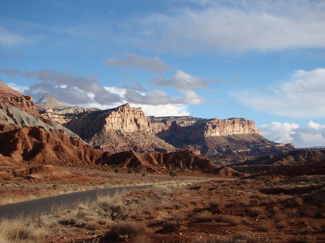
A 7.9-mile paved road runs south from the visitor center along the Waterpocket Fold, past the Fruita orchards and cliffs streaked with desert varnish. It dead-ends, so you return the same way; late light turns the walls deep red. Allow about 1.5 hours round trip including the dirt spurs, which are skippable.
- Time
- About 1.5 hours round trip, before any walking
- Best time
- Late afternoon
- Reservation needed
- No
- Fee note
- Capitol Reef entrance fee applies
- Length note
- 7.9 miles paved; dirt spurs usually suitable for passenger cars
Sources (2)
- NPS: Capitol Reef Scenic Drive · retrieved 2026-10-06
- NPS: Scenic Drive Tour · retrieved 2026-10-06
Scenic Drive to Broken Spur Inn
- Distance
- 9.9 mi
- Drive time
- 13 min
- Est. tolls
- No tolls
- Via
- UT-24
UT-24 west past the Fruita orchards and Panorama Point to Torrey, with the cliffs fading to deep red as the sun drops.
Tolls: No tolls on this leg (as of 2026-10-06). Utah's only toll roads are the I-15 Express Lanes between Spanish Fork and Layton, far north of this route.
Sources (2)
- UDOT: Utah's only tolled roads are the I-15 Express Lanes (Spanish Fork to Layton), not on this route · retrieved 2026-10-06
- OpenStreetMap contributors (route computed with a local OSRM router) · retrieved 2026-10-06
Broken Spur Inn & Steakhouse, Torrey (night 3)
A hilltop hotel in Torrey with red-rock views, about five minutes from the park entrance by its own account. It lists hotel rooms and wagon-style units, an indoor pool and hot tub, EV charging, an on-site steakhouse for dinner and a complimentary hot breakfast for guests, handy before the longer Day 4 drive. Check current rates.
- Type
- Hotel
- Location
- Outside the park
- Booking
- Book / details
- Reservation notes
- Check current rates on the official site.
Sources (3)
- Broken Spur Inn official site · retrieved 2026-10-06
- Broken Spur Inn: on-site steakhouse · retrieved 2026-10-06
- Torrey town business listing: Broken Spur Inn · retrieved 2026-10-06
Capitol Reef to Moab through the San Rafael Desert
Cross the empty desert to wander among Goblin Valley's mushroom-shaped rocks, then continue through Green River to Moab for a free evening.
Broken Spur Inn to Goblin Valley State Park
- Distance
- 78.3 mi
- Drive time
- 1 h 30 min
- Est. tolls
- No tolls
- Via
- UT-24, Temple Mountain Rd (SR-24 to the park road)
UT-24 runs east through Capitol Reef's cliffs and Fruita, then out across the open desert past Caineville and Hanksville, with the Henry Mountains to the south. Services are thin, so fill the tank in Torrey or Hanksville.
Tolls: No tolls on this leg (as of 2026-10-06). Utah's only toll roads are the I-15 Express Lanes between Spanish Fork and Layton, far north of this route.
Sources (2)
- UDOT: Utah's only tolled roads are the I-15 Express Lanes (Spanish Fork to Layton), not on this route · retrieved 2026-10-06
- OpenStreetMap contributors (route computed with a local OSRM router) · retrieved 2026-10-06
Valley of Goblins, Goblin Valley State Park
Thousands of small mushroom-shaped sandstone 'goblins' fill a bowl of desert that visitors can wander among, scrambling over and around the formations for an hour or two. Mornings are quieter and cooler.

- Time
- About 2 hours
- Best time
- Morning, outside midday heat
- Fee note
- A day-use fee applies (Utah State Parks); not priced here
Sources (3)
- Wikimedia Commons: photo (CC BY 2.0) · retrieved 2026-10-06
- Utah State Parks: Goblin Valley (hours, coordinates, heat and flash-flood alerts) · retrieved 2026-10-06
- Utah State Parks: Goblin Valley directions (physical address) · retrieved 2026-10-06
Goblin Valley State Park to Moab Valley Inn
- Distance
- 100.9 mi
- Drive time
- 1 h 42 min
- Est. tolls
- No tolls
- Via
- UT-24, I-70 E, US-191 S
Back to UT-24 and north to I-70, then east past Green River (the natural fuel and lunch stop) and south on US-191 across open desert, with the La Sal Mountains growing on the horizon ahead.
Tolls: No tolls on this leg (as of 2026-10-06). Utah's only toll roads are the I-15 Express Lanes between Spanish Fork and Layton, far north of this route.
Sources (2)
- UDOT: Utah's only tolled roads are the I-15 Express Lanes (Spanish Fork to Layton), not on this route · retrieved 2026-10-06
- OpenStreetMap contributors (route computed with a local OSRM router) · retrieved 2026-10-06
Moab Valley Inn (night 4)
A Main Street hotel on Moab's south side, close to the town's restaurant strip. The inn lists a pool, fitness room, guest laundry and complimentary breakfast, which helps with the early start tomorrow. Rates are not published on the page, so check current prices when booking. Use the free evening to wander Main Street.
- Type
- Hotel
- Location
- Outside the park
- Booking
- Book / details
- Reservation notes
- Check current rates; the site advertises a website-only discounted rate.
Sources (2)
- OpenStreetMap geocode (address and coordinates) · retrieved 2026-10-06
- Moab Valley Inn official site · retrieved 2026-10-06
Moab: Canyonlands and Arches
Spend the morning on the Island in the Sky mesa, then finish at Arches with a sunset hike to Delicate Arch and dinner in Moab.
Moab Valley Inn to Mesa Arch
- Distance
- 39.4 mi
- Drive time
- 57 min
- Est. tolls
- No tolls
- Via
- US-191 N, UT-313, Island in the Sky Road
North on US-191, then UT-313 up a dramatic climb onto the Island in the Sky mesa, with a long, quiet stretch of ranch and desert before the park entrance.
Tolls: No tolls on this leg (as of 2026-10-06). Utah's only toll roads are the I-15 Express Lanes between Spanish Fork and Layton, far north of this route.
Sources (2)
- UDOT: Utah's only tolled roads are the I-15 Express Lanes (Spanish Fork to Layton), not on this route · retrieved 2026-10-06
- OpenStreetMap contributors (route computed with a local OSRM router) · retrieved 2026-10-06
Mesa Arch
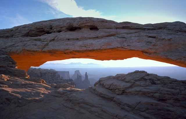
A short loop to a 27-foot arch on the edge of a cliff, framing the La Sal Mountains and the canyon far below. The path has stone steps and rough footing. It is a classic sunrise spot; mid-morning is quieter and the view still works.
- Distance
- 0.6 mi
- Elevation gain
- 56 ft
- Route
- Loop
- Difficulty
- Easy
- Permit required
- No
- Dogs allowed
- No
- Trailhead
- Mesa Arch trailhead, Island in the Sky
- Fee note
- Canyonlands entrance fee applies
- Distance note
- 0.6 mi round-trip loop, 56 ft elevation change, about 30 minutes.
Sources (3)
- NPS Data API places: Canyonlands · retrieved 2026-10-06
- NPS: Canyonlands hiking (distance, elevation change) · retrieved 2026-10-06
- NPS: Mesa Arch · retrieved 2026-10-06
Mesa Arch to Grand View Point
- Distance
- 6.2 mi
- Drive time
- 15 min
- Est. tolls
- No tolls
- Via
- Island in the Sky Road
The Island in the Sky Road runs south along the mesa to its end.
Tolls: No tolls on this leg (as of 2026-10-06). Utah's only toll roads are the I-15 Express Lanes between Spanish Fork and Layton, far north of this route.
Sources (2)
- UDOT: Utah's only tolled roads are the I-15 Express Lanes (Spanish Fork to Layton), not on this route · retrieved 2026-10-06
- OpenStreetMap contributors (route computed with a local OSRM router) · retrieved 2026-10-06
Grand View Point Overlook
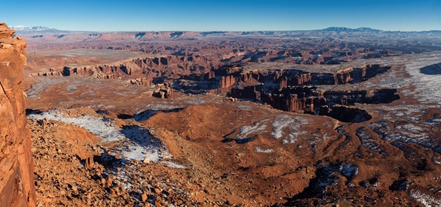
The paved road ends at the mesa's southern tip, with a rim view of corrugated canyons and the White Rim far below; on clear days features of The Maze and The Needles show. A short sidewalk reaches the main overlook and more rim walking continues beyond (about 1.8 miles round trip, 73 ft of gain).
- Best time
- Late morning
- Fee note
- Canyonlands entrance fee applies
- Distance mi
- 1.8
- Distance note
- 1.8 mi round trip, 73 ft elevation change, about 1.5 hours for the full rim trail; the first overlook is a short paved walk.
- Elevation gain ft
- 73
Sources (2)
- NPS: Canyonlands hiking · retrieved 2026-10-06
- NPS: Grand View Point · retrieved 2026-10-06
Grand View Point to Milt's Stop & Eat
- Distance
- 45.4 mi
- Drive time
- 1 h 11 min
- Est. tolls
- No tolls
- Via
- Island in the Sky Road, UT-313, US-191 S
Back up the mesa road and down the UT-313 switchbacks to US-191 and into Moab.
Tolls: No tolls on this leg (as of 2026-10-06). Utah's only toll roads are the I-15 Express Lanes between Spanish Fork and Layton, far north of this route.
Sources (2)
- UDOT: Utah's only tolled roads are the I-15 Express Lanes (Spanish Fork to Layton), not on this route · retrieved 2026-10-06
- OpenStreetMap contributors (route computed with a local OSRM router) · retrieved 2026-10-06
Lunch at Milt's Stop & Eat
A family-run Moab drive-in serving burgers since 1954, according to its own site. It lists hormone-free, grass-fed beef burgers with eat-in or takeout service: a quick, unfussy lunch after the mesa. The site lists daily hours from 11 AM to closing, between 7 and 9 PM depending on the season.
- Meal
- Lunch
- Cuisine
- Burgers
- Reservation needed
- No
- Duration note
- Free time after lunch (about 2 hours): rest at the hotel or walk Main Street before the evening hike.
Sources (1)
- Milt's Stop & Eat official site · retrieved 2026-10-06
Milt's Stop & Eat to Delicate Arch Trailhead
- Distance
- 19 mi
- Drive time
- 33 min
- Est. tolls
- No tolls
- Via
- US-191 N, Arches Entrance Road, Main Park Road, Delicate Arch Road
US-191 north to the Arches entrance, then the main park road up the switchbacks and out to Wolfe Ranch. Parking at trailheads can fill, so arrive with time in hand.
Tolls: No tolls on this leg (as of 2026-10-06). Utah's only toll roads are the I-15 Express Lanes between Spanish Fork and Layton, far north of this route.
Sources (2)
- UDOT: Utah's only tolled roads are the I-15 Express Lanes (Spanish Fork to Layton), not on this route · retrieved 2026-10-06
- OpenStreetMap contributors (route computed with a local OSRM router) · retrieved 2026-10-06
Delicate Arch Trail at sunset
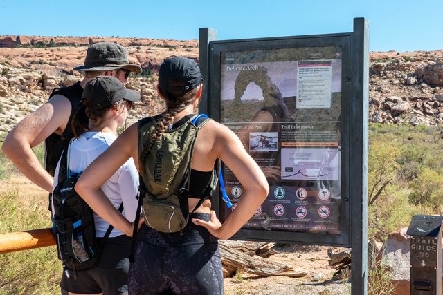
The most famous arch in the park. The trail crosses open slickrock past historic Wolfe Ranch, climbs steadily following cairns, then follows a narrow ledge for about 200 yards before the arch appears all at once. Reach the top 45 minutes or so before sunset, carry at least 2 quarts (2 L) of water per person, and pack a headlamp for the descent.
- Distance
- 3 mi
- Elevation gain
- 538 ft
- Route
- Out and back
- Difficulty
- Strenuous
- Permit required
- No
- Dogs allowed
- No
- Trailhead
- Wolfe Ranch trailhead
- Distance note
- 3 mi round trip, 538 ft elevation change. Start time assumes early October (sunset about 6:55 PM MDT); shift it to reach the arch 30-45 minutes before local sunset in other months.
Sources (2)
- NPS Data API places: Arches · retrieved 2026-10-06
- NPS: Wolfe Ranch trailhead · retrieved 2026-10-06
Delicate Arch Trailhead to Pasta Jay's
- Distance
- 18.2 mi
- Drive time
- 32 min
- Est. tolls
- No tolls
- Via
- Delicate Arch Road, Main Park Road, Arches Entrance Road, US-191 S
Down the park road and south on US-191 into Moab in the dark; watch for wildlife on the road.
Tolls: No tolls on this leg (as of 2026-10-06). Utah's only toll roads are the I-15 Express Lanes between Spanish Fork and Layton, far north of this route.
Sources (2)
- UDOT: Utah's only tolled roads are the I-15 Express Lanes (Spanish Fork to Layton), not on this route · retrieved 2026-10-06
- OpenStreetMap contributors (route computed with a local OSRM router) · retrieved 2026-10-06
Finale dinner at Pasta Jay's
Moab's Italian restaurant on Main Street, open since 1992 per its site, and a practical late dinner after a sunset hike. The site lists daily hours of 11 AM to 11 PM, so a late dinner after the hike works.
- Meal
- Dinner
- Cuisine
- Italian
- Reservation needed
- No
Sources (1)
- Pasta Jay's official site · retrieved 2026-10-06
Where to stay
Where to eat
More options
Route map
- Las Vegas, Nevada (departure point) (opens Google Maps in a new tab) Day 1
- Mesquite, Nevada (I-15 fuel and rest stop) (opens Google Maps in a new tab) Day 1
- Timber Creek Overlook Trailhead (opens Google Maps in a new tab) Day 1
- Cable Mountain Lodge (opens Google Maps in a new tab) Day 1
- Pa'rus Trail (Zion Canyon Visitor Center end) (opens Google Maps in a new tab) Day 1
- Main Street, Cedar City (opens Google Maps in a new tab) Day 2
- Red Canyon Recreation Area (Dixie National Forest) (opens Google Maps in a new tab) Day 2
- The Lodge at Bryce Canyon (opens Google Maps in a new tab) Day 2
- Queen's Garden Trailhead (Sunrise Point) (opens Google Maps in a new tab) Day 2
- Sunset Point (opens Google Maps in a new tab) Day 2
- Lower Calf Creek Falls Trailhead (Calf Creek Recreation Area) (opens Google Maps in a new tab) Day 3
- Hickman Bridge Trailhead (opens Google Maps in a new tab) Day 3
- Capitol Reef National Park's Scenic Drive (opens Google Maps in a new tab) Day 3
- Broken Spur Inn & Steakhouse (opens Google Maps in a new tab) Day 3
- Goblin Valley State Park (opens Google Maps in a new tab) Day 4
- Moab Valley Inn (opens Google Maps in a new tab) Day 4
- Mesa Arch Trail (opens Google Maps in a new tab) Day 5
- Grand View Point Overlook and Trail (opens Google Maps in a new tab) Day 5
- Milt's Stop & Eat (opens Google Maps in a new tab) Day 5
- Wolfe Ranch / Delicate Arch Trailhead (opens Google Maps in a new tab) Day 5
- Pasta Jay's Moab (opens Google Maps in a new tab) Day 5
- Best Western Plus Ruby's Inn (opens Google Maps in a new tab) Option
- Aarchway Inn (opens Google Maps in a new tab) Option
- The Pioneer Kitchen at Capitol Reef Resort (opens Google Maps in a new tab) Option
- Ray's Tavern (opens Google Maps in a new tab) Option
Good to know
Season and timing
- Best months: April-May and September-October. Summer brings desert heat at Goblin Valley, Moab and Calf Creek; winter snow can close or slow roads around Bryce and Boulder Mountain. Times assume early October (sunset about 7:00 PM in southern Utah); shift evening items in other months.
- Time zones: Las Vegas is on Pacific Time and Utah on Mountain Time, one hour ahead. Day 1 times up to the Mesquite stop are Pacific; every later time is Utah time.
- Weekday assumption: a mid-week departure. Milt's lists daily hours from 11 AM to closing (7-9 PM by season). Pasta Jay's lists daily 11 AM to 11 PM; confirm hours for the optional Ray's Tavern and Pioneer Kitchen.
- Driving: the OSM-routed legs add up to 785.2 miles and 15 h 57 min over the five days (longest day is Day 1 at 3 h 35 min, including Las Vegas to Mesquite to Kolob Canyons). No tolls on any leg (Nevada has none; Utah's only tolls are the I-15 Express Lanes far to the north).
- Difficulty: moderate. The driving is easy paved road, but distances are long, services are sparse between towns, the Hogback has steep drop-offs on both sides and several stops are at altitude or in desert heat. Carry water and start with a full tank.
- Hikes: Hickman Bridge (400 ft) and Queen's Garden (450 ft) are the steepest climbs after Delicate Arch (538 ft); Calf Creek is the longest (6 miles round trip).
Reservations
- Book all four nights early, especially the Bryce lodge and Cable Mountain Lodge in spring and fall.
- Entrance fees apply at all five national parks; an America the Beautiful pass covers the park entrance fees.
Current conditions (as of 2026-10-06)
- Zion-Mt. Carmel Highway (UT-9 through the park) is closed from Canyon Junction to Great Arch Pullout, with no through traffic until further notice (park alert). This plan therefore reaches Bryce via UT-14; the Mt. Carmel alternate in the options depends on the road reopening. Watchman Trail is closed pending repairs. The park also warns of toxic cyanobacteria in Zion's rivers and streams: do not drink the water or submerge your head.
- Bryce Canyon: Wall Street (Navajo Loop) is closed after recent rains; other trails are open but muddy. This plan uses the Queen's Garden out-and-back.
- Capitol Reef: advisory for elevated E. coli in the Fremont River and Sulphur Creek; monsoon flash-flood caution for washes and canyons.
- Arches and Canyonlands: Arches needs no advance timed-entry reservation in 2026. Expect possible long entrance waits and full trailhead parking at both parks.
- Red Canyon Visitor Center (Dixie National Forest) expects its seasonal closure on 2026-10-16; the roadside stop in this plan does not need it.
- Goblin Valley State Park: the Utah State Parks site currently lists a heat advisory and flash-flood warnings for canyons and notes weekend crowds; arrive in the morning.
- Fees (2026-10-06): Zion and Bryce Canyon are $35 per private vehicle for 7 days; non-US residents aged 16+ pay an additional $100 per person unless they hold an annual or America the Beautiful pass (park fee pages). BLM lists a $5 per vehicle day-use fee at Calf Creek (free with an interagency pass). Goblin Valley charges a day-use fee (Utah State Parks).
Want live alerts and up-to-date info?
Roads, tolls and closures change fast. Create an account on the DriftKin app to get live alerts and up-to-date information for your drive.
Sources
Good to know: distances and drive times are typical figures without live traffic, and where routes are shown the route data comes from OpenStreetMap contributors. Toll amounts are estimates and change often, so check them in the DriftKin planner or with the toll authority before you plan around them. Opening hours, fees, prices, permits and closures also change, so confirm with the park or business before you go.
- OpenStreetMap geocode (coordinates) retrieved 2026-10-06
- UDOT: Utah's only tolled roads are the I-15 Express Lanes (Spanish Fork to Layton), not on this route retrieved 2026-10-06
- KTNV: NDOT states Nevada does not have tolls on public roads retrieved 2026-10-06
- OpenStreetMap contributors (route computed with a local OSRM router) retrieved 2026-10-06
- OpenStreetMap reverse geocode (I-15, Mesquite NV) retrieved 2026-10-06
- City of Mesquite official site retrieved 2026-10-06
- NPS Data API thingstodo: Timber Creek Overlook retrieved 2026-10-06
- NPS: Kolob Canyons (Exit 40, five-mile scenic route) retrieved 2026-10-06
- OpenStreetMap geocode of address (coordinates) retrieved 2026-10-06
- Cable Mountain Lodge official site retrieved 2026-10-06
- NPS Data API thingstodo: Stargazing in Zion (International Dark Sky Park) retrieved 2026-10-06
- NPS Data API thingstodo: Pa'rus Trail retrieved 2026-10-06
- NPS: Pa'rus Trail retrieved 2026-10-06
- OpenStreetMap geocode (coordinates) retrieved 2026-10-06
- Cedar City official site retrieved 2026-10-06
- Wikimedia Commons: Red Canyon East Tunnel photo (CC BY-SA 4.0) retrieved 2026-10-06
- Dixie National Forest: Red Canyon Recreation Area retrieved 2026-10-06
- Dixie National Forest: Red Canyon Visitor Center (coordinates, location on Highway 12) retrieved 2026-10-06
- NPS: Bryce Canyon lodging (114 rooms; reservations recommended) retrieved 2026-10-06
- NPS: Bryce Canyon Lodge place record retrieved 2026-10-06
- NPS Data API places: Queens Garden Trailhead retrieved 2026-10-06
- NPS Data API thingstodo: Queen's Garden Trail retrieved 2026-10-06
- NPS Data API places: Sunset Point retrieved 2026-10-06
- NPS: Sunset Point to Sunrise Point Hike (paved, 1.0 mi round trip) retrieved 2026-10-06
- American Southwest: trail stats (200 ft elevation change) retrieved 2026-10-06
- BLM trail brochure (3-4 hours, sandy, minimal elevation change) retrieved 2026-10-06
- BLM: Lower Calf Creek Falls Trail (6.0 mi round trip, 126 ft falls, coordinates) retrieved 2026-10-06
- NPS: Capitol Reef trail guide retrieved 2026-10-06
- NPS: Hike an Easy or Moderate Trail retrieved 2026-10-06
- OpenStreetMap: Hickman Bridge Trailhead retrieved 2026-10-06
- NPS: Capitol Reef Scenic Drive retrieved 2026-10-06
- NPS: Scenic Drive Tour retrieved 2026-10-06
- Broken Spur Inn official site retrieved 2026-10-06
- Broken Spur Inn: on-site steakhouse retrieved 2026-10-06
- Torrey town business listing: Broken Spur Inn retrieved 2026-10-06
- Wikimedia Commons: photo (CC BY 2.0) retrieved 2026-10-06
- Utah State Parks: Goblin Valley (hours, coordinates, heat and flash-flood alerts) retrieved 2026-10-06
- Utah State Parks: Goblin Valley directions (physical address) retrieved 2026-10-06
- OpenStreetMap geocode (address and coordinates) retrieved 2026-10-06
- Moab Valley Inn official site retrieved 2026-10-06
- NPS Data API places: Canyonlands retrieved 2026-10-06
- NPS: Canyonlands hiking retrieved 2026-10-06
- NPS: Mesa Arch retrieved 2026-10-06
- NPS: Grand View Point retrieved 2026-10-06
- Milt's Stop & Eat official site retrieved 2026-10-06
- NPS Data API places: Arches retrieved 2026-10-06
- NPS: Wolfe Ranch trailhead retrieved 2026-10-06
- Pasta Jay's official site retrieved 2026-10-06
- OpenStreetMap geocode (coordinates) retrieved 2026-10-06
- Ruby's Inn official site (name, address, year-round, dining) retrieved 2026-10-06
- Aarchway Inn official site retrieved 2026-10-06
- OpenStreetMap: Aarchway Inn retrieved 2026-10-06
- Torrey town business listing: The Pioneer Kitchen retrieved 2026-10-06
- Utah.com listing: address 25 S Broadway, coordinates retrieved 2026-10-06
- Visit Utah: Ray's Tavern retrieved 2026-10-06
- NPS Data API thingstodo: Canyon Overlook (1 mi round trip, trailhead east of the tunnel) retrieved 2026-10-06
- NPS: Zion directions (Zion-Mt. Carmel Highway, large-vehicle restrictions) retrieved 2026-10-06
- NPS: Driving the Burr Trail (mix of paved and dirt, impassable when wet, no RVs) retrieved 2026-10-06
- OpenStreetMap geocode: Cisco and Dewey Bridge (via points) retrieved 2026-10-06
More trips like this
 Road tripPage to Moab
Page to Moab in One Day: Monument Valley, Valley of the Gods and Natural Bridges
1 day Moderate$$ Road tripLas Vegas to Lone Pine
Las Vegas to Lone Pine in One Day: Through Death Valley to the Eastern Sierra
1 day Moderate$$ Road tripLos Angeles to San Francisco
Los Angeles to San Francisco in 2 Days: The Pacific Coast Highway
2 days Moderate$$$