Rocky Mountain: 4 Days of Alpine Lakes and Trail Ridge Road
Lakes at dawn, tundra at noon, elk at dusk
- Length
- 4 days
- Difficulty
- Moderate
- Best months
- Jul–Sep
- Budget
- $$
A four-day, Estes Park-based loop through Rocky Mountain National Park: an acclimatizing first day, a sunrise-to-brunch lake hike from Bear Lake, a full Trail Ridge Road crossing to the quiet west side, and a last-morning climb to Gem Lake. Built for July through September with seasonal roads and timed-entry rules called out.
- Hike past Nymph and Dream Lakes to Emerald Lake from the Bear Lake Trailhead
- Drive Trail Ridge Road, the highest continuous paved road in the U.S., cresting at 12,183 feet
- Ride Old Fall River Road, a 1913-1920 one-way dirt road, to the Alpine Visitor Center at 11,796 feet
- Cross the Continental Divide at Milner Pass and explore the west side's Holzwarth Historic Site
- Watch elk at Moraine Park, especially at dawn and dusk
- Finish with the climb to Gem Lake at Lumpy Ridge
The story
Rocky Mountain National Park is what happens when a mountain range is allowed to keep going up. Trail Ridge Road, the park's signature drive, tops out at 12,183 feet, making it the highest continuous paved road in the United States, and the tundra you stroll across up there is a world away from the ponderosa pine forest just below. This four-day itinerary is built to let you feel that contrast without wearing yourself out at altitude.
The plan uses Estes Park as a single base for all three nights, which means unpacking once and looping out to whichever side of the park the day calls for. We start gently on day one, because Estes Park itself sits around 7,500 feet and the trailheads climb well above 9,000. A stop at Beaver Meadows Visitor Center, an easy loop at Sprague Lake and dusk at Moraine Park (a classic place to watch elk) give your body time to adjust while still delivering big views of the Continental Divide.
Day two is the payoff hike: Bear Lake to Emerald Lake, passing Nymph Lake and Dream Lake on the way. It is about 3.4 miles round trip and famously popular, which is why the plan starts at dawn. NPS notes the Bear Lake parking area is often full by 9 a.m., so an early start (or the free summer shuttle from Park & Ride) is the difference between a peaceful lakeside morning and circling the lot.
Day three is the long, unforgettable one. Old Fall River Road, a 1913-to-1920 dirt road that climbs one-way to the Alpine Visitor Center, gets you into the alpine zone slowly. From there Trail Ridge Road carries you over the Continental Divide at Milner Pass and down to the quieter Kawuneeche Valley on the west side, where the Holzwarth Historic Site tells the story of a homesteading family. Lunch in Grand Lake and an early-afternoon return over the tundra, with overlook stops before dusk, finish the loop.
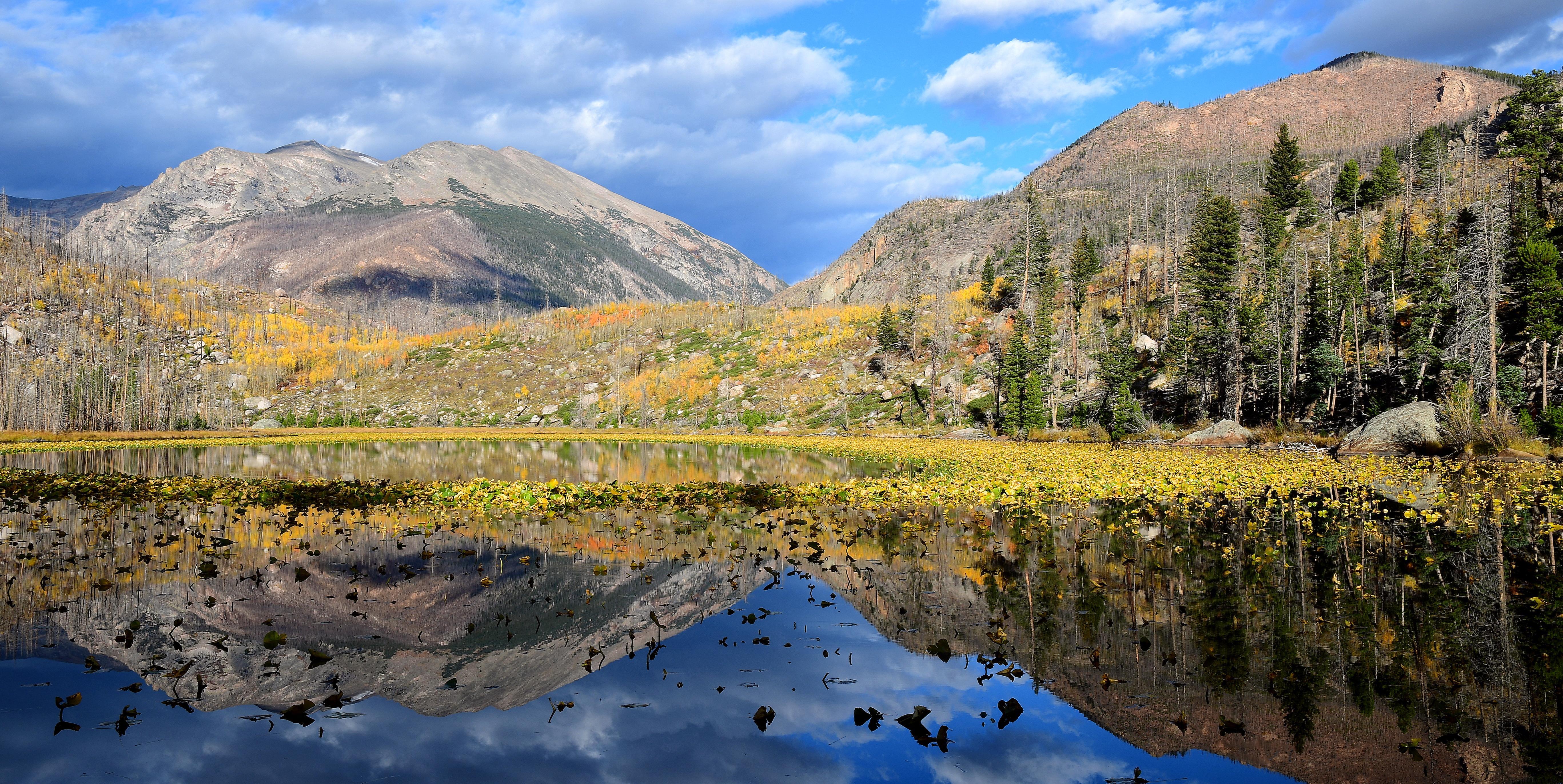
If you have spare time, NPS's Cub Lake trail (2.4 miles one way, 540 feet of gain, from Moraine Park; pictured in the header photo; it is in the Bear Lake Road corridor, so in season it needs a Timed Entry + Bear Lake Road reservation between 5 a.m. and 6 p.m.) makes a lovely optional add-on. On day four, you head to the Lumpy Ridge side of town for the climb to Gem Lake, a compact 3.2-mile round trip through granite and pine, then brunch before you leave.
Timing matters a great deal here. Trail Ridge Road and Old Fall River Road are seasonal, and the timed-entry reservation system applies for much of the summer and early fall (see the tips section for the dates NPS published for 2026 and how to plan around them). Aim for July through September, when the high roads are typically open, or September for the elk rut, when bulls gather in the meadows. Whenever you go, pack layers, sun protection and rain gear: mountain weather changes quickly, and the tundra is exposed.
Day by day
Arrive, acclimate and meet the valley
Estes Park sits near 7,500 feet and the park climbs from there, so day one is deliberately gentle: a stop at Beaver Meadows Visitor Center for current conditions, an easy lap around Sprague Lake, elk-watching at Moraine Park as the light softens, and a sit-down dinner in town. Note that Sprague Lake and Moraine Park are on Bear Lake Road, so you need a Timed Entry + Bear Lake Road reservation in season (see tips).
Beaver Meadows Visitor Center: get your bearings
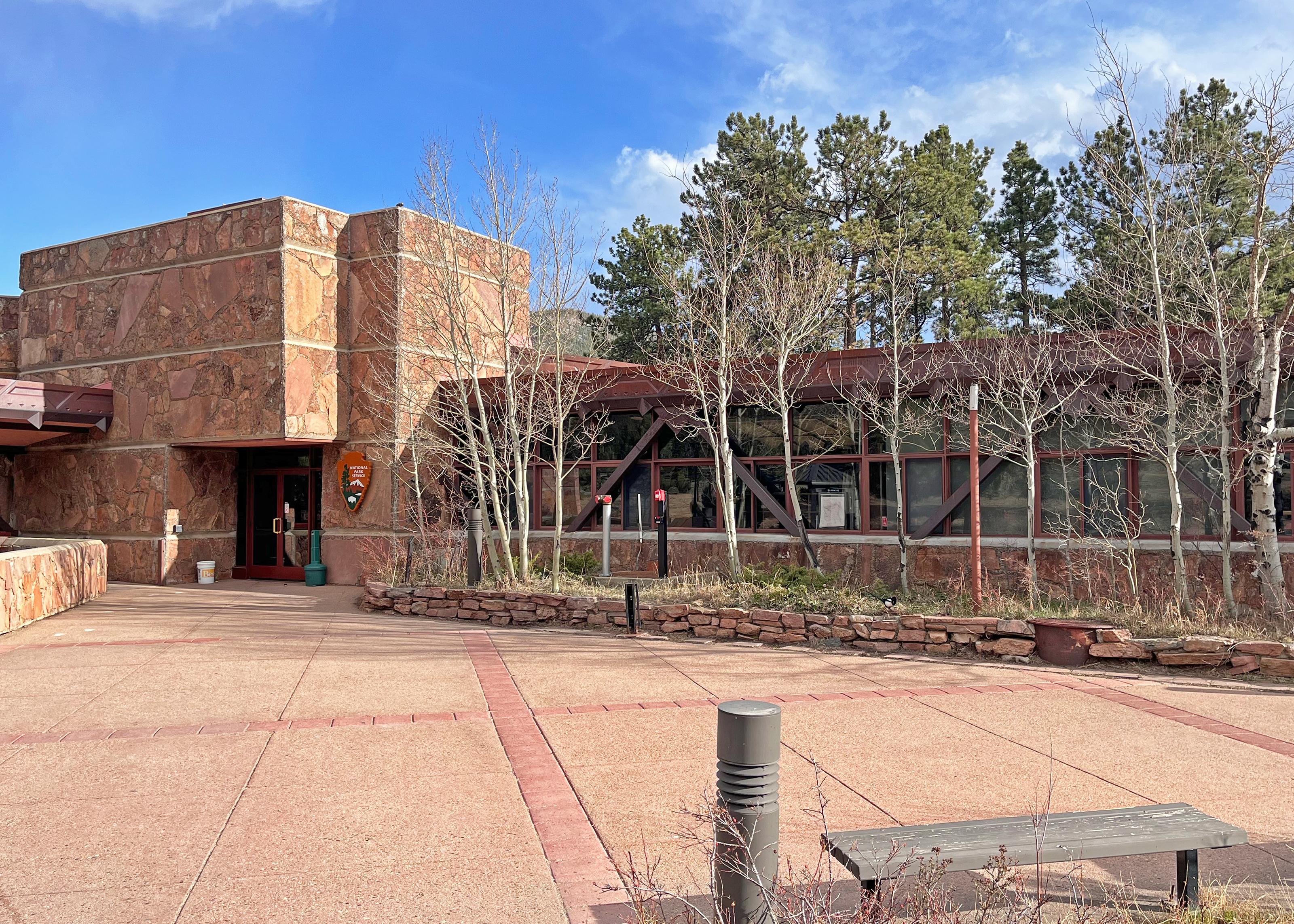
Start where the rangers are. Beaver Meadows sits along US 36 about a mile east of the Beaver Meadows Entrance, so you can visit it before you enter the park, and it is open year-round (winter hours differ). Ask about current trail, road and parking conditions, pick up a map, and watch the park film. The Rocky Mountain Conservancy Nature Store inside is a good place to grab a trail guide. Estes Park sits around 7,500 feet, so treat this first day as acclimatization and drink plenty of water. Note that if you drive into the park between 9 a.m. and 2 p.m. during the timed-entry season you need a Timed Entry reservation (see tips), so plan your afternoon entry accordingly.
- Time
- About 45 minutes
- Best time
- Late morning on arrival day
- Reservation needed
- None to visit the center (it is outside the entrance gate); entering the park during the timed-entry window requires a reservation (see tips)
Sources (1)
- NPS Data API: visitorcenters (romo) · retrieved 2026-09-28
Sprague Lake loop: an easy first stroll
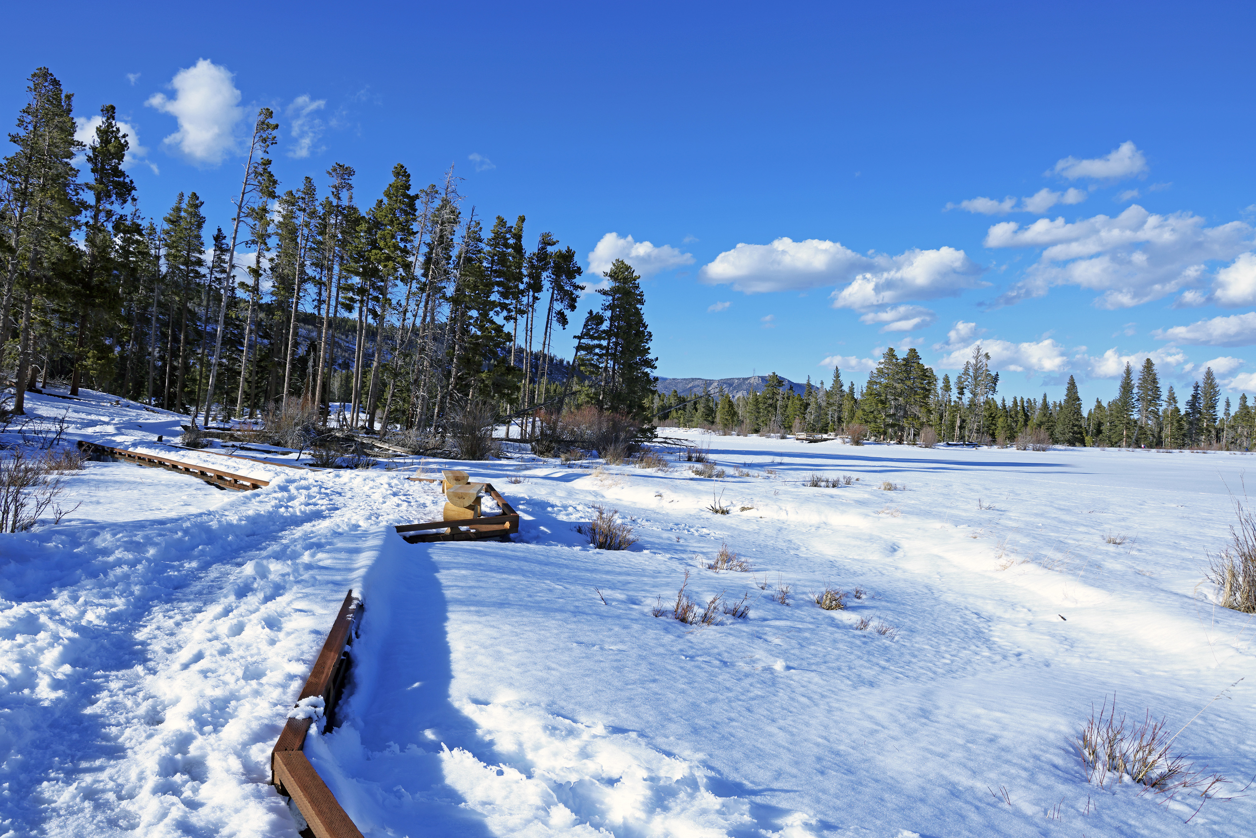
Sprague Lake is the gentlest possible introduction to the high country: a flat loop of roughly 0.7 to 0.8 miles around a small lake with benches, picnic tables and restrooms, and Continental Divide peaks reflected in the water on calm days. It is a low-effort way to let your lungs adjust to about 8,700 feet before tomorrow's bigger hike. Sprague Lake is on Bear Lake Road, so during the timed-entry season you need a Timed Entry + Bear Lake Road reservation if you enter between 5 a.m. and 6 p.m. (see tips).
- Distance
- 0.8 mi
- Elevation gain
- 0 ft
- Route
- Loop
- Difficulty
- Easy
- Permit required
- Park entrance pass; Timed Entry + Bear Lake Road reservation in season (5 a.m.-6 p.m.)
- Dogs allowed
- No
- Trailhead
- Sprague Lake parking area, Bear Lake Road
- Note
- NPS corridor page says 0.8 mi loop, NPS place record says 0.7 mi loop; terrain is essentially flat (elevation gain listed as 0); starting elevation 8,701 ft
- Reservation needed
- Yes
Sources (3)
- NPS Data API: places (romo) · retrieved 2026-09-28
- NPS place record: Sprague Lake · retrieved 2026-09-28
- NPS: Exploring the Bear Lake Road Corridor · retrieved 2026-09-28
Moraine Park at golden hour: elk and Longs Peak light
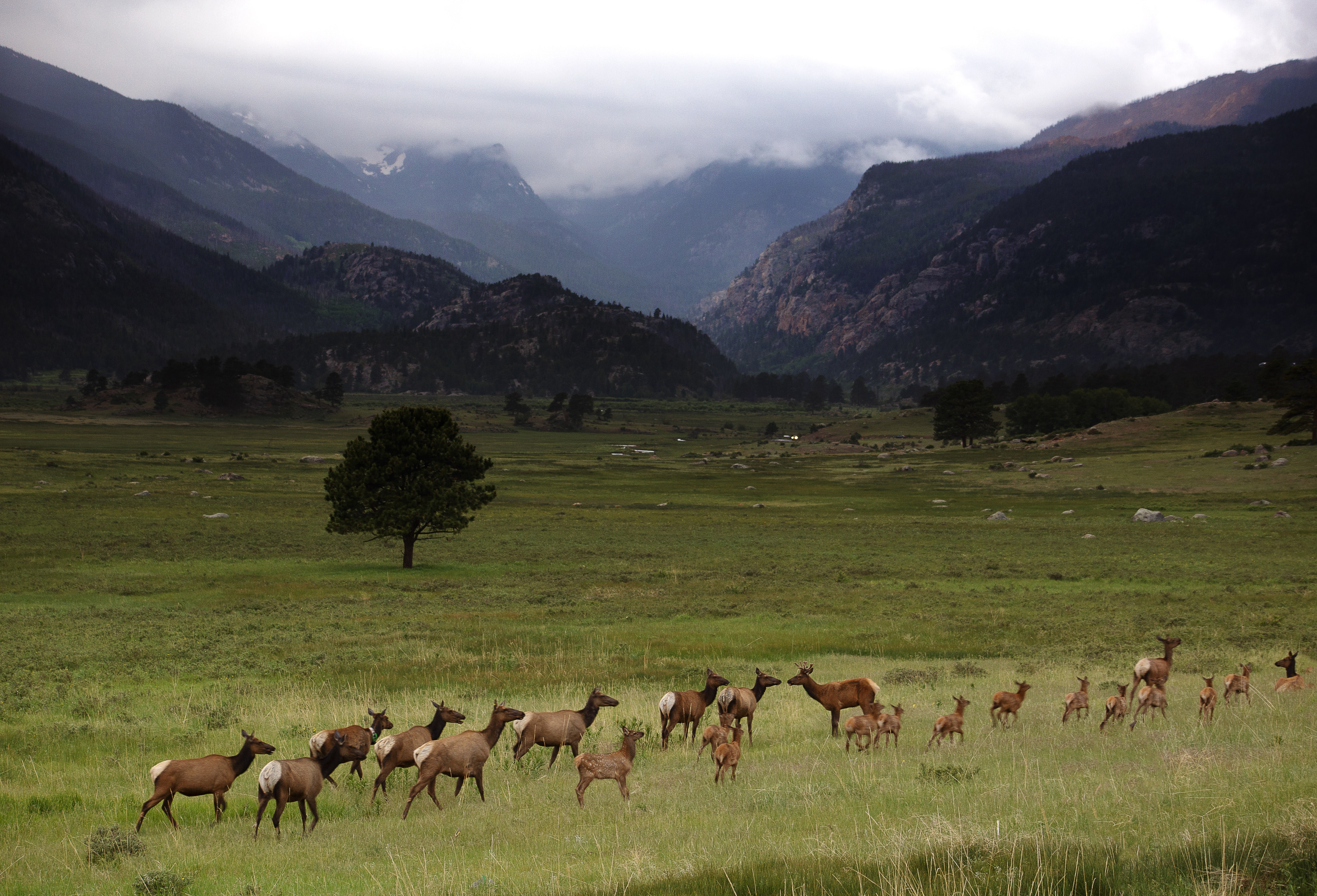
Moraine Park is a broad glacial valley just off Bear Lake Road, and NPS calls it a top wildlife-viewing spot, especially for elk in spring and fall. Pull off at dusk and stay well back (NPS asks visitors to keep at least 75 feet from wildlife). Note that from September 1 to October 31 NPS closes Moraine Park's meadows to foot travel from 5 p.m. to 10 a.m. for the elk rut, so in that period watch from the road pullouts and established trails only. If you pass the Moraine Park Discovery Center earlier in the day, its Nature Store is open daily in summer.
- Time
- 30-60 minutes
- Best time
- Dawn and dusk
- Reservation needed
- Timed Entry + Bear Lake Road applies 5 a.m.-6 p.m. in season; arriving after 6 p.m. needs none (see tips)
Sources (3)
- NPS Data API: places (romo) · retrieved 2026-09-28
- NPS: Exploring the Bear Lake Road Corridor · retrieved 2026-09-28
- NPS: Watching Elk · retrieved 2026-09-28
Bird & Jim: mountain-casual dinner
For a proper first-night dinner, Bird & Jim is a well-regarded Estes Park restaurant serving seasonal menus that lean on local ingredients, with an extensive wine list. Its own website says reservations are encouraged, so book before you head up to the park.
- Meal
- Dinner
- Cuisine
- Seasonal American
- Price
- $$$
- Reservation needed
- Encouraged per restaurant website
Sources (2)
- Bird & Jim official page · retrieved 2026-09-28
- OpenStreetMap node: Bird and Jim (coordinates) · retrieved 2026-09-28
The Stanley Hotel (recommended base)
A historic 1909 hotel on a hill above Estes Park, with rooms across several properties, on-site restaurants and a shorter run to the Beaver Meadows Entrance than most of the lodging in town. The property's website says guests at The Stanley, The Lodge or Aspire receive a nightly breakfast voucher. Rates swing widely with season and room type, so check the booking page for your dates. The three nights here let you unpack once and use Estes Park as the hub for every day.
- Type
- Hotel
- Location
- Outside the park
- Booking
- Book / details
- Reservation notes
- Book well ahead for summer weekends; nightly rates not published on the pages we could verify
Sources (2)
- OpenStreetMap geocode (coordinates) · retrieved 2026-09-28
- The Stanley Hotel official site · retrieved 2026-09-28
Bear Lake Road: three lakes before the crowds
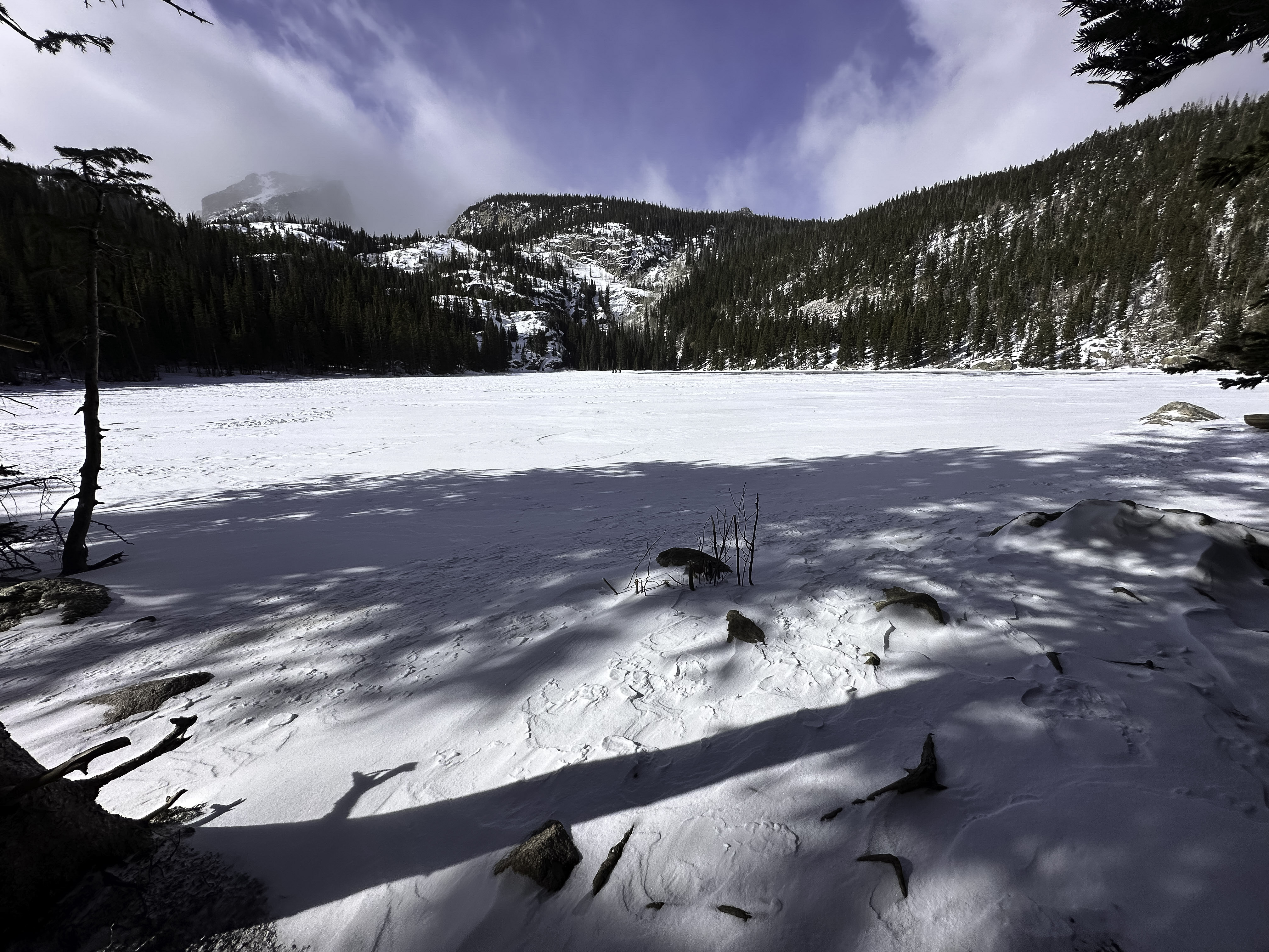
Beat the parking rush to Bear Lake, then hike past Nymph and Dream Lakes to Emerald Lake beneath Hallett Peak. Reward yourself with brunch in town, an unhurried afternoon at the Moraine Park Discovery Center, and dinner at the hotel.
Bear Lake to Emerald Lake: three alpine lakes in one walk
This is the park's signature short-and-spectacular hike. From the Bear Lake trailhead you climb past Nymph Lake (0.5 mile), Dream Lake (1.1 miles) and finish at Emerald Lake (1.7 miles one way), tucked beneath Hallett Peak and Flattop Mountain. NPS lists 771 feet of climbing on its Bear Lake Road corridor page (a different NPS trail list shows a slightly lower figure, so treat it as roughly 600 to 770 feet). Bear Lake sits at 9,475 feet, so go slowly. The trailhead lot is often full by 9 a.m., so arrive early or ride the free shuttle from Park & Ride in summer. After the hike, walk the flat 0.6-mile lap around Bear Lake if you have energy left.
- Distance
- 3.4 mi
- Elevation gain
- 771 ft
- Route
- Out and back
- Difficulty
- Moderate
- Permit required
- Park entrance pass plus timed-entry + Bear Lake Road reservation in season (see tips)
- Dogs allowed
- No
- Trailhead
- Bear Lake Trailhead, end of Bear Lake Road
- Note
- Distance is 1.7 mi one way (Bear Lake Road corridor page, updated 2025) doubled; the older NPS trail list (dated 2017) shows 1.8 mi and 605 ft, which is likely stale
- Reservation needed
- Yes
Sources (2)
- NPS: Exploring the Bear Lake Road Corridor · retrieved 2026-09-28
- NPS: List of Hiking Trails · retrieved 2026-09-28
Notchtop Bakery & Cafe: post-hike brunch
Come here for a hearty late brunch after your hike. The Notchtop cooks from scratch, and its menu runs to banana bread French toast, eggs Benedict and a breakfast hash. It is open daily 7 a.m. to 3 p.m. per its website.
- Meal
- Lunch
- Cuisine
- Breakfast and lunch, American
- Price
- $$
- Reservation needed
- Not stated on the website
Sources (2)
- OpenStreetMap node: Notchtop Bakery and Cafe (coordinates) · retrieved 2026-09-28
- The Notchtop official site · retrieved 2026-09-28
Moraine Park Discovery Center and afternoon rest
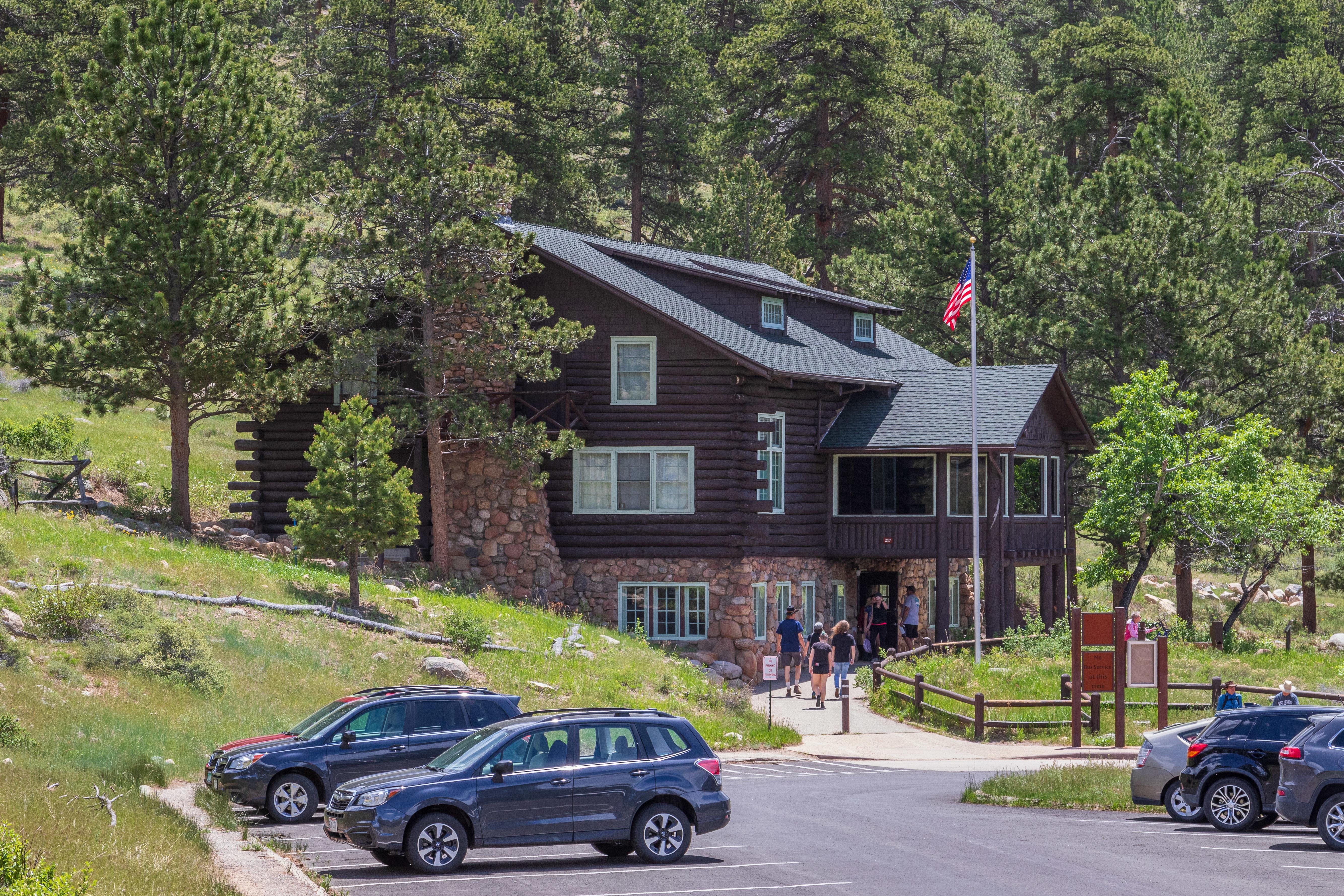
After lunch, roll back down Bear Lake Road and stop at the Moraine Park Discovery Center, a seasonal visitor center with exhibits on wildlife and the Moraine Park valley, views across the valley to the Continental Divide, and a Rocky Mountain Conservancy Nature Store. It is open daily in summer, from late May to early October per NPS, and closes for the season after that. It is an unhurried place to look at a map for Day 3 while your legs recover.
- Time
- 30-45 minutes
- Best time
- Afternoon
- Reservation needed
- Bear Lake Road corridor: Timed Entry + Bear Lake Road applies 5 a.m.-6 p.m. in season; re-entry after 2 p.m. under your existing reservation per NPS FAQ
Sources (2)
- NPS Data API: visitorcenters (romo) · retrieved 2026-09-28
- NPS: Exploring the Bear Lake Road Corridor · retrieved 2026-09-28
MacGregor Chop House at the Stanley: end-of-day dinner
If you want dinner within a short walk of your room, the Stanley's website lists MacGregor Chop House among its on-site restaurants, alongside The Post Mountain House and a wine bar. Check the hotel's site for current menus, hours and reservations before you go.
- Meal
- Dinner
- Cuisine
- Steakhouse (per hotel listing)
- Price
- $$$
- Reservation needed
- Check hotel website
Sources (1)
- The Stanley Hotel official site (on-site dining list) · retrieved 2026-09-28
Trail Ridge Road: up to the tundra and over the Divide
The big scenic day, sequenced so you are over the tundra in daylight both ways: the old dirt road up early, the highest visitor center in the National Park System, the Continental Divide, the quieter west side with its historic ranch and a pizza lunch in Grand Lake, then an early-afternoon start back over Trail Ridge Road for overlooks before dusk. Trail Ridge Road takes 1.5 to 2 hours one way per NPS and is closed in winter, so this day works best July through September. Plan your weekday: Firefly serves lunch Friday to Sunday only and is closed Wednesdays; Holzwarth's cabins are summer-only and the NPS API lists Fridays as closed.
Old Fall River Road: the slow way up
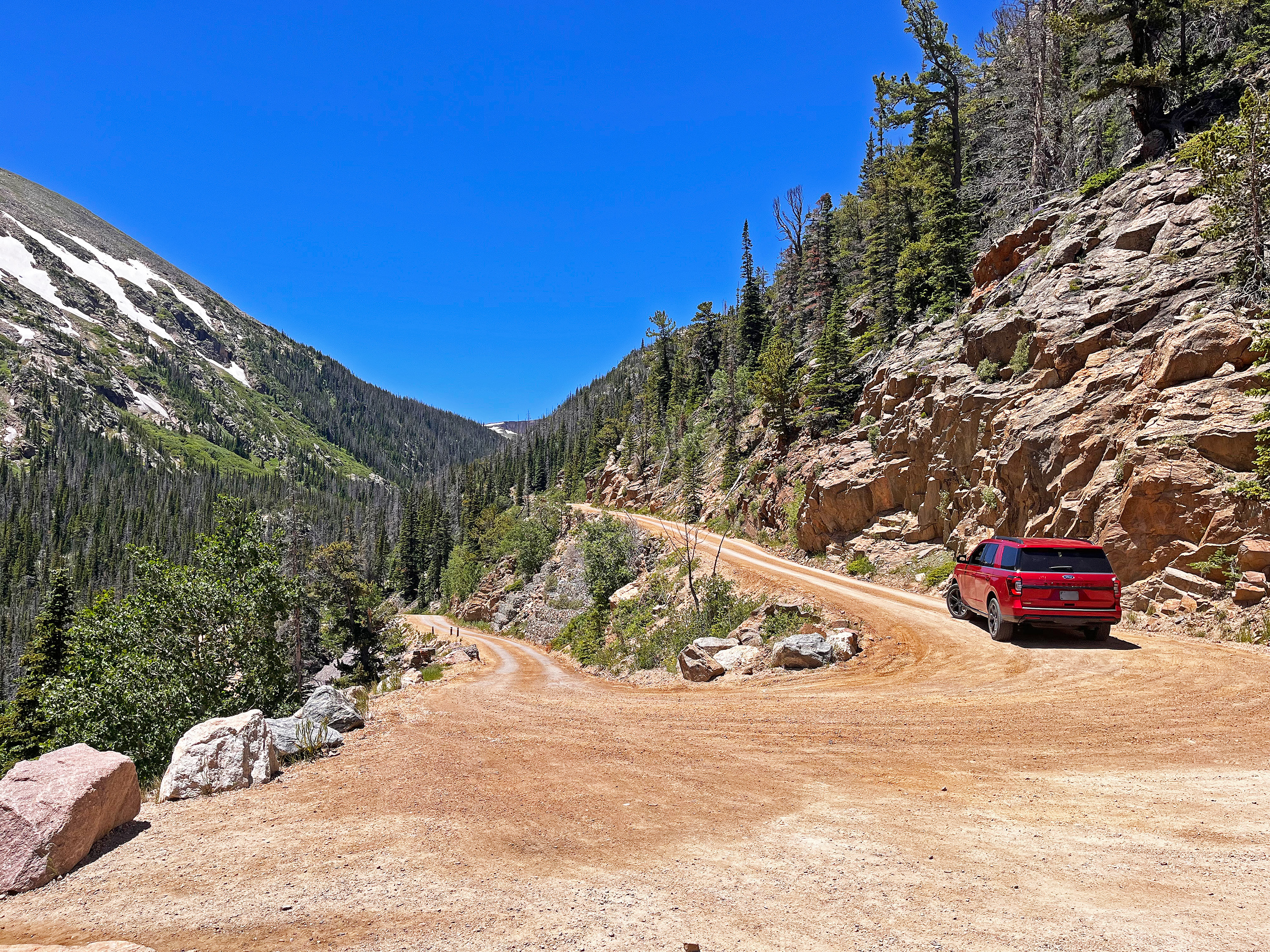
Built between 1913 and 1920, this 9.4-mile dirt road begins beside Endovalley Picnic Area, switchbacks up the south face of Mount Chapin and tops out at Alpine Visitor Center at 11,796 feet. It is narrow, winding and uphill one-way only; NPS says grades reach 16 percent and the speed limit is 15 mph. NPS's record puts the drive at approximately 2 hours; plan about 1.5 to 2 hours with photo stops (our estimate). NPS prohibits vehicles over 25 feet and trailers. Stop at the pullout for a short walk to Chasm Falls, and watch for marmots, elk and pikas. NPS says the road is typically open from early July to early or mid-October. If it is closed, drive Trail Ridge Road directly from the Beaver Meadows or Fall River Entrance (Rainbow Curve is a fine substitute stop). Because you would enter the Fall River Entrance in the morning, a reservation is not needed before 9 a.m. in season (see tips).
- Time
- NPS: approximately 2 hours; plan 1.5-2 hours with stops (estimate)
- Best time
- Early morning, before the 9 a.m. timed-entry window opens
- Reservation needed
- Enter before 9 a.m. or hold a Timed Entry reservation (in season)
- Distance mi
- 9.4
- Vehicle limits
- No vehicles over 25 ft; no trailers
Sources (3)
- NPS Data API: places (romo), Endovalley Picnic Area · retrieved 2026-09-28
- NPS Data API: thingstodo (romo) · retrieved 2026-09-28
- NPS: Enjoy a Scenic Drive on Old Fall River Road · retrieved 2026-09-28
Alpine Visitor Center: the highest in the National Park System
At 11,796 feet, the Alpine Visitor Center at Fall River Pass is billed by NPS as the highest-elevation visitor center in the National Park System. Wander the tundra exhibits, then step out to look for marmots. The NPS API lists it open 9:30 a.m. to 5 p.m. for the 2026 summer season; temporary closures can happen with weather.
- Time
- 30-45 minutes
Sources (1)
- NPS Data API: visitorcenters (romo) · retrieved 2026-09-28
Milner Pass and the Continental Divide
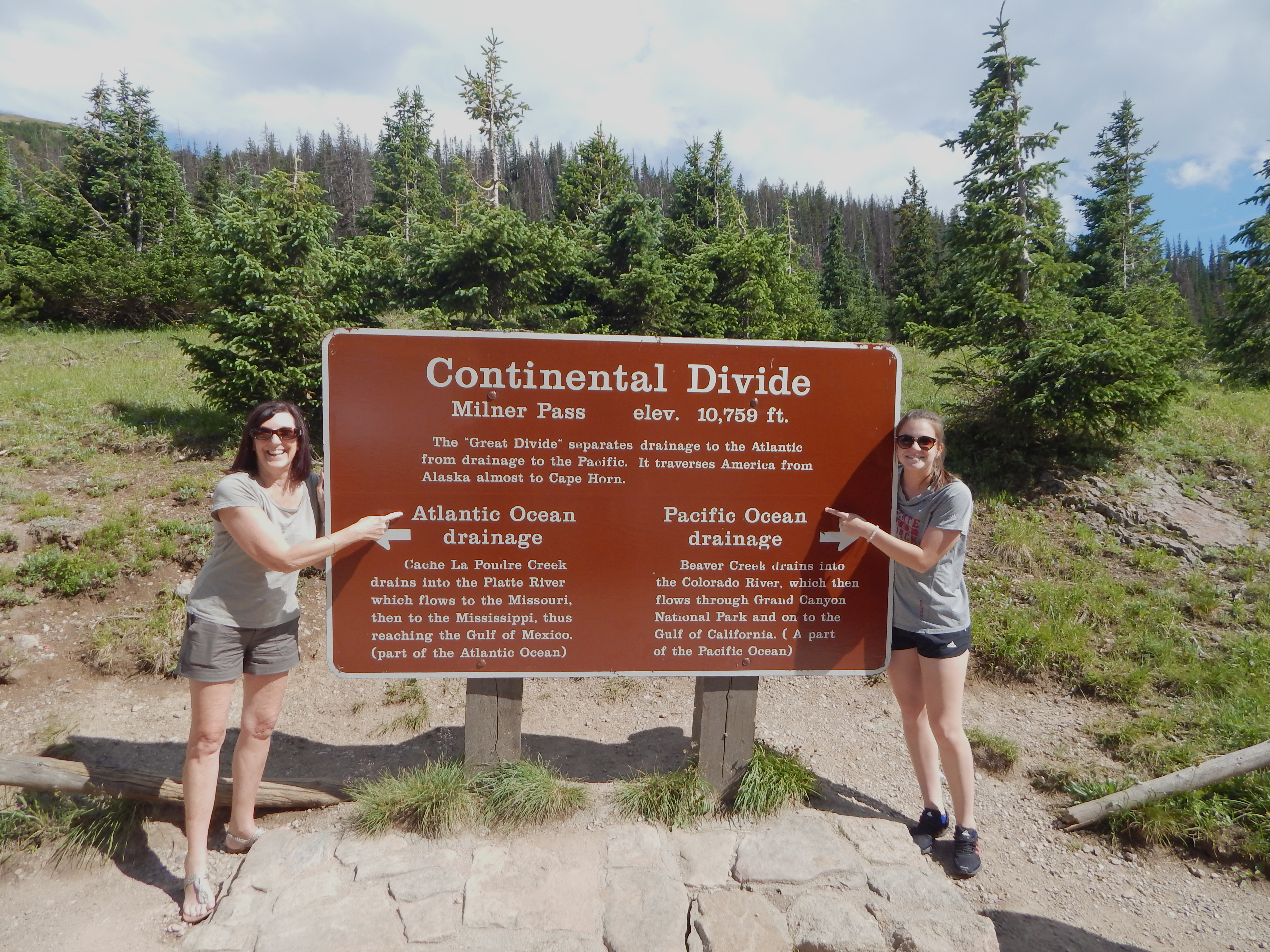
Continue west on Trail Ridge Road to Milner Pass at 10,759 feet, where the road crosses the Continental Divide beside Poudre Lake. It is a quick photo stop that marks the moment you move from the Atlantic to the Pacific watershed.
- Time
- 15 minutes
- Best time
- Late morning
Sources (2)
- NPS Data API: places (romo) · retrieved 2026-09-28
- NPS: Enjoy a Scenic Drive on Trail Ridge Road · retrieved 2026-09-28
Holzwarth Historic Site: a dude ranch in the meadow
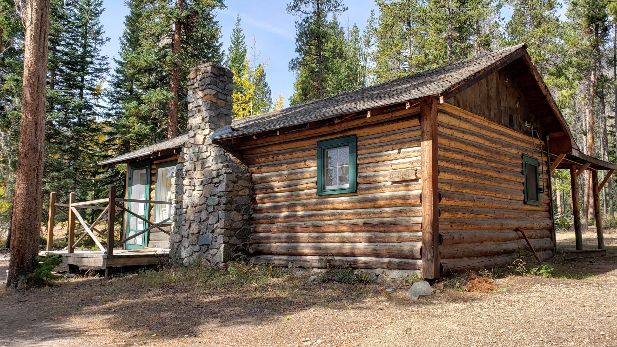
On the quieter west side, the Holzwarth Historic Site preserves the Never Summer Ranch and Holzwarth Trout Lodge, run by the Holzwarth family from the 1910s to the 1970s. The grounds are open year-round, but the cabin interiors are open only Memorial Day to Labor Day, 9:30 a.m. to 2:30 p.m.; after Labor Day you still get the grounds. The site is about a half-mile walk from the parking area. The NPS API lists Fridays as closed, which NPS prose does not mention, so check with the visitor center if Day 3 lands on a Friday. If the cabins are closed, shorten the stop to 30 minutes and move on to Grand Lake early. The Kawuneeche Valley is a good place to look for moose and elk.
- Time
- About 1 hour
- Best time
- Late morning to early afternoon (cabins close 2:30 p.m.)
Sources (2)
- NPS Data API: visitorcenters (Holzwarth) · retrieved 2026-09-28
- NPS: Visit the Holzwarth Historic Site · retrieved 2026-09-28
Firefly Pizzeria in Grand Lake: wood-fired lunch (Fri-Sun)
Grand Lake is a lakeside town at the west entrance, and Firefly turns out Neapolitan-style pizzas from a wood-fired oven: 12-inch pies with a thin base and puffy edge, roughly one per two people. Its website lists lunch 11:30 a.m. to 2:30 p.m. Friday to Sunday only, dinner 5 to 8 p.m., closed Wednesdays, and a season of early May through October. Because the drive back over Trail Ridge Road needs daylight, this trip uses Firefly as a lunch stop. Fallback: Monday, Tuesday or Thursday it serves dinner only and Wednesday it is closed, so pack a picnic (NPS lists Beaver Ponds Picnic Area and Beaver Creek Picnic Area on the west side) or eat in Estes Park that evening.
- Meal
- Lunch
- Cuisine
- Neapolitan pizza
- Price
- $$
- Reservation needed
- Not stated; online ordering available
Sources (2)
- OpenStreetMap geocode (coordinates) · retrieved 2026-09-28
- Firefly Pizzeria official page · retrieved 2026-09-28
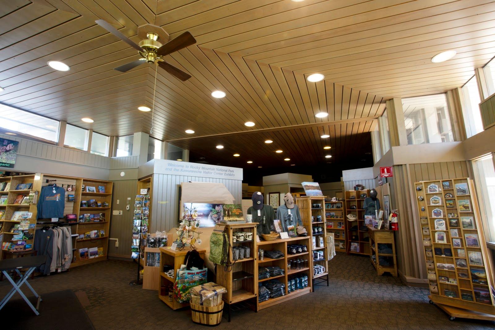
Kawuneeche Visitor Center
A good west-side pit stop just north of the town of Grand Lake: exhibits, a Conservancy Nature Store and a ranger to ask about wildlife sightings and the return drive.
- Time
- 30 minutes
Sources (1)
- NPS Data API: visitorcenters (romo) · retrieved 2026-09-28
Rock Cut, Forest Canyon Overlook and Rainbow Curve on the drive home
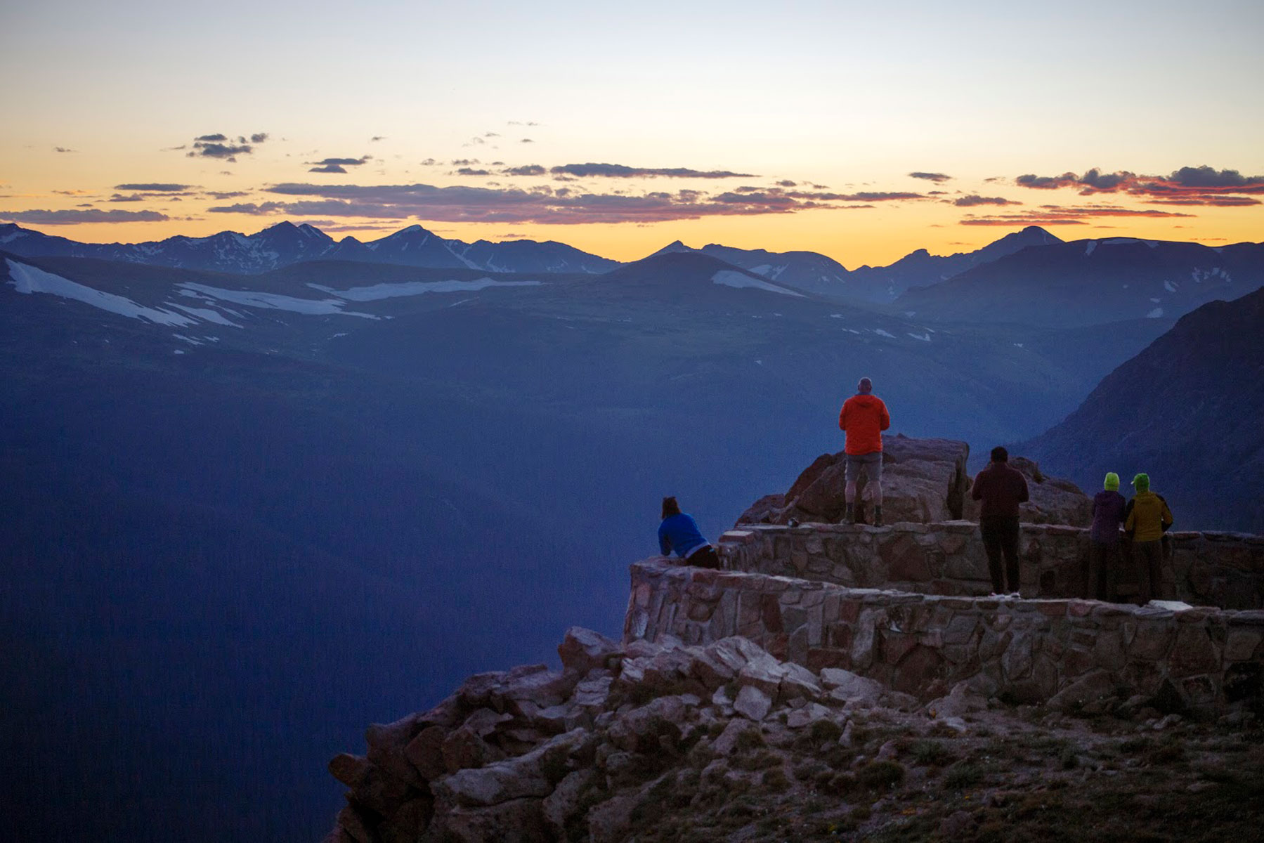
Head back east over Trail Ridge Road by about 15:00 so you cross the tundra in good light. NPS says the whole 48-mile crossing takes about 1.5 to 2 hours in steady traffic, so with stops expect to reach Rock Cut around 16:00 (our estimate). Rock Cut is a stop above 12,000 feet where a short walk on the Tundra Communities Trail shows off alpine flowers (best in June and July). Next comes Forest Canyon Overlook at 11,716 feet, with a five-minute paved walk to a panorama of Forest Canyon and Hayden Gorge. Rainbow Curve is the last pull-off on the way down. With three stops and the drive down, plan to be back in Estes Park around 18:15 to 18:30 (our estimate). Sunset moves from about 20:30 in July to about 18:30 by early October (approximate), so this timing gets tighter in the fall; skip Rainbow Curve if you are running late. Wildlife, especially elk, are active on and beside the road near dusk, so drive carefully. For dinner, use the Stanley's on-site restaurants or another Estes Park spot.
- Time
- 20-30 minutes per stop
- Best time
- Late afternoon, before dusk
Sources (2)
- NPS Data API: places (Forest Canyon Overlook, Rock Cut) · retrieved 2026-09-28
- NPS: Enjoy a Scenic Drive on Trail Ridge Road · retrieved 2026-09-28
Gem Lake and a farewell brunch
Save one more mountain for the last morning: an early climb to Gem Lake on the quieter Lumpy Ridge side of town, then a big breakfast and the drive out.
Gem Lake from Lumpy Ridge: granite and a hidden pool
Finish on the quiet side of Estes Park. From the Lumpy Ridge trailhead the trail climbs through ponderosa forest and rounded granite formations to Gem Lake, a small rock-bound pool. NPS lists it at 1.6 miles one way (about 3 miles round trip) with about 1,000 feet of climbing, so expect a steady uphill on the way in and an easy descent. Go early to beat the heat and the parking crunch. NPS publishes no street address for this trailhead; it lies about 0.3 mi from the Lumpy Ridge turnoff off MacGregor Ave.
- Distance
- 3.2 mi
- Elevation gain
- 1,000 ft
- Route
- Out and back
- Difficulty
- Moderate
- Permit required
- Park entrance pass; timed entry applies in season, including outlying areas such as Lumpy Ridge (see tips)
- Dogs allowed
- No
- Trailhead
- Lumpy Ridge Trailhead, north of Estes Park
- Note
- Distance is 1.6 mi one way (NPS) doubled
- Reservation needed
- Timed entry applies in season per NPS (outlying areas such as Lumpy Ridge are named); confirm current rules
Sources (3)
- NPS: List of Hiking Trails · retrieved 2026-09-28
- NPS Fees & Passes: outlying areas incl. Lumpy Ridge covered by park pass · retrieved 2026-09-28
- OpenStreetMap node: Lumpy Ridge Trailhead (coordinates) · retrieved 2026-09-28
Notchtop Bakery & Cafe: farewell brunch
Close the trip with the Notchtop's from-scratch breakfast and lunch menu before the drive out. It is open daily 7 a.m. to 3 p.m. per its website.
- Meal
- Breakfast
- Cuisine
- Breakfast and lunch, American
- Price
- $$
- Reservation needed
- Not stated on the website
Sources (2)
- OpenStreetMap node: Notchtop Bakery and Cafe (coordinates) · retrieved 2026-09-28
- The Notchtop official site · retrieved 2026-09-28
Where to stay
Map of places
- Beaver Meadows Visitor Center (opens Google Maps in a new tab) Day 1
- Sprague Lake (opens Google Maps in a new tab) Day 1
- Moraine Park (opens Google Maps in a new tab) Day 1
- Bird & Jim (opens Google Maps in a new tab) Day 1
- The Stanley Hotel (opens Google Maps in a new tab) Day 1
- Bear Lake Trailhead (opens Google Maps in a new tab) Day 2
- The Notchtop Bakery & Cafe (opens Google Maps in a new tab) Day 2
- Moraine Park Discovery Center (opens Google Maps in a new tab) Day 2
- MacGregor Chop House (The Stanley Hotel) (opens Google Maps in a new tab) Day 2
- Old Fall River Road (start at Endovalley Picnic Area) (opens Google Maps in a new tab) Day 3
- Alpine Visitor Center (opens Google Maps in a new tab) Day 3
- Milner Pass (opens Google Maps in a new tab) Day 3
- Holzwarth Historic Site (opens Google Maps in a new tab) Day 3
- Firefly Pizzeria (opens Google Maps in a new tab) Day 3
- Kawuneeche Visitor Center (opens Google Maps in a new tab) Day 3
- Forest Canyon Overlook (opens Google Maps in a new tab) Day 3
- Lumpy Ridge Trailhead (opens Google Maps in a new tab) Day 4
- The Notchtop Bakery & Cafe (opens Google Maps in a new tab) Day 4
- Moraine Park Campground (opens Google Maps in a new tab) Option
- YMCA of the Rockies, Estes Park Center (opens Google Maps in a new tab) Option
- Timber Creek Campground (opens Google Maps in a new tab) Option
Good to know
Timed entry (evergreen rule): During the timed-entry season, typically late May to mid-October (check NPS for current dates), Rocky Mountain National Park requires a Timed Entry reservation to enter between 9 a.m. and 2 p.m., and a Timed Entry + Bear Lake Road reservation to enter between 5 a.m. and 6 p.m. if you are going to the Bear Lake Road corridor (Sprague Lake, Moraine Park, Glacier Gorge, Bear Lake). NPS says the requirement covers outlying destinations such as Lily Lake, Longs Peak and Wild Basin. Entering before or after the window needs no reservation. A park entrance pass is separate. Reserve on Recreation.gov (a small non-refundable processing fee applies).
Applying this to the trip: Day 1: the visitor center is outside the gate, but Sprague Lake (afternoon) and Moraine Park (evening) are Bear Lake Road stops, so hold a Timed Entry + Bear Lake Road reservation for the afternoon, or shift the Sprague stroll to after 6 p.m. Day 2: Bear Lake at 7 a.m. is inside the 5 a.m.-6 p.m. window, so a Timed Entry + Bear Lake Road reservation is required. Day 3: Old Fall River Road at about 7:45 a.m. is before the 9 a.m. general window; the return over Trail Ridge Road is exiting rather than entering, but if you re-enter between 9 and 2 you need a reservation. Day 4: Gem Lake at 7:30 a.m. is before the window (NPS names Lumpy Ridge as an outlying area covered when the system is in effect).
Current conditions (as of 2026-09-28, per NPS): For 2026 the timed-entry system ran from Friday, May 22 to mid-October: standard Timed Entry through Monday, Oct 12 and Timed Entry + Bear Lake Road through Sunday, Oct 18. The NPS API showed no active alerts on 2026-09-28. Check nps.gov/romo conditions and call 970-586-1206 (Information Office) before you go.
Entrance fees (as of 2026-09-28, NPS API): $30 for a 1-day private vehicle pass, $35 for 7 days; $15 or $20 per person (1 or 7 days); the API also lists a $100 nonresident fee per person aged 16+ unless you hold an annual or America the Beautiful pass. Passes can be bought at entrance stations or in advance at Recreation.gov.
Seasonality: Trail Ridge Road is open 24 hours but can close temporarily for weather; NPS runs a recorded status line at 970-586-1222. Old Fall River Road is typically open early July to early/mid-October. Alpine Visitor Center is a summer-season facility. Summer shuttle service on Bear Lake Road does not run in winter (late October to early June is the NPS-stated period for snow on the Bear Lake trails).
Elk closures: From September 1 to October 31, NPS closes areas of Horseshoe Park, Moraine Park, Upper Beaver Meadows, Harbison Meadow and Holzwarth Meadow to foot travel from 5 p.m. to 10 a.m. daily (stay on roads and established trails). Keep at least 75 feet from elk.
Weekday planning for Day 3: Firefly serves lunch Friday to Sunday only and is closed Wednesdays; Holzwarth cabins are open Memorial Day to Labor Day only (NPS API lists Fridays closed); use the picnic fallback in the Firefly item.
Altitude and weather: Bear Lake is at 9,475 feet and Trail Ridge Road crests at 12,183 feet. Drink water, start early (afternoon storms are common in summer), and bring layers.
Parking: Glacier Gorge and Bear Lake lots fill early; NPS advises parking at Park & Ride and riding the free Bear Lake shuttle in summer.
Dogs: Pets are prohibited on all park trails, tundra and meadow areas; leashed pets are allowed only in picnic areas, parking lots, campgrounds and along roadsides.
Want live alerts and up-to-date info?
Conditions change fast. Create an account on the DriftKin app to get live park alerts, closures and information for your trip.
Sources
- NPS Data API: visitorcenters (romo) retrieved 2026-09-28
- NPS Data API: places (Forest Canyon Overlook, Rock Cut) retrieved 2026-09-28
- NPS place record: Sprague Lake retrieved 2026-09-28
- NPS: Exploring the Bear Lake Road Corridor retrieved 2026-09-28
- NPS: Watching Elk retrieved 2026-09-28
- Bird & Jim official page retrieved 2026-09-28
- OpenStreetMap node: Bird and Jim (coordinates) retrieved 2026-09-28
- OpenStreetMap geocode (coordinates) retrieved 2026-09-28
- The Stanley Hotel official site (on-site dining list) retrieved 2026-09-28
- NPS: List of Hiking Trails retrieved 2026-09-28
- OpenStreetMap node: Notchtop Bakery and Cafe (coordinates) retrieved 2026-09-28
- The Notchtop official site retrieved 2026-09-28
- NPS Data API: thingstodo (romo) retrieved 2026-09-28
- NPS: Enjoy a Scenic Drive on Old Fall River Road retrieved 2026-09-28
- NPS: Enjoy a Scenic Drive on Trail Ridge Road retrieved 2026-09-28
- NPS: Visit the Holzwarth Historic Site retrieved 2026-09-28
- OpenStreetMap geocode (coordinates) retrieved 2026-09-28
- Firefly Pizzeria official page retrieved 2026-09-28
- NPS Fees & Passes: outlying areas incl. Lumpy Ridge covered by park pass retrieved 2026-09-28
- OpenStreetMap node: Lumpy Ridge Trailhead (coordinates) retrieved 2026-09-28
- NPS Data API: campgrounds (romo) retrieved 2026-09-28
- NPS: Moraine Park Campground retrieved 2026-09-28
- Recreation.gov: Moraine Park Campground (URL from NPS API reservationUrl) retrieved 2026-09-28
- OpenStreetMap: YMCA of the Rockies Administration Building (coordinates) retrieved 2026-09-28
- YMCA of the Rockies official page retrieved 2026-09-28
- NPS: Timber Creek Campground retrieved 2026-09-28
Hours, fees, prices and closures change. Confirm details with the park or business before you go.