Saguaro: 2 Days of Cactus Forests on Both Sides of Tucson
A west-side loop hike and Gates Pass sunset, then the east-side Cactus Forest Loop
- Length
- 2 days
- Difficulty
- Easy
- Best months
- Jan–Mar, Nov–Dec
- Budget
- $$
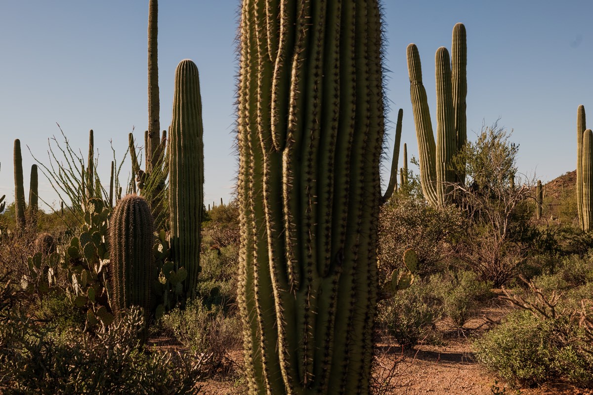
Two easy-to-moderate days covering both of Saguaro's districts: the King Canyon and Gould Mine loop and a Gates Pass sunset in the west, then the Cactus Forest Loop Drive and short trails in the east. One Tucson hotel, cool-season timing.
- King Canyon and Gould Mine loop among the saguaros
- Sunset from Gates Pass Overlook
- Cactus Forest Loop Drive in the east district
- Freeman Homestead and Tanque Verde Ridge walks
- Lunch at El Charro and Saguaro Corners
The story
Saguaro National Park is two parks in one, split by the city of Tucson, and each half rewards a different mood. The west side is the postcard: dense saguaro forests on the Tucson Mountains' slopes, with a short loop hike past an old mine and a sunset at Gates Pass that NPS itself recommends. The east side is quieter and a bit wilder, with a paved loop drive through the cactus forest and trails that begin to climb toward the Rincon Mountains.
Day one starts early in the west district with the King Canyon and Gould Mine loop, then slows down at Red Hills Visitor Center, lunches at El Charro, and ends with sunset at Gates Pass. Day two heads east for the Cactus Forest Loop Drive, a short walk to the Freeman Homestead, and a first climb up the Tanque Verde Ridge Trail, before lunch at Saguaro Corners.
One hotel on the south-west side of Tucson serves both days. The plan is built for the cooler months, when mornings are comfortable and the afternoon is yours.
Day by day
West District: King Canyon Loop and Gates Pass Sunset
An early loop hike and visitor center in the Tucson Mountain District, a downtown lunch, and sunset from Gates Pass.
King Canyon and Gould Mine Loop
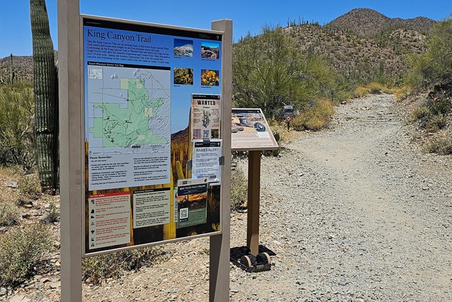
A short desert loop in the Tucson Mountains that stitches together the King Canyon, Sendero Esperanza and Gould Mine trails. NPS rates it moderate, and the payoff is a dense saguaro forest plus the remains of an old mine. Start early: the trail is exposed, and the trailhead lot is managed by Pima County rather than the park.
- Distance
- 2.4 mi
- Elevation gain
- 380 ft
- Route
- Loop
- Difficulty
- Moderate
- Trailhead
- King Canyon Trailhead in Tucson Mountain Park, just outside the park boundary
- Distance note
- NPS hiking page: 2.4 mi loop, 380 ft gain (loop basis). Other sources list 2.5-2.6 mi.
Sources (4)
- NPS Data API - places (sagu) · retrieved 2026-10-03
- Western National Parks Association - King Canyon/Gould Mine Loop guide · retrieved 2026-10-03
- NPS - King Canyon Trailhead · retrieved 2026-10-03
- NPS - Saguaro hiking trail recommendations · retrieved 2026-10-03
Red Hills Visitor Center and Cactus Garden Trail
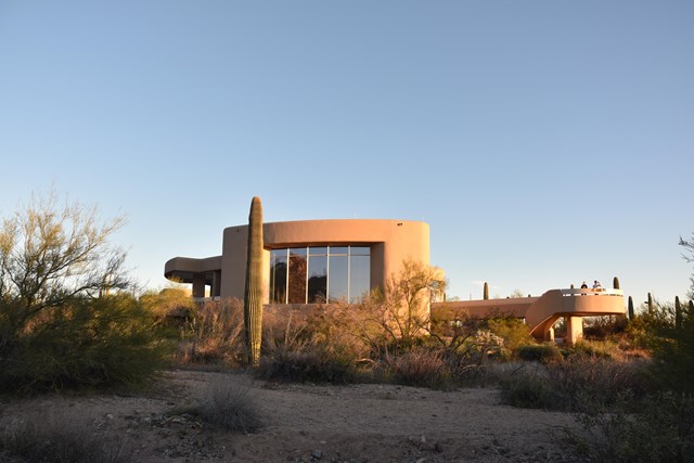
The west-side visitor center has maps, the bookstore, and a patio overlooking the Red Hills and saguaro forest; NPS says the patio's maps and hiking guides are available 24/7. The paved, accessible Cactus Garden Trail (about 300 ft) loops beside the parking lot and labels the common Sonoran Desert plants, a good primer before the afternoon.
- Time
- About 45-60 minutes with the Cactus Garden Trail
- Best time
- After opening; entrance fees can be paid here
Sources (3)
- NPS Data API - visitorcenters (sagu) · retrieved 2026-10-03
- NPS - Cactus Garden Trail · retrieved 2026-10-03
- NPS - Saguaro fees · retrieved 2026-10-03
Lunch at El Charro Cafe (downtown Tucson)
A Tucson institution: the cafe's site says it was founded in 1922 and bills itself as the nation's oldest Mexican restaurant in continuous operation by the same family. The menu leans on Tucson-style and northern Mexican dishes such as chimichangas, enchiladas, tamales and carne seca. The downtown original is a sensible midday break between the park's west side and the hotel.
- Meal
- Lunch
- Cuisine
- Tucson-style Mexican
- Reservation needed
- No
- Reservation notes
- Site offers reservation options.
Sources (2)
- El Charro Cafe official site · retrieved 2026-10-03
- El Charro Cafe - Downtown location · retrieved 2026-10-03
Hotel McCoy
A restored 1970 roadside motel (originally the E-Z 8 Motel, per the hotel's site) turned art-filled boutique stay in southwest Tucson. It lists a heated saltwater pool, free room-front parking and a complimentary breakfast, which helps with the early starts both days. Rates are not published on the page, so check current prices when booking.
- Type
- Hotel
- Location
- Outside the park
- Booking
- Book / details
- Reservation notes
- Check current rates; check-in 3 PM, check-out 11 AM.
Sources (1)
- Hotel McCoy Tucson official page · retrieved 2026-10-03
Sunset at Gates Pass Overlook
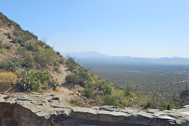
NPS points visitors to Gates Pass, in Tucson Mountain Park just east of the park's west district, as a wonderful place to watch sunset. The overlook and trailhead have parking and restrooms and are managed by Pima County, not NPS. Arrive about an hour before sunset, since the lot is gated and cars cannot leave between 8 PM and 6 AM.
- Time
- About 60-90 minutes around sunset
- Best time
- Roughly an hour before sunset; sunset time shifts by season
Sources (2)
- NPS Data API - places (sagu) · retrieved 2026-10-03
- NPS - Gates Pass Trailhead · retrieved 2026-10-03
East District: Cactus Forest Loop and Tanque Verde Ridge
Drive the Cactus Forest Loop in the morning, add two short trails, and finish with lunch beside the entrance.
Cactus Forest Loop Drive
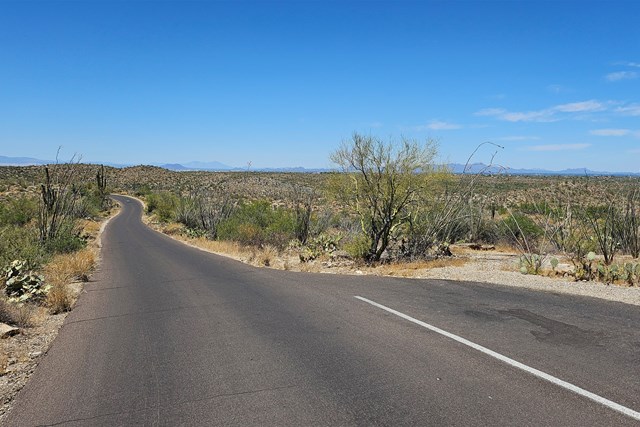
An 8-mile paved loop through the park's east-side saguaro forest, starting at the Rincon Mountain Visitor Center. Pull-offs and trailheads sit along the way, including Javelina Rocks Overlook about 6 miles in, which NPS calls a much-loved sunset area. Going early keeps the light soft and the lot space easy. The loop is open to bikes, and long trailers are not allowed.
- Time
- 8 miles; about an hour with pull-off stops, more if you hike
- Best time
- Morning or the hour before sunset
- Vehicle limit
- Vehicles over 102 in wide and/or 40+ ft combined length are prohibited (NPS)
Sources (3)
- NPS Data API - visitorcenters (sagu) · retrieved 2026-10-03
- NPS - Javelina Rocks Overlook · retrieved 2026-10-03
- NPS - Getting around (scenic loop drives) · retrieved 2026-10-03
Freeman Homestead Trail
A short desert-wash loop to the foundation of a homesteading family's house. NPS lists it as an easy walk of about a mile. A bit of the route crosses a sandy wash, so closed shoes help.
- Distance
- 0.9 mi
- Elevation gain
- 98 ft
- Route
- Loop
- Difficulty
- Easy
- Trailhead
- Freeman Homestead trailhead on the Cactus Forest Loop Drive
- Distance note
- NPS accessibility page: 0.9 mi, 98.4 ft gain (loop basis); NPS hiking page rounds to 1 mile. About 0.2 mi is a sandy wash.
Sources (3)
- NPS - Rincon Mountain District trail accessibility · retrieved 2026-10-03
- NPS - Saguaro hiking trail recommendations · retrieved 2026-10-03
- OpenStreetMap - Freeman Homestead Trailhead (coordinates) · retrieved 2026-10-03
Tanque Verde Ridge Trail to the Overlook
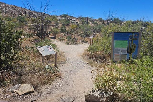
The trail climbs the ridge toward the Rincon Mountains, but NPS suggests a taste of it: about 0.6 mi up to an overlook, roughly 100 ft of climbing, which NPS also recommends for sunset viewing. The trailhead has restrooms and picnic tables.
- Distance
- 0.6 mi
- Elevation gain
- 100 ft
- Route
- Out and back
- Difficulty
- Moderate
- Trailhead
- Tanque Verde Ridge trailhead off the Cactus Forest Loop Drive
- Distance note
- One-way basis to the overlook: about 0.6 mi and roughly 100 ft gain (NPS); about 1.2 mi round trip. The full trail is much longer and strenuous.
Sources (3)
- NPS Data API - places (sagu) · retrieved 2026-10-03
- NPS - Tanque Verde Ridge Trail · retrieved 2026-10-03
- NPS - Saguaro hiking trail recommendations · retrieved 2026-10-03
Lunch at Saguaro Corners
A scratch-kitchen restaurant and bar just outside the park's east entrance, on the corner of Escalante and Old Spanish Trail, with views of the Rincon Mountains. Its site lists burgers, steaks, seafood, mac and cheese and tacos, plus a shaded, misted patio. Established in 1956, per the site.
- Meal
- Lunch
- Cuisine
- American / Tucson comfort food
- Reservation needed
- No
Sources (1)
- Saguaro Corners official site · retrieved 2026-10-03
Where to stay
More options
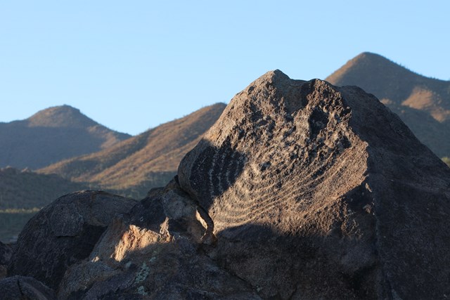
Signal Hill Petroglyphs
NPS calls Signal Hill the best place to see petroglyphs in the park. A short, non-accessible walk climbs a small rocky hill to rock art, and there is a picnic area at the base. It sits on the Bajada Loop Drive, so check that the road is open before planning it as a swap for the King Canyon loop.
- Time
- Short walk; allow about 30-45 minutes
- Best time
- Morning
Sources (1)
- NPS - Signal Hill (West District) · retrieved 2026-10-03
Valley View Overlook Nature Trail
A short nature trail built by the Civilian Conservation Corps in the 1930s. It dips through a couple of washes, climbs gently to a ridge with benches, and looks across Avra Valley toward Signal Hill and Picacho Peak. NPS lists it as 0.8 mi round trip. It is on the Bajada Loop Drive; check that the road is open.
- Time
- 0.8 mi round trip (NPS); about 30-45 minutes
- Best time
- Morning or late afternoon
Sources (1)
- NPS - Valley View Overlook Nature Trail · retrieved 2026-10-03
Map of places
- King Canyon Trailhead (opens Google Maps in a new tab) Day 1
- Red Hills Visitor Center (West) (opens Google Maps in a new tab) Day 1
- El Charro Cafe (Downtown) (opens Google Maps in a new tab) Day 1
- Hotel McCoy (opens Google Maps in a new tab) Day 1
- Gates Pass Overlook and Trailhead (opens Google Maps in a new tab) Day 1
- Cactus Forest Loop Drive (opens Google Maps in a new tab) Day 2
- Freeman Homestead Trailhead (opens Google Maps in a new tab) Day 2
- Tanque Verde Ridge Trail (opens Google Maps in a new tab) Day 2
- Saguaro Corners (opens Google Maps in a new tab) Day 2
- Arizona Inn (opens Google Maps in a new tab) Option
- Hotel Congress (opens Google Maps in a new tab) Option
- Hacienda del Sol Guest Ranch Resort (opens Google Maps in a new tab) Option
- Signal Hill (West District) (opens Google Maps in a new tab) Option
- Valley View Overlook Nature Trail (opens Google Maps in a new tab) Option
Good to know
Current conditions (as of 2026-10-03)
- NPS alerts: the Bajada Loop Drive in the Tucson Mountain District (including Hohokam Road and Golden Gate Road) is closed for flash-flood road damage until repaired, and the Javelina Wash Trail near Red Hills Visitor Center is closed. This itinerary avoids both; the two Bajada Loop options (Signal Hill, Valley View) work only after reopening.
- NPS alert: vehicle break-ins have occurred at the King Canyon Trailhead and other trailheads; hide or take valuables.
- NPS alert: Rincon Mountain District phones were reported down on 2026-10-02; use the contact page's email form.
- Entrance (NPS, as of 2026-10-03): $25 private vehicle, $15 per person on foot or bike (age 16+), good for 7 days at both districts; payment is cashless. Veterans Day (Nov 11) is a listed 2026 fee-free day.
- Visitor centers are closed Nov 25 and Dec 25, 2026. NPS hours data for Red Hills in summer 2027 is inconsistent; confirm before a summer 2027 visit.
Evergreen tips
- Best months are roughly November-March. NPS says summer highs run from the mid-90s to the low 110s F and advises outdoor activity only before 10 AM or after 4 PM; late-summer monsoons bring flash-flood risk.
- The two districts are separated by Tucson, 30-60 minutes apart (NPS); this plan puts one on each day with one hotel base.
- NPS recommends entering the district's physical address in your map app instead of searching the park name. West: 2700 N Kinney Rd; East: 3693 S Old Spanish Trail.
- Rideshares drop off at the west side but usually will not pick up; arrange return rides in advance (NPS).
- Carry water on every trail; ticks carrying spotted fever are present in Arizona (NPS).
- Saguaros bloom from late May through July (NPS), too hot for this plan's hikes.
- Sunset time shifts by season, so set the Gates Pass start time about an hour ahead of it.
Want live alerts and up-to-date info?
Conditions change fast. Create an account on the DriftKin app to get live park alerts, closures and information for your trip.
Sources
Good to know: distances and drive times are typical figures without live traffic, and where routes are shown the route data comes from OpenStreetMap contributors. Toll amounts are estimates and change often, so check them in the DriftKin planner or with the toll authority before you plan around them. Opening hours, fees, prices, permits and closures also change, so confirm with the park or business before you go.
- NPS Data API - places (sagu) retrieved 2026-10-03
- Western National Parks Association - King Canyon/Gould Mine Loop guide retrieved 2026-10-03
- NPS - King Canyon Trailhead retrieved 2026-10-03
- NPS - Saguaro hiking trail recommendations retrieved 2026-10-03
- NPS Data API - visitorcenters (sagu) retrieved 2026-10-03
- NPS - Cactus Garden Trail retrieved 2026-10-03
- NPS - Saguaro fees retrieved 2026-10-03
- El Charro Cafe official site retrieved 2026-10-03
- El Charro Cafe - Downtown location retrieved 2026-10-03
- Hotel McCoy Tucson official page retrieved 2026-10-03
- NPS - Gates Pass Trailhead retrieved 2026-10-03
- NPS - Javelina Rocks Overlook retrieved 2026-10-03
- NPS - Getting around (scenic loop drives) retrieved 2026-10-03
- NPS - Rincon Mountain District trail accessibility retrieved 2026-10-03
- OpenStreetMap - Freeman Homestead Trailhead (coordinates) retrieved 2026-10-03
- NPS - Tanque Verde Ridge Trail retrieved 2026-10-03
- Saguaro Corners official site retrieved 2026-10-03
- Arizona Inn official site retrieved 2026-10-03
- Hotel Congress official site retrieved 2026-10-03
- Hacienda del Sol official site retrieved 2026-10-03
- NPS - Signal Hill (West District) retrieved 2026-10-03
- NPS - Valley View Overlook Nature Trail retrieved 2026-10-03