Las Vegas to Lone Pine in One Day: Through Death Valley to the Eastern Sierra
Badlands, the lowest point in North America, a Panamint Valley fuel stop and Alabama Hills arches with Mount Whitney as backdrop
- Length
- 1 day
- Total distance
- 263.2 mi
- Driving time
- 5 h 9 min
- Est. tolls
- No tolls
- Stops
- 5
- Driving
- Moderate
- Best months
- Jan–Mar, Nov–Dec
- Budget
- $$
A one-day, one-way drive of about 263 miles from Las Vegas to Lone Pine through Death Valley National Park on SR-160, CA-190 and CA-136. Five stops: Zabriskie Point, Badwater Basin, lunch and the visitor center at Furnace Creek, fuel at Panamint Springs and the Alabama Hills at the foot of the Sierra, with dinner in Lone Pine. No tolls.
- Drive time5 h 9 min
- Distance263.2 mi
- Est. tollsNo tolls
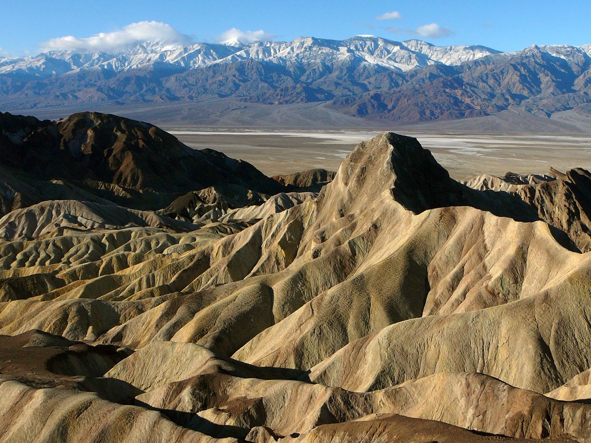
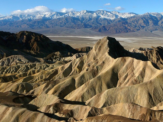
- Zabriskie Point: golden badlands and Manly Beacon over the salt flats
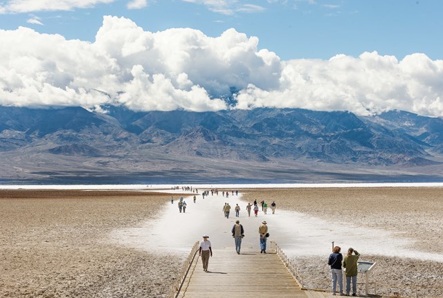
- Badwater Basin: walk out onto the lowest point in North America
- Alabama Hills: arches that frame Mount Whitney near Lone Pine
The story
Death Valley makes a spectacular one-day crossing if you plan for fuel and heat. This route leaves Las Vegas at 6:45 am, runs west to Pahrump and crosses the desert to Death Valley Junction, about two hours on the road before the first stop. Then comes a string of very different landscapes: the golden badlands of Zabriskie Point, the salt flats of Badwater Basin at 282 ft (86 m) below sea level, and the green oasis of Furnace Creek, where one stop covers the visitor center and a saloon lunch.
The afternoon is the long haul. CA-190 crosses Towne Pass into the wide Panamint Valley (plan 75 to 80 minutes even though the router says 61), with a short fuel stop at Panamint Springs, then CA-190 and CA-136 carry you over to the Owens Valley, where the Sierra Nevada rises abruptly in front of you. The Alabama Hills at its foot are a boulder-strewn film-set landscape (hundreds of films, according to Wikipedia) with arches that frame Mount Whitney. The day ends with dinner in Lone Pine.
The rhythm is five stops with uneven gaps: about two hours of driving to the first stop, a tight cluster of three stops in the park's core within about an hour (Zabriskie Point, Badwater, Furnace Creek), then roughly 75 minutes to Panamint Springs and 70 minutes to the Alabama Hills. Fuel is the thing to watch: fill up in Las Vegas, top up at Furnace Creek (and at Stovepipe Wells if needed), and fill up again at Panamint Springs, the last fuel before Lone Pine. Winter and spring are the best seasons; the NPS puts summer highs at 110-116 degrees F and advises against more than about 15 minutes outside at Badwater in the extreme heat.
Three alternatives are mapped below: the Artists Drive loop, a north-side route through the ghost town of Rhyolite and Daylight Pass, and a longer approach on CA-127 through Shoshone.
Day by day
Las Vegas to Lone Pine
A 6:45 am start leads west through Pahrump to Death Valley: Zabriskie Point, Badwater Basin, the visitor center and lunch at Furnace Creek, a fuel stop at Panamint Springs, then Alabama Hills and dinner in Lone Pine.
Start in Las Vegas: the Welcome to Fabulous Las Vegas sign
Begin at the 1959 neon welcome sign at the south end of the Strip for the obligatory photo, then top off the tank at a nearby station and point the car west. A 6:45 am start reaches Death Valley with the morning light still low and finishes the Alabama Hills stop before Lone Pine sunset even in December. Bring plenty of water; the next reliable fuel inside the park is at Furnace Creek, about 115 miles away; Pahrump, about 60 miles in, is the last real town before the park.

- Time
- 15 minutes: photo plus filling the tank. Parking lot at the sign per Wikipedia
Sources (2)
- Welcome to Fabulous Las Vegas sign (Wikipedia: address, 1959, parking) · retrieved 2026-10-03
- OpenStreetMap contributors (routing data, local OSRM) · retrieved 2026-10-03
Las Vegas to Zabriskie Point
- Distance
- 111.7 mi
- Drive time
- 2 h
- Est. tolls
- No tolls
- Via
- SR-160 through Pahrump, Bell Vista Rd, CA-190
The opening stretch is the longest of the day: out of the Las Vegas Valley, west over the hills on SR-160 into Pahrump, then across the open Amargosa desert to the Death Valley Junction crossroads and into the park on CA-190. Pahrump is the only real town on the way if anyone needs a coffee or restroom; the OSM time is about two hours, and 5 minutes of buffer is built in before Zabriskie Point.
Tolls: No tolls on this leg or anywhere on this route (as of 2026-10-03).
Sources (1)
- OpenStreetMap contributors (routing data, local OSRM) · retrieved 2026-10-03
Zabriskie Point
The classic first look at Death Valley: a short paved climb to a lookout over ridged, golden badlands, with Manly Beacon in the middle and the salt flats and Panamint Range beyond. NPS calls it one of the most photographed views in the park and a favorite for sunrise and sunset; mid-morning is less dramatic, but it is on the way. Park entrance fee machines (credit card only) are here, so pay before moving on.
- Time
- About a quarter-mile (400 m) paved walk uphill from the parking lot, each way (NPS)
- Best time
- Sunrise and sunset; mid-morning still works
Sources (2)
- NPS: Death Valley entrance fees and payment locations · retrieved 2026-10-03
- NPS: Zabriskie Point · retrieved 2026-10-03
Zabriskie Point to Badwater Basin
- Distance
- 20.1 mi
- Drive time
- 25 min
- Est. tolls
- No tolls
- Via
- CA-190, Badwater Rd (CA-178)
Down CA-190 to Furnace Creek, then south on Badwater Road along the foot of the Black Mountains with the salt flats opening out to the west. NPS describes Badwater as about 30 minutes south of the visitor center.
Tolls: No tolls on this leg or anywhere on this route (as of 2026-10-03).
Sources (1)
- OpenStreetMap contributors (routing data, local OSRM) · retrieved 2026-10-03
Badwater Basin salt flats
The lowest point in North America, 282 ft (86 m) below sea level, is a vast crust of salt you can walk onto. NPS says a quarter-mile (400 m) walk from the boardwalk reaches the salt polygons; the best patterns need a longer 1.5-2 mile round trip across the flat, which this plan skips. Look up at the cliffs on the east side for the sea-level sign. Bring water and a hat; the flats offer no shade.
- Time
- Quarter-mile (400 m) walk to the salt polygons each way per NPS; the stop is timed for the short walk
- Best time
- Cooler months; heat is dangerous in summer
- Parking
- Parking lot off Badwater Road with fee machine and restrooms (NPS amenities list)
Sources (3)
- NPS: Badwater Basin · retrieved 2026-10-03
- NPS: Visit Badwater Basin · retrieved 2026-10-03
- OpenStreetMap contributors (parking-lot coordinates; the NPS place point lies out on the salt flat) · retrieved 2026-10-03
Badwater Basin to Furnace Creek
- Distance
- 17.5 mi
- Drive time
- 22 min
- Est. tolls
- No tolls
- Via
- Badwater Rd (CA-178), CA-190
Straight back north on Badwater Road, passing the turnoff for the Artists Drive loop (see the alternatives below) and the badlands of Golden Canyon before reaching the Furnace Creek oasis.
Tolls: No tolls on this leg or anywhere on this route (as of 2026-10-03).
Sources (1)
- OpenStreetMap contributors (routing data, local OSRM) · retrieved 2026-10-03
Furnace Creek: lunch at The Last Kind Words Saloon
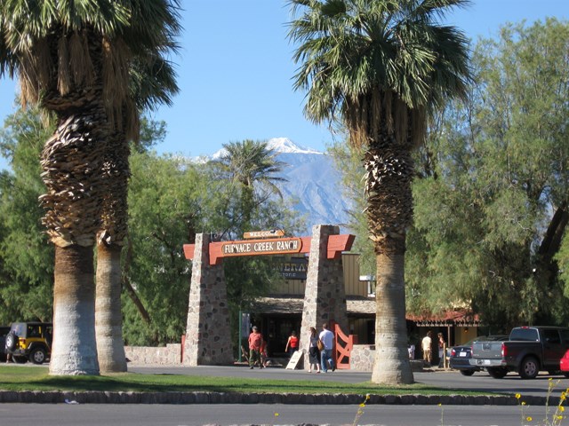
One Furnace Creek stop covers the park's main information point and lunch, which sit 0.34 mi apart. Start at the Furnace Creek Visitor Center (NPS lists it open daily 8:00 am to 5:00 pm, with rangers, restrooms, a park film and a bookstore) to ask about road conditions ahead and buy the entrance pass if you have not yet. Then eat at The Last Kind Words Saloon at The Ranch at Death Valley, a western-themed room whose official site describes a menu running from barbecued ribs and steaks to salmon and pasta; lunch service starts at 11:00 am and reservations are recommended. Prices were not captured, so check the menu online. The Ranch also has fuel (per NPS): top up here, since the only fuel before Panamint Springs is at Stovepipe Wells.
- Meal
- Lunch
- Cuisine
- Western / steakhouse
- Reservation needed
- No
- Duration note
- About 20 minutes at the visitor center (NPS: 15-120 minutes depending on interest) plus about an hour for lunch, with 5 minutes of slack; the two are 0.34 mi apart
- Visitor center
- Furnace Creek Visitor Center
Sources (4)
- NPS Data API: Furnace Creek Visitor Center (hours, location) · retrieved 2026-10-03
- NPS: The Ranch at Death Valley (fuel, location) · retrieved 2026-10-03
- NPS: Visit the Furnace Creek Visitor Center · retrieved 2026-10-03
- The Oasis at Death Valley: The Last Kind Words Saloon (hours, menu description) · retrieved 2026-10-03
Furnace Creek to Panamint Springs
- Distance
- 55.2 mi
- Drive time
- 1 h 1 min
- Est. tolls
- No tolls
- Via
- CA-190
- Planning note
- OSM estimate 61 min; schedule allows 78 min for Towne Pass and slower traffic
- Planning minutes
- 78
The longest empty stretch of the day: CA-190 passes Stovepipe Wells and the Mesquite Flat dunes, climbs over Towne Pass and drops into the wide Panamint Valley. Stovepipe Wells is the only fuel on the way. The OSM router says 61 minutes; plan 75 to 80 for the pass and the slower stretches, and the schedule allows 78 minutes (17 of them buffer).
Tolls: No tolls on this leg or anywhere on this route (as of 2026-10-03).
Sources (1)
- OpenStreetMap contributors (routing data, local OSRM) · retrieved 2026-10-03
Fuel and restroom break at Panamint Springs Resort
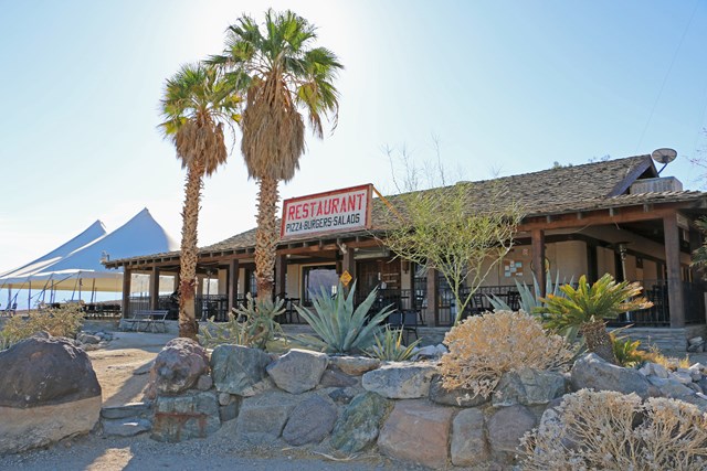
A small, rustic resort in Panamint Valley with a gas station and general store, a restaurant and bar, and an ATM, per NPS. Fill up here and stretch before the final run to the Owens Valley. This is the last fuel before Lone Pine.
- Time
- 15 minutes: fuel, restroom, snack
- Stop kind
- fuel_break
Sources (2)
- NPS Data API: alerts (Panamint Springs gas hours) · retrieved 2026-10-03
- NPS: Panamint Springs Resort · retrieved 2026-10-03
Panamint Springs to Alabama Hills
- Distance
- 54.4 mi
- Drive time
- 1 h 11 min
- Est. tolls
- No tolls
- Via
- CA-190, CA-136, US-395, Whitney Portal Rd, Movie Rd
Up out of Panamint Valley on CA-190, then north on CA-136 past the dry Owens Lake bed with the Sierra Nevada rising ahead, into Lone Pine and west on Whitney Portal Road.
Tolls: No tolls on this leg or anywhere on this route (as of 2026-10-03).
Sources (1)
- OpenStreetMap contributors (routing data, local OSRM) · retrieved 2026-10-03
Alabama Hills: Mobius Arch Loop and Movie Road
Rounded granite boulders and natural arches in front of the Sierra crest, a landscape used as a film location for more than a century. The short Mobius Arch Loop is under a mile (exact figures vary by source; the BLM page gives none) and passes arches that frame Mount Whitney. Trailhead parking is a dirt lot reached by Whitney Portal Road and Movie Road, per BLM. The stop is timed to finish well before sunset, which falls early in winter (see the sunset table in the tips).

- Time
- About 30 minutes for the loop, plus time for photos and a short drive along Movie Road
- Best time
- Afternoon light on the rocks; early morning is a classic Whitney view
- Parking
- Dirt parking area at the trailhead (BLM)
Sources (2)
- Alabama Hills (Wikipedia: BLM National Scenic Area, film history) · retrieved 2026-10-03
- BLM: Mobius Arch Loop Trail (directions: Whitney Portal Rd, Movie Rd, dirt parking) · retrieved 2026-10-03
Alabama Hills to Lone Pine
- Distance
- 4.3 mi
- Drive time
- 10 min
- Est. tolls
- No tolls
- Via
- Movie Rd, Whitney Portal Rd, US-395
Back along Movie Road and Whitney Portal Road into town, with Mount Whitney in the mirror.
Tolls: No tolls on this leg or anywhere on this route (as of 2026-10-03).
Sources (1)
- OpenStreetMap contributors (routing data, local OSRM) · retrieved 2026-10-03
Dinner at Seasons Restaurant, Lone Pine
A Main Street dinner house; its own site lists service from 5 pm Tuesday to Saturday, asks for reservations, and says it may close early on slower evenings, so call ahead. Menu and prices were not captured; check the site. If you arrive on a Sunday or Monday, ask locally for another option.
- Meal
- Dinner
- Cuisine
- American / seafood and steak
- Reservation needed
- Yes
- Duration note
- Arrive in Lone Pine about 4:20 pm, about 40 minutes before opening: time to check in or stroll Main Street
Sources (1)
- Seasons Restaurant, Lone Pine (official site: address, phone, hours) · retrieved 2026-10-03
Where to stay
Stay in Lone Pine: Dow Villa Motel
A family-run motel (since 1957, per its site) with a separate historic hotel from the 1920s, central Lone Pine, pool and hot tub, free parking and some pet-friendly motel rooms. No rates on the site; check current rates.
- Type
- Hotel
- Location
- Outside the park
- Booking
- Book / details
- Reservation notes
- Check current rates on the official site.
Sources (2)
- Dow Villa Motel official site · retrieved 2026-10-03
- OpenStreetMap Nominatim (coordinates) · retrieved 2026-10-03
Stay at Furnace Creek: The Ranch at Death Valley
A full-service stay in the heart of the park, next to the visitor center, with restaurants, pool, fuel and a campground; a good base if you would rather split the drive over two days and linger in Death Valley. Rates not captured; check current rates.
- Type
- Hotel
- Location
- Inside the park
- Booking
- Book / details
- Reservation notes
- Check current rates and seasonal availability.
Sources (2)
- NPS: The Ranch at Death Valley · retrieved 2026-10-03
- The Oasis at Death Valley official site · retrieved 2026-10-03
Stay in the west of the park: Panamint Springs Resort
Per NPS, a rustic resort with historic hotel rooms, cabin-style motel rooms, tent cabins, a cottage and camping, plus a restaurant and bar. Rates not captured; check the resort's website.
- Type
- Lodge
- Location
- Inside the park
- Booking
- Book / details
- Reservation notes
- Check current rates on the resort website.
Sources (1)
- NPS: Panamint Springs Resort · retrieved 2026-10-03
More options
Alternative: Artists Drive scenic loop (Badwater to Furnace Creek)
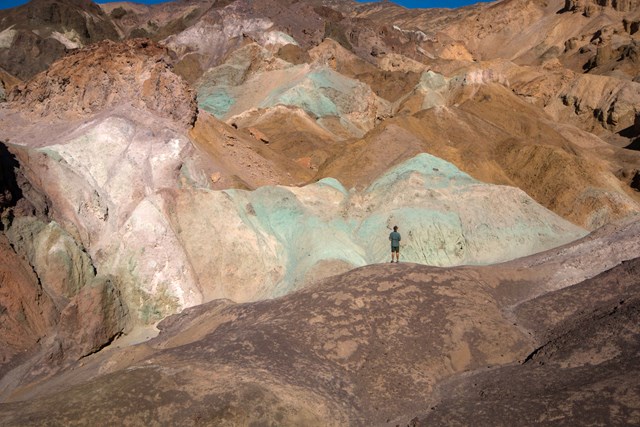
Instead of returning straight up Badwater Road, take the nine-mile one-way paved Artists Drive through multicolored hills; NPS calls it the park's most popular scenic drive and says the colors are most dramatic in afternoon light. The OSM router puts it at 22.9 mi and 43 min versus 17.5 mi and 22 min on the direct road (about 5.4 mi and 21 min more driving, plus stops; NPS suggests 25-45 minutes for the loop). Vehicles over 25 ft are not allowed; watch for cyclists. Artists Palette is the viewpoint highlight. Every minute spent here pushes the rest of the day later, so use it only if you leave Las Vegas early or skip the visitor center.
- Distance
- 22.9 mi
- Drive time
- 43 min
- Est. tolls
- No tolls
- Via
- Badwater Rd, Artists Drive Scenic Loop, CA-190
- To
- The Last Kind Words Saloon
- From
- Badwater Basin
Tolls: No tolls (as of 2026-10-03).
Sources (3)
- NPS: Artists Palette · retrieved 2026-10-03
- NPS: Tour Artists Drive · retrieved 2026-10-03
- OpenStreetMap contributors (routing data, local OSRM) · retrieved 2026-10-03
Alternative: the north entry via Beatty, Rhyolite and Daylight Pass
A different shape of day: take US-95 to Beatty, wander the ruins of the Rhyolite ghost town (founded 1905; Cook Bank and the Bottle House survive, per Wikipedia; managed by BLM), then cross Daylight Pass past Hell's Gate into the park and drop to Stovepipe Wells for fuel and a look at the Mesquite Flat dunes. It skips Zabriskie Point, Badwater and Furnace Creek. OSM puts Las Vegas to Panamint Springs this way at 190.7 mi and 203 min, versus 204.5 mi and 228 min on the main route through the same stops. Add about an hour for Rhyolite and the dunes, and pay the park fee at Hell's Gate.

- Distance
- 190.7 mi
- Drive time
- 3 h 23 min
- Est. tolls
- No tolls
- Via
- US-95, Rhyolite, SR-374 / Daylight Pass Rd, CA-190
- To
- Panamint Springs Resort
- From
- Welcome to Fabulous Las Vegas sign
Tolls: No tolls (as of 2026-10-03).
Sources (4)
- Rhyolite, Nevada (Wikipedia) · retrieved 2026-10-03
- NPS: Hell's Gate (fee station on Daylight Pass Road) · retrieved 2026-10-03
- NPS: Mesquite Flat Sand Dunes · retrieved 2026-10-03
- OpenStreetMap contributors (routing data, local OSRM) · retrieved 2026-10-03
Alternative: the long way round through Shoshone on CA-127
Instead of cutting straight across the Amargosa desert on Bell Vista Road, stay on Pahrump's main road to Shoshone, a tiny desert town that Wikipedia describes as a southern gateway to Death Valley with a gas station, restaurant, bar and coffee house, then follow CA-127 north along the Amargosa River country to the Death Valley Junction crossroads and turn west on CA-190 to Zabriskie Point. The OSM router puts Las Vegas to Zabriskie Point this way at 145.3 mi and 164 min, versus 111.7 mi and 120 min on the main route (about 33.6 mi and 44 min more). It is a road a navigation app would not choose for this trip, and it adds a fuel and coffee option in Shoshone; with the extra time it works best if you leave earlier or drop the Artists Drive idea.
- Distance
- 145.3 mi
- Drive time
- 2 h 44 min
- Est. tolls
- No tolls
- Via
- SR-160, Pahrump Valley Blvd (SR-372), Shoshone, CA-127, Death Valley Junction, CA-190
- To
- Zabriskie Point
- From
- Welcome to Fabulous Las Vegas sign
Tolls: No tolls (as of 2026-10-03).
Sources (3)
- California State Route 127 (Wikipedia) · retrieved 2026-10-03
- Shoshone, California (Wikipedia: services, location) · retrieved 2026-10-03
- OpenStreetMap contributors (routing data, local OSRM) · retrieved 2026-10-03
Route map
- Welcome to Fabulous Las Vegas sign (opens Google Maps in a new tab) Day 1
- Zabriskie Point (opens Google Maps in a new tab) Day 1
- Badwater Basin (parking lot and boardwalk) (opens Google Maps in a new tab) Day 1
- The Last Kind Words Saloon (The Ranch at Death Valley) (opens Google Maps in a new tab) Day 1
- Panamint Springs Resort (opens Google Maps in a new tab) Day 1
- Mobius Arch Loop trailhead (Alabama Hills National Scenic Area) (opens Google Maps in a new tab) Day 1
- Seasons Restaurant (opens Google Maps in a new tab) Day 1
- Artists Palette (opens Google Maps in a new tab) Option
- Rhyolite Ghost Town (opens Google Maps in a new tab) Option
- Shoshone (opens Google Maps in a new tab) Option
- Dow Villa Motel (opens Google Maps in a new tab) Option
- The Ranch at Death Valley (opens Google Maps in a new tab) Option
- Panamint Springs Resort (opens Google Maps in a new tab) Option
Good to know
Weekday assumption. The plan assumes a Saturday departure. Seasons Restaurant is open Tuesday to Saturday evenings per its site, so a Tuesday to Saturday departure works; otherwise find another dinner in Lone Pine.
When to go. Best months are November to March. NPS lists summer highs of about 110-116 F and an October average high of 93 F; the stretch from Badwater to Panamint Springs has little shade, so avoid summer and early fall. Spring is windy. Sunrise/sunset (computed with the NOAA solar equations, Pacific time): Las Vegas Nov 15 6:16 am / 4:33 pm, Dec 21 6:47 / 4:29, Feb 15 6:29 / 5:20; Lone Pine Nov 15 6:29 / 4:44, Dec 21 7:00 / 4:39, Feb 15 6:41 / 5:31. The 6:45 am start is timed so the Alabama Hills stop ends by about 4:10 pm, before Lone Pine sunset even in December.
Fuel and supplies. Fill up in Las Vegas (the sign stop). Fuel in the park: The Ranch at Death Valley in Furnace Creek, Stovepipe Wells (24 h per an NPS alert) and Panamint Springs, the last before Lone Pine. Carry water and download offline maps as a precaution. From Furnace Creek to Lone Pine is about 110 miles with fuel only at Stovepipe Wells and Panamint Springs.
Totals. 263.2 mi and 5 h 9 min of OSM-router driving across six legs. The schedule allows 17 extra minutes on the Furnace Creek to Panamint Springs leg (78 minutes planned vs 61 from the router), so real arrival times run a little later than the sum of the legs. No tolls anywhere on the route.
Timing. Leave the sign 7:00 (after a 15-minute photo and fuel stop from 6:45), Zabriskie Point 9:05, Badwater 9:55, Furnace Creek 11:00 (visitor center, then lunch), leave Furnace Creek 12:25, Panamint Springs 13:45, leave 14:00, Alabama Hills 15:15, back in Lone Pine by 16:20 and dinner at 5:00 pm. Opening hours were taken from the sources listed on each stop; confirm before you go.
Current conditions (as of 2026-10-03). NPS road status (updated 2026-09-28 11:20 am): Bonnie Clare Road and Scotty's Castle are closed for flood recovery; Southern Badwater Road south of Badwater Basin toward Shoshone carries a caution (not used in this plan); Titus Canyon Road's one-way section is closed until about May 2027; Darwin Falls Road is closed until about summer 2027; Emigrant restrooms are closed (nearest open: Stovepipe Wells). None of these affect the CA-190 route used here, and Artists Drive is not listed as closed. The NPS alerts feed (indexed 2025-01-27) says Panamint Springs gas is available 7 am to 9:30 pm daily and Furnace Creek and Stovepipe Wells 24 hours. Park entrance fee: $30 per private vehicle for 7 days, $55 annual pass, payable by card at fee machines (Zabriskie Point, Badwater Basin, Hell's Gate) and at the Furnace Creek Visitor Center (as of 2026-10-03; NPS).
Every stop's hours, prices and status can change. Confirm before you go.
Want live alerts and up-to-date info?
Roads, tolls and closures change fast. Create an account on the DriftKin app to get live alerts and up-to-date information for your drive.
Sources
Good to know: distances and drive times are typical figures without live traffic, and where routes are shown the route data comes from OpenStreetMap contributors. Toll amounts are estimates and change often, so check them in the DriftKin planner or with the toll authority before you plan around them. Opening hours, fees, prices, permits and closures also change, so confirm with the park or business before you go.
- Welcome to Fabulous Las Vegas sign (Wikipedia: address, 1959, parking) retrieved 2026-10-03
- OpenStreetMap contributors (routing data, local OSRM) retrieved 2026-10-03
- NPS: Death Valley entrance fees and payment locations retrieved 2026-10-03
- NPS: Zabriskie Point retrieved 2026-10-03
- NPS: Badwater Basin retrieved 2026-10-03
- NPS: Visit Badwater Basin retrieved 2026-10-03
- NPS Data API: Furnace Creek Visitor Center (hours, location) retrieved 2026-10-03
- NPS: The Ranch at Death Valley retrieved 2026-10-03
- NPS: Visit the Furnace Creek Visitor Center retrieved 2026-10-03
- The Oasis at Death Valley: The Last Kind Words Saloon (hours, menu description) retrieved 2026-10-03
- NPS Data API: alerts (Panamint Springs gas hours) retrieved 2026-10-03
- NPS: Panamint Springs Resort retrieved 2026-10-03
- Alabama Hills (Wikipedia: BLM National Scenic Area, film history) retrieved 2026-10-03
- BLM: Mobius Arch Loop Trail (directions: Whitney Portal Rd, Movie Rd, dirt parking) retrieved 2026-10-03
- Seasons Restaurant, Lone Pine (official site: address, phone, hours) retrieved 2026-10-03
- NPS: Artists Palette retrieved 2026-10-03
- NPS: Tour Artists Drive retrieved 2026-10-03
- Rhyolite, Nevada (Wikipedia) retrieved 2026-10-03
- NPS: Hell's Gate (fee station on Daylight Pass Road) retrieved 2026-10-03
- NPS: Mesquite Flat Sand Dunes retrieved 2026-10-03
- California State Route 127 (Wikipedia) retrieved 2026-10-03
- Shoshone, California (Wikipedia: services, location) retrieved 2026-10-03
- Dow Villa Motel official site retrieved 2026-10-03
- OpenStreetMap Nominatim (coordinates) retrieved 2026-10-03
- The Oasis at Death Valley official site retrieved 2026-10-03
More trips like this
 Road tripPage to Moab
Page to Moab in One Day: Monument Valley, Valley of the Gods and Natural Bridges
1 day Moderate$$ Road tripPhoenix to Grand Canyon (South Rim) via Sedona
Phoenix to the Grand Canyon in One Day: Red Rocks, Oak Creek and the East Rim
1 day Moderate$$ Road tripMiami to Key West
Miami to Key West in One Day: The Overseas Highway
1 day Easy$$