Phoenix to the Grand Canyon in One Day: Red Rocks, Oak Creek and the East Rim
Sedona's chapel, a drive through Oak Creek Canyon, a Flagstaff burger, the Desert View Watchtower and a South Rim sunset
- Length
- 1 day
- Total distance
- 254.2 mi
- Driving time
- 5 h 8 min
- Est. tolls
- No tolls
- Stops
- 4
- Driving
- Moderate
- Best months
- Apr–May, Sep–Oct
- Budget
- $$
A one-day, one-way drive from Phoenix to the Grand Canyon's South Rim through Sedona and Oak Creek Canyon: 254.2 miles and about 5 h 8 min of driving, no tolls, four stops and a sunset finish at Mather Point. Lodging choices in Tusayan and in the park are listed for anyone who wants to stay.
- Drive time5 h 8 min
- Distance254.2 mi
- Est. tollsNo tolls
- Chapel of the Holy Cross in Sedona: a modernist chapel set between red-rock spires
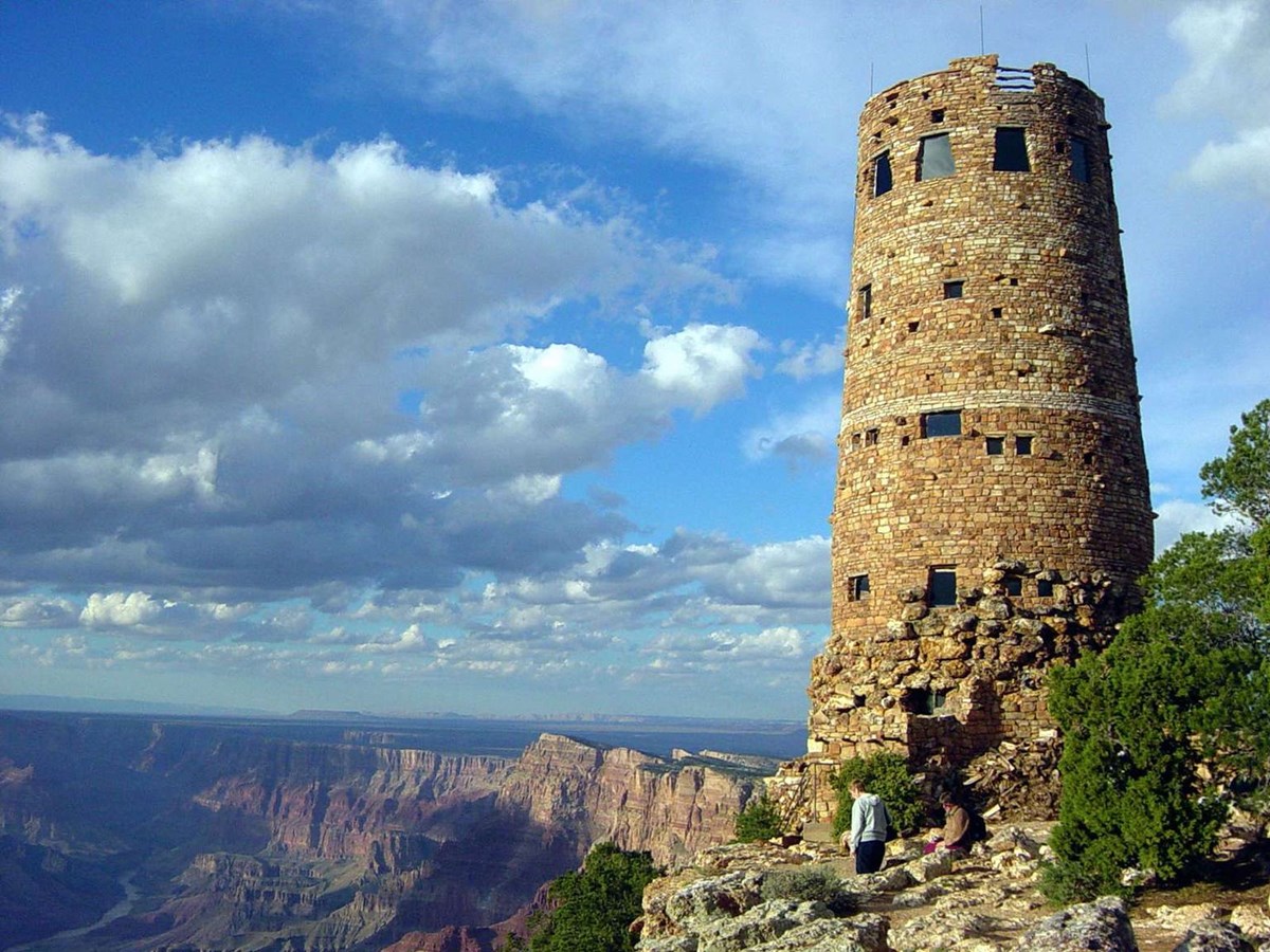
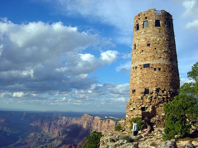
- Desert View Watchtower: Mary Colter's 1932 tower on the canyon's eastern rim
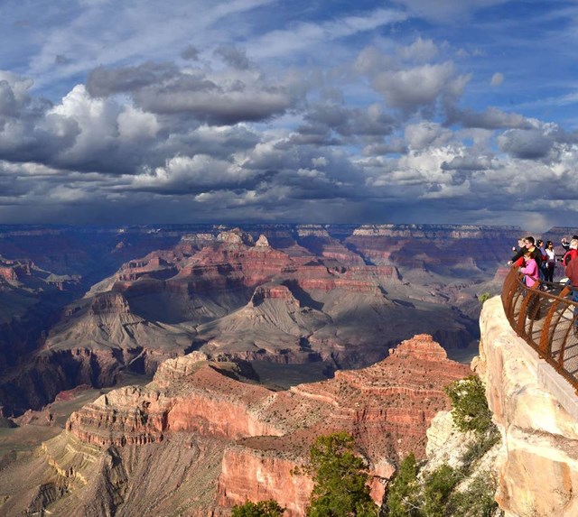
- Mather Point at sunset on the South Rim
The story
The simplest way from Phoenix to the Grand Canyon is I-17 to Flagstaff and then north. This route takes the scenic way instead: it leaves I-17 at Exit 298, drives the Red Rock Scenic Byway into Sedona, climbs through Oak Creek Canyon on AZ-89A, and then enters the park by the East Entrance at Desert View rather than the South Entrance. Pure driving is about 5 hours 8 minutes over 254.2 miles, so it fits one long day with a 7:15 a.m. start.
The morning belongs to Sedona. Leaving at 7:30, you reach the Chapel of the Holy Cross near 9:25, right after it opens, when the small lot is still quiet and the light on the buttes is soft. The chapel is a 1950s piece of modernist architecture wedged between two red-rock spires, and it works as much as a viewpoint as a landmark. From there the road turns north into Oak Creek Canyon, a canyon that Wikipedia says runs about 12 miles and up to 2,000 feet deep, before switchbacks lift you onto the plateau above Flagstaff.
By 11:35 you are in downtown Flagstaff for lunch at Diablo Burger, a compact local spot that builds its menu around Arizona grass-fed beef. After lunch the road runs north on US-89 through volcanic country and the edge of the Painted Desert, and turns west at Cameron onto AZ-64. It enters Grand Canyon National Park at the East Entrance, and Desert View is the first developed area you reach.
Desert View is the payoff for going this way. Mary Colter's 1932 stone Watchtower, modeled on Ancestral Puebloan towers, stands right on the edge, and inside the park you get 23 miles of rim road, Desert View Drive, that runs west past a string of viewpoints before reaching Grand Canyon Village. The plan spends 90 minutes at Desert View and then drives west, arriving at Mather Point around 4:35 p.m., with time to walk the Rim Trail toward Yavapai Point and watch the light change before sunset.
This is a long, full day and the driving is more demanding than a highway run: an early start, mountain grades, a narrow curving canyon road and a two-lane finish. It ends at the rim with several lodging choices in Tusayan or the park if you would rather stay than head back. Everything on this itinerary can be done in a single day without rushing, but leaving a night in or near the park lets the sunrise do the rest.
Day by day
Sedona, Oak Creek Canyon, Flagstaff and the East Rim
An early Phoenix start gets you to Sedona's Chapel of the Holy Cross just after 9. AZ-89A then climbs Oak Creek Canyon into Flagstaff for lunch, US-89 and AZ-64 lead to Desert View, and Desert View Drive delivers you to Mather Point for sunset.
Start in Phoenix: Heard Museum
The route is measured from the Heard Museum on North Central Avenue in midtown Phoenix, a familiar landmark close to the I-10/I-17 interchange. It is a suggested starting pin only; any address in central Phoenix works with a few minutes' change to the first leg. Use the quarter hour before leaving to fill the tank and pack water, because the stretch between Cameron and the East Entrance has few services. The museum itself does not open until 10 a.m., so this is a meeting point, not a stop.

- Time
- 15 minutes to fuel, grab water and go; a departure by 07:30 keeps the Sedona chapel stop ahead of the day's crowds
Sources (1)
- Heard Museum official site (address, phone, hours) · retrieved 2026-09-29
Phoenix to Chapel of the Holy Cross (Sedona)
- Distance
- 114.1 mi
- Drive time
- 1 h 53 min
- Est. tolls
- No tolls
- Via
- I-17 N, exit 298, AZ-179 N (Red Rock Scenic Byway), Chapel Rd
Two hours of mostly straight interstate: I-17 north climbs out of the Valley past saguaros and then up the Verde Valley's black mesas and juniper hills, with Exit 298 marking the turn onto AZ-179, the Red Rock Scenic Byway. The last dozen miles through the Village of Oak Creek is the first look at Sedona's red buttes, and roundabouts slow the road down. Weekend and holiday traffic on I-17 and AZ-179 can add a lot of time.
Tolls: No tolls on this leg (Google Routes API returns no toll for it, and none of these roads is a tolled facility); as of 2026-09-29. toll_usd is the same on a cash, toll-by-plate or transponder basis because there is nothing to pay. Grand Canyon's entrance fee on the last legs is an NPS fee, not a toll (see tips).
Sources (1)
Chapel of the Holy Cross: a 1950s chapel built into the red rock
A stone-and-glass chapel sits between two red-rock pinnacles above AZ-179, with a tall cross set into the glass front. According to Wikipedia, it was commissioned by local rancher and sculptor Marguerite Brunswig Staude, built in 1954 to 1956, and listed on the National Register of Historic Places in 2011. A short ramp climbs from the small parking lot, and the view back over the Verde Valley and Sedona's buttes is the reason to come. The chapel is a working place of worship: the official site asks visitors to keep silence and to keep food and drink and pets outside.
The official site describes parking as limited (45 spaces), so the plan gets here just after the 9 a.m. opening, well before the tour buses and the midday queue on Chapel Road. Allow about an hour, which includes the ramp, the interior and photos from the terraces below.
- Time
- About 60 minutes
- Best time
- Just after the 9 a.m. opening
- Fee
- Free
- Reservation needed
- No
- Parking
- Limited lot (45 spaces per the official site); no RVs or trailers; only limited restrooms at the site (portable toilets at the base of the hill per the official site)
Sources (3)
- Wikipedia: Chapel of the Holy Cross (history, NRHP listing) · retrieved 2026-09-29
- Chapel of the Holy Cross official site, Hours page (archived 2025-01-01: hours, parking, rules) · retrieved 2026-09-29
- Chapel of the Holy Cross official site, contact page (address, phone; archived 2026-09-23) · retrieved 2026-09-29
Chapel of the Holy Cross to Flagstaff (Diablo Burger) via Oak Creek Canyon
- Distance
- 34.2 mi
- Drive time
- 1 h 5 min
- Est. tolls
- No tolls
- Via
- AZ-179 N, AZ-89A N through Oak Creek Canyon, then I-17/AZ-89A N and Milton Rd/Route 66 into downtown Flagstaff
The heart of the day. From the chapel you drop onto AZ-89A through Sedona's uptown, then follow Oak Creek north on AZ-89A. According to Wikipedia the canyon is about 12 miles long and 800 to 2,000 feet deep, and the highway winds through it for roughly 13 miles before it climbs the switchbacks out of the north end onto the Coconino Plateau. Expect narrow, curving road with slow-moving traffic, roadside parking that fills fast at Slide Rock, and a steep, tight climb; Flagstaff's pines are a different world from the desert you left. Give the driving your full attention and use pullouts for photos.
Tolls: No tolls on this leg (Google Routes API returns no toll for it, and none of these roads is a tolled facility); as of 2026-09-29. toll_usd is the same on a cash, toll-by-plate or transponder basis because there is nothing to pay. Grand Canyon's entrance fee on the last legs is an NPS fee, not a toll (see tips).
Sources (1)
Lunch at Diablo Burger in downtown Flagstaff
Downtown Flagstaff is a good place to break the drive: Diablo Burger is a downtown Flagstaff restaurant that builds its burgers around 6-ounce patties of grass-fed beef from Diablo Trust ranches, according to its own site. The menu also lists vegetarian and gluten-free options and kids' meals, plus Arizona wines. Its site lists burgers at roughly $15 to $17.75 (as of 2026-09-29). Find parking downtown and be back on the road within about 75 minutes. Order ahead through the site's online ordering if the line looks long.
- Meal
- Lunch
- Cuisine
- Burgers, locally sourced beef
- Reservation needed
- No
- Price note
- Burgers about $15 to $17.75 per the official site, as of 2026-09-29
Sources (1)
- Diablo Burger official site (address, hours, menu, prices) · retrieved 2026-09-29
Flagstaff to Desert View Watchtower via US-89 and AZ-64
- Distance
- 82.8 mi
- Drive time
- 1 h 32 min
- Est. tolls
- No tolls
- Via
- US-89 N, AZ-64 W (Desert View Drive) through the East Entrance
Head north out of Flagstaff on US-89, past the lava and cinder country of the San Francisco Volcanic Field, then descend to the Painted Desert country and join AZ-64 at Cameron. From there AZ-64 climbs west through pinyon-juniper forest and skirts the Little Colorado River Gorge before reaching the East Entrance of Grand Canyon National Park, with the Desert View settlement just past it. Plan for a two-lane road with few services after Cameron, and buy or have ready your entrance payment: the park is cashless.
Tolls: No tolls on this leg (Google Routes API returns no toll for it, and none of these roads is a tolled facility); as of 2026-09-29. toll_usd is the same on a cash, toll-by-plate or transponder basis because there is nothing to pay. Grand Canyon's entrance fee on the last legs is an NPS fee, not a toll (see tips).
Sources (1)
Desert View Watchtower and the eastern rim
Desert View is the eastern-most developed area on the South Rim, and its 1932 stone Watchtower, designed by architect Mary Colter and inspired by Ancestral Puebloan towers, is a National Historic Landmark (NPS). It is roughly a quarter-mile walk from the main parking area past the market and trading post. The upper floors are open when staffing allows (typically 8 a.m. to 5 p.m.), admission is by free first-come tickets that admit 25 people at a time for 20 minutes, and the tower's lower View Room has a Grand Canyon Conservancy store. From the rim path beside the tower the Colorado River shows up as a green-brown ribbon in the gorge.
After about 90 minutes here you will start the 23-mile Desert View Drive west to the village, which the NPS describes as open to private vehicles and lined with viewpoints. Anyone with more time could break the drive at Navajo Point or Grandview Point; a short snack from the Desert View Market & Deli is an option, since the NPS lists the deli inside the market.
- Time
- About 90 minutes with the tower, rim walk and a snack
- Best time
- Early to mid afternoon
- Fee
- Free
- Reservation needed
- No
- Parking
- Main lot at Desert View; the Watchtower is about a quarter-mile walk (NPS)
- Entrance note
- Park entrance is $35 per private vehicle at the East (Desert View) entrance station, card only (NPS, as of 2026-09-29; see tips)
- Detour minutes
- 0
Sources (2)
- NPS: Desert View Drive · retrieved 2026-09-29
- NPS: Desert View Watchtower (hours, tickets, history) · retrieved 2026-09-29
Desert View Watchtower to Mather Point (Grand Canyon Village)
- Distance
- 23.1 mi
- Drive time
- 38 min
- Est. tolls
- No tolls
- Via
- AZ-64 W (Desert View Drive) to the South Rim visitor center area
Desert View Drive, the 23-mile rim road, runs west through ponderosa forest with a canyon viewpoint every few miles; the NPS lists Navajo Point, Moran Point, Grandview Point and Pipe Creek Vista among the stops. The road is open to private vehicles except for a short spur to Yaki Point, which is shuttle-only. Allow extra time for pullouts and slow traffic.
Tolls: No tolls on this leg (Google Routes API returns no toll for it, and none of these roads is a tolled facility); as of 2026-09-29. toll_usd is the same on a cash, toll-by-plate or transponder basis because there is nothing to pay. Grand Canyon's entrance fee on the last legs is an NPS fee, not a toll (see tips).
Sources (1)
Sunset at Mather Point and the Rim Trail
Finish where most South Rim visits begin. Mather Point is a short walk from the Grand Canyon Visitor Center and parking lots 1 to 4 (the NPS says there is no parking right at the point), and the NPS calls it a popular place for both sunrise and sunset. On a clear day it offers views of 30-plus miles to the east and 60-plus miles to the west and the Bright Angel trails threading below. Arrive with about two hours in hand so that you can park, use the visitor center, stroll the paved Rim Trail west to Yavapai Point (the NPS gives 0.7 miles one-way from the visitor center, about 1.1 km) and then settle in for the color show.
The free Kaibab/Rim (Orange) shuttle stops at Mather Point and runs until about an hour after sunset in the busy season, which is a relief if the parking lots are full. Bring a warm layer: the rim sits at high elevation and evenings cool quickly, especially in fall and spring. Places to stay in Tusayan and in the park are listed under the trip's options.
- Time
- About 105 minutes: parking, visitor center, Rim Trail walk to Yavapai Point, sunset
- Best time
- Sunset; check the sunset time for your date (see tips)
- Fee
- $35
- Reservation needed
- No
- Parking
- No parking at the point; use the lots around the Grand Canyon Visitor Center (NPS)
- Fee note
- $35 per private vehicle, valid 7 days, card only (NPS, as of 2026-09-29)
Sources (3)
- NPS: Fees and passes · retrieved 2026-09-29
- NPS: Mather Point (views, parking, sunrise/sunset) · retrieved 2026-09-29
- NPS: Yavapai Geology Museum (0.7 mi Rim Trail from the visitor center) · retrieved 2026-09-29
Where to stay
Red Feather Lodge, Tusayan
A family-owned motel and hotel in Tusayan, about a mile from the South Rim entrance according to its own site, with pet-friendly rooms, a pool, a fitness room and on-site dining. Check current rates on the site.
- Type
- Hotel
- Location
- Outside the park
- Booking
- Book / details
- Reservation notes
- Rates not shown in the sources; check current rates and book ahead in fall and spring.
Sources (1)
- Red Feather Lodge official site · retrieved 2026-09-29
The Grand Hotel at the Grand Canyon, Tusayan
A larger hotel in Tusayan, one mile from the South Rim entrance per its own site, with rooms its site says were fully renovated in 2026, an indoor pool and hot tub, and the Canyon Star Steakhouse & Saloon. The hotel operates cashless. Check current rates.
- Type
- Hotel
- Location
- Outside the park
- Booking
- Book / details
- Reservation notes
- Rates not shown in the sources; check current rates. Cashless payments.
Sources (1)
- The Grand Hotel at the Grand Canyon official site · retrieved 2026-09-29
El Tovar Hotel (in the park, when overnight lodging reopens)
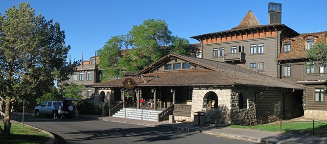
The 1905 rim-side hotel with 78 rooms and a fine-dining room is the classic in-park splurge, according to the operator's site. Typically it books far ahead. Check its current booking status (see tips).
- Type
- Hotel
- Location
- Inside the park
- Booking
- Book / details
- Reservation notes
- Check current rates and the operator's reopening dates; the dining room requires advance reservations per NPS.
Sources (2)
- El Tovar Hotel (operator site) · retrieved 2026-09-29
- NPS: El Tovar Hotel · retrieved 2026-09-29
Where to eat
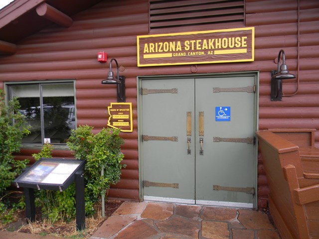
Arizona Steakhouse at Bright Angel Lodge (dinner after sunset)
The NPS describes it as one of the few park restaurants with canyon views from the dining room, serving Southwestern cuisine that focuses on Arizona-grown ingredients, with online reservations 45 days ahead; check current hours.
- Meal
- Dinner
- Cuisine
- Southwestern
- Reservation needed
- No
Sources (1)
- NPS: Arizona Steakhouse · retrieved 2026-09-29
More options
Optional detour: Slide Rock State Park, Oak Creek Canyon
A state park on Oak Creek with a natural water slide, in the canyon the route drives through; it is a popular summer swim spot but can hit capacity, and the park does not allow people to queue on the highway or driveway if the lot is full. Adds at least 1 to 2 hours; skip the Flagstaff lunch stop or start earlier to fit it.

- Time
- 1 to 2 hours plus parking wait
- Fee
- $20
- Reservation needed
- No
- Fee note
- Official site: $20 per vehicle (1-4 people) Aug 22 to April; $30 May to Aug 21 (as of 2026-09-29); card or exact cash
- Detour minutes
- 15
Sources (1)
- Arizona State Parks: Slide Rock State Park · retrieved 2026-09-29
Route map
- Heard Museum (opens Google Maps in a new tab) Day 1
- Chapel of the Holy Cross (opens Google Maps in a new tab) Day 1
- Diablo Burger (opens Google Maps in a new tab) Day 1
- Desert View Watchtower (opens Google Maps in a new tab) Day 1
- Mather Point (opens Google Maps in a new tab) Day 1
- Red Feather Lodge (opens Google Maps in a new tab) Option
- The Grand Hotel at the Grand Canyon (opens Google Maps in a new tab) Option
- El Tovar Hotel (opens Google Maps in a new tab) Option
- Arizona Steakhouse at Bright Angel Lodge (opens Google Maps in a new tab) Option
- Slide Rock State Park (opens Google Maps in a new tab) Option
Good to know
Route, timing and weekday assumptions
- Assumed weekday: a midweek departure (Tuesday to Thursday). Weekends and holidays mean heavier traffic in Sedona and on I-17 and at the park entrance.
- Departure: 7:15 a.m. from central Phoenix (route measured from the Heard Museum), leaving by 7:30. Chapel of the Holy Cross opens at 9 a.m. per its official site, Diablo Burger opens at 11 a.m., and Desert View Watchtower's upper floors open at 8 a.m. per NPS, so every stop is open at its scheduled time.
- Sunset check: for Grand Canyon Village (Arizona has no daylight saving), approximate sunset computed with NOAA's solar equations is about 6:15 p.m. on Oct 1, 5:55 p.m. mid-Oct, 5:35 p.m. on Oct 31, 7:00 p.m. mid-April and 7:25 p.m. mid-May. The plan arrives at Mather Point at 4:35 p.m. and stays until 6:20 p.m., so late-October and other short days still give an hour or more before dark; in spring add Grandview or Navajo Point stops.
- Best months: April, May, September and October: comfortable temperatures at both ends, roads normally clear of snow, and sunset at a sensible hour. In midsummer Phoenix is very hot and thunderstorms hit the rim; in winter snow and ice on I-17, AZ-89A and AZ-64 are possible.
Difficulty: moderate
Length (254.2 miles, 5 h 8 min of driving, so roughly 10.5 hours door to door with stops) plus a mountain climb from the low desert to the 6,500-7,200 ft rims (Wikipedia gives those figures for Oak Creek Canyon's rims), curving canyon road with slow traffic, and a remote two-lane finish. There are no tolls, and none of the driving is technical.
Totals (sum of the four legs)
254.2 miles, 5 h 8 min of pure driving, $0 in tolls (no tolls on any leg; the same on cash, toll-by-plate or transponder). Entrance fee to the park is separate (see below).
Park entry, shuttle and reservations (evergreen)
- Grand Canyon entrance is $35 per private vehicle (valid 7 days), $30 motorcycle, $20 per person on foot or bike, and $100 extra for non-US residents age 16+ without an annual or America the Beautiful pass (NPS, as of 2026-09-29). The park is cashless: cards only. There is typically no timed entry; check current rules. Annual pass $70, America the Beautiful $80 (US residents).
- South Rim shuttle buses are free. The Kaibab/Rim (Orange) route serves Mather Point, Yavapai Point and Yaki Point, and Hermit Road is closed to private vehicles from March 1 to November 30 (shuttle only). Desert View Drive is open to private vehicles except the Yaki Point spur.
- Chapel of the Holy Cross has a small lot (45 spaces per the official site); no RVs or trailers.
Current conditions (as of 2026-09-29)
- In-park lodging is closed to overnight guests since Aug 31, 2026, after an Aug 29 flash flood damaged the Transcanyon waterline. The park is under Stage 4 water restrictions: day use remains open, food and drink services continue (some with reduced hours), bathrooms are open. The NPS projects pumping to restart by Nov 16 and phased reopening of overnight lodging around Thanksgiving, dates that could change. Tusayan lodging (Red Feather Lodge, The Grand Hotel and others) is open. Bring drinking water and conserve it. Check nps.gov/grca daily updates before you go.
- Lipan Point on Desert View Drive is closed June 22 to Dec 23, 2026 for rehabilitation (NPS). The plan does not depend on it.
- Inner-canyon trails (North Kaibab, Phantom Ranch, parts of South Kaibab and the River Trail) and inner-canyon water are closed or shut off. This does not affect rim viewpoints or this drive.
- Shuttle fall 2026 schedule: Sep 12 to Nov 30; Kaibab/Rim (Orange) route 6 a.m. to one hour after sunset (NPS).
- Lipan Point aside, the NPS lists Desert View Drive (SR 64) as open (weather permitting). I could not retrieve live ADOT/AZ511 status: check az511.gov for I-17, AZ-179, AZ-89A, US-89 and AZ-64 before leaving. The Coconino National Forest lists no closure of AZ-89A in its alerts (as of 2026-09-29).
- Slide Rock State Park: its site notes the swim area reopened but swimming is not recommended after heavy rain.
- Chapel and Diablo Burger hours are from the official sites, and Diablo Burger's site notes short closures for renovations at times, so confirm before you go.
Want live alerts and up-to-date info?
Roads, tolls and closures change fast. Create an account on the DriftKin app to get live alerts and up-to-date information for your drive.
Where to stay
This is a long day: a Phoenix-to-Phoenix round trip would be very tiring. Overnight in Tusayan (about 7 miles south of the village) or in the park when reopened; see the options list. Flagstaff and Williams are farther but also offer lodging (per NPS).
What was not verified
Live road status, current in-park restaurant hours during the water restrictions, and lodging rates (omitted; check current rates).
Sources
- Heard Museum official site (address, phone, hours) retrieved 2026-09-29
- Google Routes API computeRoutes (distance, duration, polyline, toll check), computed 2026-09-29 retrieved 2026-09-29
- Wikipedia: Chapel of the Holy Cross (history, NRHP listing) retrieved 2026-09-29
- Chapel of the Holy Cross official site, Hours page (archived 2025-01-01: hours, parking, rules) retrieved 2026-09-29
- Chapel of the Holy Cross official site, contact page (address, phone; archived 2026-09-23) retrieved 2026-09-29
- Diablo Burger official site (address, hours, menu, prices) retrieved 2026-09-29
- NPS: Desert View Drive retrieved 2026-09-29
- NPS: Desert View Watchtower (hours, tickets, history) retrieved 2026-09-29
- NPS: Fees and passes retrieved 2026-09-29
- NPS: Mather Point (views, parking, sunrise/sunset) retrieved 2026-09-29
- NPS: Yavapai Geology Museum (0.7 mi Rim Trail from the visitor center) retrieved 2026-09-29
- Red Feather Lodge official site retrieved 2026-09-29
- The Grand Hotel at the Grand Canyon official site retrieved 2026-09-29
- El Tovar Hotel (operator site) retrieved 2026-09-29
- NPS: El Tovar Hotel retrieved 2026-09-29
- NPS: Arizona Steakhouse retrieved 2026-09-29
- Arizona State Parks: Slide Rock State Park retrieved 2026-09-29
Hours, tolls, prices and closures change. Confirm details with the business or toll authority before you go.
More trips like this
 Road tripLos Angeles to San Francisco
Los Angeles to San Francisco in 2 Days: The Pacific Coast Highway
2 days Moderate$$$ Road tripMiami to Key West
Miami to Key West in One Day: The Overseas Highway
1 day Easy$$ Road tripManhattan to Acadia National Park
Manhattan to Acadia in One Very Long Day: Newport, Boston, Camden and a Cadillac Sunset
1 day Strenuous$$