Seattle to Glacier National Park in 2 Days: The North Cascades Highway Route
Diablo Lake, Washington Pass, a Winthrop lunch, Sherman Pass, Sandpoint's lake and a swinging bridge at Kootenai Falls before Lake McDonald
- Length
- 2 days
- Total distance
- 667.6 mi
- Driving time
- 12 h 43 min
- Est. tolls
- No tolls
- Stops
- 8
- Driving
- Strenuous
- Best months
- Jul–Sep
- Budget
- $$
A two-day, one-way drive from Seattle to Apgar Village in Glacier National Park over SR 20, with an overnight in Kettle Falls, a Sandpoint lunch and no tolls. A strenuous route of 12h43 of driving and 667.6 miles, with the mountain passes on Day 1.
- Drive time12 h 43 min
- Distance667.6 mi
- Est. tollsNo tolls
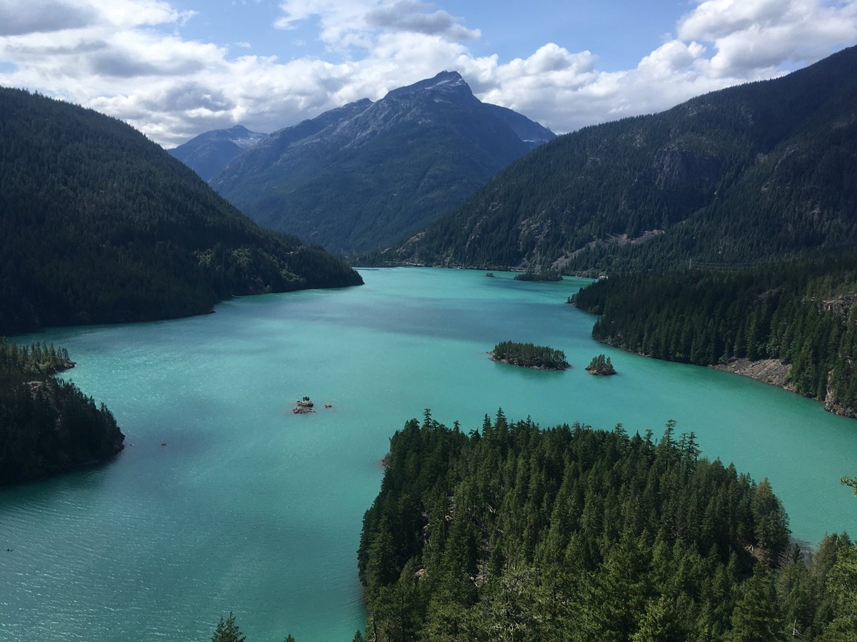
- Diablo Lake Overlook: glacier-fed turquoise water in the North Cascades
- Washington Pass Overlook: Liberty Bell Mountain from a short paved path
- Kootenai Falls: a swinging bridge over a big free-flowing Montana waterfall
The story
Seattle to Glacier is a long way, and the pleasure of this version is that it does not take the freeway. Day one climbs the North Cascades Highway, stopping for Diablo Lake's turquoise water and the Liberty Bell spires at Washington Pass before a brewery lunch in Winthrop on the Methow side. After that the road swings east through the Okanogan country, over Sherman Pass, and drops to Kettle Falls for the night. Day two is a different landscape: the Pend Oreille River at Newport, a lunch in Sandpoint near Lake Pend Oreille, and a time-zone jump into Montana at Kootenai Falls, where a short trail leads to a swinging bridge over the river. The last push runs through Libby and Kalispell to Apgar Village, at the foot of Lake McDonald and the start of Going-to-the-Sun Road. Be honest about the cost: this is a strenuous two-day drive of about twelve and three-quarter hours at the wheel, with Day 1 the heavier at a little over six and a half hours. The reward is crossing the Cascades the scenic way, with no tolls, and arriving at Glacier on the lake. The alternate routes in the options trade extra time for Flathead Lake or Lake Koocanusa.
Day by day
Seattle to Kettle Falls: over the North Cascades and the Okanogan
An early start takes you up I-5 and SR 530 onto the North Cascades Highway for two overlooks, lunch in Winthrop, a long drive over Sherman Pass and a night in Kettle Falls.
Start in Seattle at Pike Place Market
Any Seattle address works as a start; Pike Place Market is the postcard one. The plan leaves early on a Saturday so the long Day 1 climbs through the North Cascades in daylight and the mountain pullouts are not rushed. Fill the tank and pack snacks and water before leaving the city: the highway across the Cascades is a long, quiet stretch.

- Time
- 15 minutes to fuel up and depart; the market's own hours do not matter for a start point
Sources (2)
- OpenStreetMap Nominatim: Pike Place Market location · retrieved 2026-10-06
- Pike Place Market official site · retrieved 2026-10-06
Seattle to Diablo Lake Overlook
- Distance
- 128.1 mi
- Drive time
- 2 h 37 min
- Est. tolls
- No tolls
- Via
- I-5 N, SR 530, SR 20 (North Cascades Highway)
Interstate 5 north out of the city, then the Skagit and Sauk valleys on SR 530, and finally SR 20 climbing east along the river into the North Cascades. The last stretch gets quiet and curvy as the dams and glacier-fed lakes begin.
Tolls: No tolls on this leg: WSDOT's toll facilities are all in the Puget Sound region, away from I-5 north of Seattle, SR 530 and SR 20 (as of 2026-10-06).
Sources (2)
- WSDOT: Washington toll facilities (all in the Puget Sound region) · retrieved 2026-10-06
- OpenStreetMap contributors (routing: distance, time and route line) · retrieved 2026-10-06
Diablo Lake Overlook
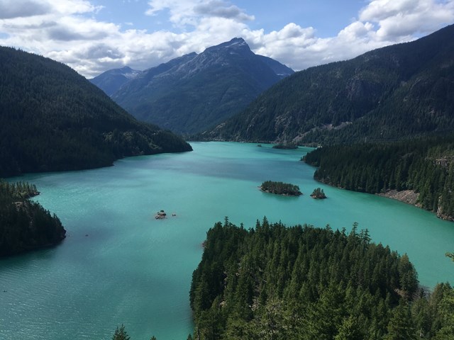
The roadside pullout above Diablo Lake is the classic North Cascades stop: a big, glacier-fed lake ringed by steep forested mountains, with the historic Diablo Dam in the distance. NPS says the lake's turquoise color comes from fine rock particles called glacial flour and is most vibrant on sunny days in July, August and September. There are vault toilets and picnic tables, so it doubles as the first proper break of the day. Diablo Lake and Washington Pass are deliberately close together: they are the two big views on the one stretch of SR 20 that earns them. Do not feed wildlife or leave food unattended.
- Time
- 15 minutes for the view, photos and restrooms
- Best time
- Sunny days show the lake's color best (NPS)
- Reservation needed
- No
- Parking
- Roadside parking lot; NPS lists auto and bus/RV parking
Sources (1)
- NPS: Diablo Lake Overlook (description, amenities, glacial-flour color) · retrieved 2026-10-06
Diablo Lake Overlook to Washington Pass Overlook
- Distance
- 32.6 mi
- Drive time
- 39 min
- Est. tolls
- No tolls
- Via
- SR 20
SR 20 climbs past Ross Lake and Rainy Pass to the highest point on the North Cascades Highway. Mind the curves and watch for cyclists and slow vehicles in the climb.
Tolls: No tolls on this leg (as of 2026-10-06).
Sources (2)
- WSDOT: Washington toll facilities (all in the Puget Sound region) · retrieved 2026-10-06
- OpenStreetMap contributors (routing: distance, time and route line) · retrieved 2026-10-06
Washington Pass Overlook
A short, paved, fully accessible path leads to a ledge with a head-on view of Liberty Bell Mountain, the Early Winters Spires and Kangaroo Ridge, per the Forest Service. The walk is about a quarter mile round trip (Washington Trails Association: 61 feet of gain), so it is a leg-stretcher rather than a hike. The Forest Service lists restrooms and no fee, and the site is day-use only.

- Time
- 30 minutes including the walk out and back
- Best time
- Morning or midday light on the spires
- Fee
- Free
- Reservation needed
- No
- Parking
- Paved lot; no fee (Forest Service)
- Distance mi
- 0.25
- Distance basis
- round trip, paved path
- Elevation source
- Washington Trails Association (round trip)
- Elevation gain ft
- 61
Sources (2)
- U.S. Forest Service: Washington Pass Observation Site · retrieved 2026-10-06
- Washington Trails Association: Washington Pass Overlook (0.25 mi round trip, 61 ft gain) · retrieved 2026-10-06
Washington Pass to Winthrop
- Distance
- 28.6 mi
- Drive time
- 31 min
- Est. tolls
- No tolls
- Via
- SR 20
The road drops out of the high country down the Methow side, with the landscape turning from dark conifers toward drier, open valley bottoms by the time Winthrop comes into view.
Tolls: No tolls on this leg (as of 2026-10-06).
Sources (2)
- WSDOT: Washington toll facilities (all in the Puget Sound region) · retrieved 2026-10-06
- OpenStreetMap contributors (routing: distance, time and route line) · retrieved 2026-10-06
Lunch in Winthrop: Old Schoolhouse Brewery
A riverside brewery pub in Winthrop with outdoor seating beside the Chewuch River, a brewery pub. It is an easy, un-fancy lunch stop that lets you walk off the mountain driving. Its site lists the Winthrop pub open Friday to Sunday from noon, so the plan arrives about 12:02 and sits down at 12:10, a few minutes after opening; the stop only works Friday to Sunday.
- Meal
- Lunch
- Cuisine
- Brewery pub
- Route note
- Arrive about 12:02, seated 12:10; pub opens at noon Fri-Sun (brewery website)
Sources (1)
- Old Schoolhouse Brewery official site (address, hours, riverside seating) · retrieved 2026-10-06
Winthrop to Sherman Overlook
- Distance
- 127.5 mi
- Drive time
- 2 h 26 min
- Est. tolls
- No tolls
- Via
- SR 20, US-97, SR 20
The longest stretch of the day: down the Methow to Twisp, over Loup Loup Pass, through Okanogan and Tonasket country on US-97, then SR 20 east through Republic and up to Sherman Pass. Plan a driver change or fuel stop in Omak or Republic if needed; this is open country with towns spaced well apart.
Tolls: No tolls on this leg (as of 2026-10-06).
Sources (2)
- WSDOT: Washington toll facilities (all in the Puget Sound region) · retrieved 2026-10-06
- OpenStreetMap contributors (routing: distance, time and route line) · retrieved 2026-10-06
Sherman Overlook Interpretive Trail
At Sherman Pass on SR 20, a short paved loop circles a viewpoint with scenic peaks and signs about how wildfire shaped the landscape. Washington Trails Association lists it as 0.25 mile round trip with 35 feet of gain and a high point of 5,262 feet, and notes the larches that turn gold in fall. It is a real stretch of the legs after a three-hour drive.

- Distance
- 0.25 mi
- Elevation gain
- 35 ft
- Fee usd
- 0
- Parking
- Pullout lot at the overlook; WTA lists no pass needed
- Duration note
- 25 minutes for the loop and a break
- Distance basis
- round trip, paved interpretive loop
- Elevation source
- Washington Trails Association (round trip; highest point 5,262 ft)
- Reservation needed
- No
Sources (1)
- Washington Trails Association: Sherman Overlook (0.25 mi round trip, 35 ft gain) · retrieved 2026-10-06
Sherman Overlook to Kettle Falls
- Distance
- 24.5 mi
- Drive time
- 29 min
- Est. tolls
- No tolls
- Via
- SR 20, US-395
A downhill finish: SR 20 drops off the Kettle River Range into the Columbia River valley at Kettle Falls, where US-395 runs past the resort.
Tolls: No tolls on this leg (as of 2026-10-06).
Sources (2)
- WSDOT: Washington toll facilities (all in the Puget Sound region) · retrieved 2026-10-06
- OpenStreetMap contributors (routing: distance, time and route line) · retrieved 2026-10-06
Overnight in Kettle Falls: Columbia Point Resort
Kettle Falls is the most even place to split this drive: far enough east that Day 2 is not longer than Day 1, on US-395 beside the Columbia River valley. Columbia Point Resort by Jet Hospitality describes itself as an upscale vintage hotel with boutique rooms, glamping tents and RV sites, plus a camp store, firepit and outdoor grill. Check current rates and book direct.
- Type
- Hotel
- Location
- Outside the park
- Booking
- Book / details
- Duration note
- Overnight; runs until the 08:45 departure on Day 2
- Reservation notes
- Reservations run through the resort's booking system linked from its site; rates not shown on the page checked, so check current rates. Overnight duration runs to the 08:45 departure.
Sources (2)
- Columbia Point Resort by Jet Hospitality (address, phone, lodging types) · retrieved 2026-10-06
- OpenStreetMap Nominatim: 978 Highway 395, Kettle Falls (location) · retrieved 2026-10-06
Kettle Falls to Apgar: Sandpoint, a swinging bridge and Lake McDonald
A relaxed start covers the Idaho panhandle, a pub lunch in Sandpoint, Kootenai Falls in Montana, and the final run to the foot of Lake McDonald.
Kettle Falls to Newport
- Distance
- 89.4 mi
- Drive time
- 1 h 43 min
- Est. tolls
- No tolls
- Via
- US-395, US-2
US-395 runs south through Colville and Chewelah to Deer Park, then US-2 heads north-east to Newport on the Washington-Idaho line. Mostly two-lane highway through farmland and forest.
Tolls: No tolls on this leg (as of 2026-10-06).
Sources (2)
- WSDOT: Washington toll facilities (all in the Puget Sound region) · retrieved 2026-10-06
- OpenStreetMap contributors (routing: distance, time and route line) · retrieved 2026-10-06
Fuel and stretch in Newport, WA, at the Idaho line
Newport is the last Washington town before the Idaho border, with the Pend Oreille River and Oldtown, Idaho just across. It is a good place to fuel, use a restroom and swap drivers before Lake Pend Oreille. This is a plain break, not a sight.
- Time
- 10 minutes for fuel, restroom and a driver change
Sources (1)
- OpenStreetMap Nominatim: Newport, Washington · retrieved 2026-10-06
Newport to Sandpoint
- Distance
- 29.3 mi
- Drive time
- 36 min
- Est. tolls
- No tolls
- Via
- US-2
US-2 crosses into Idaho and follows the Pend Oreille River valley west to east toward Sandpoint, which sits at the north end of Lake Pend Oreille.
Tolls: No tolls on this leg: Idaho has no toll roads (ITD) and the Washington portion has none (as of 2026-10-06).
Sources (2)
- Idaho Transportation Department: 'Idaho does not have toll roads' · retrieved 2026-10-06
- OpenStreetMap contributors (routing: distance, time and route line) · retrieved 2026-10-06
Lunch in Sandpoint: Eichardt's Pub, Grill & Coffeehouse
A downtown Sandpoint pub with a coffee bar, 18 beers on tap and a menu of craft pub fare with garlic fries as a standout, per its website, which says it is open every day. The site does not publish opening hours; a Sandpoint Online directory lists 11:30, so the plan arrives about 11:15 and sits down around 11:30. Confirm the opening time before relying on it. Afterward, Sandpoint City Beach on Lake Pend Oreille is a short walk from Cedar Street if you want a lake view before the road east.
- Meal
- Lunch
- Cuisine
- Pub fare
- Route note
- Arrive about 11:15; sit down at 11:30 (slack explicit); confirm opening time
Sources (2)
- Sandpoint Online directory (third-party): lists 11:30 am daily opening · retrieved 2026-10-06
- Eichardt's Pub and Grill official site (address, phone, menu highlights) · retrieved 2026-10-06
Sandpoint to Kootenai Falls
- Distance
- 73.3 mi
- Drive time
- 1 h 21 min
- Est. tolls
- No tolls
- Via
- US-95, US-2
US-95 north to Bonners Ferry, then US-2 east along the Kootenai River into Montana. The Idaho panhandle is on Pacific time and Montana is on Mountain time, so clocks jump forward one hour on this leg.
Tolls: No tolls on this leg: Idaho and Montana have no toll roads (as of 2026-10-06).
Sources (3)
- Idaho Transportation Department: 'Idaho does not have toll roads' · retrieved 2026-10-06
- KULR-8 reporting MDT: Montana has no toll roads · retrieved 2026-10-06
- OpenStreetMap contributors (routing: distance, time and route line) · retrieved 2026-10-06
Kootenai Falls and the Swinging Bridge
Kootenai Falls, which the Forest Service calls one of the largest free-flowing waterfalls in the northwest, drops through China Rapids and a 30-foot main cascade. A dirt trail of roughly half a mile leads to the swinging bridge over the river (about a third of a mile to the falls overlook), with a 64-step metal staircase over the railroad tracks. The first 500 feet are level and accessible. The area is culturally significant to the Kootenai Tribe of Idaho and the Confederated Salish and Kootenai Tribes, so stay on the trail. Mountain time: the clock here is one hour ahead of Sandpoint.

- Time
- About 50 minutes round trip including time at the bridge
- Fee
- Free
- Reservation needed
- No
- Parking
- Dedicated parking area at the trailhead; no fees mentioned by the Forest Service
- Distance mi
- 0.5
- Timezone note
- Mountain Time; arrival is 13:51 Pacific = 14:51 Mountain
- Distance basis
- one way to the swinging bridge (Forest Service: about 0.5 mile); no elevation gain figure found, so typed as activity
Sources (2)
- OpenStreetMap Nominatim: Kootenai Falls location · retrieved 2026-10-06
- U.S. Forest Service, Kootenai National Forest: Kootenai Falls and Swinging Bridge · retrieved 2026-10-06
Kootenai Falls to Apgar Village
- Distance
- 134.3 mi
- Drive time
- 2 h 21 min
- Est. tolls
- No tolls
- Via
- US-2 (via Libby, Kalispell, Columbia Falls)
US-2 continues through Libby and the Flathead Valley around Kalispell, then Columbia Falls and on to West Glacier and the park gate. Entering the park here needs an entrance pass (see tips).
Tolls: No tolls on this leg: Montana has no toll roads (as of 2026-10-06).
Sources (2)
- KULR-8 reporting MDT: Montana has no toll roads · retrieved 2026-10-06
- OpenStreetMap contributors (routing: distance, time and route line) · retrieved 2026-10-06
Finale at Apgar Village on Lake McDonald
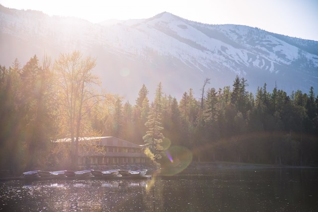
Apgar Village sits at the foot of Lake McDonald just inside the West Glacier entrance. NPS describes it as a busy village with the wilderness permit office, the Apgar Nature Center, a boat launch and boat rentals, with beach and water access and a scenic view. Walk down to the shore and look up the lake at the mountains. The area is also important to Indigenous communities such as the Kootenai, NPS notes. Going-to-the-Sun Road starts just beyond.
- Time
- 40 minutes at the lakeshore
- Best time
- Late afternoon light; check sunset time before leaving Kootenai Falls
- Reservation needed
- No
- Parking
- Lots in Apgar; NPS lists auto and bus/RV parking
- Timezone note
- Mountain Time
Sources (2)
- NPS Glacier: entrance fees · retrieved 2026-10-06
- NPS: Apgar Village · retrieved 2026-10-06
Where to stay
More options
Route map
- Pike Place Market (opens Google Maps in a new tab) Day 1
- Diablo Lake Overlook (opens Google Maps in a new tab) Day 1
- Washington Pass Overlook (Washington Pass Observation Site) (opens Google Maps in a new tab) Day 1
- Old Schoolhouse Brewery (opens Google Maps in a new tab) Day 1
- Sherman Overlook (opens Google Maps in a new tab) Day 1
- Columbia Point Resort (opens Google Maps in a new tab) Day 1
- Newport, Washington (downtown) (opens Google Maps in a new tab) Day 2
- Eichardt's Pub, Grill & Coffeehouse (opens Google Maps in a new tab) Day 2
- Kootenai Falls (opens Google Maps in a new tab) Day 2
- Apgar Village (opens Google Maps in a new tab) Day 2
- Benny's Colville Inn (opens Google Maps in a new tab) Option
- Kettle Falls Inn (opens Google Maps in a new tab) Option
Good to know
Route, timing and weekday assumptions
- Assumed weekday: Saturday departure, Sunday Day 2. Old Schoolhouse Brewery's Winthrop pub is listed open Friday to Sunday from noon, so Day 1 should be a Friday, Saturday or Sunday. Eichardt's website says it is open every day but publishes no hours.
- Why two days, and why Day 1 is over 6 hours: pure driving is 12h43 (667.6 miles), so no two-day split can come in under about 6h21 per day. This plan splits it as evenly as the towns allow: Day 1 is 341.3 miles and 6h42, Day 2 is 326.3 miles and 6h01. Kettle Falls was the most even overnight with a lodging that has an official site; Colville would push Day 1 to 6h57 and Republic would push Day 2 to about 6h50. A three-day trip is a separate option not built here. Times are typical drive times without traffic and do not include the stops.
- Tolls: none on any leg (toll_usd 0 on every leg). WSDOT's toll facilities are all in the Puget Sound region, Idaho's transportation department says Idaho does not have toll roads, and Montana's transportation department has said Montana has no toll roads.
- Difficulty (driving demand): strenuous. Long total distance, two days of mountain two-lane highway and few services on the Cascades crossing. The Forest Service lists the Washington Pass Observation Site at 5,500 feet. A Roadtrippers guide reports no fuel between Marblemount and Mazama, so fill the tank before the mountains.
- Time zone: Washington and North Idaho are on Pacific Time; Montana is on Mountain Time. Clocks jump forward one hour on the Sandpoint to Kootenai Falls leg; Day 2 item times from Kootenai Falls onward are Mountain Time.
- Best months: July to September, when both SR 20 (typically open roughly May to between late November and mid-December) and the full Going-to-the-Sun Road (typically late June to about the third Monday of October) are open. This itinerary ends at Apgar, near the West Entrance and open year-round, so it also works in shoulder months. Late September to mid-October brings gold larches around the passes (WTA notes them at Sherman Overlook).
- Daylight and sunset limit: the finale stay ends at 18:42 Mountain. Apgar sunset is about 18:57 on Oct. 11, 18:43 on Oct. 18 and 18:30 on Oct. 25 (computed from the NOAA solar equations; check a sunset table). After about Oct. 18 the Apgar stop ends after sunset, so trim the Newport and Kootenai Falls stops or start earlier. In summer there are hours of daylight to spare.
- Getting home: this is one-way. Glacier Park International Airport (Kalispell) is the nearest major airport; one-way car rentals usually carry a drop fee.
Current conditions (as of 2026-10-06)
- SR 20 North Cascades Highway: WSDOT says the highway fully reopened on June 14, 2026 after emergency storm and rockslide repairs, with no traffic control expected. No 2026 winter-closure date was found in the sources checked; WSDOT closed it at 6 pm on Dec. 4 in 2025, and it usually closes between late November and mid-December. Check WSDOT before leaving.
- North Cascades NPS alerts: Cascade River Road closes to vehicles at milepost 20 starting Oct. 13 for maintenance (not on this route). NPS also lists a break-in warning for trailheads along SR 20: lock valuables out of sight.
- Going-to-the-Sun Road: NPS said the road was fully open for the 2026 summer season (alert indexed 2026-06-22). The alpine sections typically close around the third Monday of October (Oct. 19, 2026) or earlier with snow. This route ends at Apgar, on the section open year-round near the West Entrance. NPS says vehicle reservations are not required in 2026.
- Fees (NPS, as of 2026-10-06): Glacier private vehicle $35 (winter rate $25, Nov. 1 to Apr. 30), good for seven days; per person $20; a $100 nonresident fee applies to non-US residents aged 16 and up unless they hold an annual or America the Beautiful pass. Diablo Lake Overlook, Washington Pass and Sherman Overlook list no fee.
Want live alerts and up-to-date info?
Roads, tolls and closures change fast. Create an account on the DriftKin app to get live alerts and up-to-date information for your drive.
Practical tips
- Download offline maps before Day 1: cell coverage is patchy in the Cascades and the Okanogan Highlands.
- Pack layers and water; the passes are cooler and can see snow early in the season.
- Kootenai Falls is culturally significant to the Kootenai Tribe of Idaho and the Confederated Salish and Kootenai Tribes: stay on the trail.
Sources
Good to know: distances and drive times are typical figures without live traffic, and where routes are shown the route data comes from OpenStreetMap contributors. Toll amounts are estimates and change often, so check them in the DriftKin planner or with the toll authority before you plan around them. Opening hours, fees, prices, permits and closures also change, so confirm with the park or business before you go.
- OpenStreetMap Nominatim: Pike Place Market location retrieved 2026-10-06
- Pike Place Market official site retrieved 2026-10-06
- WSDOT: Washington toll facilities (all in the Puget Sound region) retrieved 2026-10-06
- OpenStreetMap contributors (routing: distance, time and route line) retrieved 2026-10-06
- NPS: Diablo Lake Overlook (description, amenities, glacial-flour color) retrieved 2026-10-06
- U.S. Forest Service: Washington Pass Observation Site retrieved 2026-10-06
- Washington Trails Association: Washington Pass Overlook (0.25 mi round trip, 61 ft gain) retrieved 2026-10-06
- Old Schoolhouse Brewery official site (address, hours, riverside seating) retrieved 2026-10-06
- Washington Trails Association: Sherman Overlook (0.25 mi round trip, 35 ft gain) retrieved 2026-10-06
- Columbia Point Resort by Jet Hospitality (address, phone, lodging types) retrieved 2026-10-06
- OpenStreetMap Nominatim: 978 Highway 395, Kettle Falls (location) retrieved 2026-10-06
- OpenStreetMap Nominatim: Newport, Washington retrieved 2026-10-06
- Idaho Transportation Department: 'Idaho does not have toll roads' retrieved 2026-10-06
- Sandpoint Online directory (third-party): lists 11:30 am daily opening retrieved 2026-10-06
- Eichardt's Pub and Grill official site (address, phone, menu highlights) retrieved 2026-10-06
- KULR-8 reporting MDT: Montana has no toll roads retrieved 2026-10-06
- OpenStreetMap Nominatim: Kootenai Falls location retrieved 2026-10-06
- U.S. Forest Service, Kootenai National Forest: Kootenai Falls and Swinging Bridge retrieved 2026-10-06
- NPS Glacier: entrance fees retrieved 2026-10-06
- NPS: Apgar Village retrieved 2026-10-06
- Benny's Colville Inn official site (amenities, family-owned since 1966) retrieved 2026-10-06
- OpenStreetMap Nominatim: Benny's Colville Inn location retrieved 2026-10-06
- OpenStreetMap Nominatim: Kettle Falls Inn (205 East 3rd Avenue) retrieved 2026-10-06
More trips like this
 Road tripDenver to Durango
Denver to Durango in One Day: Monarch Pass and the Million Dollar Highway
1 day Strenuous$$ Road tripManhattan to Acadia National Park
Manhattan to Acadia in One Very Long Day: Newport, Boston, Camden and a Cadillac Sunset
1 day Strenuous$$ Road tripBoston to Portland via the White Mountains
Boston to Portland the Long Way: The Kancamagus and the White Mountains
1 day Easy$$