Shenandoah: 4 Days of Skyline Drive Summits, Waterfalls and Meadows
Ride the ridge north to south with a hike, a view and a wayside meal at every stop
- Length
- 4 days
- Difficulty
- Moderate
- Best months
- May–Jun, Sep–Oct
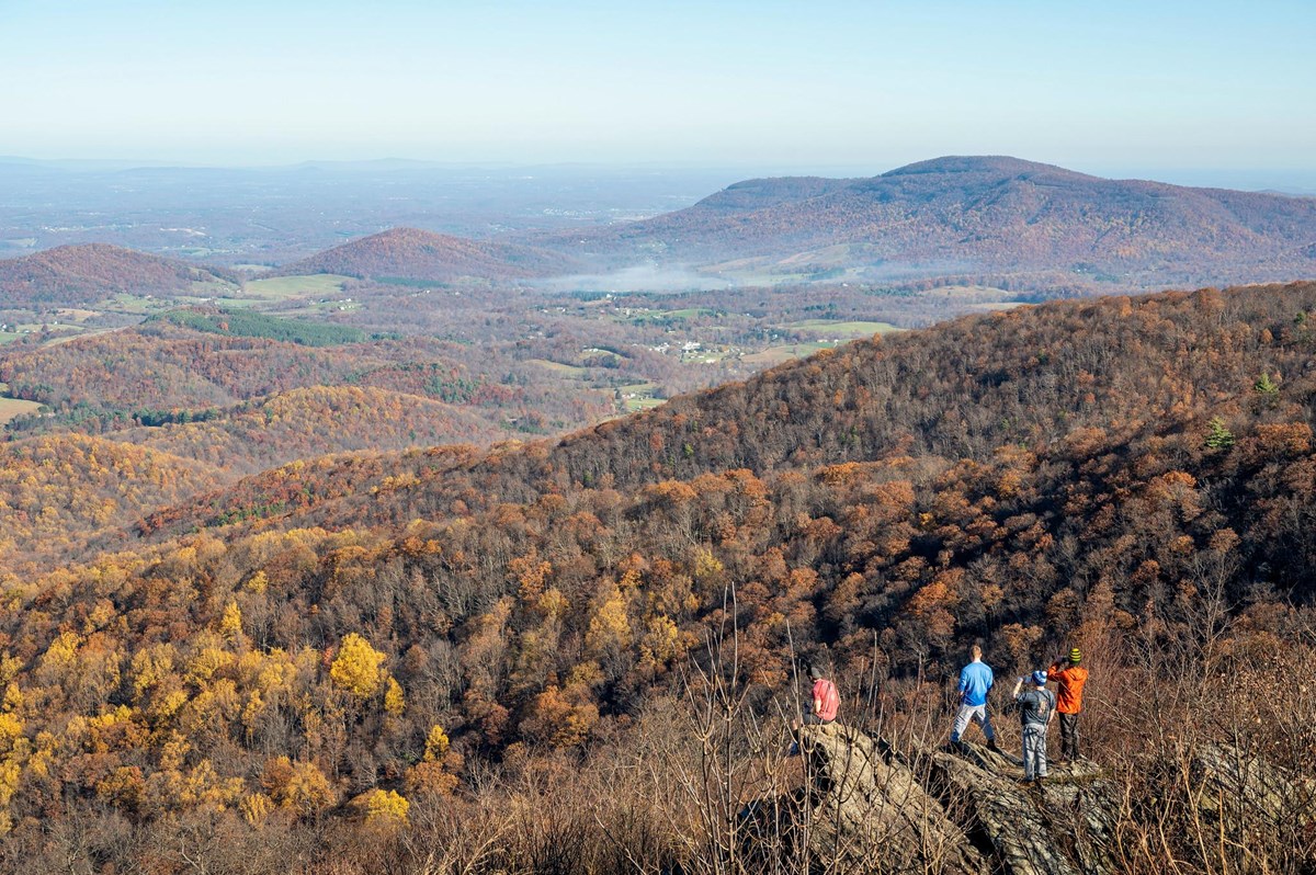
Drive Skyline Drive from Front Royal to Rockfish Gap over four days, mixing easy loops, moderate waterfall hikes and summit views. Base at Skyland and Big Meadows Lodge, with dining on the Drive.
- Marys Rock, Stony Man and Hawksbill summit views
- Rose River, Dark Hollow, South River and Doyles River waterfalls
- Two in-park lodge nights on Skyline Drive
- Sunset at Crescent Rock Overlook and dusk in Big Meadows
- Easy Fox Hollow, Limberlost and Blackrock loops for recovery
The story
Shenandoah's whole personality is in its spine: a single 105-mile road, Skyline Drive, runs along a ridge of the Blue Ridge Mountains with the Shenandoah Valley on one side and the Virginia Piedmont on the other. The speed limit is 35 mph in most places, and that is not a nuisance so much as the design. This trip treats the Drive as a slow conveyor belt, dropping you at a different kind of hike every few miles and moving your bed only once.
You enter at Front Royal at the north end and start the way many visitors do, at Dickey Ridge Visitor Center. The park's Fox Hollow loop is the day-one warm-up: rock walls and a family cemetery under the trees, a reminder that this was farmland before it was a national park. Compton Peak follows, with a view west and a close-up of columnar jointing on the east side. The afternoon climb to Marys Rock ends on a boulder-strewn summit, and you arrive at Skyland, the highest resort on the Drive, in time for dinner.
Day two stays put. Stony Man is a short hike to a big valley view, Hawksbill is the park's highest peak and ends at a platform with a 360-degree panorama, and Limberlost is an accessible loop of old hemlocks and laurel that lets your legs recover. Crescent Rock Overlook faces west for the sunset; the timing shifts with the season, as the item notes.
On day three you shift south to Big Meadows. Rose River Falls is a moderate loop in the morning; Dark Hollow Falls is short but steep in the afternoon; Big Meadows itself, a high-elevation meadow, is the place to be at dusk and after dark, when the park's night sky gets its due. Byrd Visitor Center is across the road for rangers, maps and exhibits.
Day four heads to the quieter southern half of the Drive: South River Falls in the morning, a wayside lunch at Loft Mountain, Doyles River Falls in the afternoon and the easy boulder field at Blackrock Summit to finish. Then you roll out through Rockfish Gap, where the Drive meets the Blue Ridge Parkway.
Go in fall if you can stand the crowds: the NPS says fall weekends draw large numbers and lodges are usually booked well ahead. Weekdays and the southern entrances are quieter. Late spring and early summer bring wildflowers and lush forest, and Skyland and Big Meadows Lodge run from spring to late fall.
All timings here are planning estimates: NPS hike times, plus an allowance of about two minutes per Skyline Drive mile at the typical 35 mph limit.
Day by day
North District: Fox Hollow, Compton Peak and Marys Rock
Enter at Front Royal and let the Drive set the pace. You warm up with the family-history loop at Fox Hollow, climb Compton Peak for a look at the park's lava-column geology, then take a wayside lunch at Elkwallow before the afternoon summit at Marys Rock. The day ends at Skyland, where the dining-room windows face the sunset side of the valley.
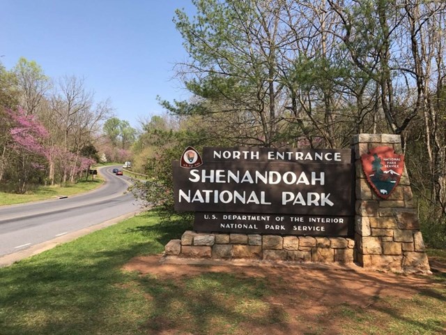
Enter at the Front Royal Entrance Station
The Drive starts at mile 0 and the numbers climb as you head south, so every stop below is easy to find by mile marker. NPS lists the speed limit as 35 mph in most places, and the road is a slow, looking-around kind of drive, so plan roughly two minutes per mile rather than trusting the map's estimate. Cell coverage is unreliable inside the park (it is generally available at Dickey Ridge and some west-facing overlooks), so download offline maps before you go. Fees are paid at the station by card only.
- Time
- Address per NPS directions page; ~75 miles from Washington, D.C.
Sources (4)
- NPS: North Entrance · retrieved 2026-09-29
- NPS: Basic Information (cell coverage) · retrieved 2026-09-29
- NPS: Directions (entrance addresses) · retrieved 2026-09-29
- NPS: Driving Skyline Drive (mileposts; speed limit 35 mph in most places) · retrieved 2026-09-29
Dickey Ridge Visitor Center
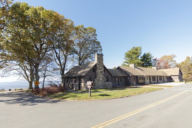
A stone building at mile 4.6 that works as your orientation stop: restrooms, maps, a bookstore and rangers who can tell you what the weather is doing up the ridge. It is one of the few spots in the park where cell service is generally available, which makes it a good place to screenshot anything you need for the day.
- Time
- Mile 4.6
- Reservation needed
- No
Sources (2)
- NPS: Basic Information (cell coverage at Dickey Ridge) · retrieved 2026-09-29
- NPS: Operating hours and seasons (visitor centers, mile 4.6 and mile 51) · retrieved 2026-09-29
Fox Hollow Trail
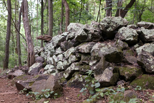
Right across the road from the visitor center, this 1.2-mile loop is a gentle history lesson: old rock walls, stacked rock piles from clearing fields, the Fox family cemetery and periwinkle planted by former residents, all now under forest canopy. It is a designated TRACK Trail with a kids' brochure, and a good leg-stretcher before the day's bigger climb. Dogs are not allowed.
- Distance
- 1.2 mi
- Elevation gain
- 310 ft
- Route
- Loop
- Difficulty
- Easy
- Dogs allowed
- No
- Trailhead
- Across Skyline Drive from Dickey Ridge Visitor Center (mile 4.6)
- Distance basis
- Loop distance and gain per NPS; NPS hiking time is 45 minutes
Sources (1)
- NPS: Fox Hollow Trail (Things To Do) · retrieved 2026-09-29
Compton Peak via the Appalachian Trail
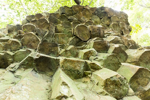
Cross the Drive at Compton Gap and follow the Appalachian Trail to two viewpoints. The west-facing overlook gives a valley view, and the east side offers a look at columnar jointing, hexagon-like cliff columns formed from ancient lava flows. NPS notes the optional trail below the cliff to see the columns up close is rough and rocky. Dogs are allowed on leash.
- Distance
- 2.4 mi
- Elevation gain
- 855 ft
- Route
- Out and back
- Difficulty
- Moderate
- Dogs allowed
- Yes
- Trailhead
- Compton Gap Parking Area (mile 10.4)
- Distance basis
- Round trip distance and gain per NPS (a lollipop with two viewpoints)
Sources (1)
- NPS: Compton Peak (Things To Do) · retrieved 2026-09-29
Lunch at Elkwallow Wayside
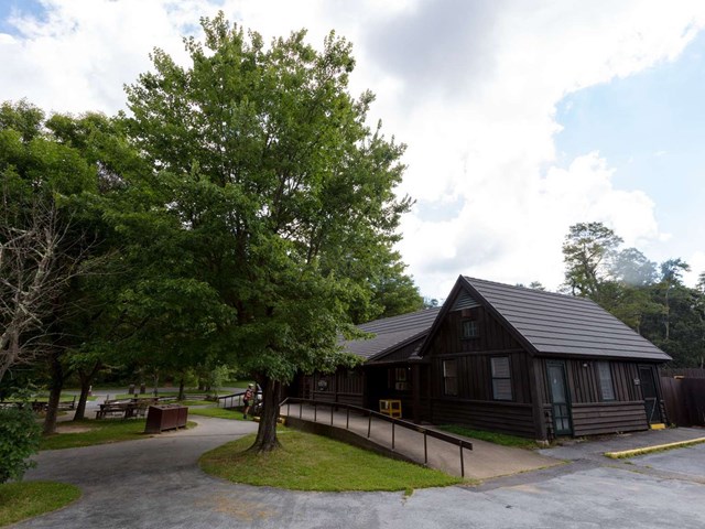
A trailside-style wayside at mile 24.1 with grab-and-go and carry-out food, groceries and outdoor picnic seating. It is a practical, unfussy lunch stop, and the timing lands right between the north-district hike and the afternoon climb to Marys Rock. On the way south you pass through the Marys Rock Tunnel (mile 32.2) later in the day; it is 12 ft 8 in tall, so check your vehicle's clearance.
- Meal
- Lunch
- Cuisine
- Grab-and-go, sandwiches, grilled items
- Reservation needed
- No
- Operator
- DNC Parks & Resorts at Shenandoah (Delaware North)
Sources (3)
- Go Shenandoah: Service updates (hours) · retrieved 2026-09-29
- NPS: Elkwallow Wayside · retrieved 2026-09-29
- NPS: Dining (mile 24.1, menu types) · retrieved 2026-09-29
Marys Rock via Meadow Spring
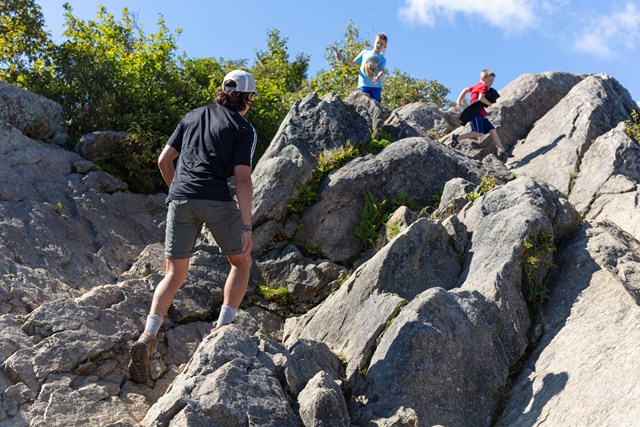
A short, steep-ish climb to one of the park's classic 360-degree summits: upturned boulders make natural seats, and NPS photos show hikers scrambling across the top. Starting from the Meadow Spring lot (rather than Panorama) trims the mileage and the climb compared with the longer Marys Rock Summit route. Aim to be on top ahead of sunset; on the way down the light on the valley is the reward.
- Distance
- 2.9 mi
- Elevation gain
- 830 ft
- Route
- Out and back
- Difficulty
- Moderate
- Dogs allowed
- Yes
- Trailhead
- Meadow Spring Parking Area (mile 33.5); cross Skyline Drive to the Meadow Spring Trail
- Distance basis
- Round trip distance and gain per NPS; NPS hiking time 3 hours (the from-Panorama route is 3.7 mi / 1,210 ft)
Sources (2)
- NPS: Marys Rock From Meadow Spring (Things To Do) · retrieved 2026-09-29
- NPS: Marys Rock Summit (Things To Do) · retrieved 2026-09-29
Check in at Skyland (recommended base, nights 1-2)
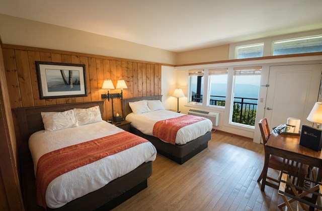
Skyland is the park's highest resort, at 3,680 feet, spread over 28 buildings on more than 27 acres, with room types from traditional rooms to cabins and suites. It began as a mountaintop escape marketed in the 1890s, and the west-facing ridge is the draw: you can see the valley from the dining room and the overlooks are minutes away. Book well ahead for fall weekends.
- Type
- Lodge
- Location
- Inside the park
- Booking
- Book / details
- Reservation notes
- Nightly rates are not published on the concessioner page; check rates and pet-friendly rooms (fee listed at $30/pet/night as of 2026-09-29) when booking. Address as printed on the concessioner page (Skyline Dr Mile 51 / Mile 41.7, Shenandoah National Park, VA 22835); the Luray PO Box 727 is a mailing address.
Sources (3)
- Go Shenandoah: Skyland · retrieved 2026-09-29
- NPS: Skyland Lodging · retrieved 2026-09-29
- NPS: Lodging · retrieved 2026-09-29
Dinner at Pollock Dining Room, Skyland
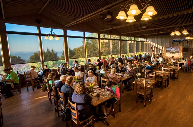
The full-service dining room at Skyland serves breakfast, lunch and dinner, with a view over the Shenandoah Valley from the building on the historic resort grounds. The concessioner lists local farm-fresh ingredients and a signature blackberry ice cream pie among its highlights. Vegetarian, vegan and gluten-free options are noted on the site.
- Meal
- Dinner
- Cuisine
- American / regional
- Reservation notes
- Check the concessioner site for reservation policy
Sources (3)
- Go Shenandoah: Dining · retrieved 2026-09-29
- Go Shenandoah: Service updates (hours) · retrieved 2026-09-29
- NPS: Skyland Dining Room · retrieved 2026-09-29
Skyland Day: Stony Man, Hawksbill and Limberlost
A no-checkout day around the highest part of the Drive. Stony Man is the short, sweet morning view; Hawksbill takes you to the park's tallest summit; Limberlost is the gentle afternoon cool-down. End at Crescent Rock Overlook for a west-facing sunset.
Breakfast at Pollock Dining Room
Breakfast is served from 7:30, which gives you time to eat and still get on the trail before the tour-bus crowd reaches the Stony Man lot. Fuel up: today's three outings add up to roughly six miles.
- Meal
- Breakfast
- Cuisine
- American / regional
Sources (2)
- Go Shenandoah: Service updates (hours) · retrieved 2026-09-29
- NPS: Skyland Dining Room · retrieved 2026-09-29
Stony Man Trail
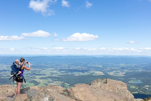
The easiest big view in the park: a short walk on the Appalachian Trail joins the blue-blazed Stony Man Trail to a rocky summit with a wide look over the Shenandoah Valley and Massanutten Mountain. NPS gives it 1 hour, and it is a good sunrise-adjacent morning outing from Skyland. Dogs are not allowed.
- Distance
- 1.6 mi
- Elevation gain
- 340 ft
- Route
- Loop
- Difficulty
- Easy
- Dogs allowed
- No
- Trailhead
- Stony Man parking area (mile 41.7)
- Distance basis
- Round trip / circuit per NPS ("1.6-mile round trip"); the route is a lollipop
Sources (1)
- NPS: Stony Man (Things To Do) · retrieved 2026-09-29
Hawksbill Loop to the summit platform
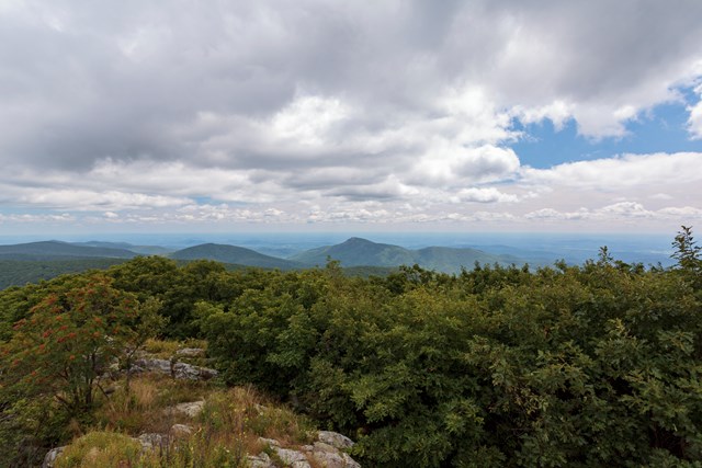
Hawksbill is the park's highest peak at 4,050 feet, and the loop via the Appalachian Trail, Salamander Trail and Upper Hawksbill Trail ends at a viewing platform with a 360-degree panorama of the valley, the Blue Ridge and the Piedmont. Return by the Lower Hawksbill Trail, as NPS directs, not the Upper. It is a steady climb but short.
- Distance
- 2.9 mi
- Elevation gain
- 860 ft
- Route
- Loop
- Difficulty
- Moderate
- Dogs allowed
- Yes
- Trailhead
- Hawksbill Gap Parking Area (mile 45.5)
- Distance basis
- Circuit distance and gain per NPS
Sources (2)
- NPS: Crescent Rock Overlook (Hawksbill 4,050 ft) · retrieved 2026-09-29
- NPS: Hawksbill Loop (Things To Do) · retrieved 2026-09-29
Lunch at Pollock Dining Room
Back at Skyland for a sit-down lunch (served noon to 2:30). If you would rather keep moving, the Grab 'n Go station in the same building offers sandwiches, salads, pastries and drinks.
- Meal
- Lunch
Sources (2)
- Go Shenandoah: Service updates (hours) · retrieved 2026-09-29
- NPS: Skyland Dining Room · retrieved 2026-09-29
Limberlost Trail
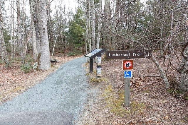
A wide greenstone path looping through forest that includes old hemlock stands, mountain laurel in spring and a columnar-jointing outcrop. It is fully accessible, easy, and a nice cool-down after Hawksbill. NPS lists it as a TRACK Trail with a kids' brochure. Dogs are not allowed.
- Distance
- 1.3 mi
- Elevation gain
- 130 ft
- Route
- Loop
- Difficulty
- Easy
- Dogs allowed
- No
- Trailhead
- Limberlost Parking Area (mile 43)
- Distance basis
- Circuit distance and gain per NPS
Sources (1)
- NPS: Limberlost (Things To Do) · retrieved 2026-09-29
Sunset at Crescent Rock Overlook
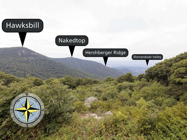
Facing west at 3,550 feet, Crescent Rock is described by NPS as having some of the best views of Hawksbill Peak, and a west-facing overlook is exactly what you want at the end of the day. Arrive about 30-45 minutes before sunset and bring a jacket; it is cooler on the ridge than in the valley. The 17:30 start suits an early-fall sunset (roughly 6:30-7 PM in late September and early October). In May and June sunset is after 8 PM, so eat dinner at Pollock Dining Room first and drive to the overlook about 7:30 PM, then have a late taproom drink instead; check the sunset time for your date.
- Time
- Arrive 30-45 min before sunset; sunset time varies by season
- Best time
- Sunset (west-facing)
- Reservation needed
- No
Sources (1)
- NPS: Crescent Rock Overlook · retrieved 2026-09-29
Evening at the Mountain Taproom
For a lighter dinner, the Mountain Taproom in the Skyland dining building serves a lighter-fare menu with beer and local wines, and NPS notes nightly family-friendly entertainment. Prefer a full dinner? Pollock Dining Room stays open until 9.
- Meal
- Dinner
- Cuisine
- Lighter fare, beer and local wine
Sources (2)
- Go Shenandoah: Service updates (hours) · retrieved 2026-09-29
- NPS: Skyland Dining Room · retrieved 2026-09-29
Waterfalls and Meadows: Rose River, Dark Hollow and Big Meadows
Move your base ten miles south. You hike the Rose River loop in the morning, eat at Big Meadows Wayside, then drop into Dark Hollow Falls before a visitor-center stop and an evening in the meadow. Big Meadows Lodge is your bed tonight.
Breakfast at Pollock Dining Room and check out
Eat when breakfast opens at 7:30, load the car, and move south along the Drive. Today shifts your base 10 miles south to Big Meadows Lodge.
- Meal
- Breakfast
Sources (1)
- Go Shenandoah: Service updates (hours) · retrieved 2026-09-29
Rose River Falls Loop
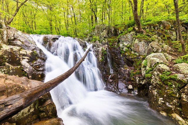
A loop that drops through the Shenandoah Wilderness to a 67-foot waterfall, then climbs a steeper, rockier section past cascades before returning along a fire road. Cross Skyline Drive from Fishers Gap and start down the fire road. NPS mentions an optional 0.25-mile side trip to the base of Dark Hollow Falls; skip it here because you will see that waterfall this afternoon. Waterfalls flow best after rain. Dogs are allowed on leash.
- Distance
- 4 mi
- Elevation gain
- 910 ft
- Route
- Loop
- Difficulty
- Moderate
- Dogs allowed
- Yes
- Trailhead
- Fishers Gap parking area (mile 49.4)
- Distance basis
- Circuit distance and gain per NPS; NPS hiking time 4.5 hours
Sources (1)
- NPS: Rose River Falls (Things To Do) · retrieved 2026-09-29
Lunch at Big Meadows Wayside
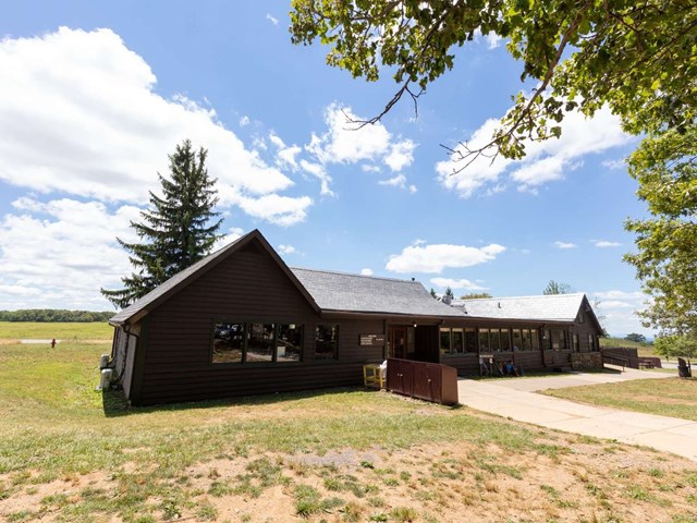
A wood-fronted wayside at mile 51.2 with regional favorites available carry-out or sit-down, plus a Grab 'n Go kiosk (sandwiches, salads, pastries), groceries and camping supplies.
- Meal
- Lunch
- Cuisine
- Regional favorites, grab-and-go
- Reservation needed
- No
Sources (3)
- Go Shenandoah: Service updates (hours) · retrieved 2026-09-29
- NPS: Big Meadows Wayside · retrieved 2026-09-29
- NPS: Dining · retrieved 2026-09-29
Dark Hollow Falls
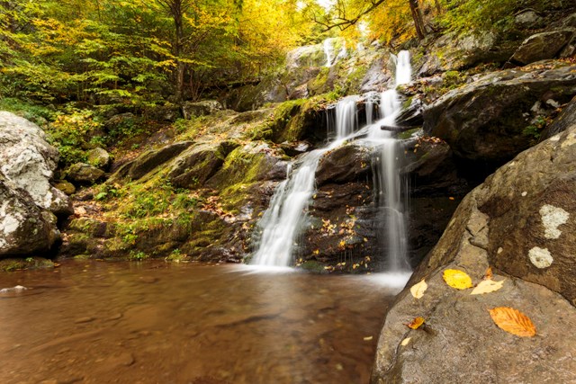
One of the park's most-traveled trails, and NPS is blunt about it: short, very steep and rocky, and the climb back up is the hard part. It follows a stream down about 0.75 mile to a cascading waterfall (NPS photos show it framed by yellow fall leaves). Take your time on wet rock. Dogs are not allowed (Rose River is the dog-friendly alternative).
- Distance
- 1.4 mi
- Elevation gain
- 440 ft
- Route
- Out and back
- Difficulty
- Moderate
- Dogs allowed
- No
- Trailhead
- Dark Hollow Falls Parking Area (mile 50.7)
- Distance basis
- Total round trip distance and gain per NPS (NPS labels it a circuit but describes descending and returning the same way)
Sources (1)
- NPS: Dark Hollow Falls (Things To Do) · retrieved 2026-09-29
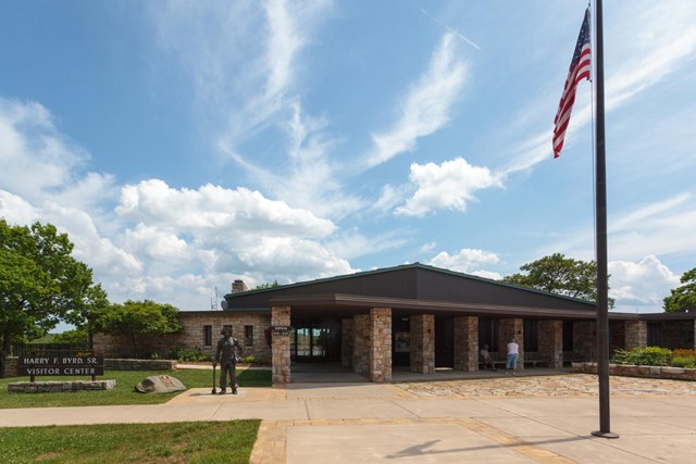
Harry F. Byrd Sr. Visitor Center
Across from the meadow at mile 51, with exhibits, a bookstore, maps, first aid and a ranger desk. Ask about that evening's ranger programs and current trail conditions. Free Wi-Fi is available here.
- Time
- Mile 51
Sources (2)
- NPS: Basic Information (Wi-Fi) · retrieved 2026-09-29
- NPS: Operating hours and seasons (visitor centers, mile 4.6 and mile 51) · retrieved 2026-09-29
Check in at Big Meadows Lodge (night 3)
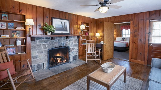
A rustic lodge at mile 51 with main-lodge rooms, detached cabins, suites and Blackrock premium rooms, all within walking distance of the main building. Its dining room and taproom are downstairs, and the meadow across the road is a good place to be at dusk.
- Type
- Lodge
- Location
- Inside the park
- Booking
- Book / details
- Reservation notes
- Nightly rates are not published on the concessioner page; pets allowed for $30/pet/night, two-pet limit (as listed 2026-09-29). Address as printed on the concessioner page (Skyline Dr Mile 51 / Mile 41.7, Shenandoah National Park, VA 22835); the Luray PO Box 727 is a mailing address.
Sources (2)
- Go Shenandoah: Big Meadows Lodge · retrieved 2026-09-29
- NPS: Big Meadows Lodge · retrieved 2026-09-29
Big Meadows at golden hour
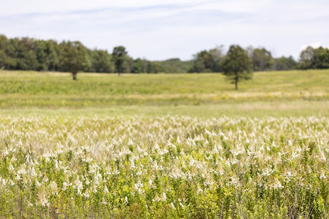
A high-elevation meadow that surprises you after miles of forest. NPS calls it essential habitat for plants and animals and a place to view wildlife, stargaze or simply wander its paths. Walk the meadow loop paths toward sunset and stay for the dark: Shenandoah's night skies are a park highlight, and the Drive is open around the clock outside winter closures.
- Time
- Mile 51
- Best time
- Sunset and after dark
- Reservation needed
- No
Sources (2)
- NPS: Big Meadows · retrieved 2026-09-29
- NPS: Stargaze in Shenandoah · retrieved 2026-09-29
Dinner at Spottswood Dining Room
The lodge's rustic dining room serves breakfast, lunch and dinner. The neighboring New Market Taproom serves lighter food with entertainment; the lodge advertises pet-friendly outdoor seating.
- Meal
- Dinner
- Cuisine
- American / regional
- Reservation notes
- Located in the Big Meadows Lodge main building; address as printed on the concessioner page.
Sources (4)
- Go Shenandoah: Big Meadows Lodge · retrieved 2026-09-29
- Go Shenandoah: Service updates (hours) · retrieved 2026-09-29
- NPS: Big Meadows Lodge · retrieved 2026-09-29
- NPS: Operating hours (Big Meadows Lodge mile 51.2) · retrieved 2026-09-29
Southern Half: South River Falls, Doyles River and Blackrock Summit
The quieter southern half of the Drive. Two waterfall hikes bracket a lunch at Loft Mountain, and a last easy boulder-field summit at Blackrock closes the loop before you exit at Rockfish Gap.
Breakfast at Spottswood Dining Room
Breakfast is served from 7:30. Today is the quietest stretch of the Drive, so fill the tank (NPS notes there is only one gas station in the park, at Big Meadows) before heading south.
- Meal
- Breakfast
- Reservation notes
- Located in the Big Meadows Lodge main building; address as printed on the concessioner page.
Sources (2)
- Go Shenandoah: Service updates (hours) · retrieved 2026-09-29
- NPS: Operating hours (Big Meadows Lodge mile 51.2) · retrieved 2026-09-29
South River Falls
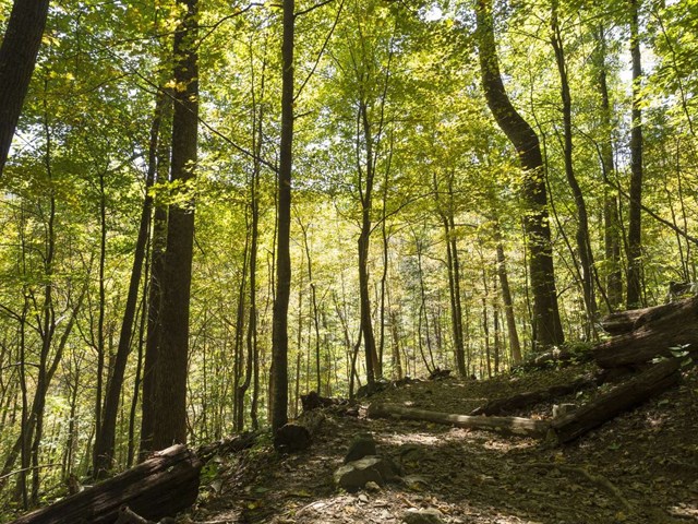
From South River Picnic Grounds, this circuit follows the blue-blazed South River Falls Trail to an observation point at the top of an 83-foot waterfall; NPS describes it as a great hike for wildflowers and birds. There is one stream crossing. Dogs are allowed on leash.
- Distance
- 3.3 mi
- Elevation gain
- 910 ft
- Route
- Loop
- Difficulty
- Moderate
- Dogs allowed
- Yes
- Trailhead
- Just below South River Picnic Grounds comfort station (mile 62.7)
- Distance basis
- Circuit distance and gain per NPS; NPS hiking time 2 h 15 min
Sources (1)
- NPS: South River Falls (Things To Do) · retrieved 2026-09-29
Lunch at Loft Mountain Wayside
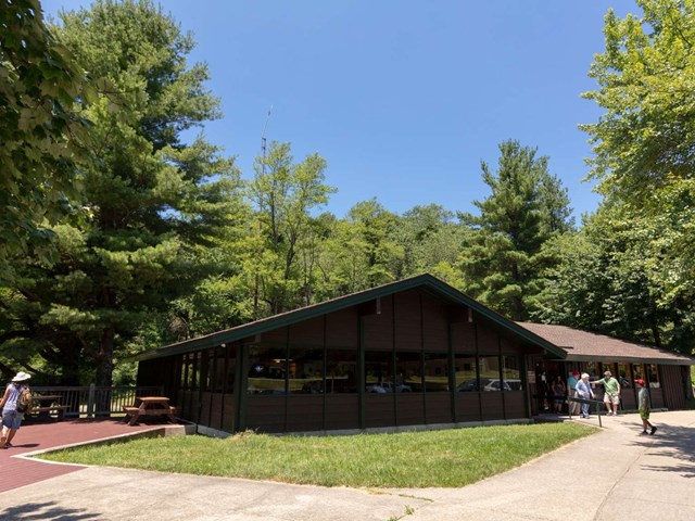
A rustic wood wayside at mile 79.5 for a quick meal: breakfast items, sandwiches and grilled items with indoor and outdoor seating, plus souvenirs and groceries. In the quiet southern district this is the main food stop.
- Meal
- Lunch
- Cuisine
- Sandwiches, grilled items
- Reservation needed
- No
Sources (3)
- Go Shenandoah: Service updates (hours) · retrieved 2026-09-29
- NPS: Loft Mountain Wayside · retrieved 2026-09-29
- NPS: Dining · retrieved 2026-09-29
Doyles River Falls
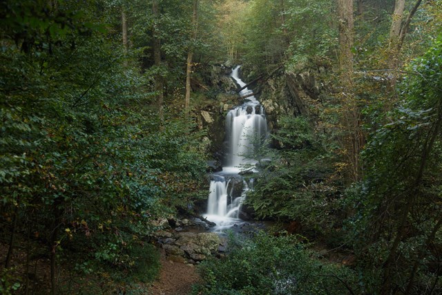
A stream-side hike to two waterfalls (Upper and Lower Doyles River Falls, marked by trail posts). NPS notes a stream crossing and the return climb accounts for most of the elevation gain listed. Dogs are allowed on leash.
- Distance
- 3.3 mi
- Elevation gain
- 1,189 ft
- Route
- Out and back
- Difficulty
- Moderate
- Dogs allowed
- Yes
- Trailhead
- Doyles River Parking Area (mile 81.1)
- Distance basis
- Round trip distance and gain per NPS; NPS hiking time 2 h 15 min
Sources (1)
- NPS: Doyles River Falls (Things To Do) · retrieved 2026-09-29
Blackrock Summit
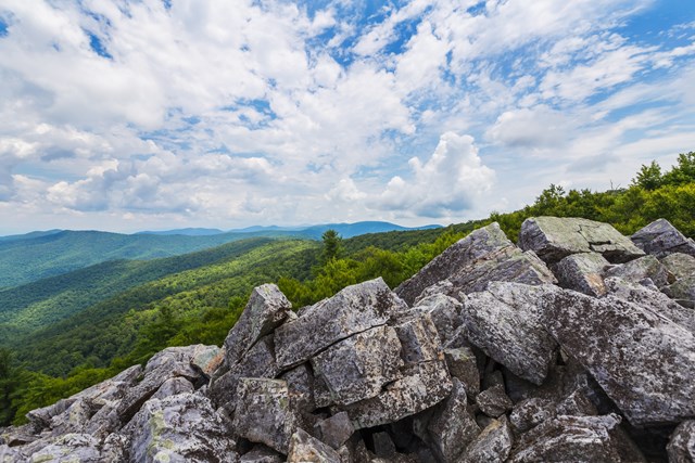
A short circuit on the Appalachian Trail to a boulder field on a talus slope with views of the Shenandoah Valley and Massanutten Mountain. It is a fine last stop of the trip, and the easy grade suits tired legs. TRACK Trail with a kids' brochure. Dogs allowed on leash.
- Distance
- 1 mi
- Elevation gain
- 175 ft
- Route
- Loop
- Difficulty
- Easy
- Dogs allowed
- Yes
- Trailhead
- Blackrock Parking Area (mile 84.4)
- Distance basis
- Circuit distance and gain per NPS
Sources (1)
- NPS: Blackrock Summit (Things To Do) · retrieved 2026-09-29
Exit via Rockfish Gap
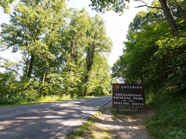
Mile 105 is the south end of Skyline Drive, where it meets the Blue Ridge Parkway near the town of Waynesboro. Allow roughly 45 minutes for the 20-odd miles from Blackrock (mile 84.4) at the typical 35 mph speed limit. Mile markers count up from the Front Royal entrance (mile 0) to Rockfish Gap (mile 105).
Sources (3)
- NPS: Rockfish Gap Entrance · retrieved 2026-09-29
- NPS: Directions (entrance addresses) · retrieved 2026-09-29
- NPS: Driving Skyline Drive (mileposts) · retrieved 2026-09-29
Where to stay
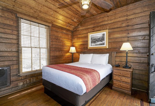
Lewis Mountain Cabins (mile 57.5)
The park's most low-key lodging: rustic furnished cabins (one-room, two-room, a bunk-bed hikers' cabin and pet-friendly cabins) with private baths in most, outdoor grill pits, no A/C, no Wi-Fi in the cabins and no refrigeration. The campstore has Wi-Fi.
- Type
- Cabin
- Location
- Inside the park
- Booking
- Book / details
- Reservation notes
- Nightly rates are not published on the concessioner page; check when booking. Reservations 877-847-1919 (540-843-2115 is the campstore late check-in line). Check-in before 6 PM per concessioner.
Sources (2)
- Go Shenandoah: Lewis Mountain Cabins · retrieved 2026-09-29
- NPS: Lodging · retrieved 2026-09-29
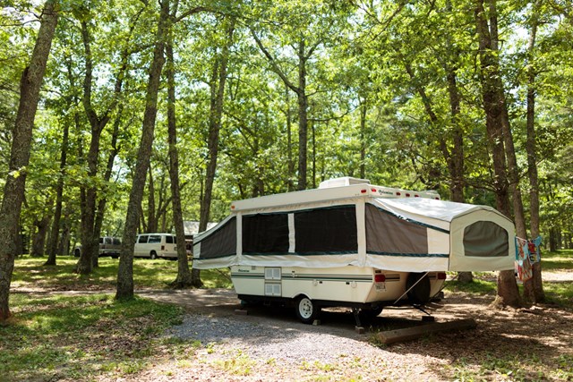
Big Meadows Campground (mile 51.2)
Central to Dark Hollow Falls, Big Meadows and Byrd Visitor Center, with tent/RV sites that each have a fire ring and picnic table. All sites are by reservation only.
- Type
- Campground
- Location
- Inside the park
- Price per night
- $30 to $75 (as of 2026-09-29)
- Booking
- Book / details
- Reservation notes
- Standard nonelectric site $30 per night; group sites $75 (NPS campground record). Reservations are made through Recreation.gov; see the NPS campground page for release details.
Sources (1)
- NPS: Big Meadows Campground · retrieved 2026-09-29
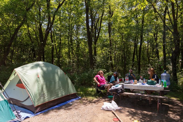
Loft Mountain Campground (mile 79.5)
Sits atop Big Flat Mountain in the south district with views east and west and two waterfalls nearby. Combination of reservable and first-come sites; a good base for Day 4 stops.
- Type
- Campground
- Location
- Inside the park
- Price per night
- From $30 (as of 2026-09-29)
- Booking
- Book / details
- Reservation notes
- Standard nonelectric site $30 per night (NPS campground record).
Sources (1)
- NPS: Loft Mountain Campground · retrieved 2026-09-29
More options
Old Rag Circuit (very strenuous add-on)
The park's most popular hike, and NPS calls it very strenuous with several rock scrambles and 360-degree views. It needs its own day (NPS lists 7.5 hours) and does not fit this itinerary; it is offered as an alternative for a fit group who can swap out Day 2 or 3. A day-use ticket is required March 1-November 30 in addition to the park entrance pass; dogs are prohibited on the Ridge, Saddle and Ridge Access trails.

- Distance
- 9.4 mi
- Elevation gain
- 2,348 ft
- Route
- Loop
- Difficulty
- Strenuous
- Permit required
- Yes
- Dogs allowed
- No
- Trailhead
- Old Rag parking area at the park boundary (outside the Skyline Drive corridor)
- Distance basis
- Circuit distance and gain per NPS
Sources (2)
- NPS: Old Rag day-use ticket FAQ · retrieved 2026-09-29
- NPS: Old Rag Circuit (Things To Do) · retrieved 2026-09-29
Map of places
- Front Royal Entrance Station (North Entrance) (opens Google Maps in a new tab) Day 1
- Dickey Ridge Visitor Center (opens Google Maps in a new tab) Day 1
- Fox Hollow Trailhead (opens Google Maps in a new tab) Day 1
- Compton Gap Parking Area / Compton Peak Trailhead (opens Google Maps in a new tab) Day 1
- Elkwallow Wayside (opens Google Maps in a new tab) Day 1
- Meadow Spring Parking Area (opens Google Maps in a new tab) Day 1
- Skyland Lodging (opens Google Maps in a new tab) Day 1
- Skyland Dining Room (Pollock Dining Room, Mountain Taproom, Grab 'n Go) (opens Google Maps in a new tab) Day 1
- Skyland Dining Room (Pollock Dining Room, Mountain Taproom, Grab 'n Go) (opens Google Maps in a new tab) Day 2
- Stony Man Trailhead (opens Google Maps in a new tab) Day 2
- Hawksbill Gap Parking Area (opens Google Maps in a new tab) Day 2
- Skyland Dining Room (Pollock Dining Room, Mountain Taproom, Grab 'n Go) (opens Google Maps in a new tab) Day 2
- Limberlost Trailhead (opens Google Maps in a new tab) Day 2
- Crescent Rock Overlook (opens Google Maps in a new tab) Day 2
- Skyland Dining Room (Pollock Dining Room, Mountain Taproom, Grab 'n Go) (opens Google Maps in a new tab) Day 2
- Skyland Dining Room (Pollock Dining Room, Mountain Taproom, Grab 'n Go) (opens Google Maps in a new tab) Day 3
- Rose River Falls Trailhead (Fishers Gap) (opens Google Maps in a new tab) Day 3
- Big Meadows Wayside (opens Google Maps in a new tab) Day 3
- Dark Hollow Falls Trailhead (opens Google Maps in a new tab) Day 3
- Harry F. Byrd Sr. Visitor Center (opens Google Maps in a new tab) Day 3
- Big Meadows Lodge (opens Google Maps in a new tab) Day 3
- Big Meadows (opens Google Maps in a new tab) Day 3
- Spottswood Dining Room at Big Meadows Lodge (opens Google Maps in a new tab) Day 3
- Spottswood Dining Room at Big Meadows Lodge (opens Google Maps in a new tab) Day 4
- South River Falls Trailhead (opens Google Maps in a new tab) Day 4
- Loft Mountain Wayside (opens Google Maps in a new tab) Day 4
- Doyles River Parking Area (opens Google Maps in a new tab) Day 4
- Blackrock Parking Area / Trailhead (opens Google Maps in a new tab) Day 4
- Rockfish Gap Entrance Station (opens Google Maps in a new tab) Day 4
- Lewis Mountain Cabins (opens Google Maps in a new tab) Option
- Big Meadows Campground (opens Google Maps in a new tab) Option
- Loft Mountain Campground (opens Google Maps in a new tab) Option
- Old Rag Trailhead (Park boundary parking area) (opens Google Maps in a new tab) Option
Good to know
Current conditions (as of 2026-09-29). From the NPS alerts feed and concessioner pages; verify before you go.
- Old Rag: the main parking lot is closed for infrastructure work, expected to finish by November 2026, with overflow parking in use. Old Rag day-use tickets are required March 1 to November 30 (Old Rag is an optional add-on only, not in the day plan).
- Fee stations are cashless: cards or mobile payments only. Vehicle entrance is $30 for 7 days, motorcycle $25, per person $15 (16 and older), annual park pass $55 (NPS fees page https://www.nps.gov/shen/planyourvisit/fees.htm, retrieved 2026-09-29).
- Appalachian Trail backcountry camping is closed between Lewis Mountain and Big Meadows (trail open to hikers), and the Naked Creek backcountry zone is closed.
- 2026 season dates per the concessioner and NPS: Skyland March 30-November 8; Big Meadows Lodge May 4-November 29; Lewis Mountain Cabins April 10-November 8. Campground closing dates: Mathews Arm and Loft Mountain November 1, Lewis Mountain November 22, Big Meadows November 29. Waysides such as Elkwallow and Loft Mountain typically close around early November.
- Marys Rock and Hawksbill: NPS says very limited closures are in effect on the summit outcrops to protect fragile outcrop ecosystems; stay on the marked route and obey posted signs.
- Text SHENALERTS to 888777 for Skyline Drive closures and reopenings.
Best months. May-June (wildflowers, lush forest) and September-October (fall color). NPS says it is impossible to predict peak fall color across a 100+ mile park; lodges and campgrounds are usually booked for fall weekends well in advance, and first-come campsites often fill by Thursday evening. Weekdays and the southern entrances (Swift Run, Rockfish) are less busy.
Getting around. The Skyline Drive speed limit is 35 mph in most places (NPS). Cell service is unreliable; download maps. The Marys Rock Tunnel (mile 32.2) has a 12 ft 8 in clearance. Concession dining is spaced roughly 25 miles apart, so carry water and snacks for hikes.
Reservations. Book lodging as early as you can (nightly rates are not published on the concessioner pages, so check them when booking); both lodges are run by DNC Parks & Resorts at Shenandoah (877-847-1919). Big Meadows Campground is reservations-only through Recreation.gov.
Hiking notes. NPS hike distance and gain are used throughout; trail hours are NPS estimates. Waterfall flow depends on recent rain. Dogs are prohibited on Fox Hollow, Stony Man, Limberlost and Dark Hollow trails; Rose River, Compton Peak, Marys Rock, Hawksbill, South River, Doyles River and Blackrock allow leashed dogs (NPS). Follow ranger guidance on wildlife encounters.
Packing. Layers (the ridge is cooler than the valley), rain shell, headlamp for after-dark walks.
Want live alerts and up-to-date info?
Conditions change fast. Create an account on the DriftKin app to get live park alerts, closures and information for your trip.
Sources
- NPS: North Entrance retrieved 2026-09-29
- NPS: Basic Information (Wi-Fi) retrieved 2026-09-29
- NPS: Directions (entrance addresses) retrieved 2026-09-29
- NPS: Driving Skyline Drive (mileposts) retrieved 2026-09-29
- NPS: Operating hours (Big Meadows Lodge mile 51.2) retrieved 2026-09-29
- NPS: Fox Hollow Trail (Things To Do) retrieved 2026-09-29
- NPS: Compton Peak (Things To Do) retrieved 2026-09-29
- Go Shenandoah: Service updates (hours) retrieved 2026-09-29
- NPS: Elkwallow Wayside retrieved 2026-09-29
- NPS: Dining retrieved 2026-09-29
- NPS: Marys Rock From Meadow Spring (Things To Do) retrieved 2026-09-29
- NPS: Marys Rock Summit (Things To Do) retrieved 2026-09-29
- Go Shenandoah: Skyland retrieved 2026-09-29
- NPS: Skyland Lodging retrieved 2026-09-29
- NPS: Lodging retrieved 2026-09-29
- Go Shenandoah: Dining retrieved 2026-09-29
- NPS: Skyland Dining Room retrieved 2026-09-29
- NPS: Stony Man (Things To Do) retrieved 2026-09-29
- NPS: Crescent Rock Overlook retrieved 2026-09-29
- NPS: Hawksbill Loop (Things To Do) retrieved 2026-09-29
- NPS: Limberlost (Things To Do) retrieved 2026-09-29
- NPS: Rose River Falls (Things To Do) retrieved 2026-09-29
- NPS: Big Meadows Wayside retrieved 2026-09-29
- NPS: Dark Hollow Falls (Things To Do) retrieved 2026-09-29
- Go Shenandoah: Big Meadows Lodge retrieved 2026-09-29
- NPS: Big Meadows Lodge retrieved 2026-09-29
- NPS: Big Meadows retrieved 2026-09-29
- NPS: Stargaze in Shenandoah retrieved 2026-09-29
- NPS: South River Falls (Things To Do) retrieved 2026-09-29
- NPS: Loft Mountain Wayside retrieved 2026-09-29
- NPS: Doyles River Falls (Things To Do) retrieved 2026-09-29
- NPS: Blackrock Summit (Things To Do) retrieved 2026-09-29
- NPS: Rockfish Gap Entrance retrieved 2026-09-29
- Go Shenandoah: Lewis Mountain Cabins retrieved 2026-09-29
- NPS: Big Meadows Campground retrieved 2026-09-29
- NPS: Loft Mountain Campground retrieved 2026-09-29
- NPS: Old Rag day-use ticket FAQ retrieved 2026-09-29
- NPS: Old Rag Circuit (Things To Do) retrieved 2026-09-29
Hours, fees, prices and closures change. Confirm details with the park or business before you go.
More trips like this
 National parkGreat Smoky Mountains
Great Smoky Mountains: 4 Days of Waterfalls, Ridgelines and Cades Cove
4 days Moderate$$ National parkCuyahoga Valley
Cuyahoga Valley: 3 Days of Waterfalls, Ledges and the Canal Towpath
3 days Moderate$$$ National parkBryce Canyon
Bryce Canyon: 3 Days Among the Hoodoos, from Rim to Rainbow Point
3 days Moderate$$