Zion: 4 Days of Canyon Classics, from Angels Landing to the Narrows
Two iconic hikes, a quiet corner, and a base you can walk out of
- Length
- 4 days
- Difficulty
- Strenuous
- Best months
- Mar–May, Sep–Nov
- Budget
- $$
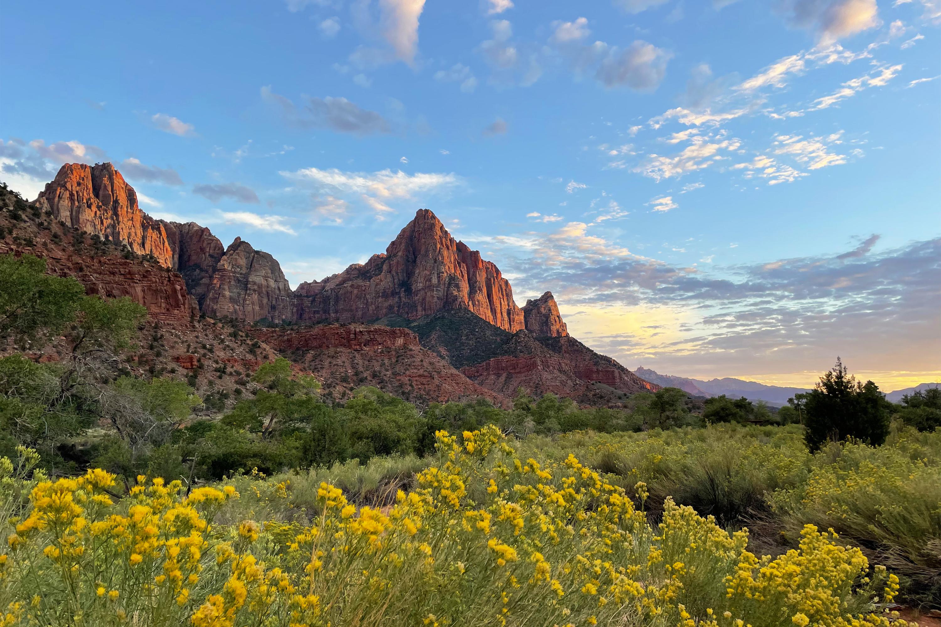
Four days in Zion Canyon built around its two headline hikes, Angels Landing and the Narrows, with sunset walks, a shuttle-friendly Springdale base and a final quiet morning at Kolob Canyons.
- Angels Landing chain ridge (permit required) with a no-permit Scout Lookout alternative
- Wading the Virgin River in the Narrows, bottom-up
- Kayenta Trail to Upper Emerald Pool
- Late-afternoon Canyon Overlook and dusk on the Pa'rus Trail
- A quiet morning at Kolob Canyons
The story
Zion Canyon is a place that rewards a plan. Cliffs of cream, pink and red sandstone rise half a mile straight up from a narrow valley, and one river, the Virgin, carved all of it. In four days you can meet the canyon three ways: from above on a famously exposed ridge, from within as you wade through a slot canyon, and from the quiet edges where far fewer people go.
The logistics work in your favor if you lean into them. For most of the year private cars are not allowed on the Zion Canyon Scenic Drive; a free shuttle carries you to nine stops, and it's the easiest way to reach the Grotto, Zion Lodge and the Narrows trailhead. That's why this itinerary bases you in Springdale, at the park's south gate, where you can walk to the visitor center and leave the car parked. NPS says parking lots often fill early in the day, so the plan front-loads the big hikes into the earliest hours and leaves the middle of the day for shade and lunch.
Day 1 eases you in with the visitor center, a late-afternoon walk to the Canyon Overlook viewpoint on the east side, and a paved sunset stroll along the Pa'rus Trail. Day 2 is Angels Landing, the chained ridge that requires a permit from recreation.gov; if the lottery doesn't smile on you, you can still hike to Scout Lookout, which needs no permit, and spend the afternoon on the Kayenta Trail and Emerald Pools. Day 3 is the Narrows: a mile on the paved Riverside Walk, then miles of river hiking in a canyon whose walls press in close. Day 4 trades crowds for quiet at Kolob Canyons, the park's northwestern district, on your way back to the interstate.
Timing matters. Fall (roughly September through November) and spring (March through May) are the sweet spots: the Narrows is most stable in fall, and cooler days make the big climbs pleasant. Summer temperatures often exceed 100 degrees Fahrenheit, and spring snowmelt and late-summer monsoons can close the Narrows.
Trail closures do change: the tips section has a dated snapshot of current conditions, and this plan is built around it. Check the NPS conditions page before you leave home.
Bring reservations, a headlamp, good shoes, and a flexible attitude toward the river. The rest, the light on the cliffs at the end of the day, takes care of itself.
Day by day
Arrive, orient, and catch the light
Ease into Zion. Check in at Cable Mountain Lodge in Springdale, visit the park's visitor center for the latest closures, drive east through the Zion-Mount Carmel Highway to Canyon Overlook for warm late light, and finish with a paved dusk walk on the Pa'rus Trail before a relaxed dinner at the brew pub.
Check in at Cable Mountain Lodge (your Springdale base)
Cable Mountain Lodge sits at the edge of Springdale near the park entrance, which lets you leave the car parked for much of the trip and use the Springdale shuttle line. The lodge's site lists studios, suites and multi-room residences, plus a pool, a heated spa and a riverside picnic area with grills. This is the recommended base for all four nights; other options are listed at the end of the trip.
- Type
- Hotel
- Location
- Outside the park
- Booking
- Book / details
- Reservation notes
- Rates not published on the lodge's site; check the booking engine for your dates. Book well ahead for spring and fall.
Sources (2)
- OpenStreetMap geocode of address (coordinates) · retrieved 2026-09-28
- Cable Mountain Lodge official site · retrieved 2026-09-28
Zion Canyon Visitor Center: orient yourself
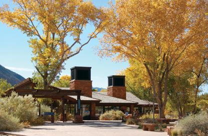
Start with a walk through the visitor center to check the day's conditions, pick up a map, and confirm the Narrows and shuttle status. Hours are shorter outside summer (see place hours), so don't leave this for late in the day. The Zion Canyon shuttle leaves from here (stop 1); the lot is large but fills early, so on later days walk in from Springdale rather than hunting for a space.
- Time
- 30-60 minutes
- Best time
- Day 1, then only for updates
Sources (3)
- NPS Data API parks (entrance fees: private vehicle $35) · retrieved 2026-09-28
- NPS Data API visitorcenters · retrieved 2026-09-28
- Current Conditions - Zion NP · retrieved 2026-09-28
Canyon Overlook Trail in late-afternoon light
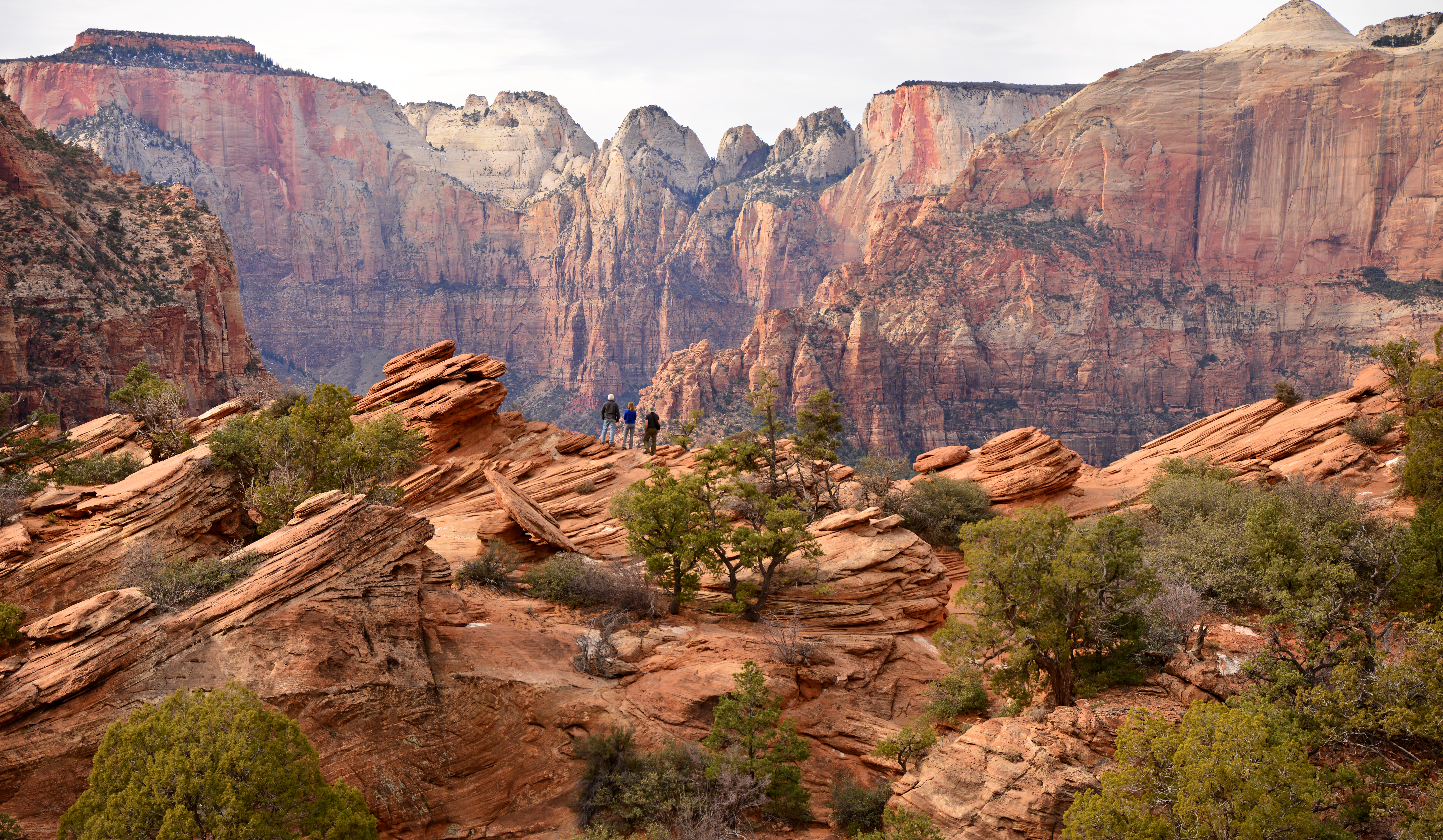
Drive east through the Zion-Mount Carmel Highway (oversized vehicles should check NPS limits first) to the small lot just past the tunnel. The trail is short but not trivial: sandstone steps and a handrail lead above a dark slot, then it opens onto slickrock with a fenced edge looking over Pine Creek Canyon toward the Towers of the Virgin. NPS warns parking is extremely limited and you must turn right when entering or leaving the lot, so be ready to try more than once - a good reason to come mid-afternoon rather than at midday.
- Distance
- 1 mi
- Elevation gain
- 154 ft
- Route
- Out and back
- Difficulty
- Moderate
- Permit required
- No
- Dogs allowed
- No
- Trailhead
- East of the Zion-Mt. Carmel tunnel; parking extremely limited
- Note
- Distance is round trip (0.5 mi each way per NPS); elevation gain is the NPS one-way figure (154 ft; NPS lists 48 ft loss), so the round-trip climb is somewhat higher.
Sources (2)
- NPS Data API thingstodo: Canyon Overlook (https://www.nps.gov/thingstodo/hike-canyon-overlook.htm) · retrieved 2026-09-28
- Current Conditions - Zion NP · retrieved 2026-09-28
Pa'rus Trail at dusk
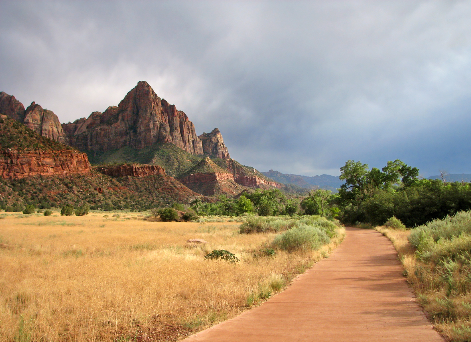
Pa'rus is Paiute for bubbling water, and this paved path along the Virgin River is the gentlest introduction to the canyon. It links the visitor center to Canyon Junction and is one of the best places to watch The Watchman glow as the light drops. It is also the one trail in the canyon open to leashed dogs and bikes. Stay after sunset if you can: NPS notes it is a good spot for stargazing, and Zion is an International Dark Sky Park.
- Distance
- 1.6 mi
- Elevation gain
- 152 ft
- Route
- Point to point
- Difficulty
- Easy
- Permit required
- No
- Dogs allowed
- Yes
- Trailhead
- Zion Canyon Visitor Center (shuttle stop 1) or Canyon Junction (stop 3)
Sources (2)
Dinner at Zion Canyon Brew Pub
A short walk from the park entrance, the brew pub serves scratch-made pub food and its own craft beer, and it's open daily for lunch and dinner. It is an easy, unfussy first-night dinner, and the patio is a nice place to compare notes on which hike to prioritize.
- Meal
- Dinner
- Cuisine
- American pub fare, craft beer
- Price
- $$
- Reservation needed
- No
Sources (2)
- Bites, Hikes & Other Likes: Four Days in Zion · retrieved 2026-09-28
- Zion Canyon Brewery official site · retrieved 2026-09-28
Angels Landing and the Emerald Pools
The big early climb. Catch the first shuttle to The Grotto for Angels Landing (or Scout Lookout if you have no permit), lunch at Zion Lodge, an afternoon along the Kayenta Trail to Upper Emerald Pool, and a saloon dinner in town.
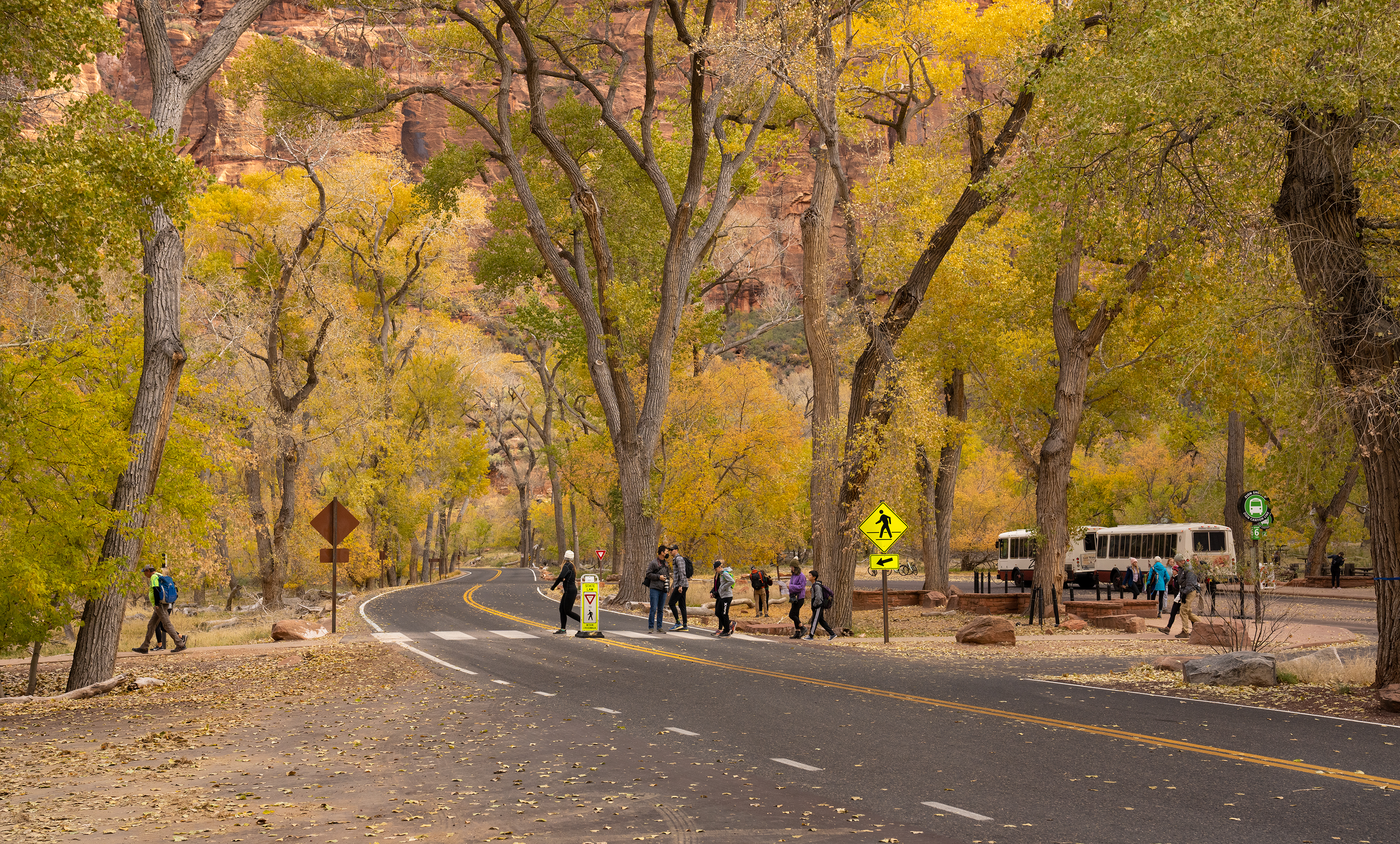
Early shuttle to The Grotto (stop 6)
Angels Landing is the day's big one, so be at the Zion Canyon Visitor Center for the first Zion Canyon Line bus at 7:00 AM (the time NPS lists from May 17 through Nov 28; check NPS for earlier spring dates). Walk in from Springdale; the Springdale Line's first bus is not until 8:00 AM. The shuttle is free and needs no reservation, but it follows a seasonal schedule (2026: Mar 7-Nov 28) with earlier last buses in fall: last bus from the visitor center is 7:00 PM through Sep 12, 6:00 PM Sep 13-Oct 24, and 5:00 PM Oct 25-Nov 28 (last out of Temple of Sinawava 8:15 / 7:15 / 6:15 PM). Check the link before you go.
- Time
- About 30 min from the visitor center to stop 6
Sources (2)
- NPS Data API places: The Zion Grotto · retrieved 2026-09-28
- Zion Canyon Shuttle System - NPS · retrieved 2026-09-28
Angels Landing (permit required) - or turn around at Scout Lookout
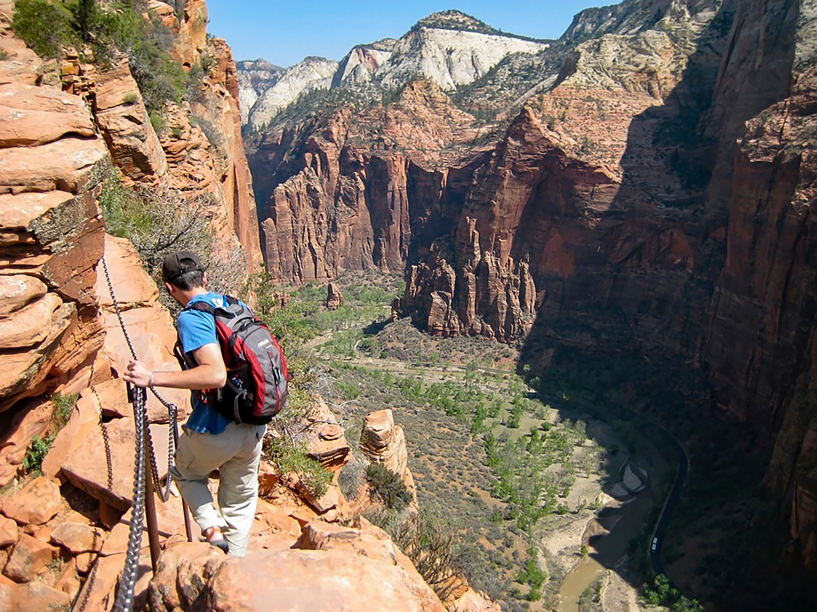
This is the hike Zion is famous for: the steep switchbacks of Walter's Wiggles, a cool break in Refrigerator Canyon, and then the chained ridge with drop-offs of up to 1,000 feet on both sides. Since April 2022 everyone continuing past Scout Lookout needs a permit from recreation.gov, and the permit lists the start time you must be at the Grotto. If you don't win a lottery spot, don't skip the hike: the West Rim Trail to Scout Lookout still delivers big canyon views and needs no permit. NPS's permit page puts Scout Lookout at about 2.25 miles and roughly 1,000 feet of climbing, and the full Angels Landing hike at 5.4 miles round trip with 1,488 feet of gain, usually around 4 hours.
Permits come from a seasonal lottery (applications cost $6 for up to six people; awarded permits are $3 per person) or a day-before lottery, entered between 12:01 AM and 3 PM MT the day prior. See the tips section for lottery windows.
- Distance
- 5.4 mi
- Elevation gain
- 1,488 ft
- Route
- Out and back
- Difficulty
- Strenuous
- Permit required
- Yes
- Dogs allowed
- No
- Trailhead
- The Grotto, shuttle stop 6
- Note
- Figures from the NPS permits page: 5.4 mi round trip, 1,488 ft gain; Scout Lookout about 2.25 mi (one way) and roughly 1,000 ft. NPS's separate West Rim trail page lists 1.9 mi / 1,187 ft to Scout Lookout, so treat trail-length figures as approximate. $6 application per group of up to 6; $3 per person if awarded.
- Fee usd
- 3
- Reservation needed
- Yes
Sources (3)
- NPS Data API thingstodo: Angels Landing (https://www.nps.gov/thingstodo/hike-angels-landing.htm) · retrieved 2026-09-28
- NPS Data API thingstodo: West Rim to Scout Lookout (https://www.nps.gov/thingstodo/hike-to-scout-lookout.htm) · retrieved 2026-09-28
- Angels Landing Permits & Hiking - NPS · retrieved 2026-09-28
Lunch at Zion Lodge's Red Rock Grill
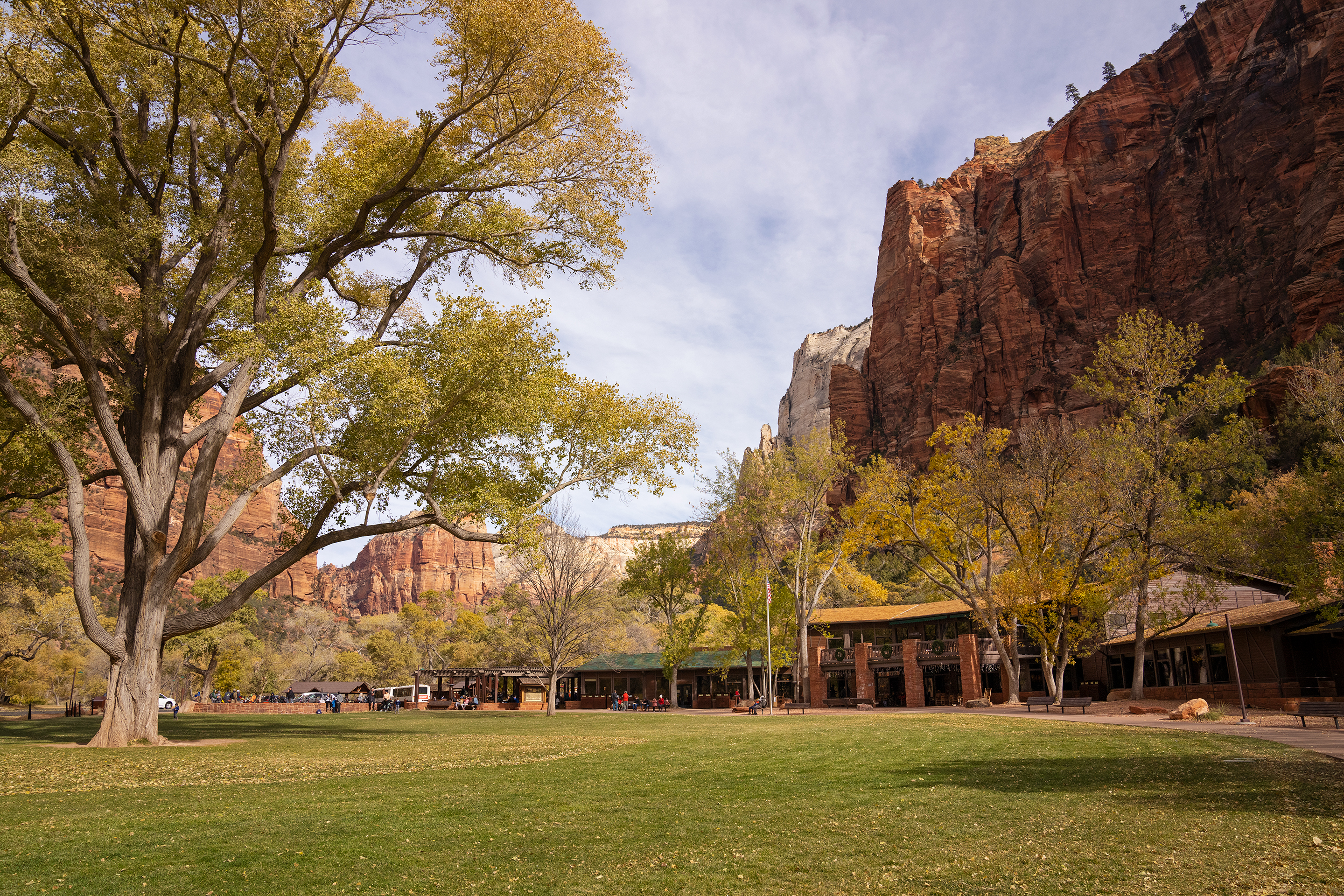
Zion Lodge is the only place inside the park to buy food. The Red Rock Grill serves American and Southwestern dishes and, per NPS, is open year-round. Castle Dome Cafe (coffee and quick meals) and the Beer Garden are seasonal, spring through fall. It's a short shuttle ride from The Grotto (stop 5), and the lawn out front is a good place to rest your legs. Confirm hours with the lodge. The lodge sits at shuttle stop 5 on Zion Canyon Scenic Drive; NPS lists only a mailing address (1 Zion Park Blvd), not a street number.
- Meal
- Lunch
- Cuisine
- American
- Price
- $$
- Reservation needed
- No
Sources (3)
- NPS Data API places: The Zion Lodge · retrieved 2026-09-28
- Lodging - Zion National Park (NPS) · retrieved 2026-09-28
- Zion Lodge official site · retrieved 2026-09-28
Kayenta Trail to Upper Emerald Pool
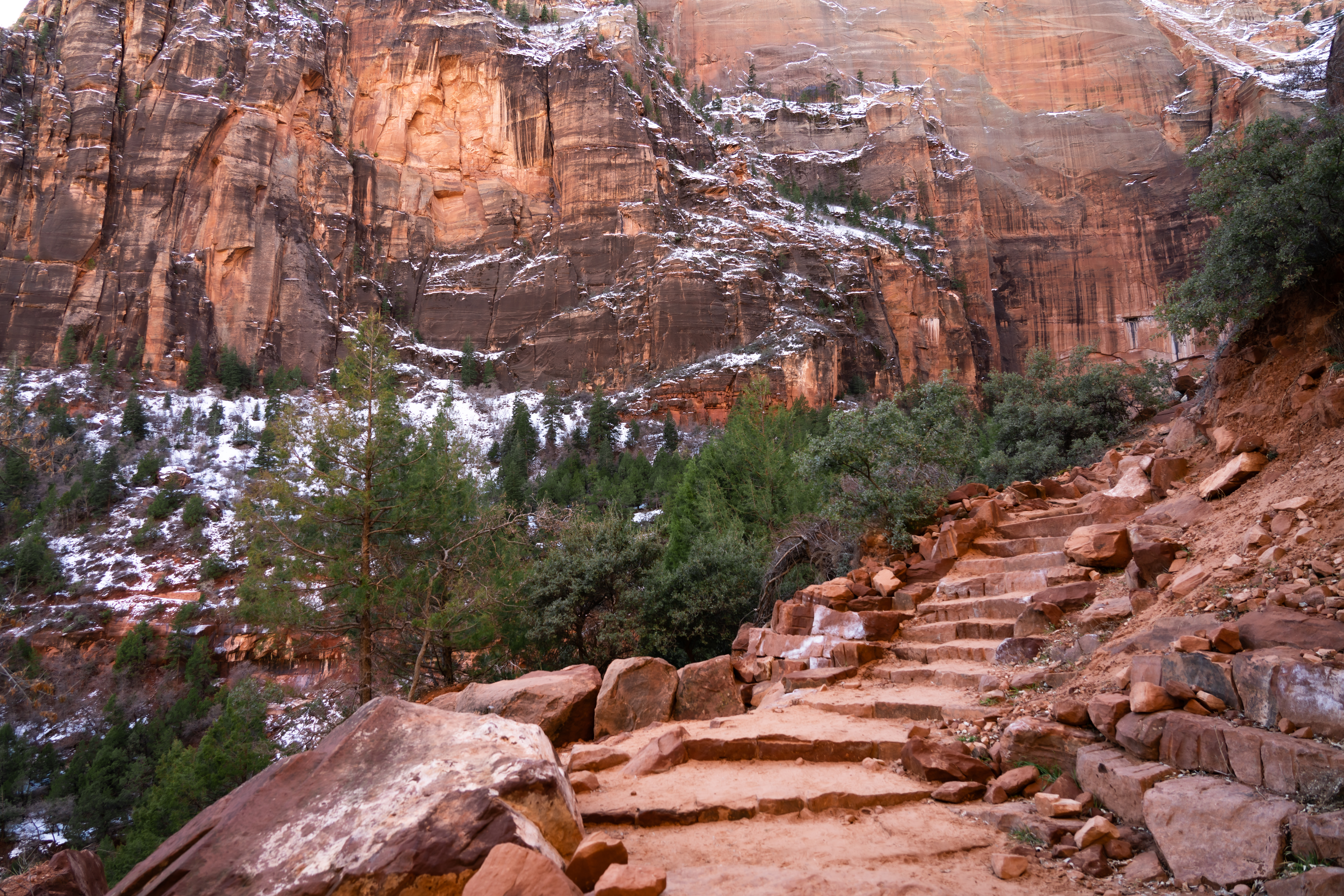
For a softer afternoon, take the Kayenta Trail from The Grotto along the Virgin River (0.9 miles one way per NPS) and continue on the Upper Emerald Pools Trail (0.3 miles one way per NPS) to a sandy pool beneath a big alcove wall where seasonal waterfalls slip down. Long drop-offs exist along the Kayenta Trail. Do not enter the pools; they are fragile and a key water source for wildlife. Waterfalls are seasonal and can be a trickle in dry months. Return the way you came, or drop down the Lower Emerald Pool Trail (0.6 miles one way from the Zion Lodge side per NPS) to the lodge and catch the shuttle from stop 5. This item's stats cover the one-way climb to the upper pool; the descent figures are not published as a combined total.
- Distance
- 1.2 mi
- Elevation gain
- 280 ft
- Route
- Point to point
- Difficulty
- Moderate
- Permit required
- No
- Dogs allowed
- No
- Trailhead
- The Grotto (stop 6) to Upper Emerald Pool, one way
- Note
- Derived total: Kayenta Trail 0.9 mi / +204 ft plus Upper Emerald Pools Trail 0.3 mi / +76 ft, both NPS one-way figures, summed. Return leg not included.
Sources (3)
- NPS Data API thingstodo: Lower Emerald Pool Trail (0.6 mi one way) · retrieved 2026-09-28
- NPS Data API thingstodo: Kayenta Trail (https://www.nps.gov/thingstodo/hike-kayenta-trail.htm) · retrieved 2026-09-28
- NPS Data API thingstodo: Upper Emerald Pools Trail (https://www.nps.gov/thingstodo/hike-upper-emerald-pools.htm) · retrieved 2026-09-28
Dinner at Bit & Spur Restaurant and Saloon
A Springdale institution with a western-saloon atmosphere. It opens daily at 5:00 PM (kitchen to 9:30 PM, late menu to 10:00 PM) and takes reservations online, which is worth doing in high season. It's a good place to celebrate a tough day on the trail.
- Meal
- Dinner
- Cuisine
- Southwestern / saloon
- Price
- $$$
- Reservation needed
- Yes
Sources (1)
- Bit & Spur official site · retrieved 2026-09-28
Into the Narrows
Spend the day in the river. Pick up rental gear, ride to Temple of Sinawava, and hike the bottom-up Narrows as far as you feel like going, then catch the evening light at the Court of the Patriarchs.
Pick up Narrows rental gear (ideally the evening before)
NPS doesn't rent gear, but private outfitters in Springdale do. Zion Outfitter is right at the park entrance, open daily 7 AM to 8 PM, and lets you reserve ahead or walk in. Get closed-toe shoes, a walking stick, and, in cooler months, waders or a drysuit. Blogs suggest picking up the night before so you can catch the earliest shuttle. Pricing was not published on the page we could retrieve.
- Time
- Pick up the night before if possible
- Reservation needed
- No
Sources (2)
- Where Are Those Morgans: Narrows day hike · retrieved 2026-09-28
- Zion Outfitter official site · retrieved 2026-09-28
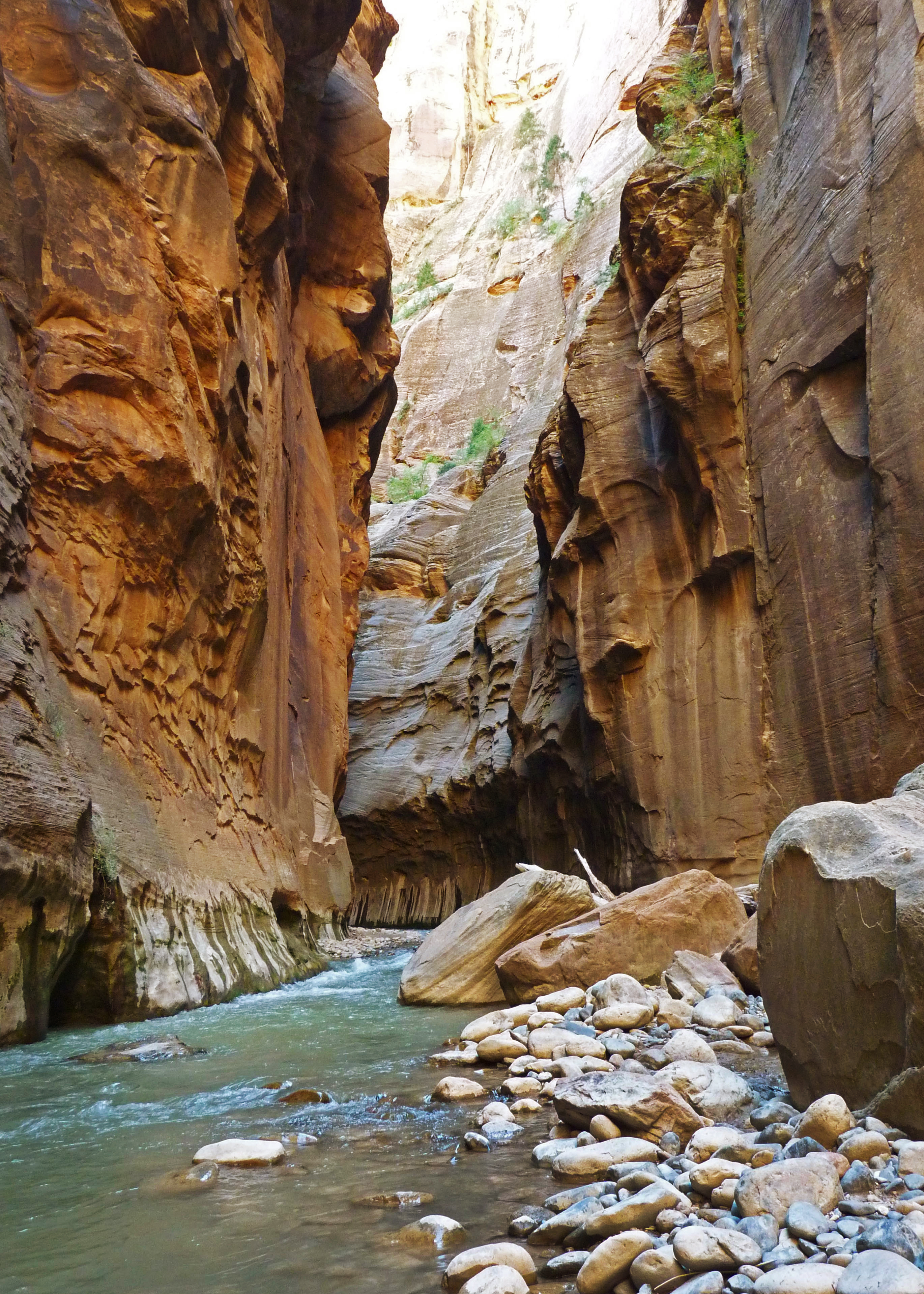
The Narrows, bottom-up
Ride to Temple of Sinawava (stop 9), walk the paved Riverside Walk for a mile, then step down the stairs and into the Virgin River. From here the river is the trail: wading, walking, sometimes swimming, between walls that squeeze in and stay shaded most of the day. There is no set destination, so go as far as you're comfortable and turn around while you still have energy; the full route to Big Spring is 9.4 miles round trip with about 334 feet of gain, and NPS says at least 60% of it is spent in the water. No permit is needed for this day hike.
Safety is the whole game. The Narrows closes when flow is too high (NPS's Narrows and conditions pages say 150 cfs; another NPS page says 140) or when flash flood warnings are issued, and the water can be cold. NPS also warns of toxic cyanobacteria in Zion's streams: do not submerge your head or drink the water. Fall is the most stable season, but check the conditions page and USGS gauge that morning.
- Distance
- 9.4 mi
- Elevation gain
- 334 ft
- Route
- Out and back
- Difficulty
- Strenuous
- Permit required
- No
- Dogs allowed
- No
- Trailhead
- Temple of Sinawava, shuttle stop 9
- Note
- Distance is to Big Spring; most visitors turn around earlier. Riverside Walk: 1 mi one way, paved, easy.
Sources (4)
- NPS Data API thingstodo: The Narrows (https://www.nps.gov/thingstodo/hike-the-narrows.htm) · retrieved 2026-09-28
- Where Are Those Morgans: Narrows day hike · retrieved 2026-09-28
- The Narrows from the Bottom Up - NPS · retrieved 2026-09-28
- The Narrows - Zion NP · retrieved 2026-09-28
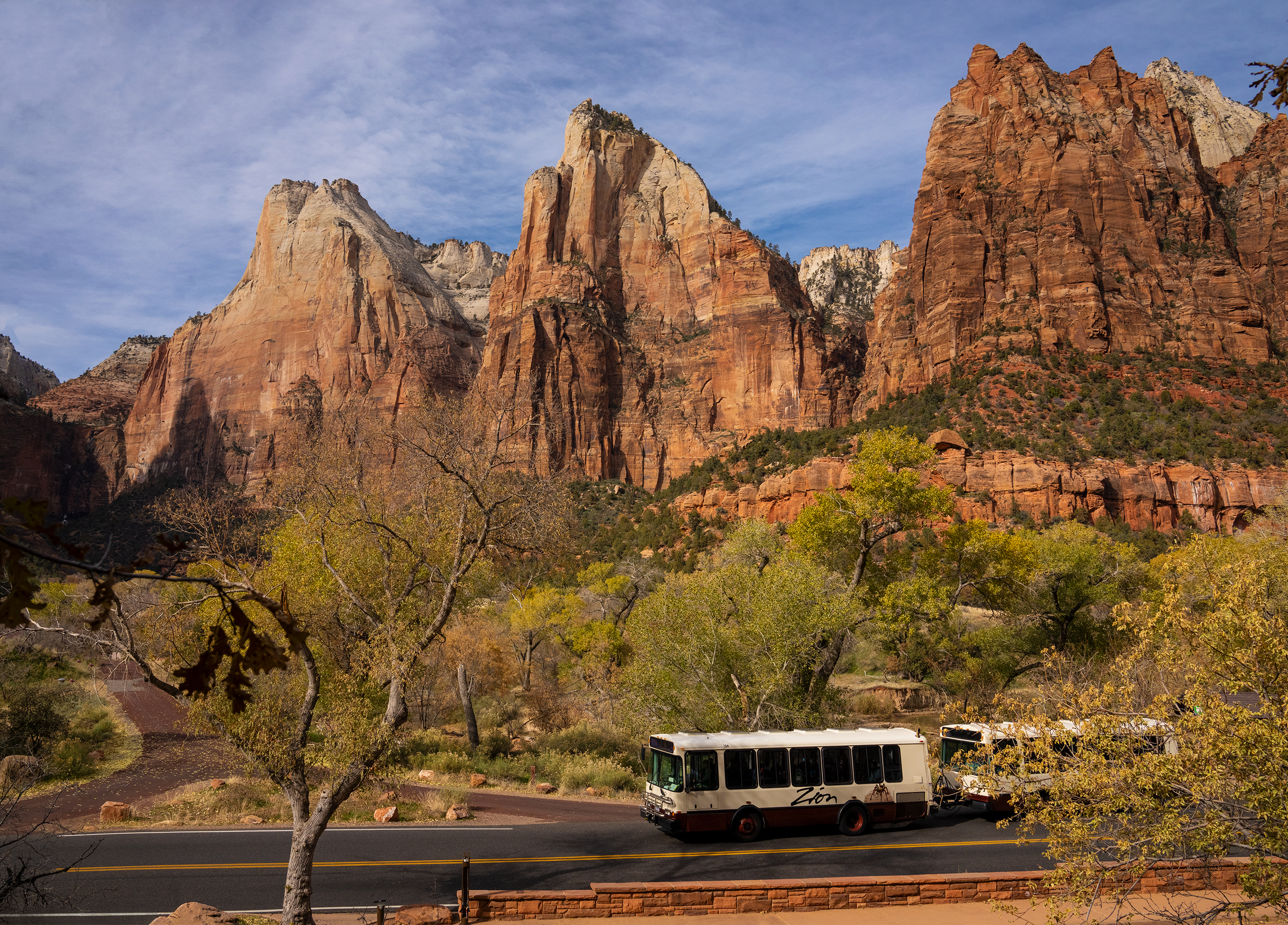
Court of the Patriarchs (shuttle stop 4)
Back on the shuttle, hop off at stop 4 for a very short but steep walk to a viewpoint of three sandstone peaks named the Patriarchs: Abraham, Isaac and Jacob, named in 1916 per NPS. Mount Moroni and The Sentinel are also visible. Mind the last bus of the season: from the visitor center it leaves at 7:00 PM through Sep 12, 6:00 PM Sep 13-Oct 24 and 5:00 PM Oct 25-Nov 28, 2026, and NPS warns that missing it means a long walk out.
- Time
- About 30 minutes
Sources (3)
- NPS Data API places: Court of the Patriarchs · retrieved 2026-09-28
- Court of the Patriarchs - NPS · retrieved 2026-09-28
- Zion Canyon Shuttle System - NPS · retrieved 2026-09-28
Dinner: your pick in Springdale
After the Narrows you will want a big meal. Both the Zion Canyon Brew Pub (open daily for lunch and dinner) and Bit & Spur (opens 5:00 PM daily; reserve online) are listed in this trip. Repeat a favorite or explore other spots along Zion Park Boulevard.
Sources (1)
- Zion Canyon Brewery official site · retrieved 2026-09-28
Kolob Canyons and a quiet goodbye
Eat breakfast in Springdale and drive an hour to Kolob Canyons, the quiet northwestern section of the park. Visit the visitor center, stroll the Timber Creek Overlook trail, picnic, and continue on I-15.
Breakfast and picnic supplies in Springdale
Eat before you leave and stock a picnic: the Kolob Canyons section has no food service per NPS's visitor center listing (only a bookstore), and the only place inside the park to buy food is Zion Lodge in the main canyon. Water is available at the Kolob Canyons Visitor Center.
Sources (1)
- Lodging - Zion National Park (NPS) · retrieved 2026-09-28
Drive to Kolob Canyons (Exit 40, I-15)
Kolob Canyons is a separate, quieter district at Exit 40 on I-15, 40 miles from Zion Canyon and 17 miles south of Cedar City per NPS; allow about an hour from Springdale. Stop at the visitor center to pay or show your pass. The five-mile scenic road climbs to the trailheads under red 2,000-foot cliffs. Kolob sits right on I-15, so it also works as the first leg of a drive home or onward.
- Time
- About 1 hour from Springdale; 5-mile scenic road
Sources (5)
- NPS Data API places: Kolob Canyons Visitor Center · retrieved 2026-09-28
- NPS Data API visitorcenters · retrieved 2026-09-28
- OpenStreetMap geocode (postal code 84757) · retrieved 2026-09-28
- Directions & Transportation - Zion NP (coordinates 37.453462, -113.225640) · retrieved 2026-09-28
- Kolob Canyons - NPS · retrieved 2026-09-28
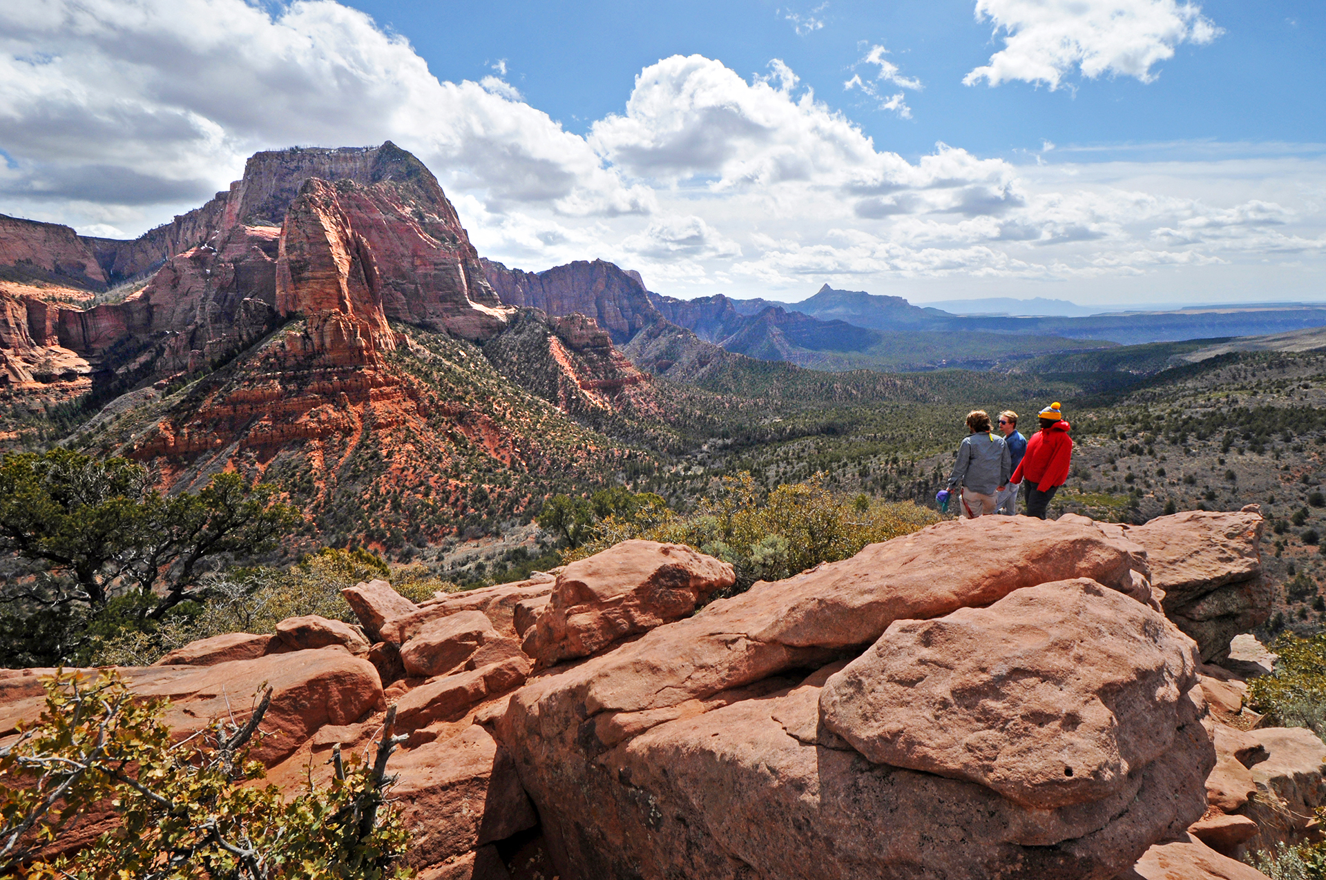
Timber Creek Overlook
At the very end of Kolob Canyons Road, this easy ridge walk is short (0.6 mile one way) and rewards you with views across Timber Creek, Kolob Terrace and the Pine Valley Mountains. On a clear day you may spot Mount Trumbull about 100 miles away. It is the only Kolob trail that allows groups of 12 or more, and in spring and early summer it's carpeted in wildflowers. A picnic table area is nearby for lunch.
- Distance
- 1.2 mi
- Elevation gain
- 117 ft
- Route
- Out and back
- Difficulty
- Easy
- Permit required
- No
- Dogs allowed
- No
- Trailhead
- End of Kolob Canyons Road
- Note
- Distance is round trip (0.6 mi each way per NPS); elevation gain is the NPS one-way figure (117 ft; NPS lists 103 ft loss), so the round-trip climb is somewhat higher.
Sources (1)
Picnic lunch near Timber Creek Overlook, then drive out
Eat the lunch you packed at the small picnic area a short distance from the Timber Creek Overlook trailhead (NPS gives no separate coordinates for it), top off water at the visitor center on your way down, and head back to I-15. If you have a full day and legs to spare, swap the overlook for a longer wilderness hike (see options below).
- Time
- 1 hour
Sources (1)
Where to stay
Zion Lodge (the only in-park lodging)
Built around a lawn beneath red cliffs at shuttle stop 5, Zion Lodge is the only lodging inside the park. NPS lists 76 hotel rooms, 6 suites and 40 historic cabins. You can walk to the Emerald Pools trailheads, and you skip the morning shuttle from town. Red Rock Grill is open year-round; Castle Dome Cafe and the Beer Garden are seasonal (spring through fall). The lodge sits at shuttle stop 5; neither the lodge's site nor NPS publishes a street number for it (NPS lists a mailing address of 1 Zion Park Blvd). Rates are on the lodge's booking page and it sells out early.
- Type
- Lodge
- Location
- Inside the park
- Booking
- Book / details
- Reservation notes
- Rates not verified; check the booking page. Book many months ahead for peak seasons.
Sources (3)
- NPS Data API places: The Zion Lodge · retrieved 2026-09-28
- Lodging - Zion National Park (NPS) · retrieved 2026-09-28
- Zion Lodge official site · retrieved 2026-09-28
Desert Pearl Inn
A riverside inn on Springdale's main road with king and double-queen rooms and a River's Edge Suite, private balconies or terraces, a pool and hot tub, e-bike rentals, and the CAMP ZION restaurant on site. Reclaimed railroad-trestle wood is used in construction. A good alternative if Cable Mountain is full.
- Type
- Hotel
- Location
- Outside the park
- Reservation notes
- Rates not published on the retrieved page; check the booking engine.
Sources (1)
- Desert Pearl Inn official site · retrieved 2026-09-28
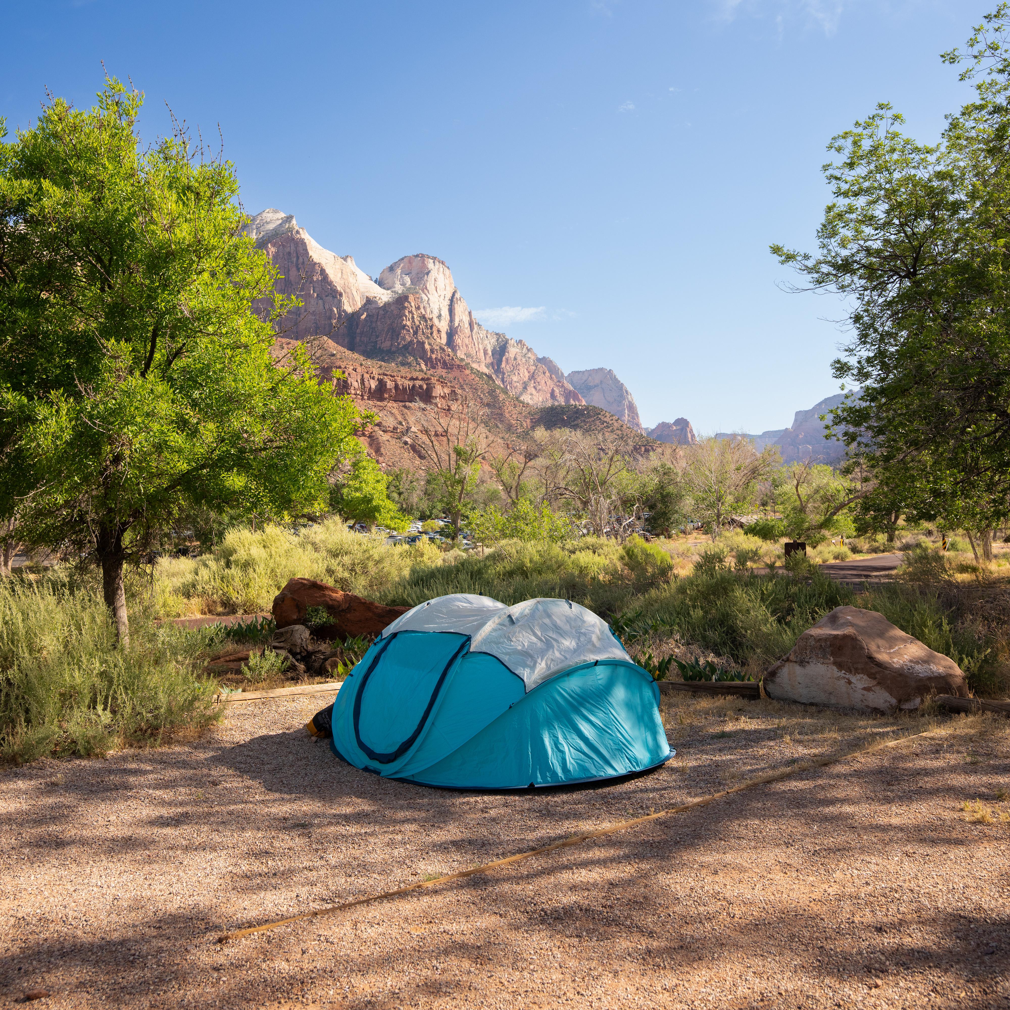
Watchman Campground (in park, budget)
The most convenient camping in Zion, just inside the south entrance near the visitor center. All sites require reservations through recreation.gov, bookable up to six months ahead, and it fills nearly every night in peak season. Non-electric sites are $35 and electric sites $45 per night as of the NPS listing. Fire rings are the only place fires are allowed, and fire restrictions may apply.
- Type
- Campground
- Location
- Inside the park
- Price per night
- $35 to $45 (as of 2026-09-28)
- Booking
- Book / details
- Reservation notes
- Reservations required; up to 6 months ahead.
Sources (1)
- NPS Data API campgrounds · retrieved 2026-09-28
Where to eat
More options
Alternative for Day 4: La Verkin Creek Trail to Kolob Arch
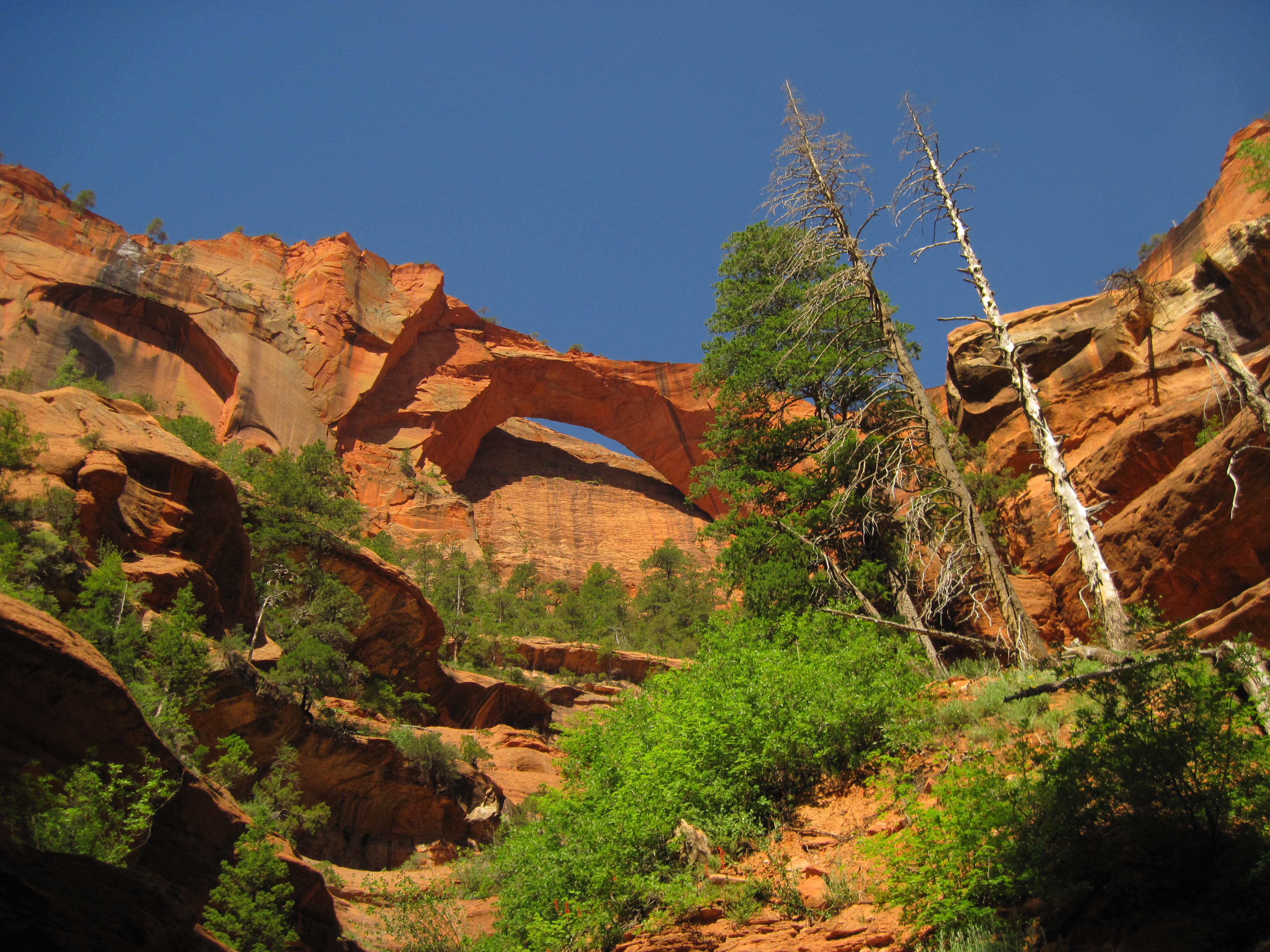
For a full wilderness day in Kolob, this 14-mile round-trip leads from Lee Pass past Timber Creek and La Verkin Creek to a viewpoint of Kolob Arch, which NPS lists as 287 feet wide, one of the world's largest natural arches. Expect solitude, sandy uneven terrain and water crossings. NPS gives it 7-9 hours and rates it strenuous; carry plenty of water, since there is none at the trailhead. Wilderness group size limits apply.
- Distance
- 14 mi
- Elevation gain
- 1,037 ft
- Route
- Out and back
- Difficulty
- Strenuous
- Permit required
- No
- Dogs allowed
- No
- Trailhead
- Lee Pass Trailhead
Sources (1)
Map of places
- Cable Mountain Lodge (opens Google Maps in a new tab) Day 1
- Zion Canyon Visitor Center (opens Google Maps in a new tab) Day 1
- Canyon Overlook Trailhead (opens Google Maps in a new tab) Day 1
- Pa'rus Trailhead (Zion Canyon Visitor Center end) (opens Google Maps in a new tab) Day 1
- Zion Canyon Brew Pub (opens Google Maps in a new tab) Day 1
- The Grotto (Zion Canyon Shuttle stop 6) (opens Google Maps in a new tab) Day 2
- West Rim Trailhead (Angels Landing route) (opens Google Maps in a new tab) Day 2
- Zion Lodge (opens Google Maps in a new tab) Day 2
- Kayenta Trailhead (opens Google Maps in a new tab) Day 2
- Bit & Spur Restaurant and Saloon (opens Google Maps in a new tab) Day 2
- Zion Outfitter (opens Google Maps in a new tab) Day 3
- Riverside Walk Trailhead / Temple of Sinawava (opens Google Maps in a new tab) Day 3
- Court of the Patriarchs (opens Google Maps in a new tab) Day 3
- Kolob Canyons Visitor Center (opens Google Maps in a new tab) Day 4
- Timber Creek Overlook Trailhead (opens Google Maps in a new tab) Day 4
- Zion Lodge (opens Google Maps in a new tab) Option
- Desert Pearl Inn (opens Google Maps in a new tab) Option
- Watchman Campground (opens Google Maps in a new tab) Option
- Lee Pass Trailhead (opens Google Maps in a new tab) Option
- Zion Canyon Brew Pub (opens Google Maps in a new tab) Option
Good to know
Permits and reservations
- Angels Landing needs a permit from recreation.gov (seasonal lottery plus a day-before lottery). Application: $6 per group of up to six; permit: $3 per person. NPS's 2026 windows: Mar 1-May 31 hikes (lottery Feb 13-25); Jun 1-Aug 31 (Apr 1-20); Sep 1-Nov 30 (Jul 1-20); Dec 1-Feb 28, 2027 (Oct 1-20, permits issued Oct 25). Expect a similar pattern in later years but confirm on NPS. Day-before lottery: apply 12:01 AM-3 PM MT the day before. Hikers turning around at Scout Lookout need no permit.
- The Narrows bottom-up needs no permit; the top-down route and Orderville Canyon beyond Big Spring do.
- Campgrounds (Watchman, South, Lava Point) are booked through recreation.gov.
Fees, shuttle and parking
- Entrance: $35 per private vehicle, $30 motorcycle, $20 per person on foot or bike (age 16+); valid 7 days (NPS, as of 2026-09-28). Non-US residents age 16+ pay an additional $100 per person nonresident fee unless they hold an annual or America the Beautiful pass. Keep your receipt for the Kolob Canyons entrance station.
- The Zion Canyon and Springdale shuttles are free and need no reservation. Season: Mar 7-Nov 28, 2026; 2027 dates not yet published. Zion Canyon Line, per the NPS 2026 schedule (as of 2026-09-28): first bus leaves the visitor center at 7:00 AM from May 17 through Nov 28. Last bus leaving the visitor center / last bus leaving Temple of Sinawava: May 17-Sep 12, 7:00 PM / 8:15 PM; Sep 13-Oct 24, 6:00 PM / 7:15 PM; Oct 25-Nov 28, 5:00 PM / 6:15 PM. No service Nov 29-Dec 25; limited service Dec 26-Jan 2 (8:00 AM-4:30 PM from the visitor center). The Mar 7-May 16 hours are not on the current page, so check NPS. Springdale Line first bus 8:00 AM from Hotel De Novo, last bus 8:00 PM (to Sep 12), 7:00 PM (Sep 13-Oct 24), 6:00 PM (Oct 25-Nov 28). NPS warns that missing the last bus means a long walk out. When the shuttle is not running, drive yourself to the trailheads.
- Parking in the canyon often fills early in the day (NPS says lots often fill early; the visitor center lot commonly fills by about 9 AM per NPS crowd guidance), so walk in from Springdale.
Safety
- The Narrows closes when the river flows too high (NPS's Narrows and conditions pages say 150 cfs; another NPS page says 140) and during flash flood warnings. Check the USGS gauge and NPS conditions that morning.
- Toxic cyanobacteria advisory: do not submerge your head in, or drink, instream water.
Season
- Best: March-May and September-November. Summer often exceeds 100 F; spring runoff and monsoon can close the Narrows; winter can be icy on the Emerald Pools trails and the Kolob road can close for snow.
- Kolob Canyons is at I-15 Exit 40, 40 miles from Zion Canyon per NPS.
Current conditions (as of 2026-09-28, from NPS; re-check before your trip)
- Watchman Trail closed pending repairs (NPS alert).
- Hidden Canyon closed; East Rim Trail partially closed; Observation Point not accessible from Zion Canyon (NPS conditions page).
- Fire restrictions in effect: campfires only in designated rings at Watchman, South and Lava Point campgrounds.
- Large-vehicle restrictions on the Zion-Mount Carmel Highway (NPS alert).
- Zion Canyon Visitor Center is on fall/winter/spring hours (8 AM-5 PM) starting Sept 13, 2026.
Want live alerts and up-to-date info?
Conditions change fast. Create an account on the DriftKin app to get live park alerts, closures and information for your trip.
Sources
- OpenStreetMap geocode of address (coordinates) retrieved 2026-09-28
- Cable Mountain Lodge official site retrieved 2026-09-28
- NPS Data API parks (entrance fees: private vehicle $35) retrieved 2026-09-28
- NPS Data API visitorcenters retrieved 2026-09-28
- Current Conditions - Zion NP retrieved 2026-09-28
- NPS Data API thingstodo: Canyon Overlook (https://www.nps.gov/thingstodo/hike-canyon-overlook.htm) retrieved 2026-09-28
- NPS Data API thingstodo: Stargazing in Zion (https://www.nps.gov/thingstodo/stargazing-in-zion.htm) retrieved 2026-09-28
- NPS Data API thingstodo: Pa'rus Trail (https://www.nps.gov/thingstodo/hike-pa-rus-trail.htm) retrieved 2026-09-28
- Bites, Hikes & Other Likes: Four Days in Zion retrieved 2026-09-28
- Zion Canyon Brewery official site retrieved 2026-09-28
- NPS Data API places: The Zion Grotto retrieved 2026-09-28
- Zion Canyon Shuttle System - NPS retrieved 2026-09-28
- NPS Data API thingstodo: Angels Landing (https://www.nps.gov/thingstodo/hike-angels-landing.htm) retrieved 2026-09-28
- NPS Data API thingstodo: West Rim to Scout Lookout (https://www.nps.gov/thingstodo/hike-to-scout-lookout.htm) retrieved 2026-09-28
- Angels Landing Permits & Hiking - NPS retrieved 2026-09-28
- NPS Data API places: The Zion Lodge retrieved 2026-09-28
- Lodging - Zion National Park (NPS) retrieved 2026-09-28
- Zion Lodge official site retrieved 2026-09-28
- NPS Data API thingstodo: Lower Emerald Pool Trail (0.6 mi one way) retrieved 2026-09-28
- NPS Data API thingstodo: Kayenta Trail (https://www.nps.gov/thingstodo/hike-kayenta-trail.htm) retrieved 2026-09-28
- NPS Data API thingstodo: Upper Emerald Pools Trail (https://www.nps.gov/thingstodo/hike-upper-emerald-pools.htm) retrieved 2026-09-28
- Bit & Spur official site retrieved 2026-09-28
- Where Are Those Morgans: Narrows day hike retrieved 2026-09-28
- Zion Outfitter official site retrieved 2026-09-28
- NPS Data API thingstodo: The Narrows (https://www.nps.gov/thingstodo/hike-the-narrows.htm) retrieved 2026-09-28
- The Narrows from the Bottom Up - NPS retrieved 2026-09-28
- The Narrows - Zion NP retrieved 2026-09-28
- NPS Data API places: Court of the Patriarchs retrieved 2026-09-28
- Court of the Patriarchs - NPS retrieved 2026-09-28
- NPS Data API places: Kolob Canyons Visitor Center retrieved 2026-09-28
- OpenStreetMap geocode (postal code 84757) retrieved 2026-09-28
- Directions & Transportation - Zion NP (coordinates 37.453462, -113.225640) retrieved 2026-09-28
- Kolob Canyons - NPS retrieved 2026-09-28
- NPS Data API thingstodo: Timber Creek Overlook (https://www.nps.gov/thingstodo/timber-creek-overlook.htm) retrieved 2026-09-28
- Desert Pearl Inn official site retrieved 2026-09-28
- NPS Data API campgrounds retrieved 2026-09-28
- NPS Data API thingstodo: La Verkin Creek Trail to Kolob Arch (https://www.nps.gov/thingstodo/la-verkin-creek-trail-to-kolob-arch.htm) retrieved 2026-09-28
Hours, fees, prices and closures change. Confirm details with the park or business before you go.