Yosemite: 4 Days of Valley Granite and High Sierra Domes
Three days among the granite giants of the Valley, one day above 8,000 feet on Tioga Road
- Length
- 4 days
- Difficulty
- Moderate
- Best months
- Jun–Jul, Sep–Oct
- Budget
- $$
A four-day loop pairing Yosemite Valley's icons (Tunnel View, the Yosemite Falls Trail, Happy Isles and the Merced River, Sentinel Bridge) with a full day on Tioga Road for Tuolumne Meadows, Lembert Dome, Tenaya Lake and Olmsted Point. Waterfalls are a spring and early-summer show; this plan works on views and hikes in late season, when Yosemite Falls is often dry. Written for arrival via Wawona Road (CA-41). The $$ budget tier is an estimate: $35 per vehicle entry and $36 campsites are NPS figures, but Hospitality lodging rates are only shown in its booking system.
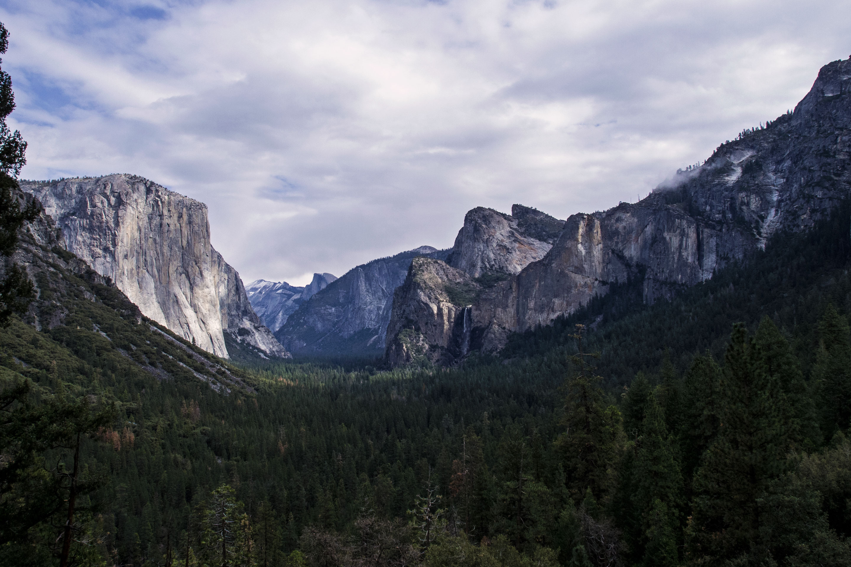
- Tunnel View's classic panorama of El Capitan, Half Dome and Bridalveil Fall
- Yosemite Falls Trail to Columbia Rock, with the option to go to the top (falls flow best in spring)
- Happy Isles to Vernal Fall Footbridge along the Merced River
- Sentinel Bridge Half Dome reflections at dusk
- Full day on Tioga Road: Tuolumne Meadows, Lembert Dome, Tenaya Lake, Olmsted Point
The story
Yosemite hits you before you have even parked. You come through the tunnel on Wawona Road, the trees open up, and there is El Capitan on the left, Half Dome ahead and Bridalveil Fall on the right, exactly as every postcard promised. That is the trick of this park: the famous parts really are that good, and the challenge is not finding them but seeing them without being swallowed by the crowd.
This four-day plan is built around that problem. The first three days live in Yosemite Valley, but each is shaped around a different way of experiencing it. Day one is the gentle introduction: viewpoints, short paved walks, golden light on Sentinel Bridge and a first night at Yosemite Valley Lodge (written for arrival via Wawona Road, CA-41). Day two is the big climb, the switchbacks of the Yosemite Falls Trail, rewarded with a long look across the Valley, followed by museums and an Ahwahnee dinner. Day three follows the Merced River toward Vernal Fall from Happy Isles, then a slow afternoon on two wheels.
On day four you trade granite walls for granite domes. Tioga Road, the park's high road, carries you up to Tuolumne Meadows at about 8,600 feet, where a subalpine meadow lies under bald domes and the air is noticeably crisper. You hike Lembert Dome, picnic at Tenaya Lake and wind back down with a stop at Olmsted Point as the light softens.
A note on timing. Yosemite is seasonal in two senses: water and road access. The waterfalls run biggest in spring; NPS says some, including Yosemite Falls, are often only a trickle or dry by August, while Bridalveil Fall flows all year (peak in May) and Vernal Fall narrows through summer. So in September and October, expect this trip to be about granite, meadows and light rather than thundering water, and treat any running fall as a bonus. Tioga Road is normally open from late May or early June until the first big snow, sometime in November, so check conditions before committing day four. Early starts help everywhere in the Valley, and the free shuttle lets you park once and forget the car.
Book lodging far ahead, carry more water than seems reasonable, and leave room for the stops that turn out to be the ones you remember.
Day by day
Arrival: Tunnel View, waterfalls and Half Dome at dusk
Written for arrival via Wawona Road (CA-41): Tunnel View is your first stop. (Arriving on CA-140 you pass Valley View and Bridalveil first, so start with Bridalveil and El Capitan Meadow and save Tunnel View for later.) Then stretch your legs at Bridalveil Fall, gaze up at El Capitan from its meadow, check into Valley Lodge, and walk Lower Yosemite Fall and Cook's Meadow as the light turns golden.
Tunnel View: your first look at the Valley
Come in from the south on Wawona Road and the tunnel spits you out onto the overlook everyone has seen on a postcard: El Capitan on the left, Half Dome in the distance, Bridalveil Fall on the right, and a sea of conifers in between. NPS calls it spectacular at sunset or after a storm clears. Even at midday it earns the stop, and the pullout is cheap on time. Arrive early or late to dodge the bus crowd; trip reports describe it as constantly packed near sunset.
- Time
- 20-30 minutes
- Best time
- Sunset or just after a storm clears
- Fee
- Free
Sources (2)
- Tunnel View - NPS · retrieved 2026-09-28
- Ultimate Yosemite Itinerary - Well Planned Journey · retrieved 2026-09-28
Bridalveil Fall Trail
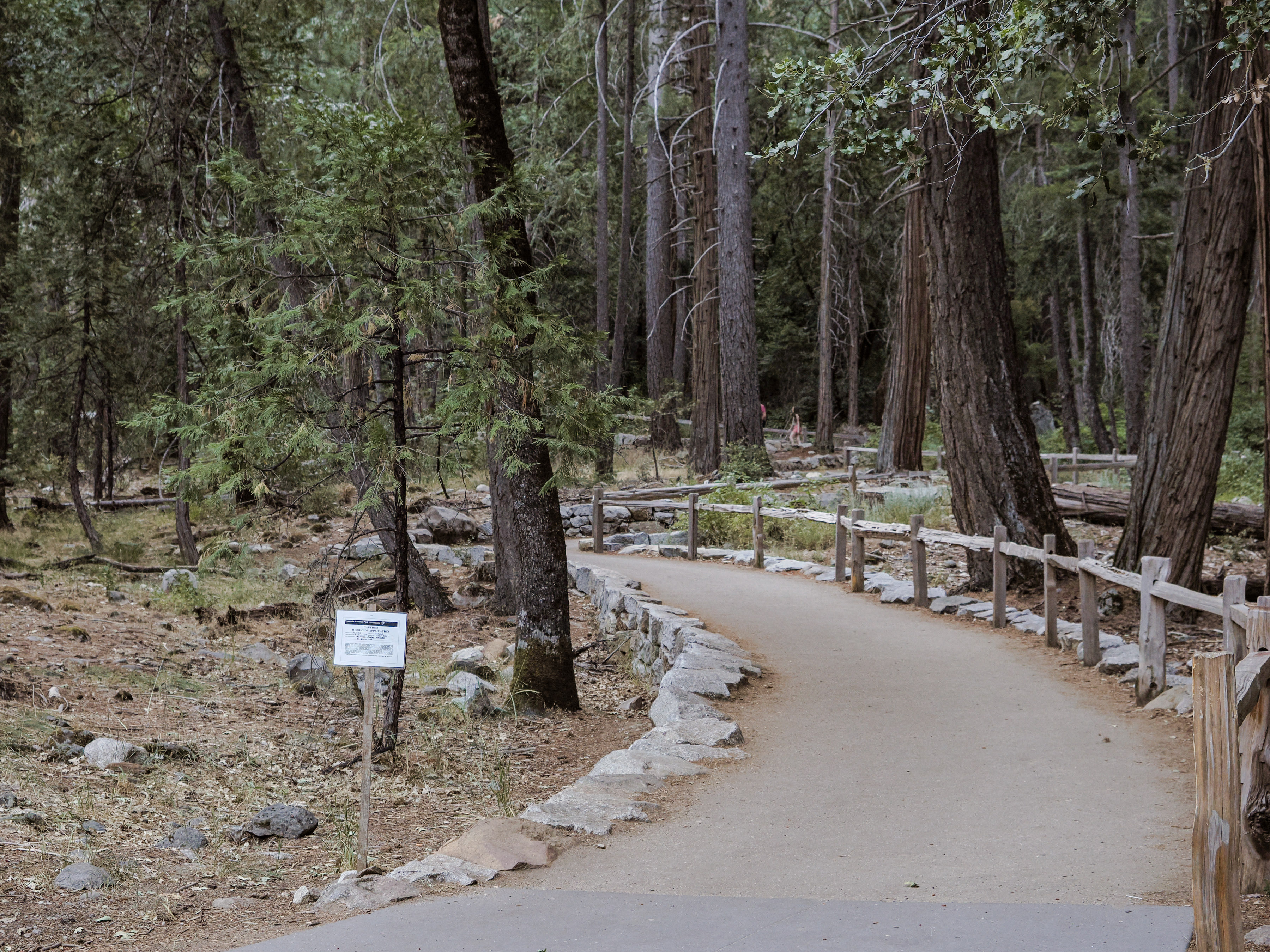
A short paved path to the base viewing area of the fall that Tunnel View teased. The mist can soak you when flow is strong, and it thins to a ribbon later in the season. This is the perfect leg-stretcher before the Valley proper.
- Distance
- 0.5 mi
- Elevation gain
- 80 ft
- Route
- Out and back
- Difficulty
- Easy
- Trailhead
- Bridalveil Fall parking area
Sources (2)
- Bridalveil Fall Trailhead - NPS · retrieved 2026-09-28
- Yosemite Valley Day Hikes - NPS · retrieved 2026-09-28
El Capitan Meadow
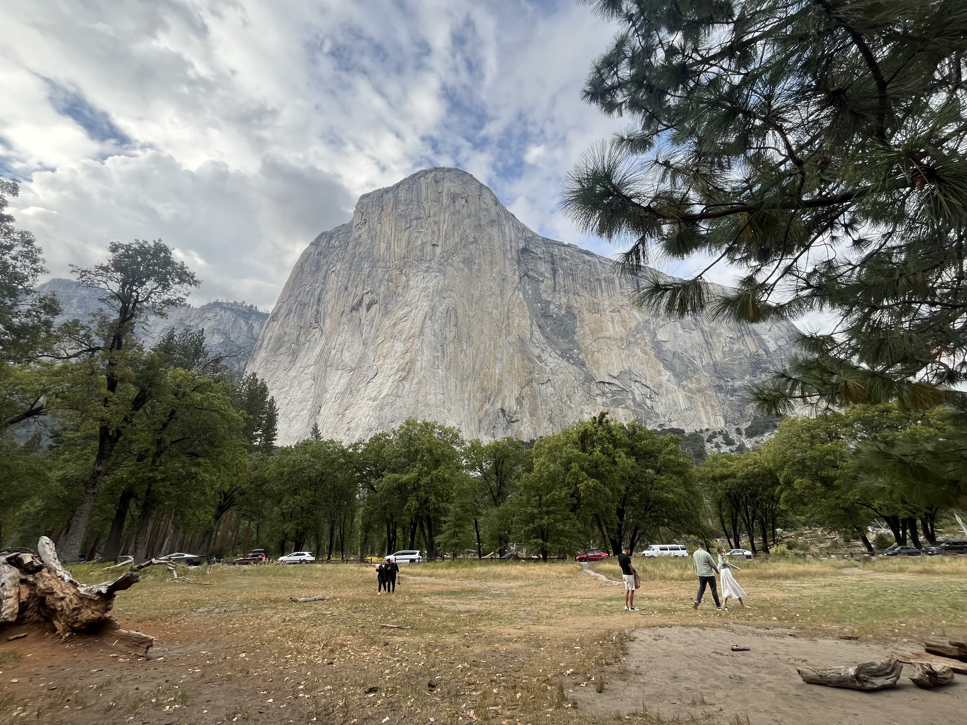
Pull off along Northside Drive, cross the road, and stand in the grass looking straight up 3,000 feet of granite. On clear days you can often pick out climbers on the face with binoculars (bring them). It is a low-effort, high-payoff stop that sets the scale for everything else.
- Time
- 20-40 minutes
- Fee
- Free
Sources (1)
- El Capitan Meadow - NPS · retrieved 2026-09-28
Lunch at Base Camp Eatery, Yosemite Valley Lodge
Base Camp Eatery is Yosemite Hospitality's fast-casual spot at the lodge (breakfast, lunch and dinner listed). It is quick, near your check-in and a good reset before the afternoon on foot. Check current hours and menu at the lodge when you arrive.
- Meal
- Lunch
- Cuisine
- Fast casual American
- Reservation needed
- No
Sources (1)
- Yosemite dining - Yosemite Hospitality · retrieved 2026-09-28
Check in at Yosemite Valley Lodge
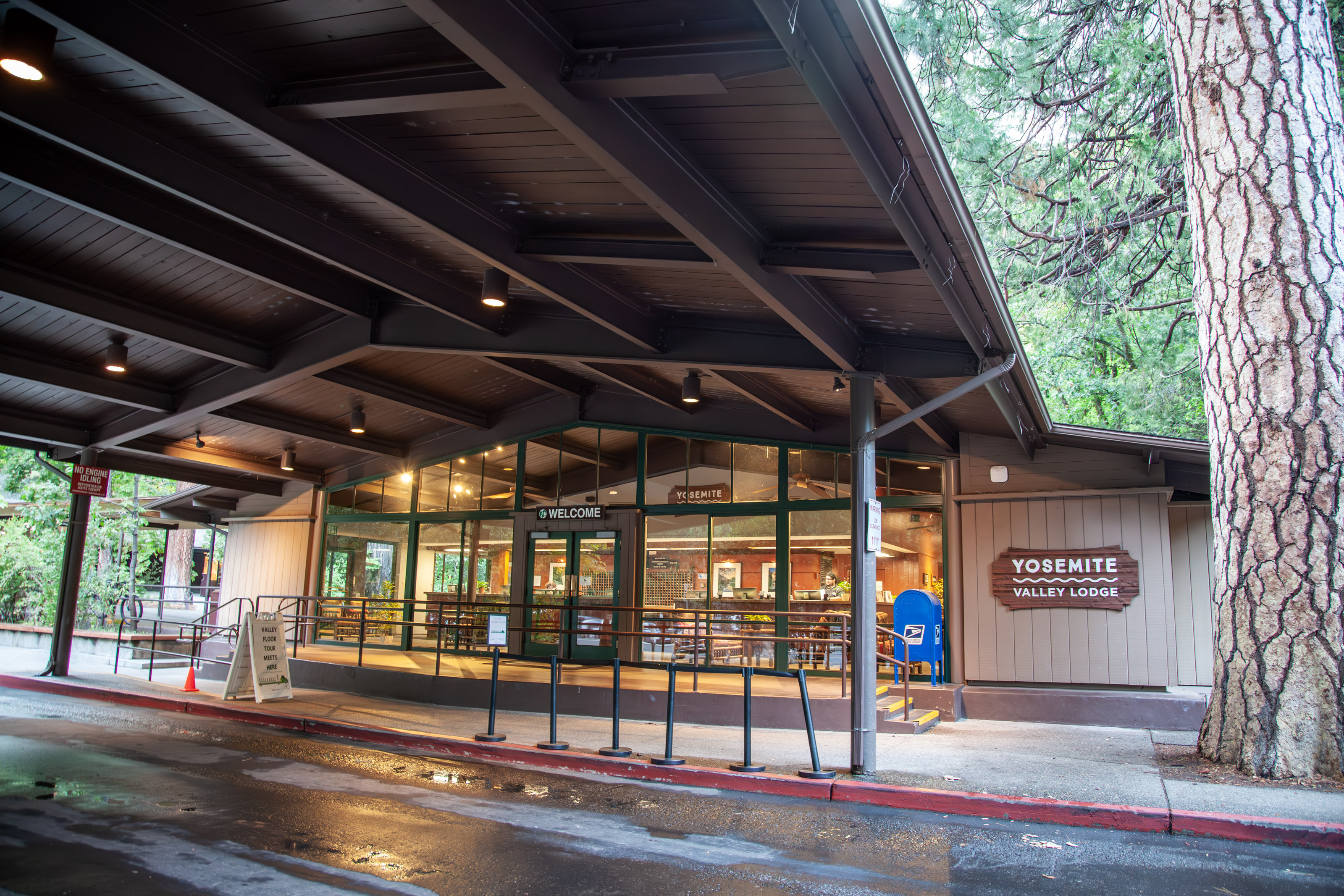
Our recommended base. The lodge sits a short walk from Lower Yosemite Fall and near the Upper Yosemite Fall trailhead, is on the Valley shuttle route, and is open year-round. Rooms come as traditional, family, bunk or ADA. Check-in is 4 pm and check-out 11 am, so drop the bags and go.
- Type
- Lodge
- Location
- Inside the park
- Booking
- Book / details
- Reservation notes
- Book through Yosemite Hospitality, (888) 413-8869; nightly rates are only shown in the booking system. Check-in 4 pm, check-out 11 am.
Sources (1)
- Yosemite Valley Lodge - Yosemite Hospitality · retrieved 2026-09-28
Lower Yosemite Fall loop
An easy paved loop that gets you to the base of the tallest waterfall in North America's most famous Valley. Yosemite Falls is seasonal: it peaks in spring and is often only a trickle or dry by late summer and fall (NPS), so later in the season the sheer granite wall and the light are the draw. Golden late-afternoon light makes this a wonderful first-evening walk.
- Distance
- 1 mi
- Elevation gain
- 50 ft
- Route
- Loop
- Difficulty
- Easy
- Trailhead
- Lower Yosemite Fall Trailhead (shuttle stop 6)
Sources (2)
- Yosemite Valley Day Hikes - NPS · retrieved 2026-09-28
- Yosemite Falls Trail - NPS · retrieved 2026-09-28
Cook's Meadow Loop and Sentinel Bridge at dusk
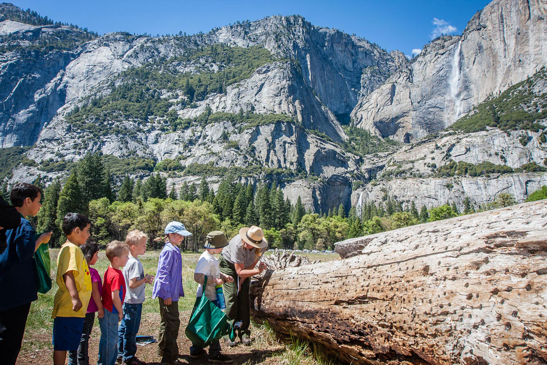
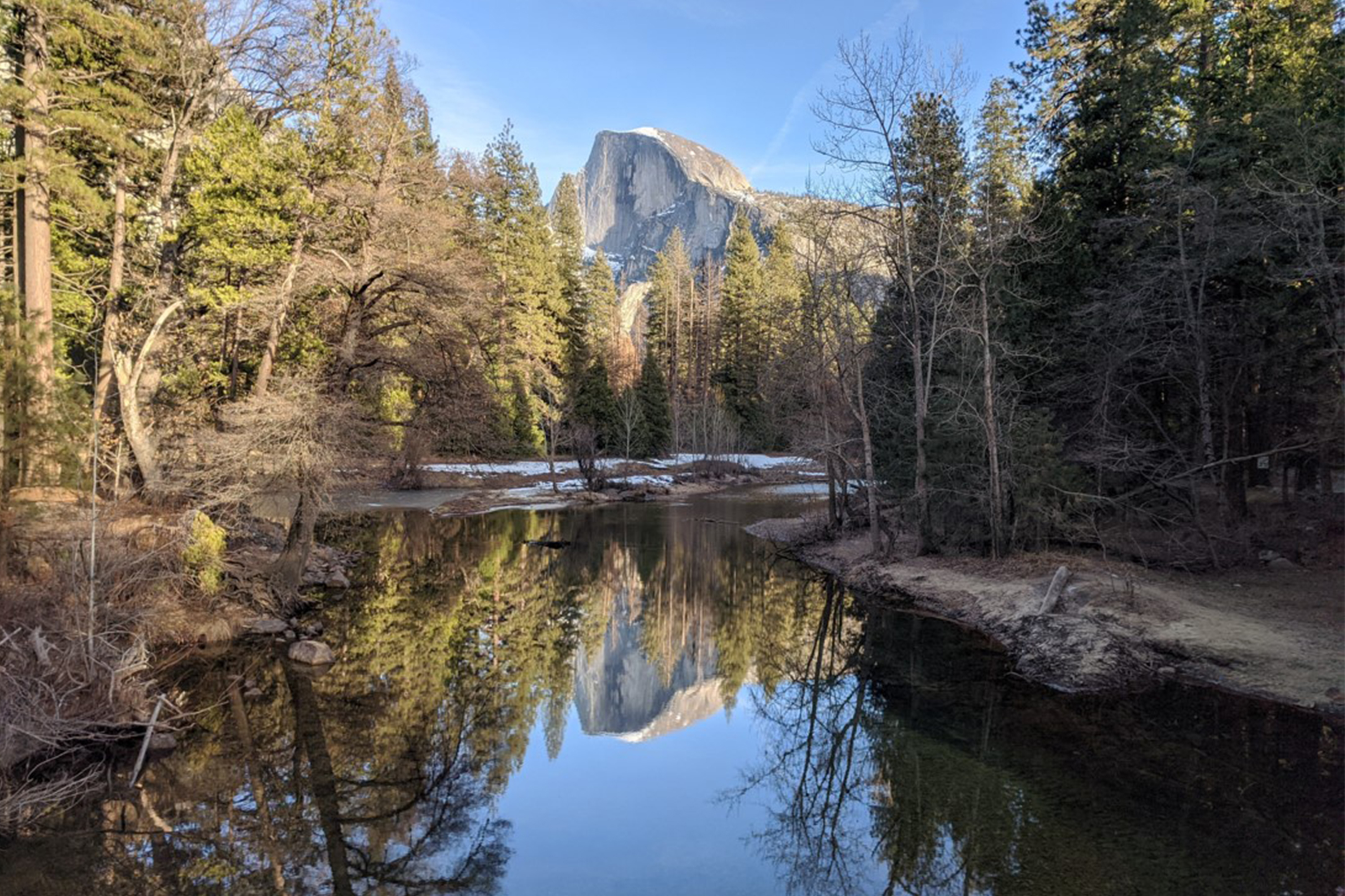
From the meadow boardwalks you get Half Dome one way and Yosemite Falls the other, with the Merced River winding through. Finish at Sentinel Bridge, where Half Dome reflects in the river when the water is calm, then stroll back toward Yosemite Village. Flat and gentle, it is a good cool-down for a travel day.
- Distance
- 1 mi
- Elevation gain
- 0 ft
- Route
- Loop
- Difficulty
- Easy
- Trailhead
- Cook's Meadow Loop Trailhead
Sources (3)
- Cook's Meadow Loop Trailhead - NPS · retrieved 2026-09-28
- Sentinel Bridge - NPS · retrieved 2026-09-28
- Yosemite Valley Day Hikes - NPS · retrieved 2026-09-28
Sentinel Bridge
The classic Half Dome reflection spot, reached at the end of your meadow loop.
- Time
- 10-15 minutes
- Fee
- Free
Sources (1)
- Sentinel Bridge - NPS · retrieved 2026-09-28
Dinner at Mountain Room, Yosemite Valley Lodge
The lodge's upscale-casual dinner room (Yosemite Hospitality lists it as dinner only, with Yosemite Falls views). A short walk from your room after a long day. Check current hours and whether reservations are advised when you book your stay.
- Meal
- Dinner
- Cuisine
- American
Sources (1)
- Yosemite dining - Yosemite Hospitality · retrieved 2026-09-28
Yosemite Falls Trail and Valley culture
An early start on the Yosemite Falls Trail to Columbia Rock, with the option to continue to the top. Afternoon in the shade at the Exploration Center and Yosemite Museum, then a splurge dinner at The Ahwahnee.
Yosemite Falls Trail to Columbia Rock (or all the way up)
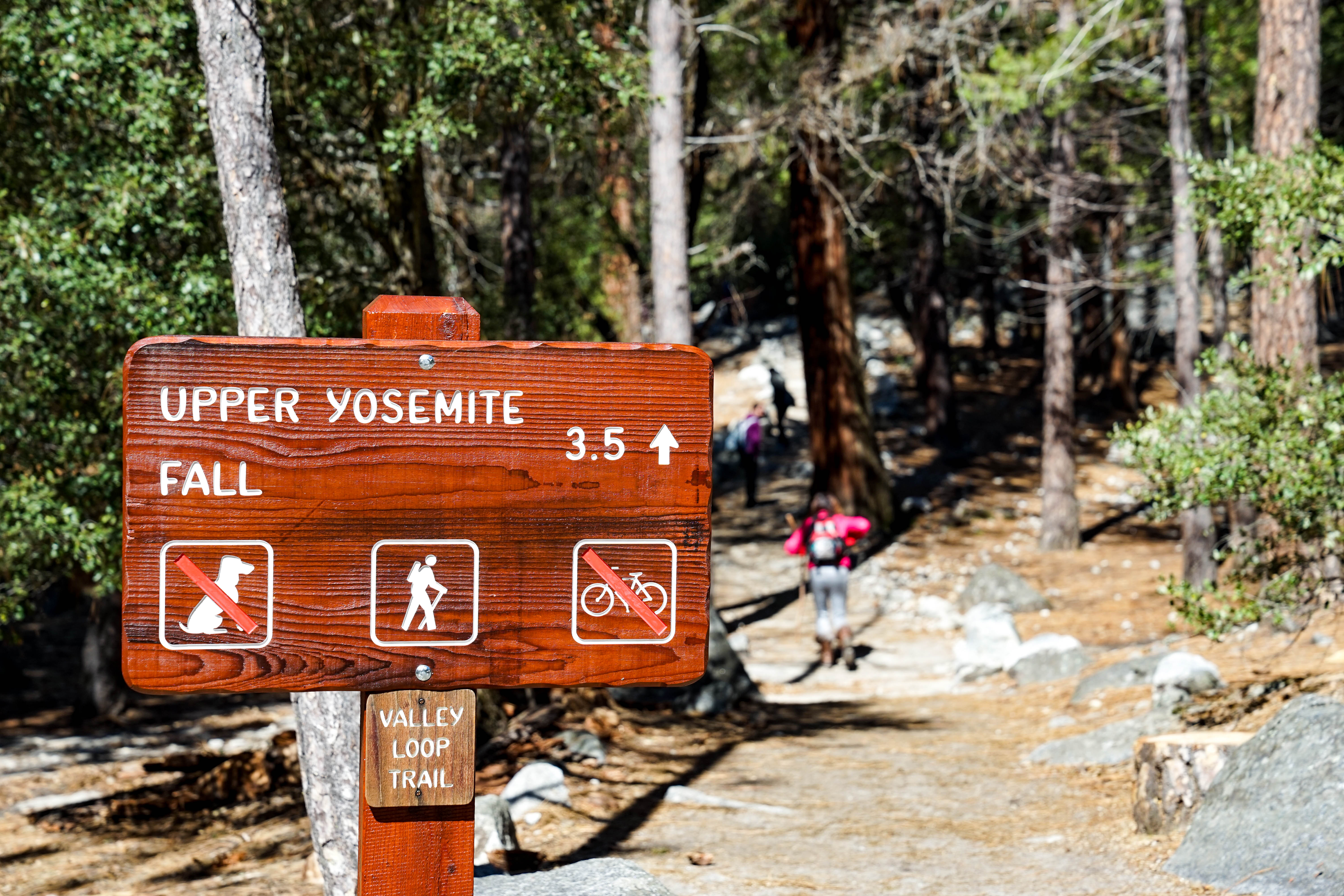
Start early: this is the Valley's big climb, all switchbacks and shade-free granite as the day warms. Columbia Rock, the first major viewpoint at about 1,000 feet up, looks straight across the Valley to Half Dome and is a rewarding turnaround (2 miles round trip, 2-3 hours per NPS). Strong hikers can push on to the top of Yosemite Falls: 7.2 miles round trip, 2,700 feet of gain, 6-8 hours. Carry lots of water (NPS suggests 4 quarts for the full route, with a fountain only at Camp 4). Yosemite Falls is seasonal (peak in spring; NPS says it is often a trickle or dry by August), so in fall you climb for the view, not for the water.
- Distance
- 2 mi
- Elevation gain
- 1,000 ft
- Route
- Out and back
- Difficulty
- Moderate
- Permit required
- No
- Trailhead
- Upper Yosemite Fall Trailhead, near Camp 4 (shuttle stop 7)
Sources (2)
- Yosemite Valley Day Hikes - NPS · retrieved 2026-09-28
- Yosemite Falls Trail - NPS · retrieved 2026-09-28
Lunch at Degnan's Kitchen
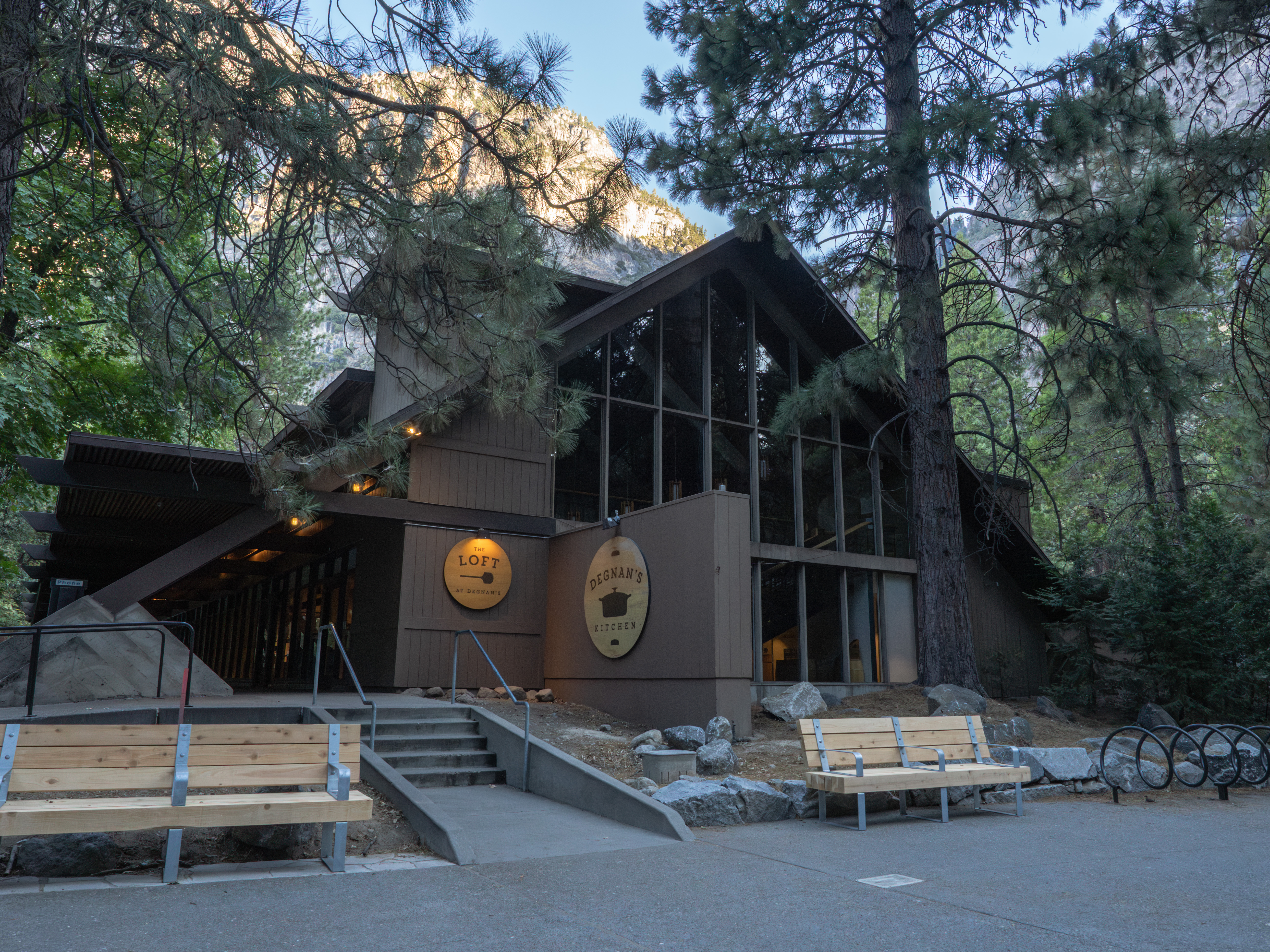
A grab-and-go stop in Yosemite Village that Yosemite Hospitality lists for breakfast and lunch. Sandwiches or bakery items work well here. Verify current hours on site.
- Meal
- Lunch
- Cuisine
- Fast casual / deli
Sources (2)
- Degnan's Kitchen - NPS · retrieved 2026-09-28
- Yosemite dining - Yosemite Hospitality · retrieved 2026-09-28
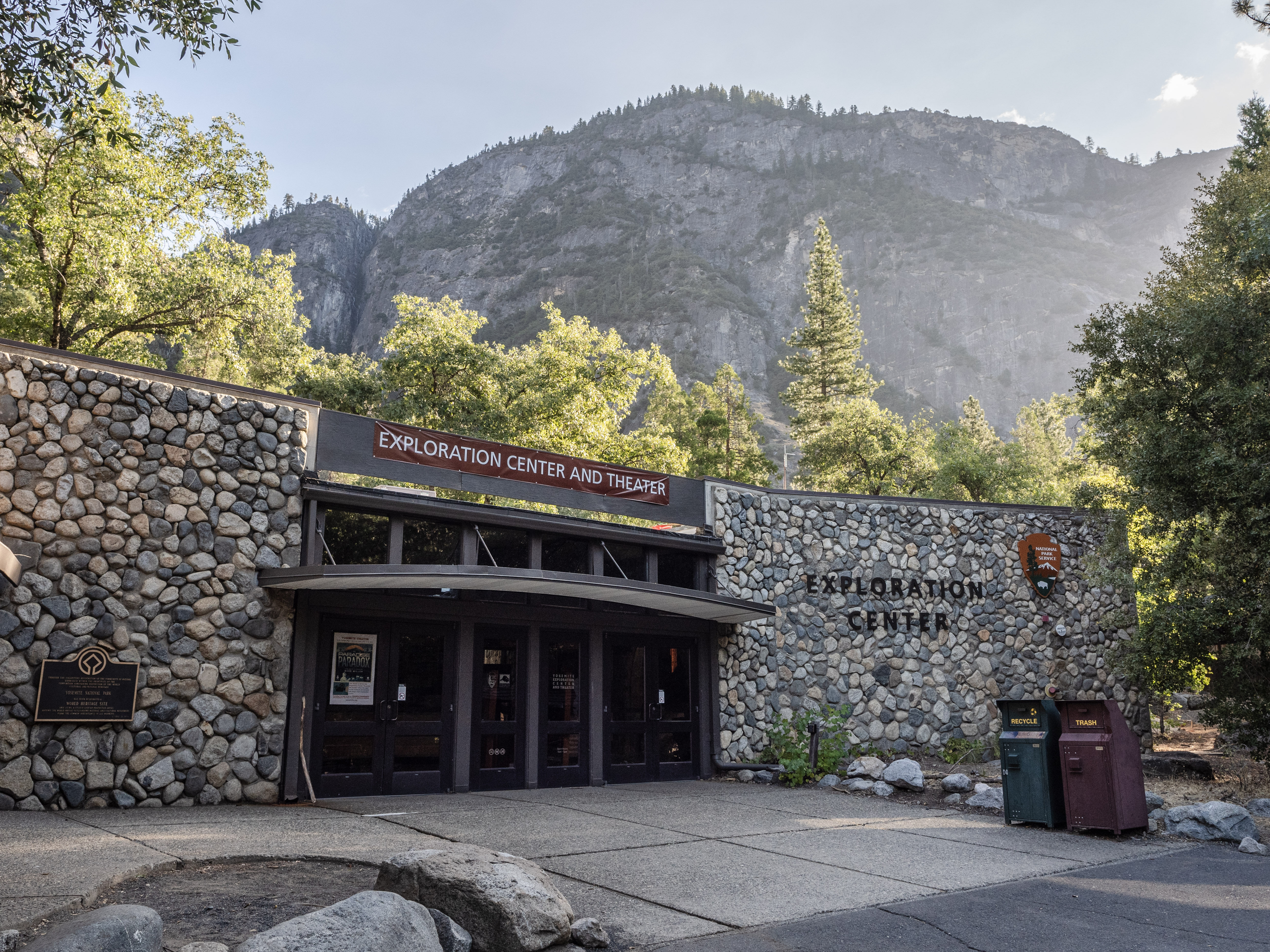
Yosemite Exploration Center
Interactive exhibits on Yosemite's history, the people who originally lived here, meadows, wildlife and sequoias. NPS lists it open daily 9 am to 5 pm. It is a good heat-of-the-day, out-of-the-sun stop after a morning hike.
- Time
- 45-60 minutes
- Fee
- Free
Sources (1)
- Visit the Yosemite Exploration Center - NPS · retrieved 2026-09-28
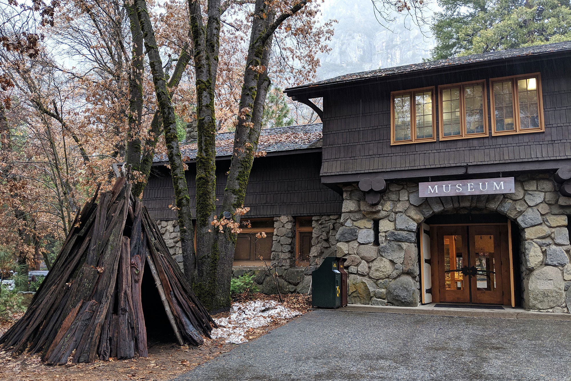
Yosemite Museum
Next door, this 1925 museum interprets the cultural history of the Southern Sierra Miwok and Paiute people, with basket-weaving and stone-tool demonstrations. Outside are a giant sequoia cross-section you can touch and a recreated cedar bark house (umacha). NPS says it was the first building constructed as a museum in the national park system.
- Time
- 30 minutes
- Fee
- Free
Sources (1)
- Visit the Yosemite Museum - NPS · retrieved 2026-09-28
Dinner in The Ahwahnee dining room
The 1920s Ahwahnee is a National Historic Landmark, and Yosemite Hospitality lists its dining room for breakfast and dinner, with a more casual bar for lunch and dinner. It is the splurge meal of the trip; dress up a bit and check current reservation guidance and menu prices at travelyosemite.com before you go.
- Meal
- Dinner
- Cuisine
- Fine dining, seasonal American
Sources (2)
- Yosemite dining - Yosemite Hospitality · retrieved 2026-09-28
- The Ahwahnee - Yosemite Hospitality · retrieved 2026-09-28
Happy Isles, Vernal Fall and a Valley bike ride
Follow the Merced River to the Vernal Fall Footbridge, extend to the Mist Trail as conditions allow, then rest your legs with a Valley-floor bike ride and an easy dinner.
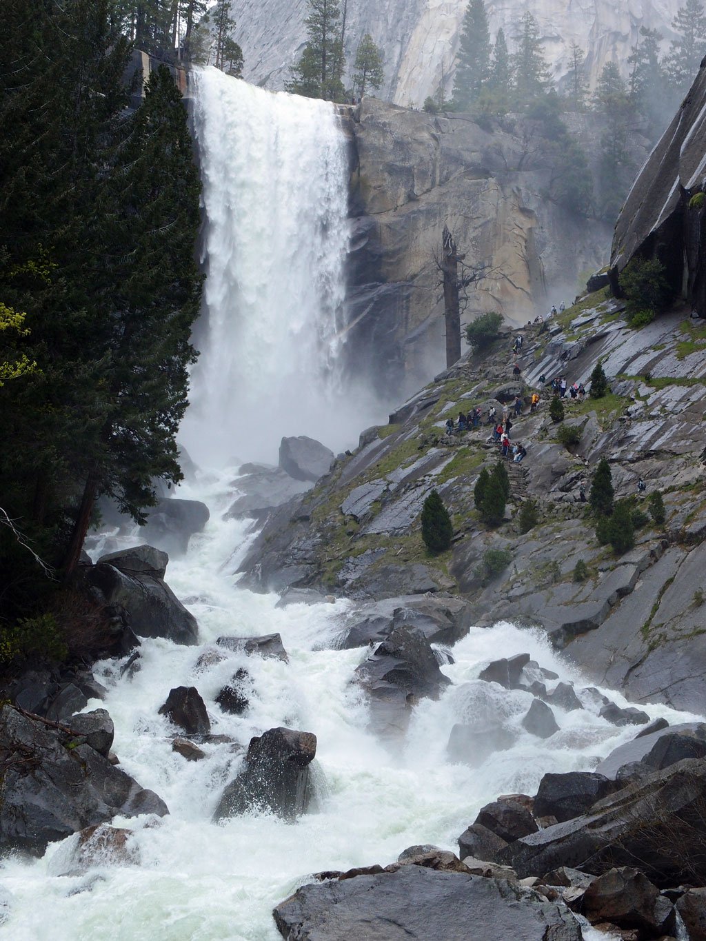
Happy Isles to Vernal Fall Footbridge and the Mist Trail
Start at Happy Isles (shuttle stop 16) and follow the Merced upstream to the Vernal Fall Footbridge: 1.6 miles round trip and about 400 feet of gain, with a view of Vernal Fall and drinking water and restrooms there May through October. If you want more, the Mist Trail continues above the footbridge to the top of Vernal Fall (2.4 miles round trip, about 1,000 feet, about 3 hours), and on to the top of Nevada Fall (5.4 miles round trip, about 2,000 feet, 5-6 hours). The stone stairs are wet and slippery near the falls. Check the conditions block for the current repair schedule on the Mist Trail above the footbridge.
- Distance
- 1.6 mi
- Elevation gain
- 400 ft
- Route
- Out and back
- Difficulty
- Moderate
- Permit required
- No
- Trailhead
- Happy Isles (shuttle stop 16)
Sources (2)
- Mist and John Muir Trailhead - NPS · retrieved 2026-09-28
- Vernal Fall and Nevada Fall Trails - NPS · retrieved 2026-09-28
Lunch at Seven Tents Pavilion, Curry Village
Yosemite Hospitality lists Seven Tents Pavilion at Curry Village as a lunch venue, a short shuttle hop from Happy Isles. Verify hours and menu on arrival.
- Meal
- Lunch
Sources (1)
- Yosemite dining - Yosemite Hospitality · retrieved 2026-09-28
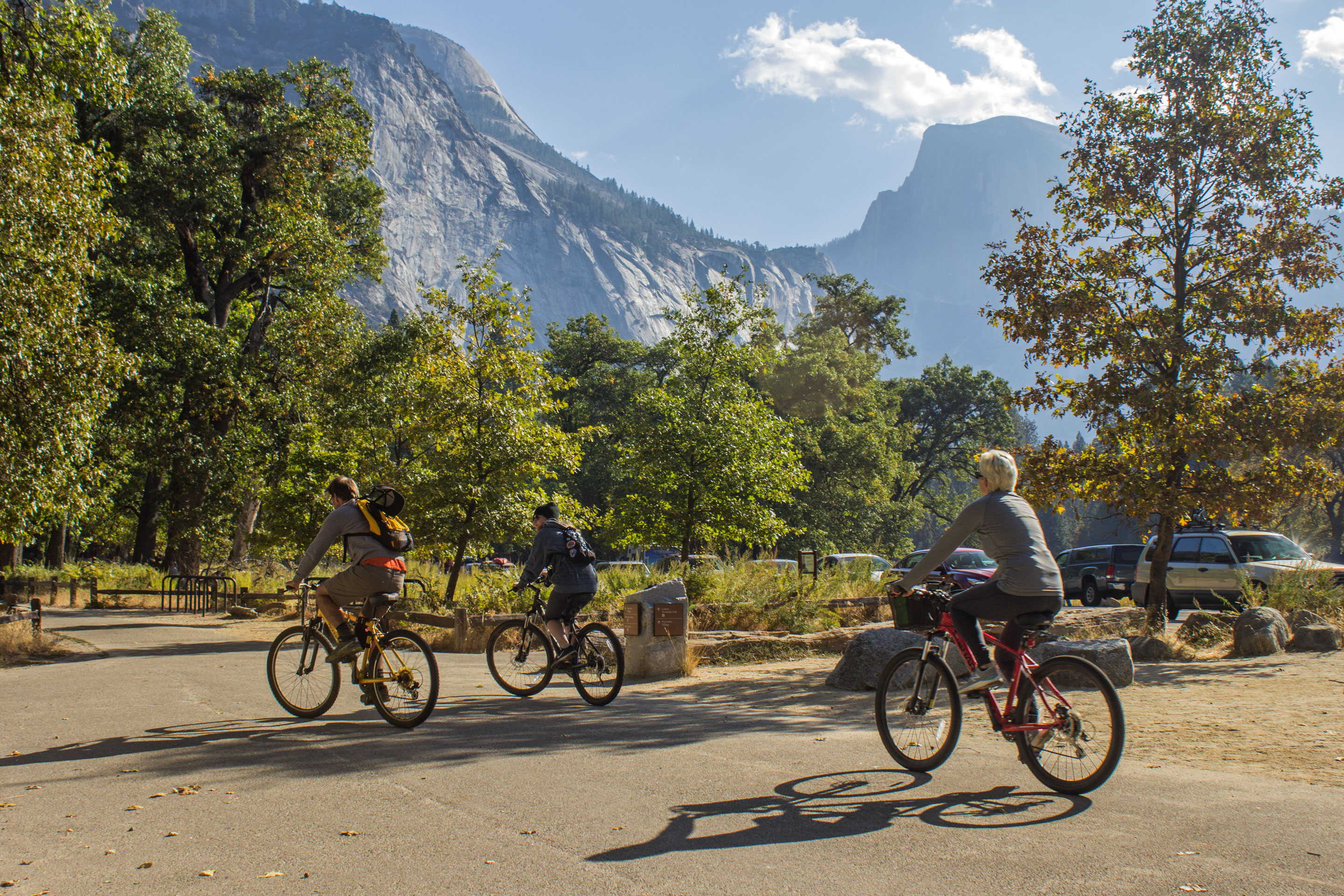
Bike the Valley loop
Over 12 miles of paved, mostly flat bike paths thread the Valley floor (15 mph limit). Rent a bike at Curry Village, Yosemite Village or Yosemite Valley Lodge (first-come, first-served), or borrow from the bike share (2-hour limit). It is the easiest way to see meadows and river bends without hunting for parking. Helmets are required for riders under 18.
- Time
- 1-6 hours (NPS)
- Best time
- Afternoon
Sources (1)
- Ride a Bike in Yosemite Valley - NPS · retrieved 2026-09-28
Dinner at Curry Village Pizza Deck
Go casual for your last Valley night. Yosemite Hospitality lists the Curry Village Pizza Deck for lunch and dinner; Bar 1899 (also lunch and dinner) is next door as an alternative. Verify hours on arrival. For tomorrow's Tioga day, buy your picnic lunch before you eat dinner, from a Valley store or eatery whose hours you have confirmed, rather than relying on an early-morning opening.
- Meal
- Dinner
- Cuisine
- Pizza / casual
Sources (1)
- Yosemite dining - Yosemite Hospitality · retrieved 2026-09-28
Tioga Road: Tuolumne Meadows, Lembert Dome and Olmsted Point
Drive up to the high country, hike to Lembert Dome, picnic at Tenaya Lake and stop at Olmsted Point on the way back in the afternoon. Leave by Tioga Pass (east) or return to the Valley/Crane Flat for your onward drive.
Drive Tioga Road to Tuolumne Meadows
Leave the Valley by 07:00. Eat breakfast first (Yosemite Hospitality lists Base Camp Eatery and Starbucks at Valley Lodge, and Curry Village Coffee Corner, for breakfast; confirm opening times) and have your picnic lunch bought the day before. Fuel up at the Crane Flat gas station on the way: gas is not sold in Yosemite Valley, and NPS says the Crane Flat pumps are open year-round with 24-hour pay at the pump. NPS gives typical driving times from Yosemite Valley of about 30 minutes to Crane Flat, 1.5 hours to Tuolumne Meadows and 1.75 hours to Tioga Pass; add roughly 15 minutes for the Big Oak Flat Road weekday delays and about 10 more at Tuolumne Meadows (see current conditions). Our estimate: with a fuel stop you reach Tuolumne Meadows about 09:15-09:30, which is why the first stop is set for 09:30. The Tioga Road (46 miles from Crane Flat to Tioga Pass) is typically open late May or early June through sometime in November; check the conditions page before leaving, since it can close after the first significant snow.
- Time
- About 1.5 hours to Tuolumne Meadows (NPS)
Sources (5)
- Crane Flat Gas Station - NPS · retrieved 2026-09-28
- Scenic Driving in Yosemite - NPS · retrieved 2026-09-28
- Yosemite Road Conditions - NPS · retrieved 2026-09-28
- Driving Directions - Yosemite National Park (NPS) · retrieved 2026-09-28
- Yosemite dining - Yosemite Hospitality · retrieved 2026-09-28
Tuolumne Meadows
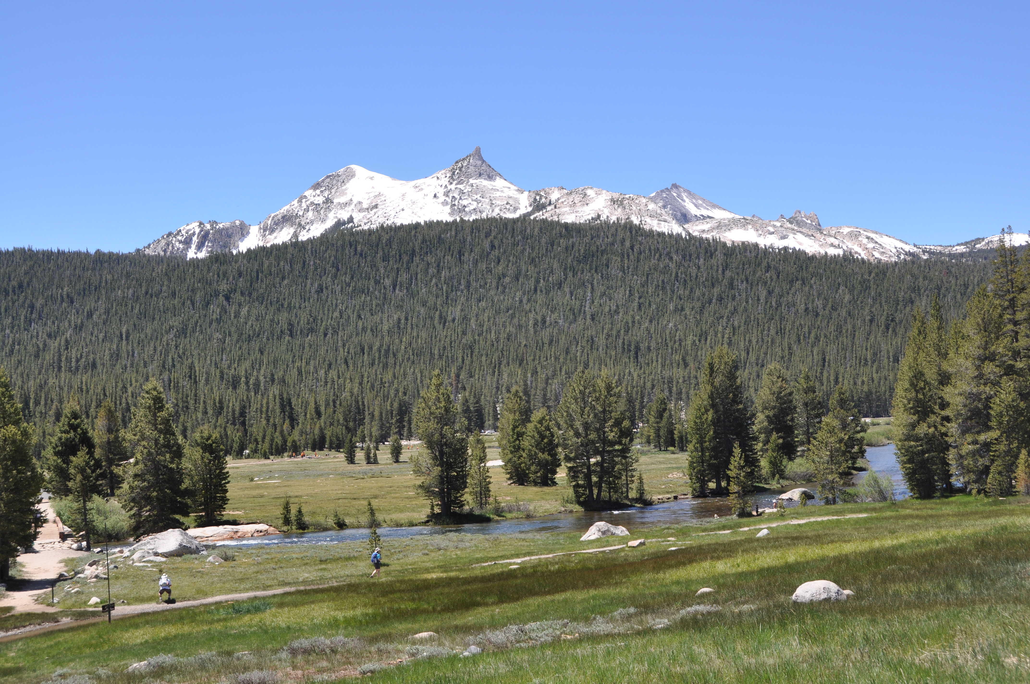
A broad subalpine meadow ringed by domes and peaks at roughly 8,600 feet, cooler and quieter than the Valley. Just walking the edge of the meadow with the Tuolumne River at your feet is a tonic after three days of Valley crowds.
- Time
- 30 minutes
- Fee
- Free
Sources (2)
- First-Timer's Guide to Tioga Pass - Flying Dawn Marie · retrieved 2026-09-28
- Tuolumne Meadows - NPS · retrieved 2026-09-28
Lembert Dome and Dog Lake
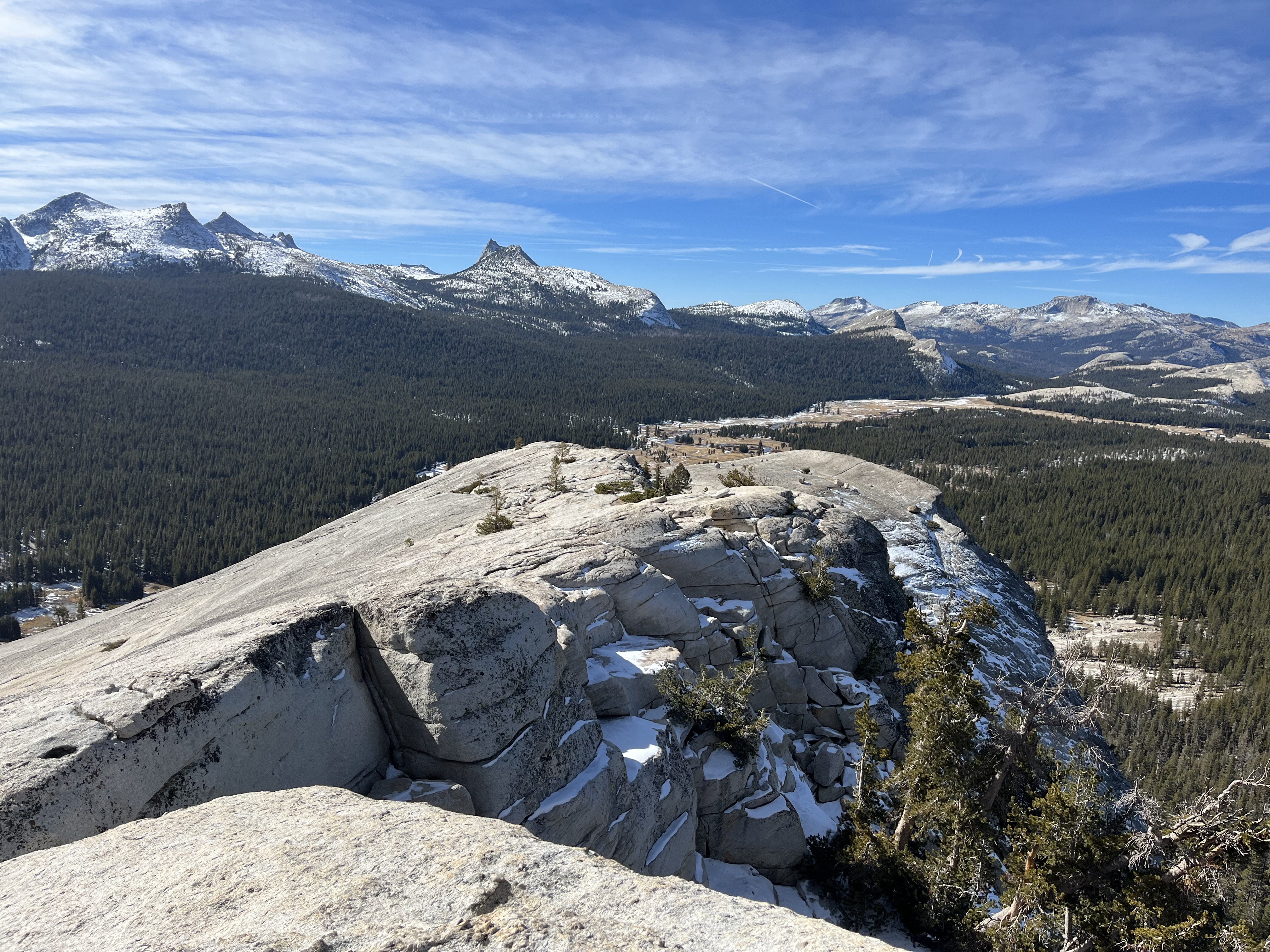
Start from the Dog Lake parking area. A steep forested climb to Dog Lake, then a spur to the bare granite summit of Lembert Dome. NPS lists 3.8 miles round trip with 850 feet of gain, 3-4 hours. There is no marked trail on the rock itself; pick the easiest line, watch your footing, and stay off the dome if there are thunderstorms or if it is wet or icy. The summit view takes in Tuolumne Meadows and the Cathedral Range. Cathedral Lakes (7.6 miles round trip, 1,000 feet gain per NPS) is a longer alternative for strong hikers.
- Distance
- 3.8 mi
- Elevation gain
- 850 ft
- Route
- Out and back
- Difficulty
- Moderate
- Permit required
- No
- Trailhead
- Lembert Dome and Dog Lake parking, Tioga Road
Sources (2)
- Lembert Dome and Dog Lake Trailhead - NPS · retrieved 2026-09-28
- Day Hikes in Tuolumne Meadows - NPS · retrieved 2026-09-28
Picnic lunch at Tenaya Lake
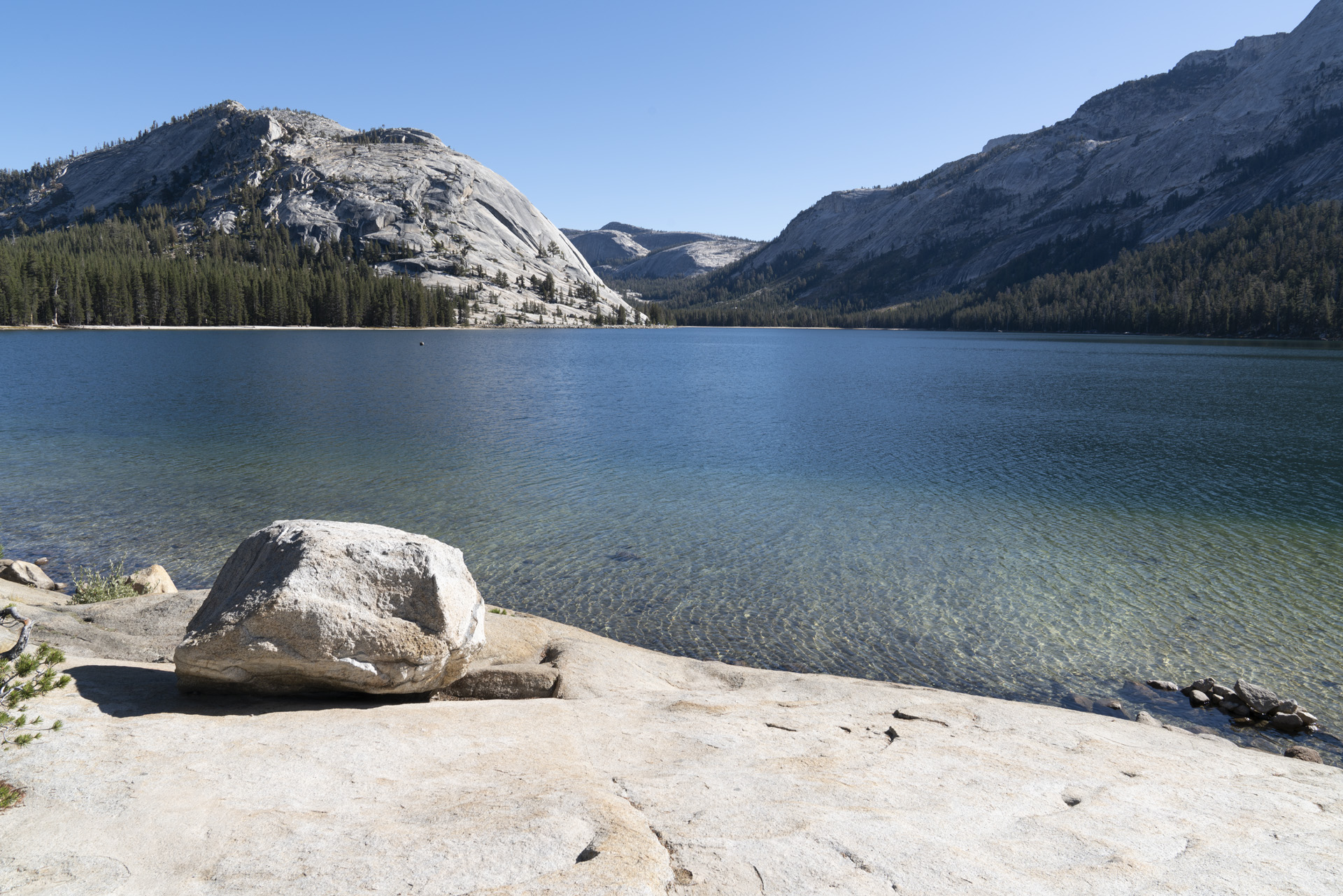
The largest lake in Yosemite's frontcountry, ringed by granite domes, and one of the park's most popular summer spots for picnicking, swimming and kayaking (NPS). Bring the Degnan's lunch and eat lakeside; the water is cold and the elevation is high, so plan for wind and strong sun.
- Time
- 45-60 minutes
- Best time
- Midday to afternoon
- Fee
- Free
Sources (2)
- First-Timer's Guide to Tioga Pass - Flying Dawn Marie · retrieved 2026-09-28
- Tenaya Lake - NPS · retrieved 2026-09-28
Olmsted Point: Half Dome from above
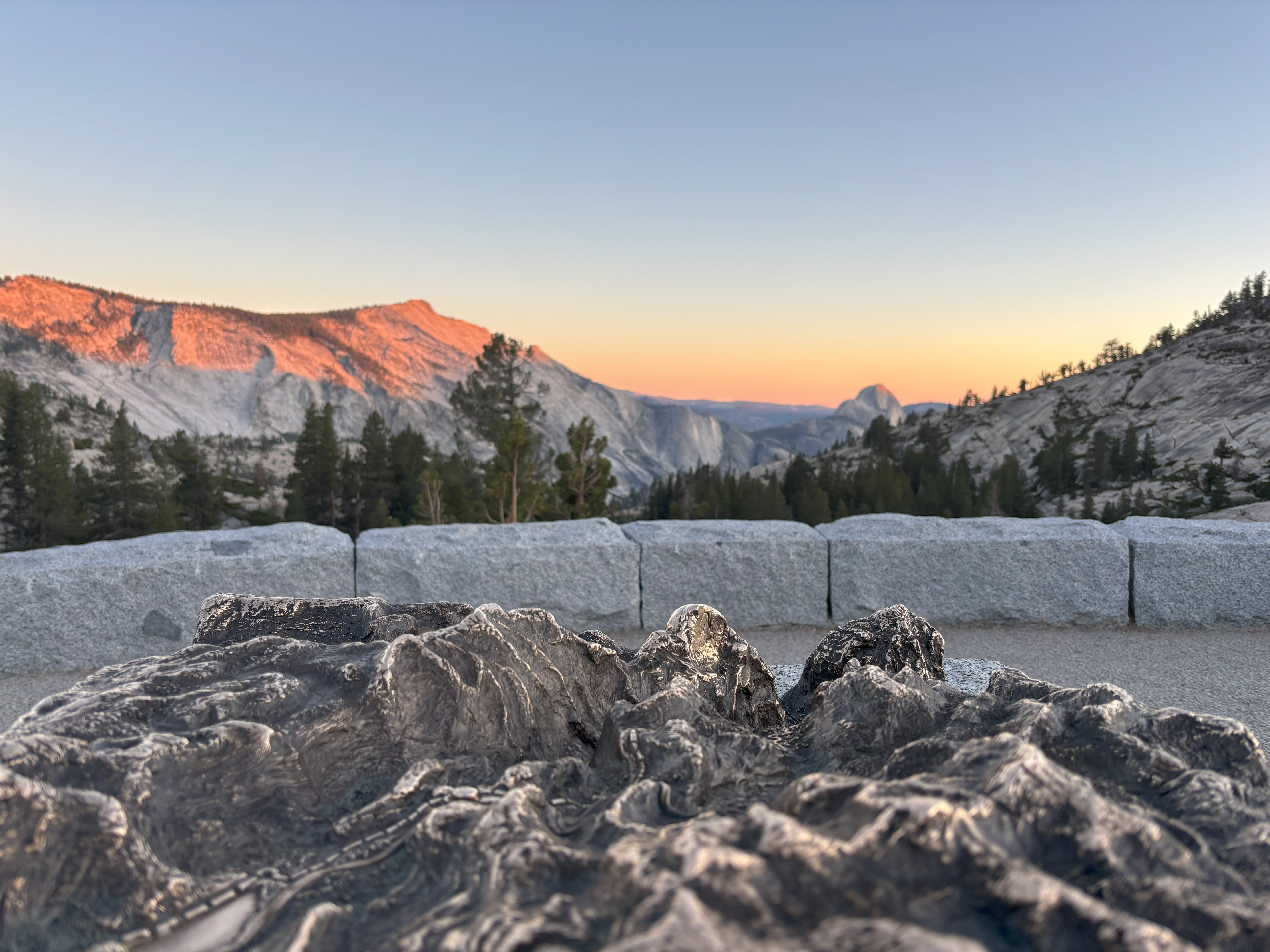
Make this your last stop before heading back. From the roadside lot (about 8,400 feet) you see Half Dome, Clouds Rest, Tenaya Lake and glacier-polished granite, with glacial erratic boulders on a short hilly quarter-mile walk each way. A bronze tactile model helps orient you. Trip-report writers rate it for sunset, but the drive back to the Valley takes about 1.5 hours on a mountain road, so a true sunset stop means driving down in the dark; this plan visits in the afternoon instead. Estimate: leaving Olmsted around 16:15 and allowing up to about 1.5 hours plus the Big Oak Flat Road delays, you reach the Valley around 18:00, before dusk. If you want the sunset, stay late only if you are comfortable with that drive.
- Time
- 30-45 minutes
- Best time
- Afternoon (sunset means a dark drive back, about 1.5 hours to the Valley)
- Fee
- Free
Sources (2)
- First-Timer's Guide to Tioga Pass - Flying Dawn Marie · retrieved 2026-09-28
- Olmsted Point - NPS · retrieved 2026-09-28
Where to stay
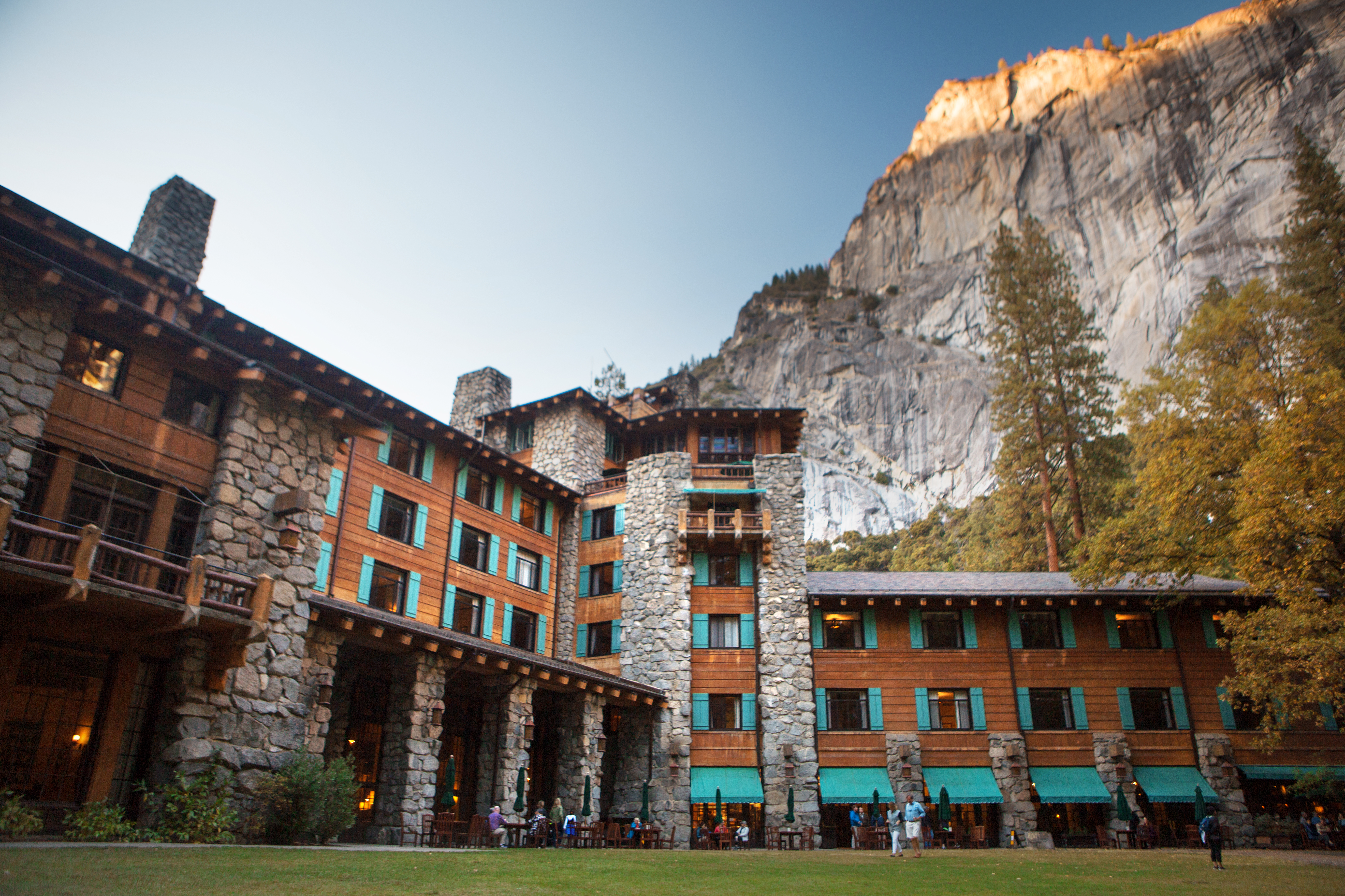
The Ahwahnee (splurge stay)
The National Historic Landmark hotel of the Valley, with standard rooms, classic rooms, prime view rooms, suites and cottages. A year-round outdoor heated pool is available to hotel guests. Check-in 4 pm, check-out 11 am.
- Type
- Hotel
- Location
- Inside the park
- Booking
- Book / details
- Reservation notes
- Rates vary by room type and are shown only in the booking system; call (888) 413-8869.
Sources (1)
- The Ahwahnee - Yosemite Hospitality · retrieved 2026-09-28
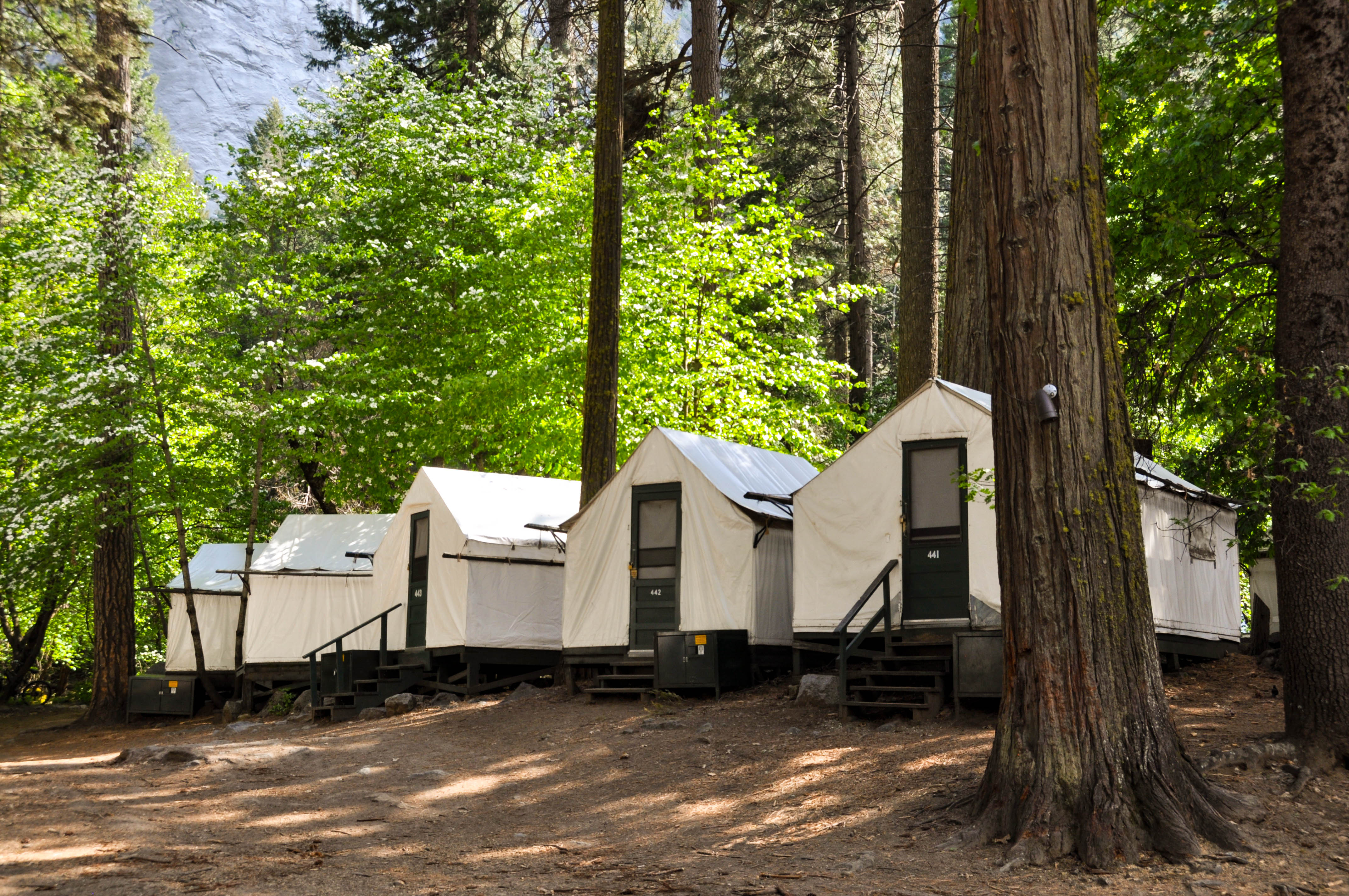
Curry Village tent cabins and cabins (budget/mid stay)
Operating since 1899, Curry Village has canvas tent cabins (heated and unheated), cabins with bath and Stoneman standard rooms under Glacier Point and Half Dome. It is lively, walkable to Happy Isles and the Mist Trail, and usually the cheapest lodging in the Valley. Expect shared bathhouses at tent cabins and bear-safe food storage rules.
- Type
- Cabin
- Location
- Inside the park
- Booking
- Book / details
- Reservation notes
- Additional person charge listed at $9.75-$17.50 plus tax depending on unit type. Nightly rates only in booking system.
Sources (1)
- Curry Village - Yosemite Hospitality · retrieved 2026-09-28
Upper Pines Campground
Open year-round for tents, RVs up to 35 ft and trailers up to 24 ft, sitting in the east end of the Valley near Happy Isles. Reservations are required year-round through Recreation.gov, released in monthly blocks five months ahead on the 15th at 7 am Pacific, and summer/fall dates go fast. NPS lists $36 per night for all sites.
- Type
- Campground
- Location
- Inside the park
- Price per night
- From $36 (as of 2026-09-28)
- Booking
- Book / details
- Reservation notes
- Reservations required year-round; 5-month rolling window, released the 15th at 7 am PT.
Sources (2)
- NPS Data API campgrounds - yose · retrieved 2026-09-28
- Pines Campgrounds - NPS · retrieved 2026-09-28
Map of places
- Tunnel View (opens Google Maps in a new tab) Day 1
- Bridalveil Fall Trailhead (opens Google Maps in a new tab) Day 1
- El Capitan Meadow (opens Google Maps in a new tab) Day 1
- Base Camp Eatery, Yosemite Valley Lodge (opens Google Maps in a new tab) Day 1
- Yosemite Valley Lodge (opens Google Maps in a new tab) Day 1
- Lower Yosemite Fall Trailhead (opens Google Maps in a new tab) Day 1
- Cook's Meadow Loop Trailhead (opens Google Maps in a new tab) Day 1
- Sentinel Bridge (opens Google Maps in a new tab) Day 1
- Mountain Room, Yosemite Valley Lodge (opens Google Maps in a new tab) Day 1
- Upper Yosemite Fall Trailhead (opens Google Maps in a new tab) Day 2
- Degnan's Kitchen (opens Google Maps in a new tab) Day 2
- Yosemite Exploration Center (opens Google Maps in a new tab) Day 2
- Yosemite Museum (opens Google Maps in a new tab) Day 2
- The Ahwahnee Dining Room (opens Google Maps in a new tab) Day 2
- Mist and John Muir Trailhead (Happy Isles) (opens Google Maps in a new tab) Day 3
- Seven Tents Pavilion, Curry Village (opens Google Maps in a new tab) Day 3
- Yosemite Valley bike paths (opens Google Maps in a new tab) Day 3
- Curry Village Pizza Deck (opens Google Maps in a new tab) Day 3
- Tuolumne Meadows (opens Google Maps in a new tab) Day 4
- Lembert Dome and Dog Lake Trailhead (opens Google Maps in a new tab) Day 4
- Tenaya Lake (opens Google Maps in a new tab) Day 4
- Olmsted Point (opens Google Maps in a new tab) Day 4
- The Ahwahnee (opens Google Maps in a new tab) Option
- Curry Village (opens Google Maps in a new tab) Option
- Upper Pines Campground (opens Google Maps in a new tab) Option
Good to know
Getting there and around
- Yosemite Valley is roughly 1.5 hours from Tuolumne Meadows and 30 minutes from Crane Flat; NPS lists Wawona/Mariposa Grove and Glacier Point at about an hour each from the Valley. The Valley shuttle (free) links stops such as Lower Yosemite Fall (6), Yosemite Falls/Valley Lodge (7), Happy Isles (16); park once.
- Entry: private vehicle entrance is $35 for 7 days, motorcycle $30, per person $20; non-residents 16 and older pay an extra $100 unless they hold an annual or America the Beautiful pass. The park takes cards and mobile payments only, no cash (NPS Fees and Passes API, as of 2026-09-28).
- Start early. General guidance (also given by the Well Planned Journey blog): get in early in the morning and use the large day-use lots (Welcome Center, Curry Village, Valley Lodge) plus the shuttle rather than moving the car.
- Arrival from CA-140 (Arch Rock) instead of CA-41: you pass Valley View and Bridalveil Fall first, so do Bridalveil and El Capitan Meadow on the way in and drive back out to Tunnel View later in the day (it is on Wawona Road, west of the Valley) or on another day.
Seasonality
- Waterfalls peak in spring and early summer. NPS: Yosemite Falls is often only a trickle or dry by August; Bridalveil flows all year (peak May); Vernal narrows as flow drops; Nevada flows all year (peak late May or June).
- Tioga Road: typically late May/early June to some time in November; it closes after the first significant snow. No overnight parking on the road from October 15.
- Best windows for this itinerary: June-July and September-October, but check Tioga status first.
Water, food, safety
- Carry plenty of water. NPS recommends up to 4 quarts for the full Yosemite Falls hike and 3-4 quarts for Nevada Fall.
- Store all food in bear boxes; do not leave food in vehicles at trailheads.
- Restaurants and shops in Yosemite change hours and seasons; verify at travelyosemite.com.
Current conditions (as of 2026-09-28)
- Yosemite Falls is dry, per the NPS conditions page. Bridalveil, Vernal and Nevada Falls flow year-round but at reduced late-season levels (NPS waterfalls page); autumn storms can revive some falls.
- Entry: no timed-entry reservation required in 2026 per NPS; NPS may manage busy days with real-time traffic monitoring, so check before you go.
- El Capitan Bridge stabilization (near El Capitan Meadow): 15-minute delays Monday-Friday 7 am to 7 pm through December 2026, with weekday Valley Loop Trail closures (NPS conditions page).
- Big Oak Flat Road (Foresta to Crane Flat): expect 15-minute weekday delays for fire-safety vegetation work; this is on the Valley-to-Tioga route for Day 4. Allow extra time.
- Dome Fire: NPS lists Glacier Point Road as temporarily closed because of smoky conditions and firefighting operations, with some trail closures south of the road (including Chilnualna Falls and Ostrander Lake areas). This itinerary avoids Glacier Point, Sentinel Dome, Taft Point and Wawona-area trails for that reason. Check nps.gov/yose/planyourvisit/conditions.htm. Air quality may be poor at times.
- Mist Trail: through October 2026, the section from the John Muir Trail junction (above Vernal Fall footbridge) to the top of Vernal Fall is open Friday-Sunday and on holidays, and normally Monday-Thursday from 3:30 pm to 7 am when safe, with the John Muir Trail as the alternative. The Vernal Fall Footbridge hike is unaffected as written. Confirm at nps.gov/yose/planyourvisit/vernalnevadatrail.htm.
- Trail closure at Tuolumne: NPS says the trail between the wilderness center and Lembert Dome is closed for construction and an alternate trail is available. The Day 4 hike starts from the Dog Lake parking area; confirm your route at the conditions page.
- Tioga Road: open with delays, about 10 minutes at Tuolumne Meadows and 15 minutes from 8 am to 3:30 pm Monday-Thursday between Olmsted Point and Tioga Pass. Overnight parking prohibited from Oct 15.
- Seasonal services ending: Tuolumne Meadows Campground: NPS API shows 2026 season July 1 to September 28 with a winter closure listed from 2026-09-28, so treat it as closed. Yosemite Hospitality's dining page (retrieved 2026-09-28, no year stated) lists Tuolumne Meadows Lodge dining June 13 to September 14, so bring a picnic on day 4.
- Curry Village will not be open November 29-December 10, 2026. Wawona Hotel is listed as closed for facility assessment.
- Mariposa Grove Road is restricted to vehicles with disability placards; a free shuttle runs about late April-November.
Want live alerts and up-to-date info?
Conditions change fast. Create an account on the DriftKin app to get live park alerts, closures and information for your trip.
Sources
- Tunnel View - NPS retrieved 2026-09-28
- Ultimate Yosemite Itinerary - Well Planned Journey retrieved 2026-09-28
- Bridalveil Fall Trailhead - NPS retrieved 2026-09-28
- Yosemite Valley Day Hikes - NPS retrieved 2026-09-28
- El Capitan Meadow - NPS retrieved 2026-09-28
- Yosemite dining - Yosemite Hospitality retrieved 2026-09-28
- Yosemite Valley Lodge - Yosemite Hospitality retrieved 2026-09-28
- Yosemite Falls Trail - NPS retrieved 2026-09-28
- Cook's Meadow Loop Trailhead - NPS retrieved 2026-09-28
- Sentinel Bridge - NPS retrieved 2026-09-28
- Degnan's Kitchen - NPS retrieved 2026-09-28
- Visit the Yosemite Exploration Center - NPS retrieved 2026-09-28
- Visit the Yosemite Museum - NPS retrieved 2026-09-28
- The Ahwahnee - Yosemite Hospitality retrieved 2026-09-28
- Mist and John Muir Trailhead - NPS retrieved 2026-09-28
- Vernal Fall and Nevada Fall Trails - NPS retrieved 2026-09-28
- Ride a Bike in Yosemite Valley - NPS retrieved 2026-09-28
- Crane Flat Gas Station - NPS retrieved 2026-09-28
- Scenic Driving in Yosemite - NPS retrieved 2026-09-28
- Yosemite Road Conditions - NPS retrieved 2026-09-28
- Driving Directions - Yosemite National Park (NPS) retrieved 2026-09-28
- First-Timer's Guide to Tioga Pass - Flying Dawn Marie retrieved 2026-09-28
- Tuolumne Meadows - NPS retrieved 2026-09-28
- Lembert Dome and Dog Lake Trailhead - NPS retrieved 2026-09-28
- Day Hikes in Tuolumne Meadows - NPS retrieved 2026-09-28
- Tenaya Lake - NPS retrieved 2026-09-28
- Olmsted Point - NPS retrieved 2026-09-28
- Curry Village - Yosemite Hospitality retrieved 2026-09-28
- NPS Data API campgrounds - yose retrieved 2026-09-28
- Pines Campgrounds - NPS retrieved 2026-09-28
Hours, fees, prices and closures change. Confirm details with the park or business before you go.